world.wikisort.org - Philippines
Bani, officially the Municipality of Bani (Pangasinan: Baley na Bani; Ilocano: Ili ti Bani; Tagalog: Bayan ng Bani), is a 2nd class municipality in the province of Pangasinan, Philippines. According to the 2020 census, it has a population of 52,603 people. [3]
Bani | |
|---|---|
Municipality | |
| Municipality of Bani | |
 Street in Bani | |
 Flag  Seal | |
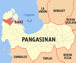 Map of Pangasinan with Bani highlighted | |
 Bani Location within the Philippines | |
| Coordinates: 16°11′13″N 119°51′33″E | |
| Country | Philippines |
| Region | Ilocos Region |
| Province | Pangasinan |
| District | 1st district |
| Founded | 1769 |
| Named for | Bani tree |
| Barangays | 27 (see Barangays) |
| Government | |
| • Type | Sangguniang Bayan |
| • Mayor | Cothera Gwen P. Yamamoto |
| • Vice Mayor | Benjamin S. Navarro II |
| • Representative | Arnold D. Celeste |
| • Municipal Council | Members |
| • Electorate | 31,025 voters (2019) |
| Area | |
| • Total | 179.65 km2 (69.36 sq mi) |
| Elevation | 43 m (141 ft) |
| Population | |
| • Total | 52,603 |
| • Density | 290/km2 (760/sq mi) |
| • Households | 12,225 |
| Economy | |
| • Income class | 2nd municipal income class |
| • Poverty incidence | 10.58% (2018)[4] |
| • Revenue | ₱187,031,318.97 (2020) |
| • Assets | ₱663,150,442.41 (2020) |
| • Expenditure | ₱242,900,718.42 (2020) |
| • Liabilities | ₱65,713,674.65 (2020) |
| Service provider | |
| • Electricity | Pangasinan 1 Electric Cooperative (PANELCO 1) |
| Time zone | UTC+8 (PST) |
| ZIP code | 2407 |
| PSGC | |
| IDD : area code | +63 (0)75 |
| Native languages | Pangasinan Ilocano Sambal Tagalog |
| Website | www |
The town, dubbed as the "Golden West" in the 1960s and early 1970s, is named after the Bani tree which could be found in the Poblacion.
History
Bani was founded on March 18, 1769 (from Zambales). In May 1903, it was transferred to Pangasinan together with the towns of Agno, Alaminos, Anda, Bolinao, Burgos, Dasol, Infanta and Mabini. San Simon, the original Bani, was transferred from Namagbagan to sitio Almacin in 1859.
The Immaculate Conception, Patron Saint of San Simon, disappeared from the church altar and discovered on top of the tall Bani tree in the vicinity of the present Church. She was brought to the Namagbagan church, and returned to the present site. Bani's name came from the Bani tree where the image of the Patroness was found. Bani (Millettia pinnata) is a smooth tree (height of 8 to 25 meters).[5]
In 1769, Fr. Mains de Lamberto erected a "visita" in Bani with settlements around Don Cayo banks and in 1762, these settlements became a sitio, with local officials headed by Don Francisco Baltazar as "Tiniente Absolute".[6]
On 21 November 1903 the town of Bani together with Alaminos, Bolinao, San Isidro de Potot and Infanta were annexed to Pangasinan.[7] In 1918 the road from Alaminos to Bani was started. During the time of Martial Law the mayor of Bani was Marcelo Navarro, a member of the Liberal Party. After the People Power of 1986 the OIC who headed Bani was Edmundo Cacho[8]
Bani is the hometown of TV host and former Pangasinan governor Oscar Orbos. From the Municipal Hall one would read that this town used to be a part of Zambales and its founders include Pangasinenses, Ilocanos and Zambals.
In May 2009, Bani along with Anda and Bolinao, was severely damaged by Typhoon Emong. The typhoon damaged an office close to the Municipal Building, the Western Pangasinan Lyceum, and a lot of structures and houses.[6]
Geography
Bani lies between Tambac Bay and the South China Sea, and Alaminos and Bolinao.[9] It has a land area of 19,243.6075 hectares.[10]
Bani is 56 kilometres (35 mi) from Lingayen and 262 kilometres (163 mi) from Manila.
Barangays
Bani is politically subdivided into 27 barangays. These barangays are headed by elected officials: Barangay Captain, Barangay Council, whose members are called Barangay Councilors. All are elected every three years.
- Ambabaay
- Aporao
- Arwas
- Ballag
- Banog Norte
- Banog Sur
- Calabeng
- Centro Toma
- Colayo
- Dacap Norte
- Dacap Sur
- Garrita
- Luac
- Macabit
- Masidem
- Poblacion
- Quinaoayanan
- Ranao
- Ranom Iloco
- San Jose
- San Miguel
- San Simon
- San Vicente
- Tiep
- Tipor
- Tugui Grande
- Tugui Norte
Climate
| Climate data for Bani, Pangasinan | |||||||||||||
|---|---|---|---|---|---|---|---|---|---|---|---|---|---|
| Month | Jan | Feb | Mar | Apr | May | Jun | Jul | Aug | Sep | Oct | Nov | Dec | Year |
| Average high °C (°F) | 31 (88) |
31 (88) |
32 (90) |
34 (93) |
35 (95) |
34 (93) |
32 (90) |
32 (90) |
32 (90) |
32 (90) |
32 (90) |
31 (88) |
32 (90) |
| Average low °C (°F) | 22 (72) |
22 (72) |
22 (72) |
24 (75) |
24 (75) |
24 (75) |
24 (75) |
24 (75) |
24 (75) |
23 (73) |
23 (73) |
22 (72) |
23 (74) |
| Average precipitation mm (inches) | 13.6 (0.54) |
10.4 (0.41) |
18.2 (0.72) |
15.7 (0.62) |
178.4 (7.02) |
227.9 (8.97) |
368 (14.5) |
306.6 (12.07) |
310.6 (12.23) |
215.7 (8.49) |
70.3 (2.77) |
31.1 (1.22) |
1,766.5 (69.56) |
| Average rainy days | 3 | 2 | 2 | 4 | 14 | 16 | 23 | 21 | 24 | 15 | 10 | 6 | 140 |
| Source: World Weather Online[11] | |||||||||||||
Demographics
| Year | Pop. | ±% p.a. |
|---|---|---|
| 1903 | 4,440 | — |
| 1918 | 8,109 | +4.10% |
| 1939 | 14,565 | +2.83% |
| 1948 | 18,402 | +2.63% |
| 1960 | 23,758 | +2.15% |
| 1970 | 25,176 | +0.58% |
| 1975 | 27,549 | +1.82% |
| 1980 | 29,102 | +1.10% |
| 1990 | 37,180 | +2.48% |
| 1995 | 37,463 | +0.14% |
| 2000 | 42,824 | +2.91% |
| 2007 | 45,652 | +0.89% |
| 2010 | 45,758 | +0.08% |
| 2015 | 50,306 | +1.82% |
| 2020 | 52,603 | +0.88% |
| Source: Philippine Statistics Authority [12] [13] [14][15] | ||
Religion

Roman Catholic population of Bani is 28,686 or 66.98% while the Philippine Independent Church (Aglipayan) population is 7,859 or 18.35%.[16] Other churches include Bani United Methodist Church and Iglesia ni Cristo (Church of Christ) Lokal ng Bani, inter alia.
The 1762 Immaculate Conception of the Blessed Virgin Mary Parish Church (Poblacion, Bani) is under Co Pastor, Fr. Raymond Oligane and Fr. Fernando Castillo. Feast day is December 8, with its Parish Priest, Fr. Roberto Casaclang, Vicariate of the Divine Savior, Vicar Forane, Father Eduardo E. Inacay.[10][16][17][18][19] is part of the Roman Catholic Diocese of Alaminos (Roman Catholic Archdiocese of Lingayen-Dagupan).[20]
Economy
Government

Bani, belonging to the first congressional district of the province of Pangasinan, is governed by a mayor designated as its local chief executive and by a municipal council as its legislative body in accordance with the Local Government Code. The mayor, vice mayor, and the councilors are elected directly by the people through an election which is being held every three years.
Spain ruled Bani from 378 from 1521 to 1899, The “pueblos”'s Gobernadorcillos were appointed by the Spanish authorities and from 1901 to 1936, the Presidentes, by the Americans. In 1937 to present, the local chief executives were elected.
The Official Seal was adopted in Resolution No. 7 on 7 March 1991.[28]
Elected officials
| Position | Name |
|---|---|
| Congressman | Arnold F. Celeste |
| Mayor | Cothera Gwen P. Yamamoto |
| Vice-Mayor | Benjamin S. Navarro II |
| Councilors | Ronaldo C. Catabay |
| John Paul T. Navarro | |
| Armando C. Rivera | |
| Philip O. Estabillo | |
| Elmer N. Ocampo | |
| Amelia R. Olores | |
| Wilhelm C. Aquino | |
| Noel I. Talania | |
Tourism
Attractions include:[30]
- 1,000 step "Via Crucis" leading to the gigantic Redeemer's Cross perched on a plateau overlooking the South China Sea of Doña Segundina Enriquez Navarro, wife Mayor Marcelo C. Navarro. Annual Archdiocesan Penitential Pilgrimage every Holy Tuesday first held in 1975.[31]
- Rock formations along the shores.
- Bird Watching at Bangrin Mangroves[32]
- Olanen Beach, Tobong Beach - Dacap Sur
- Surip Beach in Sitio Olanen, Barangay Dacap Sur - scuba diving, snorkeling and recreational fishing of tropical fishes and lobsters
- Surip Beach Mountain Resort, Hide Away Sea and Beach Resort, Cacho Beach Resor
- Oldwoods by the Sea Eco Resort - Olanen
- Surip Cave, Nalsoc Cave, Abot Aso Cave, Nangadiyan Cave, and the Dumaloy Cave.
- Nalsoc Cave is a subterranean river with natural archway of stalactites and stalagmites, Barangay Colayo: Cave Formations (Speleothems), Dripstone, Straws, Stalactites, Stalagmites, Columns or Pillars and Shawls.
- Cacho Beach Resort Bani Pangasinan
- Baliwangga falls, Barangay Ranao, near Ranao Elementary School.
- Bani Public Auditorium and Children's Playground
- The Manuel Oboza Lara-Edralin Auditorium, Poblacion
- Bani is noted for producing the sweet and juicy watermelon.[33]
Gallery
 Bani Town hall
 Bani Basketball Court
 Aglipayan Bani Church
 Downtown at dusk
 Bani-Agno Road
 Town center, at dusk


References
- Municipality of Bani | (DILG)
- "2015 Census of Population, Report No. 3 – Population, Land Area, and Population Density" (PDF). Philippine Statistics Authority. Quezon City, Philippines. August 2016. ISSN 0117-1453. Archived (PDF) from the original on May 25, 2021. Retrieved July 16, 2021.
- Census of Population (2020). "Region I (Ilocos Region)". Total Population by Province, City, Municipality and Barangay. PSA. Retrieved 8 July 2021.
- "PSA Releases the 2018 Municipal and City Level Poverty Estimates". Philippine Statistics Authority. 15 December 2021. Retrieved 22 January 2022.
- Bani Retrieved May 1, 2018.
- "Municipality of Bani Pangasinan : : . Welcome to the Golden West". Archived from the original on 2012-01-17. Retrieved 2012-12-23.
- (Rosario Cortes: Pangasinan-1901-1986, New Day Publishers, 1995, p. 16)
- (Rosario Cortes: Pangasinan-1901-1986, New Day Publishers, 1995)
- "Municipality of Bani Pangasinan". Retrieved May 1, 2018.
- Official website of Bani Pangasinan
- "Bani, Pangasinan: Average Temperatures and Rainfall". World Weather Online. Retrieved 23 September 2015.
- Census of Population (2015). "Region I (Ilocos Region)". Total Population by Province, City, Municipality and Barangay. PSA. Retrieved 20 June 2016.
- Census of Population and Housing (2010). "Region I (Ilocos Region)". Total Population by Province, City, Municipality and Barangay. NSO. Retrieved 29 June 2016.
- Censuses of Population (1903–2007). "Region I (Ilocos Region)". Table 1. Population Enumerated in Various Censuses by Province/Highly Urbanized City: 1903 to 2007. NSO.
- "Province of Pangasinan". Municipality Population Data. Local Water Utilities Administration Research Division. Retrieved 17 December 2016.
- "Municipality of Bani Pangasinan : : . Welcome to the Golden West". Archived from the original on 2006-05-10. Retrieved 2006-06-10.
- "Diocese of Alaminos". Claretian Publications. 26 May 2017. Retrieved May 1, 2018.
- "Diocese of Alaminos". Retrieved May 1, 2018.
- "Capital of Pangasinan". Blogger. February 18, 2008. Retrieved May 1, 2018.
- "Diocese of Alaminos Home Page". Archived from the original on 2012-02-04. Retrieved 2012-12-23.
- "Poverty incidence (PI):". Philippine Statistics Authority. Retrieved 28 December 2020.
- https://psa.gov.ph/sites/default/files/NSCB_LocalPovertyPhilippines_0.pdf; publication date: 29 November 2005; publisher: Philippine Statistics Authority.
- https://psa.gov.ph/sites/default/files/2003%20SAE%20of%20poverty%20%28Full%20Report%29_1.pdf; publication date: 23 March 2009; publisher: Philippine Statistics Authority.
- https://psa.gov.ph/sites/default/files/2006%20and%202009%20City%20and%20Municipal%20Level%20Poverty%20Estimates_0_1.pdf; publication date: 3 August 2012; publisher: Philippine Statistics Authority.
- https://psa.gov.ph/sites/default/files/2012%20Municipal%20and%20City%20Level%20Poverty%20Estima7tes%20Publication%20%281%29.pdf; publication date: 31 May 2016; publisher: Philippine Statistics Authority.
- https://psa.gov.ph/sites/default/files/City%20and%20Municipal-level%20Small%20Area%20Poverty%20Estimates_%202009%2C%202012%20and%202015_0.xlsx; publication date: 10 July 2019; publisher: Philippine Statistics Authority.
- "PSA Releases the 2018 Municipal and City Level Poverty Estimates". Philippine Statistics Authority. 15 December 2021. Retrieved 22 January 2022.
- "Municipality of Bani Pangasinan : : . Welcome to the Golden West". Archived from the original on 2012-06-19. Retrieved 2012-12-23.
- "2019 National and Local Elections" (PDF). Commission on Elections. Retrieved March 6, 2022.
{{cite web}}: CS1 maint: url-status (link) - "Tourist spots of Bani Pangasinan". Blogger. Retrieved May 1, 2018.
- "Municipality of Bani Pangasinan : : . Welcome to the Golden West". Archived from the original on 2011-12-07. Retrieved 2012-12-23.
- "El Nino might affect bird sanctuary in Bani, Pangasinan". ABS-CBN News. ABS-CBN Corporation. March 1, 2010. Retrieved May 1, 2018.
- "Municipality of Bani Pangasinan : : . Welcome to the Golden West". Archived from the original on 2013-10-29. Retrieved 2013-10-27.
External links
- Official website
- Bani Profile at PhilAtlas.com
- Municipal Profile at the National Competitiveness Council of the Philippines
- Bani at the Pangasinan Government Website
- Local Governance Performance Management System
- Philippine Standard Geographic Code
- Philippine Census Information
Places adjacent to Bani, Pangasinan | ||||||||||||||||
|---|---|---|---|---|---|---|---|---|---|---|---|---|---|---|---|---|
| ||||||||||||||||
Lingayen (capital) | |
| Municipalities |
|
| Component cities | |
| Independent component city |
|
| Barangays | See: List of barangays in Pangasinan |
На других языках
[de] Bani (Pangasinan)
Bani ist eine Stadtgemeinde in der philippinischen Provinz Pangasinan und grenzt im Osten an den Golf von Lingayen sowie im Westen an das restliche Südchinesische Meer.- [en] Bani, Pangasinan
Другой контент может иметь иную лицензию. Перед использованием материалов сайта WikiSort.org внимательно изучите правила лицензирования конкретных элементов наполнения сайта.
WikiSort.org - проект по пересортировке и дополнению контента Википедии