world.wikisort.org - Pakistan
Sujawal District (Sindhi: سجاول ضلعو, Urdu: ضلع سجاول) is a district of the Sindh province of Pakistan.[2] It is located at 24°36'23" North and 68°4'19" East[3] and is bordered in the northwest by the Indus river, which separates it from Thatta District. The district has an area of 7335 km2.
Sujawal District
| |
|---|---|
District of Sindh | |
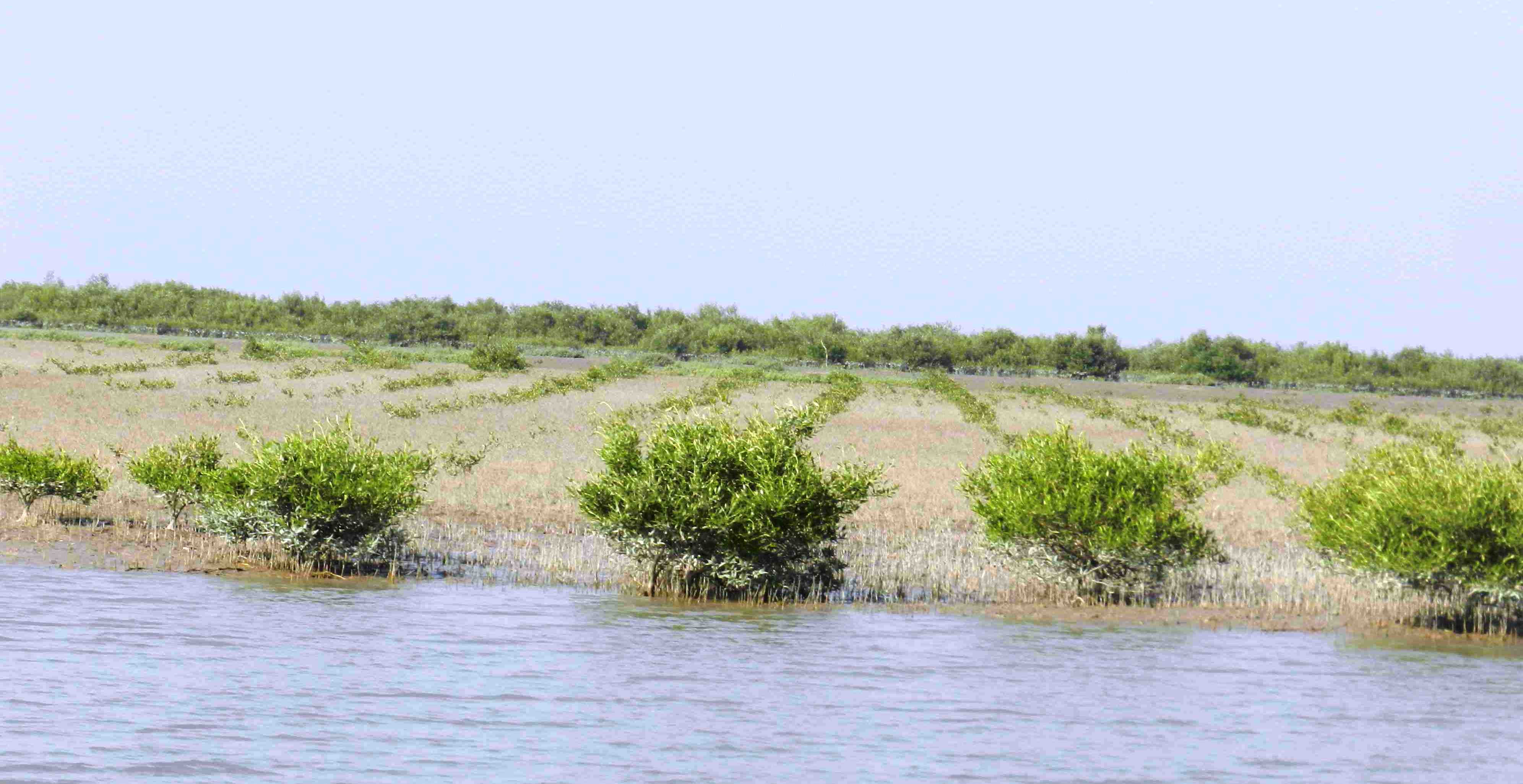 Mangrove plantation near Shahbandar | |
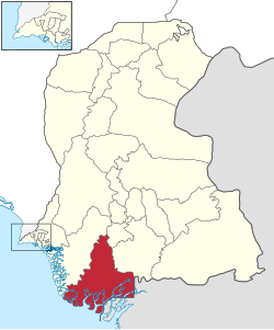 Map of Sindh with Sujawal District highlighted | |
| Country | |
| Province | |
| Division | Banbhore |
| Established | 12 October 2013 |
| Headquarters | Sujawal |
| Government | |
| • Type | District Administration |
| • Deputy Commissioner | N/A |
| • District Police Officer | N/A |
| • District Health Officer | N/A |
| Area | |
| • Total | 8,785 km2 (3,392 sq mi) |
| Population (2017)[1] | |
| • Total | 779,062 |
| • Density | 89/km2 (230/sq mi) |
| Time zone | UTC+5 (PST) |
| Number of Tehsils | 4 |
| Website | borsindh.gov.pk/ |
Administration
Sujawal District is subdivided into five tehsils:
- Jati,
- Kharo Chan,
- Mirpur Bathoro Tehsil,
- Shah Bandar Tehsil
- and Sujawal Tehsil.[4]
History and geography
The decision to divide Thatta District into two districts by the provincial government was made on 12 October 2013 through a notification issued by the Revenue Department of Sindh. The provincial revenue department said:
A new district encompassing Sujawal, Kharochhan (barring 10 dehs), Mirpur Bathoro, Jati and Shah Bundar tehsils (talukas) would be Sindh’s 28th district to be called Sujawal. Its headquarters will be located in Sujawal tehsil (taluka). The new district has been established under Section 6 of the Sindh Land Revenue Act, 1967.[5]
According to the notification, the right side of the Indus River will comprise the old Thatta district, and the left side will come under the jurisdiction of the newly created Sujawal. The Thatta District (among the largest districts of the province area-wise), will have half the size in its new boundaries, comprising Thatta, Mirpur Sakro, Keti Bunder and Ghorabari tehsils (talukas). In addition, some areas of Kharochhan tehsil (taluka) have also been included in the new Thatta District. The historical city of Thatta, which was once the capital of Sindh, was carved out from Karachi as a separate city in August 1948. It was the second largest district in Sindh, in terms of area, covering over 17,335 square kilometers before its recent separation into two parts. The Provincial Revenue Department of Sindh Notification 12 October 2013. There are two Provincial Assembly seats, Constituency PS-86 and Constituency PS-87, and one National Assembly seat, Constituency NA-238, in the newly formed districts of Sujawal.[6][7]
Demography
At the time of the 2017 census, Sujawal district had a population of 779,062, of which 404,810 were males and 374,142 females. The rural population was 693,566 (89.03%) and urban 85,496 (10.97%). The literacy rate is 25.12%: 33.14% for males and 16.14% for females.[1]
The majority religion is Islam, with 96.94% of the population. Hinduism (including those from Scheduled Castes) is practiced by 2.92% of the population. Sindhi is the dominant language, spoken by 97.95% of the population.[1]
See also
- Thatta District
- List of talukas of Sindh
- Sindh
- Kot Aalam
References
- "District-wise Tables - Census 2017 Final Results". pbs.gov.pk. Pakistan Bureau of Statistics. 2017.
- "Thatta Split to Make Sujawal 28th district of Sindh". Dawn News. Retrieved 25 October 2013.
- "Location of Sujawal - Falling Rain Genomics". Falling Rain Genomics. Retrieved 25 October 2013.
- "Sujawal summary" (PDF). Retrieved 2018-09-04.
- Provincial Revenue Department of Sindh Notification 12 October 2013. Cited in: "New Formation of Districts". Pak Times. Retrieved 25 October 2013.
- Provincial Revenue Department of Sindh, Pakistan's Notification on 12 October 2013
- "New formation of Both Districts (Thatta & Sujawal)". The Pioneer. Retrieved 25 October 2013.
External links
Districts of Sindh | ||
|---|---|---|
Provincial capital: Karachi | ||
| Banbhore |  | |
| Hyderabad |
| |
| Karachi |
| |
| Larkana | ||
| Mirpur Khas |
| |
| Sukkur | ||
| Shaheed Benazir Abad |
| |
List of Districts of Pakistan | ||||||||||||||||||||||||
|---|---|---|---|---|---|---|---|---|---|---|---|---|---|---|---|---|---|---|---|---|---|---|---|---|
| ||||||||||||||||||||||||
| ||||||||||||||||||||||||
| ||||||||||||||||||||||||
| ||||||||||||||||||||||||
| ||||||||||||||||||||||||
| ||||||||||||||||||||||||
| ||||||||||||||||||||||||
| ||||||||||||||||||||||||
| ||||||||||||||||||||||||


На других языках
[de] Sujawal (Distrikt)
Der Distrikt Sujawal ist ein Verwaltungsdistrikt in Pakistan in der Provinz Sindh. Sitz der Distriktverwaltung ist die gleichnamige Stadt Sujawal.- [en] Sujawal District
Другой контент может иметь иную лицензию. Перед использованием материалов сайта WikiSort.org внимательно изучите правила лицензирования конкретных элементов наполнения сайта.
WikiSort.org - проект по пересортировке и дополнению контента Википедии