world.wikisort.org - Pakistan
Bahawalnagar District (Urdu and Punjabi: ضلع بہاولنگر), is a district of Punjab province in Pakistan. Before the independence of Pakistan, Bahawalnagar was part of Bahawalpur state governed by the Nawab of Bahawalpur. The city of Bahawalnagar is the capital of the district. Its population according to the 2017 census is 2,982,000 people.[2]
This article needs additional citations for verification. (December 2009) |
Bahawalnagar
ضلع بہاولنگر | |
|---|---|
District of Punjab | |
  Top: Marot Fort Bottom: Fields in Chak 38-R | |
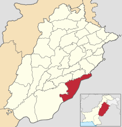 Map of Bahawalnagar District (highlighted in red) within Punjab. | |
| Country | |
| Province | |
| Division | Bahawalpur |
| Headquarters | Bahawalnagar |
| Government | |
| • Type | District Administration |
| • Deputy Commissioner | Capt. (Retired) Muhammad Waseem |
| • District Police Officer | Muhammad Zafar Buzdar |
| Area | |
| • Total | 8,878 km2 (3,428 sq mi) |
| Population (2017)[1] | |
| • Total | 2,975,656 |
| • Density | 340/km2 (870/sq mi) |
| Time zone | UTC+5 (PKT) |
| No. of Tehsils | 5 |
| Tehsils | Bahawalnagar Chishtian Fort Abbas Haroonabad Minchinabad |
| Website | bahawalnagar |
District boundaries
The boundaries of Bahawalnagar in the east and south touches the Indian territory while Bahawalpur district lies on its west and river Sutlej flows on its northern side. District Bahawalnagar spreads over an area of 8878 square kilometers.[3]
Administration

The district of Bahawalnagar is spread over an area of 8,878 square kilometres comprising five tehsils and 118 Union Councils:[4]
| Tehsil name | No of Unions | Population |
|---|---|---|
| Bahawalnagar | 31 | 815,143 |
| Chishtian | 29 | 691,221 |
| Fort Abbas | 16 | 423,529 |
| Haroonabad | 22 | 525,598 |
| Minchinabad | 20 | 526,428 |
| Total | 118 | 2,981,919 |
Demographics
At the time of the 2017 census the district had a population of 2,975,656, of which 1,510,427 were males and 1,464,900 females. Rural population is 2,355,970 while the urban population is 619,686. The literacy rate was 53.08%. Muslims made up almost the entire population with 99.58%.[1] The sub-campus of Islamia University is located here.
Languages
At the time of the 2017 Census of Pakistan, the distribution of the population of Bahawalnagar District by first language was as follows:[5]
- 95.1% Punjabi
- 2.0% Saraiki
- 1.6% Urdu
- 0.3% Pashto
- 0.0% Hindko
- 0.0% Sindhi
- 0.0% Balochi
- 0.0% Kashmiri
- 0.0% Brahui
- 0.8% Others
History
This section needs expansion. You can help by adding to it. (May 2019) |
Nawab Bahawal Khan-1[6] as second nawab of Bahawalpur ascended the throne in 1746 A.D.
Muhammad Mubarik after ruling successfully for years died issueless in 1772 A.D. He was succeeded by nephew Sahibzada Jafar Khan alias Nawab Muhammad Bahawal Khan-II[7] in 1772.
Shrine of Tajuddin Chishti
Shaikh Khawaja Tajuddin Chishti also known as Taj Sarwar Chishti was a Sufi saint of Chishti Order. He was a grandson Shaikh Farid-ud-din Ganjshakar of Pakpattan and his descendants founded the village of Chishtian around 1265 CE (574 Hijri, Islamic calendar). Many native tribes in Punjab region accepted Islam due to his missionary Daawah. Shaikh Khawaja Tajuddin Chishti faced hostility from many Mughal and Turk tribes that opposed his Muslim missionary Daawah as it interfered with their plans and he was martyred in a battle and was buried in Chishtian. Shrine of Sufi saint Shaikh Khawaja Tajuddin Chishti, located at the city of Chishtian. The dargah of Shaikh Taj-ud-din Chishti is called Roza Taj Sarwar.[8]
See also
{{columns-list|colwidth=22em|
- Bahawalnagar
- Bahawalnagar Junction railway station
- Islamia University
- Punjab, Pakistan
- India–Pakistan relations
- Bahawalnagar District
References
- "District Wise Results / Tables (Census - 2017)". www.pbscensus.gov.pk. Pakistan Bureau of Statistics.
- "Archived copy" (PDF). Archived from the original (PDF) on 7 November 2017. Retrieved 26 November 2017.
{{cite web}}: CS1 maint: archived copy as title (link) - "Bahawalnagar | Punjab Portal". Punjab.gov.pk. Archived from the original on 14 October 2012. Retrieved 31 January 2017.
- Unions in Bahawalnagar Government of Pakistan Archived 2012-02-09 at the Wayback Machine. Nrb.gov.pk. Retrieved on 2011-12-04.
- Census-2017 - Detailed Tables
- "CDA". Cholistan.gov.pk. Retrieved 31 January 2017.
- "Bahawalpur City". Archived from the original on 8 February 2013. Retrieved 27 November 2012.
- "Shrine of Tajuddin Chishti, Bahawalnagar - Mera Watan". Merawatan.pk. Retrieved 6 March 2019.
Districts of Punjab, Pakistan | ||
|---|---|---|
Provincial capital: Lahore | ||
| Bahawalpur |  | |
| Dera Ghazi Khan |
| |
| Faisalabad | ||
| Gujranwala |
| |
| Gujrat | ||
| Lahore |
| |
| Multan | ||
| Rawalpindi | ||
| Sahiwal | ||
| Sargodha | ||
На других языках
- [en] Bahawalnagar District
[ru] Бахавалнагар (округ)
Бахавалнагар (урду ضلع بہاولنگر, англ. Bahawalnagar District) — один из 36 округов пакистанской провинции Пенджаб. Административный центр — город Бахавалнагар.Другой контент может иметь иную лицензию. Перед использованием материалов сайта WikiSort.org внимательно изучите правила лицензирования конкретных элементов наполнения сайта.
WikiSort.org - проект по пересортировке и дополнению контента Википедии