world.wikisort.org - Pakistan
Mandi Bahauddin, also spelled Mandi Baha ud Din, (Punjabi and Urdu: ضلع منڈی بہاءالدین) is a district in the Punjab province of Pakistan.In the north-central area of the province. It is bordered on the northwest by the Jhelum River, on the southeast by the Chenab River (which separates it from Gujranwala District and Gujrat District), and on the southwest by the Sargodha District. The district has an area of 2,673 square kilometres (1,032 sq mi). Mandi district currently has 1.5 million population.
This article needs additional citations for verification. (January 2015) |
Mandi-Bahauddin district
ضلع منڈی بہاءالدین | |
|---|---|
District of Punjab | |
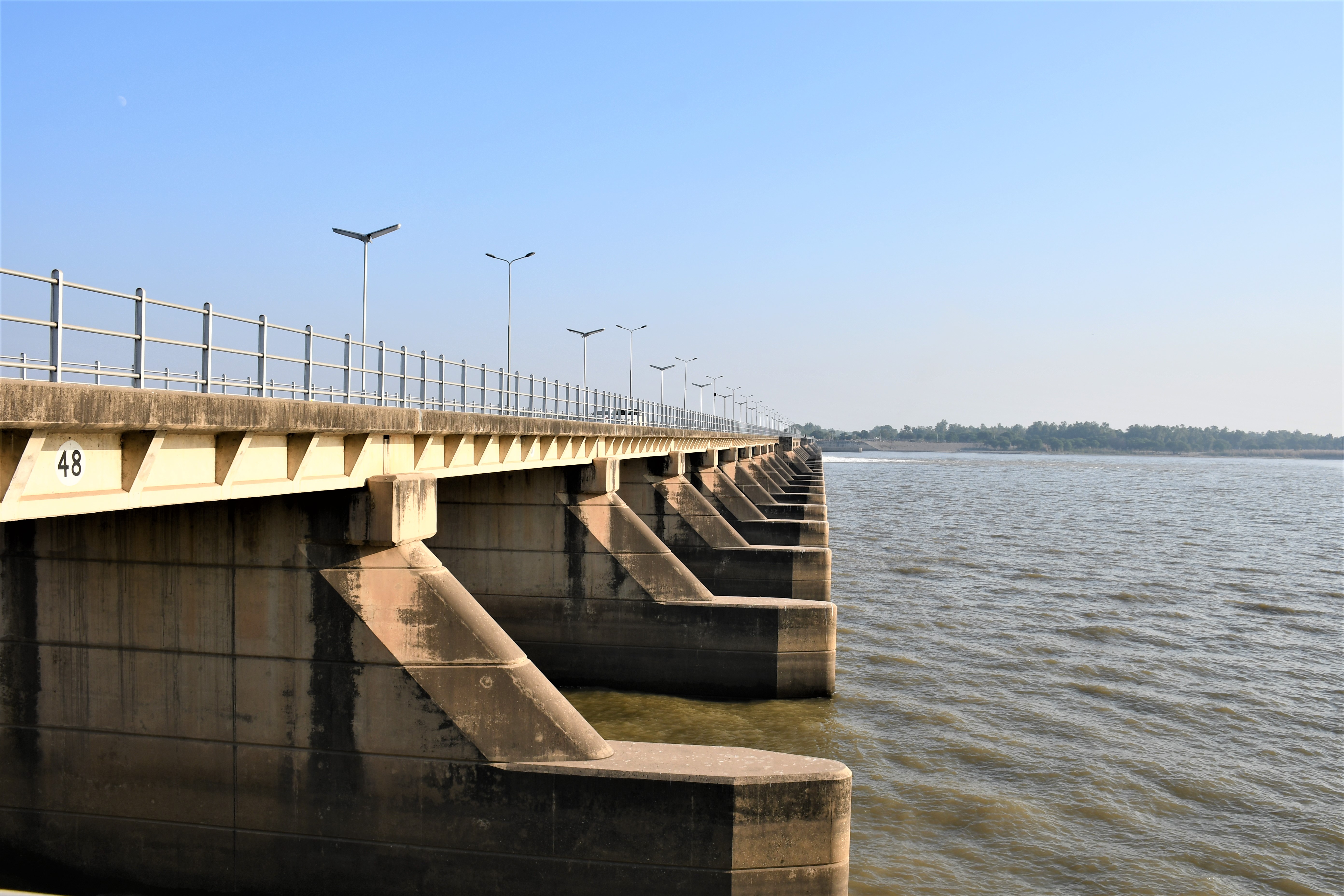  Top: Rasul Barrage, bottom: Busal rest house | |
 Map of Punjab with Mandi-Bahauddin District highlighted | |
| Coordinates: 32°35′N 73°30′E | |
| Country | |
| Province | |
| Division | Gujrat |
| Headquarters | Mandi Bahauddin |
| Government | |
| • Type | District Administration |
| • Deputy Commissioner | Tasneem Ali Khan |
| • District Police Officer | N/A |
| • District Health Officer | N/A |
| • The Chairman District Counsil | Ch Ghulam Hussain Bosal |
| Area | |
| • Total | 2,673 km2 (1,032 sq mi) |
| Population (2017)[1] | |
| • Total | 1,594,039 |
| • Density | 600/km2 (1,500/sq mi) |
| Time zone | UTC+5 (PST) |
| Number of Tehsils | 3 |
| Website | mandibahauddin |
Administration
Mandi Bahauddin is subdivided into Three tehsils and 80 Union Councils:[2]
| Name of Tehsil | Number of Union Councils |
|---|---|
| Malakwal | 20 |
| Mandi Bahauddin | 30 |
| Phalia | 30 |
| Total | 80 |
Geography
The district forms a central portion of the Chaj Doab lying between the Jhelum and Chenab rivers. It lies from 30° 8' to 32° 40' N and 73° 36' to 73° 37' E. The tehsil headquarters towns of Phalia and Malikwal are 22.5 and 28.5 kilometres (14.0 and 17.7 mi) from Mandi Bahauddin, respectively. It is bounded on the north by the Jhelum river, which separates it from Jhelum district; on the west by Sargodha district, on the south by the river Chenab (which separates it from the Gujranwala and Hafizabad districts); and on the east by Gujrat district. The total area of the district is 2,673 square kilometres (1,032 sq mi). The district comprises the Mandi Bahauddin, Phalia, and Malikwal tehsils.
Demographics
At the time of the 2017 census, the district had a population of 1,594,039, of which 775,788 were male and 818,056 female. 1,267,681 lived in rural areas while 326,358 lived in urban areas. Islam is the religion of nearly the entire population with 99.57% of the population, while a small minority of Christians lives mainly in the urban area.[1]
At the time of the 2017 census 96.50% of the population spoke Punjabi, 1.74% Urdu and 1.48% Pashto as their first language.[1] The dialect of Punjabi spoken here is close to the standard language.
According to the 1998 Pakistan census, the population of the district was 1,160,552, 14.93% of whom lived in urban environments.[3]
Climate
This district has a moderate climate, hot in summer and cold in winter. During the peak of summer the temperature may rise to 48 °C (118 °F) during the day, but in the winter months the minimum temperature may fall below 3 °C (37 °F). The average rainfall in the district is 388 millimetres (15.3 in).[4] mainly resonates with weather from Islamabad
Notable People
- Hasan Askari Rizvi, Chief Minister Punjab (Caretaker)
- Mustansar Hussain Tarar, Pakistani novelist, columnist, travel writer and TV host
- Naved Arif Gondal, Pakistani cricketer
- Pervaiz Mehdi Qureshi Ex Chief Of Pakistan Air Force
- Shaukat Ali folk singer
- Hasan Ali cricketer
- Mumtaz Ahmed Tarar, M.N.A Federal Minister of Human Rights (PML-N, Ex PPP)
- Hameeda Waheeduddin M.P.A Minister of Women Development Punjab (PML-N, Ex PLM-Q)
- Nasir Iqbal Bosal, M.N.A. Cousin of District Chairman Mandi Bahauddin (PML-N, Ex PLM-Q)
- Muhammad Tariq Tarar Ex M.N.A (PTI, Ex PPP)
- Pir Syed Muhammad Binyamin Rizvi Ex Minister of Punjab (PML-N)
- Basma Riaz Choudhry Ex M.P.A (PML-Q)
- Asif Bashir Bhagat Ex M.P.A (PPP).
- Ijaz Ahmad Chaudhry )ex MNA PMLN
- Haji imtaz Ahmad Chaudhry MNA PTI
References
- "District Wise Results / Tables (Census - 2017)". www.pbscensus.gov.pk. Pakistan Bureau of Statistics.
- "Tehsils & Unions in the District of Mandi Bahauddin". Archived from the original on 11 September 2016. Retrieved 2 September 2016.
- Population – Urban Resource Centre Archived 2006-05-13 at the Wayback Machine (1998 census details)
- "Average rainfall & Temperature in mandi bahauddin". World Weather. Retrieved 25 October 2013.
| Cities and towns |
|  | |||||
|---|---|---|---|---|---|---|---|
| Union councils and villages |
| ||||||
Districts of Punjab, Pakistan | ||
|---|---|---|
Provincial capital: Lahore | ||
| Bahawalpur |  | |
| Dera Ghazi Khan |
| |
| Faisalabad | ||
| Gujranwala |
| |
| Gujrat |
| |
| Lahore | ||
| Multan | ||
| Rawalpindi |
| |
| Sahiwal | ||
| Sargodha | ||
Authority control | |
|---|---|
| General |
|
| National libraries | |
На других языках
[de] Mandi Bahauddin (Distrikt)
Der Distrikt Mandi Bahauddin auch Mandi Baha ud Din ist ein Verwaltungsdistrikt in Pakistan in der Provinz Punjab. Sitz der Distriktverwaltung ist die gleichnamige Stadt Mandi Bahauddin.- [en] Mandi Bahauddin District
[ru] Манди-Бахауддин (округ)
Манди-Бахауддин (урду ضلع منڈی بہاؤالدین, англ. Mandi Bahauddin District) — один из 36 округов пакистанской провинции Пенджаб. Административный центр — город Манди-Бахауддин.Другой контент может иметь иную лицензию. Перед использованием материалов сайта WikiSort.org внимательно изучите правила лицензирования конкретных элементов наполнения сайта.
WikiSort.org - проект по пересортировке и дополнению контента Википедии