world.wikisort.org - Pakistan
Sargodha District (Punjabi and Urdu: ضلع سرگودها), is a district of Punjab, Pakistan. The capital of the district is Sargodha. It is an agricultural district, wheat, rice, and sugarcane along with Kinno being its main crops. The Sargodha district and region is also famous for citrus fruit including Kinnow, orange and lemon. The district has an area of 5,864 km2.[2]
Sargodha District
ضلع سرگودها | |
|---|---|
District of Punjab | |
 M-2 Motorway entering Sargodha District | |
 Flag  Seal | |
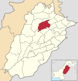 Location of Sargodha District in Punjab | |
| Country | |
| Province | |
| Division | Sargodha |
| Headquarters | Sargodha |
| Government | |
| • Type | District Administration |
| • Deputy Commissioner | Muhammad Asghar Joiya |
| • District Police Officer | N/A |
| • District Health Officer | N/A |
| Area | |
| • District of Punjab | 5,854 km2 (2,260 sq mi) |
| Population (2017)[1] | |
| • District of Punjab | 3,696,212 |
| • Density | 630/km2 (1,600/sq mi) |
| • Urban | 1,144,535 |
| Time zone | UTC+5 (PST) |
| Postal Code | 40100 |
| Constituencies | NA-88, NA-89, NA-90, NA-91, NA-92 |
| Number of Tehsils | 7 |
| National Assembly Seats (2018) | Total (5)
|
| Punjab Assembly Seats (2018) | Total (10)
|
| Website | sargodha |
Etymology
It is believed that there was an old pond in the middle of the town where an old Hindu monk or sadhu (godha) used to live. The Sanskrit word for pond is "ser".[3] Since the town had a modest population, people would refer the place as 'ser godha', the place where that famous Sadhu resided next to the pond.[4]
Administration and tehsils
Sargodha city is the administrative headquarter of Sargodha Division and handles the population of about 8.1 million.[5] Sargodha District is administratively divided into Seven Tehsils, which contain a total of 161 Union Councils.[6] Following are the seven tehsils of Sargodha district:[7]
- Sargodha
- Kot Momin
- Bhalwal
- Shahpur
- Sillanwali
- Sahiwal
- Bhera
Demographics
The population of Sargodha grew rapidly with the arrival of Muslim refugees from East Punjab, fleeing from the religious violence that followed the partition of India and the independence of Pakistan in 1947.
At the time of the 2017 census the district had a population of 3,696,212, of which 1,867,724 were males and 1,828,074 females. Rural population is 2,608,007 while the urban population is 1,144,535. The literacy rate was 65.54%.
Sargodha District is among the world's best Citrus-producing region. Sargodha District is well known for its kinnow, a citrus variety.[8]
The below list shows the population of each of the seven tehsils of Sargodha district according to the 2017 Census of Pakistan along with area:
| Tehsil | Population[1] (2017 Census) |
Area km2 (sqmi) |
|---|---|---|
| Sargodha | 1,535,152 | 1,455 (561.8) |
| Kot Momin | 451,978 | 891 (344.0) |
| Bhalwal | 456,206 | 557 (215.1) |
| Shahpur | 353,325 | 787 (303.9) |
| Silanwali | 344,487 | 610 (235.5) |
| Sahiwal | 340,695 | 759 (293.1) |
| Bhera | 314,369 | 722 (278.8) |
Religion
As per the 2017 census Muslims were the predominant religious community with 98.08% of the population while Christians were 1.76% of the population.[1]
| Religion | Population (1941)[9]: 42 | Percentage (1941) |
|---|---|---|
| Islam |
835,918 | 83.68% |
| Hinduism |
102,233 | 10.23% |
| Sikhism |
48,046 | 4.81% |
| Christianity |
12,620 | 1.26% |
| Others [lower-alpha 4] | 104 | 0.01% |
| Total Population | 998,921 | 100% |
Language
At the time of the 2017 census, 94.07% of the population spoke Punjabi, 4.31% Urdu and 1.23% Pashto as their first language.[1]
Villages
- Chak 101 NB
- Chak 104 SB
- Bhabrah
- Bucha Klan
- Wan Miana
- Dhingranwali
- Havali Mian sher Ali
- Behak Maken
See also
References
- "District Wise Results / Tables (Census - 2017)". www.pbscensus.gov.pk. Pakistan Bureau of Statistics.
- District Wise – Sargodha Archived 2008-01-04 at archive.today
- Portrait of Pakistan. Ferozsons. 1994. ISBN 9789690101051. Retrieved 31 December 2007.
The district derives its name for the headquarters town of Sargodha, which is a combination of "Sar" and "Godha". "Sar" is a Hindi word which denotes a water...
- Pakistan tourism directory. Holiday Weekly. 1997. Retrieved 31 December 2007.
Sargodha is a colony town established in 1903, but its origins are older. Sargodha is a combination of the words "Sar" meaning a pond and "Godha"...
- "DISTRICT WISE CENSUS RESULTS CENSUS 2017" (PDF). www.pbscensus.gov.pk. Archived from the original (PDF) on 29 August 2017.
- Tehsils & Unions in the District of Sargodha – Government of Pakistan Archived 9 February 2012 at the Wayback Machine. Nrb.gov.pk. Retrieved on 2012-07-01.
- [dead link]
- Mahmood, Amjad (21 December 2020). "Sarghoda's citrus claim to fame". DAWN.COM. Retrieved 27 December 2020.
- "CENSUS OF INDIA, 1941 VOLUME VI PUNJAB PROVINCE". Retrieved 21 July 2022.
- Formerly known as Shahpur District, prior to district headquarters relocated to Sarghoda in 1960
- Historic district borders may not be an exact match in the present-day due to various bifurcations to district borders — which since created new districts — throughout the historic Punjab Province region during the post-independence era that have taken into account population increases.
- 1941 census: Including Ad-Dharmis
- Including Jainism, Buddhism, Zoroastrianism, Judaism, or not stated
Neighbourhoods of Sargodha | ||
|---|---|---|
Administrations: Sargodha Division and Sargodha District | ||
| Tehsils |  | |
| Cities |
| |
| Towns & councils |
| |
| Localities |
| |
Website: Sargodha District at NRB | ||
Districts of Punjab, Pakistan | ||
|---|---|---|
Provincial capital: Lahore | ||
| Bahawalpur |  | |
| Dera Ghazi Khan |
| |
| Faisalabad | ||
| Gujranwala |
| |
| Gujrat |
| |
| Lahore | ||
| Multan | ||
| Rawalpindi |
| |
| Sahiwal | ||
| Sargodha | ||
На других языках
[de] Sargodha (Distrikt)
Der Distrikt Sargodha ist ein Verwaltungsdistrikt in Pakistan in der Provinz Punjab. Sitz der Distriktverwaltung ist die gleichnamige Stadt Sargodha.- [en] Sargodha District
[ru] Саргодха (округ)
Саргодха (урду ضِلع سرگودها, англ. Sargodha District) — один из 36 округов пакистанской провинции Пенджаб. Административный центр — город Саргодха.Другой контент может иметь иную лицензию. Перед использованием материалов сайта WikiSort.org внимательно изучите правила лицензирования конкретных элементов наполнения сайта.
WikiSort.org - проект по пересортировке и дополнению контента Википедии