world.wikisort.org - Pakistan
Khairpur District (Sindhi: خيرپور ضلعو, Urdu: ضلع خیرپور) is a district in the Pakistani province of Sindh in Sukkur Division.[2] At the 2017 census, it was the fifth most populated district in the province after four districts of Karachi city, with 2.4 million inhabitants. The headquarters of the district is the city of Khairpur. The district is further divided into eight sub-districts: Khairpur Tehsil, Mirwah Tehsil, Kot Diji Tehsil, Kingri Tehsil, Sobho Dero Tehsil, Gambat Tehsil, Faiz Ganj Tehsil and Nara Tehsil.[3]
Khairpur District
| |
|---|---|
District of Sindh | |
  Top: Kot Diji Fort Bottom: Faiz Mahal | |
 | |
| Coordinates: 27°32′N 68°46′E | |
| Country | |
| Province | |
| Division | Sukkur |
| Established | 15 October 1955 |
| Government | |
| • Type | District Administration |
| • Deputy Commissioner | N/A |
| • District Police Officer | N/A |
| • District Health Officer | N/A |
| Area | |
| • Total | 15,910 km2 (6,140 sq mi) |
| Population (2017)[1] | |
| • Total | 2,405,190 |
| • Rank | 5th:Sindh |
| • Density | 150/km2 (390/sq mi) |
| Demonym | Khairpuri |
| Time zone | UTC+5 (PKT) |
| • Summer (DST) | UTC+5 |
| Calling code | 0243 |
| Number of Tehsils | 8 |
| Number of Union Councils | 89 |
Location
Khairpur district is located between middle and northern Sindh. It is bounded on the north by Shikarpur District and Sukkur District, on the east by India, on the south by Sanghar District and Nawabshah District, and on the west by Larkana District, Naushahro Feroze District and Indus River. The revised area of the district is 15,910 km2.
Demographics
At the time of the 2017 census, Khairpur district had a population of 2,405,190, of which 1,240,254 were males and 1,164,826 females. The rural population was 1,628,184 (67.69%) and urban 777,006 (32.31%). The literacy rate is 49.15%: 62.08% for males and 35.49% for females.[1]
The majority religion is Islam, with 97.16% of the population. Hinduism (including those from Scheduled Castes) is practiced by 2.76% of the population.[1]
At the time of the 2017 census, 95.64% of the population spoke Sindhi and 1.55% Punjabi as their first language.[1]
Administration
It has 8 tehsils, 76 Union councils, 11 towns, 6800 Villages and total population 1546587 (Male 810448 and Female Population 736139) according to (Census) 1998.[4]
The eight tehsils of the district are:
- Faiz Ganj Tehsil
- Gambat Tehsil
- Khairpur Tehsil
- Kingri Tehsil
- Kot Diji Tehsil
- Nara Tehsil
- Sobho Dero Tehsil
- Thari Mirwah Tehsil
The union councils are:
- UC No. 1 Tandu Masti
- UC No. 2 Khan pur
- UC No. 3 Machyoon
- UC No. 4 Hajna Shah
- UC No. 5 Shadi Shaheed
- UC No. 6 Bugro
- UC No. 7 Gujo
- UC No. 8 Shah Ladhani
- UC No. 9 Mehr Ali
- UC No. 10 Peer Mangion
- UC No. 11 Shah Bhangio
- UC No. 12 Ubhri
- UC No. 13 Noor Pur
- UC No. 14 Peer Badal
- UC No. 15 Hadal Shah
- UC No. 16 SadarJi Bhatyoon
- UC No. 17 Manghanwari
- UC No. 18 Rahooja Meer
- UC No. 19 Mohial
- UC No. 20 Kot Meer Muhammad
- UC No. 21 Ulra
- UC No. 22 Wada Mahesar
- UC No. 23 Drib Mehar Shah
- UC No. 24 Kolab Jial
- UC No. 25 Laal Bakhsh Kandhro
- UC No. 26 Bhonbhatpur
- UC No. 27 Peer Hayat Shah
- UC No. 28 Sami
- UC No. 29 Mera
- UC No. 30 Madd
- UC No. 31 Sagyoon
- UC No. 32 Haji Abdul Kareem Kharal
- UC No. 33 Sitharja Bala
- UC No. 34 Gadeji
- UC No. 35 Rasool Abad
- UC No. 36 Daraza Sharif
- UC No. 37 Kamal Dero
- UC No. 38 Khemtia
- UC No. 39 Jado Wahan
- UC No. 40 Belharo
- UC No. 41 Ali Muhammad Khan Sarohi abad / Village Ali Bakhsh Sarohi
- UC No. 42 Razi Dero Kacho
- UC No. 43 Munawarabad
- UC No. 44 Ripri
- UC No. 45 Shaheed Naseem Ahmed Kharal / Kharalabad
- UC No. 46 Raheem Bakhsh was an
- UC No. 47 Jiskani
- UC No. 48 Fateh Pur
- UC No. 49 Jhando Mashaikh
- UC No. 50 Ali Muhammad Machi
- UC No. 51 Talpur Wada
- UC No. 52 Baphu
- UC No. 53 Nasir Fakir
- UC No. 54 Ustad Atta Muhammad Hami
- UC No. 55 Muhabat wah
- UC No. 56 Layari (HussainAbad)
- UC No. 57 Goondariro
- UC No. 58 Sohu
- UC No. 59 Hindyari
- UC No. 60 Jaffar Khan Jalalani
- UC No. 61 Saniso
- UC No. 62 Mandan
- UC No. 63 Tarko
- UC No. 64 Kharirah
- UC No. 65 Baqi Khan
- UC No. 66 Mehar Veesar
- UC No. 67 Deparja
- UC No. 68 Talee
- UC No. 69 Sabar Rind
- UC No. 70 Moosan Shah
- UC No. 71 Peer Budhro
- UC No. 72 Akri
- UC No. 73 Khushkhail
- UC No. 74 Kandiyari
- UC No. 75 Karam Khan Kubar / Rajper
- UC No. 76 Bhangu Behan
- UC No. 77 Razaabad
- UC No. 78 Kot Lalu
- UC No. 79 Punhal Rajper
- UC No. 80 Umman Rajper
- UC No. 81 Peer Abdul Qadir Shah
- UC No. 82 Kot Jubo
- UC No. 83 Dodo Faqeer Aradin
- UC No. 84 Khenwari
- UC No. 85 Tajjal Shareef
- UC No. 86 Sikandarabad
List of Dehs
The following is a list of Khairpur District's dehs, organised by taluka:[5]
- Khairpur Taluka (43 dehs)
- Aalipur
- Abad Jagir
- Atteri
- Baberloi
- Bhurgari
- Bindi Muhammad Panah
- Bugro
- Chaar Jagir
- Chhejro
- Danwaro
- Gujo
- Hajna Shah
- Jhaloji
- Keti Muhari
- Khairpur
- Khanpur
- Khariro
- Kouro Phulpoto
- Lalo Shedi
- Luqman
- Machyoon
- Mangi
- Mehar Ali
- Mitho Mari
- Nizamani
- Palh
- Paneero
- Panwari
- Phatt
- Phulwahan
- Pipri
- Pir Mangio
- Raina
- Shadi Shaheed
- Shah Bhangio
- Shah Ladhani
- Tando Masti
- Tando Nazar Ali
- Tando Nehal
- Therhi
- Ubhari
- Wassan
- Wisro Wahan
- Gambat Taluka (50 dehs)
- Agra
- Baharo Dero
- Baharo Katcho
- Belharo
- Belharo Katcho
- Dhandan
- Deh Kuria
- Dodo Bhutto
- Draza Chak-1
- Draza Chak-2
- Draza Chak-3
- Fato Sial
- Gambat
- Gangar
- Gigra Kalhora
- Golo Wahan
- Jado Wahan
- Jamra
- Kaleri
- Kamal Dero
- Keti Abhouro
- Keti Morio
- Keti Unar
- Khairo Dero
- Khemtia
- Khuhra
- Lakha
- Lal Kumbhar
- Mehro Pathan
- Miani
- Mujhid
- Nando Baharo
- Paleeja
- Paleja Kacho
- Phori
- Pir Esso
- Razi Dero
- Razi Dero Katcho
- Ripri
- Saidi Bala
- Saidi Lowor
- Sanhri
- Sarohi
- Satabo
- Shah Takio
- Sial Pathan
- Sial Pathan Kacho
- Sial Pathan/Agra Boring
- Tagar Chak-2
- Toori
- Wad Pagia
- Kingri Taluka (49 dehs)
- Abdullah Kalhoro
- Ahmed Pur
- Baharpur
- Bambho Khoruam
- Beli Chani
- Bhambho Dero
- Chachar
- Denal Shah
- Drib Rozi
- Fareedabad
- Fateh Ali Chandio
- Gahno Kalhoro
- Garhi
- Mori
- Gadhi
- Ghuriri
- Gumchi
- Kainchi
- Kanjan
- Katohar
- Keti Pandhi
- Keti Mehar
- Kingri
- Kolab Jail
- Langah
- Mangerji
- Manghanwari
- Mari
- Mian Khan
- Miano
- Mitho dero
- Mohil
- Noorpur
- Paki Khohi
- Pir Shahbazi
- Piryalo
- Qaim Kalhoro
- Rafique Mahesar
- Rahouja
- Rajo Dero
- Sadarji
- Saeed pur
- Saidi
- Sri Ghanwar Khan
- T. M. Hyder
- Ulra Chak 1
- Ulra Chak 2
- Ulra Chak 3
- Ulra Chak 4
- Kot Diji Taluka (53 dehs)
- Agha Hashim Shah
- Ali Muhammad Machhi
- Arab Machhi
- Arbani
- Babar
- Bago Dharo
- Baharo Lashari
- Bakho Lashari
- Bapho
- Chhudahu
- Chouniro
- Dadloo
- Dhukar
- Fateh Pur
- Goondariro
- Hussainabad
- Jahndo Mashaikh
- Jiskani
- Junna
- Kanasira
- Khuda Bux Hisbani
- Kot Diji
- Kotlu
- Layari
- Luhrani
- Malku Wahan
- Mehrano-1
- Mehrano-2
- Mir Khan Muhammad
- Mithan Fakir
- Mithri
- Muhammad Hajam
- Muhbat Wah
- Nagrija
- Naro Dhoro
- Nasir Fakir
- Nawab Wassan
- Nebahu Patta
- Noor Bozdar
- Panhwari
- Patta
- Pir Gudo
- Pir Misri
- Qaim Gopang
- Raban Rajper
- Rajpari
- Rind
- Shafi Muhammad Ujjan
- Sohu
- Sono Gopang
- Talpur Wada
- Tando Shah
- Wali Muhammad Bhatti
- Mirwah Taluka (55 dehs)
- Ahmed Ali Wah
- Allah Dino Amur
- Allah Wasayo Depar
- Bago Dhoro
- Bozdar
- Chutto Wandier
- Dato Dasti
- Deparja
- Dhedhano
- Faiz Muhammad Mojai
- Gabar
- Gahi Chakrani
- Gigro
- Habib Phull
- Halepota
- Hindyari
- Jalalani
- Jalbani
- Jangwaro
- Jeorge Ali Murad
- Kalro
- Kanchhi
- Kharirah
- Khuda Bux Kubar
- Mandan
- Maroro
- Matt
- Mengho Shar
- Mossan Shah
- Mothar
- Muhammad Ashabi
- Mureed Haji
- Nazim Shar
- Pirwasan
- Punihar
- Ranyah
- Sabar Rind
- Saindad Haji
- Saindad Machhi
- Saneso
- Sanjrani
- Sawri
- Seri
- Shah Nawaz
- Sher Khan Lund
- Soofai
- Sutyaro
- Tali
- Tando Mir Ali
- Tarko
- Telahu
- Thari
- Wagah
- Wali Dad Lund
- Waryam Wandier
- Nara Taluka (59 dehs)
- Ahsan Jaro
- Beewari
- Bewatoo
- Bhait Tharoji
- Bhaongiwari
- Bhit Bhonji
- Bhit Kindari
- Bux Ali Aradin
- Chachro
- Chhohar Shar
- Choondko-1
- Choondko-2
- Dadu
- Dandh Simmi
- Daoji
- Darbhoo
- Dedhano
- Dingari
- Dodiwari
- Geandhaou
- Ghulam Hussain
- Gogo
- Gulab Bhanbhro
- Idhoie
- Ilyas Wari
- Jhuryaro
- Jubo
- Kamaraho
- Katgarh
- Kathore
- Kharch
- Khenwari
- Kherap
- Kirari
- Kiri Aradin
- Klahoo
- Ladhou
- Laiwari
- Lemoo Rajpar
- Luck Turko
- Methari
- Muhammad Khan Bhurgari
- Nisrullah
- Pateji
- Patel pota
- Pharhiyaro
- Pir Bux Aradin
- Pir Bux Gaho
- Pir Ibu
- Razo Bhanbhro
- Sarhadano
- Saido
- Sami Pota
- Santarahoo
- Soomarwari
- Sorah
- Tahroji
- Taj Muhammad Mullo
- Tajal
- Faiz Ganj Taluka (59 dehs)
- Abdullah Hisbani
- Akri
- Akro
- Allah Warayo
- Amin Pato
- Anheeri
- Anoi
- Araro
- Aub
- Baseero
- Bather
- Bhangu Behan
- Budho Mullo
- Buo
- Cheena
- Chibherero
- Derah
- Dhundh
- Gadano
- Ghulam Nabi
- Hussain Shah
- Hussain Pato
- Izat Shar
- Jaffar Lashari
- Jakhereri
- Jalalji
- Kandiari
- Karam Khan
- Karoondi
- Khair Muhammad
- Khinyari
- Khuteero
- Kot Laloo
- Kup
- Lakhrand
- Mari
- Mehar Ali Unar
- Mitho Chang
- Moheja
- Mohib Shah
- Nangar Shah
- Nazar M. Behan
- New Laheero
- Nindhero
- Pacca Chang
- Palyo Lashari
- Paneeri
- Pario Mari
- Pholahri
- Prano Laheero
- Punhal Rajper
- Radhan Mashaikh
- Rattar
- Sahito
- Sijawal Rajper
- Tarai
- Uman
- Usman Mullo
- Wahleer
- Sobho Dero Taluka (45 dehs)
- Abdul Karim Kharal
- Bhellar
- Bhombhatpur
- Bindi Motayio
- Chutto Channo
- Gaddeji
- Gahno Bhagat
- Hingoreja
- Kazi Bhutta
- Keti Kanoori
- Keti Moosa Bughio
- Keti Noorpur
- Khalifa Huryah
- Kharal
- Kot Chandiko
- Larik
- Machhar
- Maddd
- Mangi Mari
- Mangnapota
- Meerak
- Mehnidero
- Mir Khan Shahani
- Niwaro
- Noor Pur Katcho
- Noor Pur Reyasat
- Pialo
- Pir Mashaikh
- Pir Taj Muhammad
- Pir Umar Shah
- Rahopota
- Ranipur
- Ranipur Road
- Rasoolabad
- Rukrani
- Sagyon
- Sahita
- Sami
- Setaerja Bala
- Setharja Lower
- Shah Awais
- Sobho Dero
- Thatti
- Tunia
- Watani
People from Khairpur District
- Pir Pagaro - President of Pakistan Muslim League (F)
- Sachal Sarmast - eighteenth-Century Sufi Poet
- Qaim Ali Shah - former Chief Minister of Sindh Province
- Ghous Ali Shah - former Defense Minister of Pakistan and Former Chief Minister of Sindh province
- Mir Ali Murad Talpur - former ruler of the princely state of Khairpur
References
- "District-wise Tables - Census 2017 Final Results". pbs.gov.pk. Pakistan Bureau of Statistics. 2017.
- "Khairpur: then and now - Daily Times". Daily Times. 6 February 2018. Retrieved 16 May 2018.
- "Khairpur History". Khairpur.gos.pk.
- "Archived copy". Archived from the original on 28 March 2015. Retrieved 7 December 2018.
{{cite web}}: CS1 maint: archived copy as title (link) - "List of Dehs in Sindh" (PDF). Sindh Zameen. Retrieved 22 March 2021.
Sources
- Basti, Malik Peeran Ditta daisi. "populated places of Alipur Tehsil". Local. ciclone. Retrieved 24 November 2011.[permanent dead link]
- 1998 District census report of Khairpur. Census publication. Vol. 86. Islamabad: Population Census Organization, Statistics Division, Government of Pakistan. 2000.
External links
- District of Khairpur
- http://www.nrb.gov.pk/lg_election/union.asp?[permanent dead link]
Districts of Sindh | ||
|---|---|---|
Provincial capital: Karachi | ||
| Banbhore | 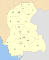 | |
| Hyderabad |
| |
| Karachi |
| |
| Larkana |
| |
| Mirpur Khas |
| |
| Sukkur | ||
| Shaheed Benazir Abad |
| |
Authority control | |
|---|---|
| General | |
| National libraries | |
На других языках
[de] Khairpur (Distrikt)
Der Distrikt Khairpur ist ein Verwaltungsdistrikt in Pakistan in der Provinz Sindh. Sitz der Distriktverwaltung ist die gleichnamige Stadt Khairpur.- [en] Khairpur District
[ru] Хайрпур (округ)
Хайрпур (урду ضلع خیرپور, англ. Khairpur District) — один из 23 округов пакистанской провинции Синд. Административный центр — город Хайрпур.Другой контент может иметь иную лицензию. Перед использованием материалов сайта WikiSort.org внимательно изучите правила лицензирования конкретных элементов наполнения сайта.
WikiSort.org - проект по пересортировке и дополнению контента Википедии