world.wikisort.org - Pakistan
Karachi East District (Urdu: ضلع کراچی مشرقی ) is an administrative district of Karachi Division in Sindh, Pakistan.
Karachi East District
ضلع شرقی کراچی | |
|---|---|
District of Sindh | |
 Aziz Bhatti Park in Gulshan Town | |
 Map of Karachi East District | |
| Country | |
| Province | |
| Division | Karachi |
| Established | 2013 |
| Headquarters[1] | DMC East office |
| Government | |
| • Type | Municipal corporation |
| • Body | DMC East |
| • Deputy Commissioner | Asif Jan Siddiqui[3] |
| • Administrator | Rahmatullah Sheikh[2] |
| Area | |
| • Total | 139 km2 (54 sq mi) |
| Population (2017)[citation needed] | |
| • Total | 2,875,315 |
| • Density | 21,000/km2 (54,000/sq mi) |
| Website | www |
Map of Karachi Division

History
The district was abolished in 2000, and was divided into four towns namely:
- Gulshan Town
- Jamshed Town
- Gulzar-e-Hijri Town
- Faisal Cantonment
- Feroz Abad Town.
On 11 July 2015, the Sindh Government restored again Karachi East District.[4]
In November 2013, three eastern towns of Karachi East District separated to form a new District named Korangi also Jamshed Town of Karachi South District was added into this district. Now Karachi East comprises two towns: Jamshed and Gulshan.[5][6][7]
Demographics
At the time of the 2017 census, Karachi East district had a population of 2,875,315, of which 1,506,788 were males and 1,368,002 females. The entire population was urban. The literacy rate is 76.00%: 78.26% for males and 73.49% for females.[citation needed]
The majority religion is Islam, with 95.31% of the population. Christianity is practiced by 3.14% and Hinduism (including Scheduled Castes) is practiced by 1.38% of the population.
At the time of the 2017 census, 37.51% of the population spoke Urdu, 13.91% Pashto, 13.29% Punjabi, 11.55% Sindhi, 8.38% Saraiki, 3.29% Hindko and 2.34% Balochi as their first language.[citation needed]
Administrative Towns in Karachi East
Following is the list of two administrative towns of Karachi East District.[7]
| Union Council |
|
|---|---|
| U.C. 1 Akhtar Colony | |
| U.C. 2 Manzoor Colony | |
| U.C. 3 Azam Basti | |
| U.C. 4 Chanesar Goth | |
| U.C. 5 Mahmudabad | |
| U.C. 6 P.E.C.H.S. (Pakistan Employees Co-operative Housing Society) | |
| U.C. 7 P.E.C.H.S. II | |
| U.C. 8 Jut Line | |
| U.C. 9 Central Jacob Lines | |
| U.C. 10 Jamshed Quarters | |
| U.C. 11 Garden East | |
| U.C. 12 Soldier Bazar | |
| U.C. 13 Pakistan Quarters | |

| Union Council |
|
|---|---|
| U.C. 1 Delhi Mercantile Society | |
| U.C. 2 Civic Centre | |
| U.C. 3 Pir Ilahi Buksh Colony | |
| U.C. 4 Essa Nagri | |
| U.C. 5 Gulshan-e-Iqbal | |
| U.C. 6 Gillani Railway Station | |
| U.C. 7 Shanti Nagar | |
| U.C. 8 Jamali Colony | |
| U.C. 9 Gulshan-e-Iqbal II | |
| U.C. 10 Pehlwan Goth | |
| U.C. 11 Matrovil Colony | |
| U.C. 12 Gulzar-e-Hijri | |
| U.C. 13 Safooran Goth | |


List of Dehs
The following is a list of Karachi East District's dehs, organised by taluka:[8]
- Gulshan-e-Iqbal taluka (5 dehs)
- Dozan (P)
- Gujero (P)
- Okewari
- Safooran (P)
- Songal (P)
- Gulzar-e-Hijri taluka (5 dehs)
- Bitti Amri
- Dozan (P)
- Gujro-1
- Songal
- Thoming
Hospital and health care facilities
There are several healthcare facilities in the East District, such as the Aga Khan University Hospital[9] and Liaquat National Hospital.[10]
Education Center
there is several education center in district east like NED university of Engineering and Technology,[11] University of Karachi[12] & Dow University of Health Sciences (Ojha Campus),
See also
- Sindh Baloch Society
References
- "ADMINISTRATIVE DISTRICTS". Commissioner, Karachi Division.
- "Puddles of rainwater cause hardships for motorists". The News International (newspaper). 6 January 2022. Retrieved 11 January 2022.
- "Commissioner chaired a meeting to finalize the arrangements for the Pakistan Super League". Pakistan Observer (newspaper). 20 January 2022. Retrieved 20 January 2022.
- Karachi’s district status restored, notification issued, Published in The News Tribe on 11 July 2011, Retrieved on 7 August 2012
- Mansoor, Hasan (6 November 2013). "Korangi notified as sixth district of Karachi". Dawn. Pakistan. Retrieved 6 November 2019.
- "Former UN staffer being tipped as PM's focal person for polio". www.thenews.com.pk. Retrieved 23 February 2022.
- "District". www.kmc.gos.pk. Retrieved 23 February 2022.
- "List of Dehs in Sindh" (PDF). Sindh Zameen. Retrieved 22 March 2021.
- "The Aga Khan University Hospital, Karachi - The Aga Khan Hospitals". www.agakhanhospitals.org. Retrieved 11 March 2021.
- "Liaquat National Hospital and Medical College". www.lnh.edu.pk. Retrieved 11 March 2021.
- "Home | NED University of Engineering & Technology". www.neduet.edu.pk. Retrieved 23 February 2022.
- "Home". uok.edu.pk.
Districts of Sindh | ||
|---|---|---|
Provincial capital: Karachi | ||
| Banbhore | 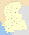 | |
| Hyderabad |
| |
| Karachi |
| |
| Larkana | ||
| Mirpur Khas |
| |
| Sukkur | ||
| Shaheed Benazir Abad |
| |
Authority control | |
|---|---|
| General |
|
| National libraries | |
This geography of Karachi-related article is a stub. You can help Wikipedia by expanding it. |
Другой контент может иметь иную лицензию. Перед использованием материалов сайта WikiSort.org внимательно изучите правила лицензирования конкретных элементов наполнения сайта.
WikiSort.org - проект по пересортировке и дополнению контента Википедии