world.wikisort.org - Pakistan
Jacobabad District (Sindhi: جيڪب آباد ضلعو, Urdu: ضلع جیکب آباد) is a district in the province of Sindh, Pakistan. It is located in the north of Sindh, by the provincial boundary with Balochistan. Its headquarters is the town of Jacobabad, which was founded by General John Jacob in 1847.[2]
Jacobabad District
(Previously Upper Sind Frontier District) | |
|---|---|
District of Sindh | |
| |
 Bungalow in Thul taluk | |
 Map of Sindh with Jacobabad District highlighted | |
| Country | |
| Province | |
| Division | Larkana |
| Established | 1847 |
| Founded by | British Government |
| Headquarters | Jacobabad |
| Government | |
| • Type | District Administration |
| • Deputy Commissioner | N/A |
| • District Police Officer | N/A |
| • District Health Officer | N/A |
| Area | |
| • Total | 2,686 km2 (1,037 sq mi) |
| Population (2017)[1] | |
| • Total | 1,007,009 |
| • Density | 370/km2 (970/sq mi) |
| Time zone | UTC+5 (PST) |
| Number of Tehsils | 4 |
Administration
District Council Jacobabad have 44 Union councils, 2 Municipal Committees and 3 Town Committees
The district is administratively subdivided into the following tehsil:
History
During British India, the town was the administrative headquarters of the Upper Sindh Frontier District of the Bombay Presidency; with a station on the Quetta branch of the North-Western railway, 37 m. from the junction at Ruk, on the main line. It is famous as having consistently the highest temperature in Pakistan. During the month of June the thermometer ranges between 120° and 127 °F. The town was founded on the site of the village of Khangarh in 1847 by General John Jacob, for many years commandant of the Sind Horse, who died here in 1858, and left a marvellous Victoria Tower in his remembrance in the heart of the city. It has cantonments for a cavalry regiment, with accommodation for caravans from Central Asia. It is watered by two canals. An annual horse show is held in January.
The district has had its present name since 1952.[2] For a brief period after 1961, it included the Nasirabad subdivision.[2] In 2004 Kashmore District was formed from its eastern half.[citation needed]
Notable people
- Muhammad Mian Soomro, Pakistani Politician
- Saira Shahliani, Pakistani Politician
- Kiran Baluch, Pakistani Former Cricketer
- Aijaz Hussain Jakhrani, Pakistani Politician
- Muhammad Muqeem Khan Khoso, Pakistani Politician
- Ahmed Mian Soomro, Pakistani Politician
- Abdul Hafeez Shaikh, Pakistani economist and politician
- Elahi Bux Soomro, Pakistani Senior Politician
Demography
| Year | Pop. | ±% p.a. |
|---|---|---|
| 1972 | 402,114 | — |
| 1981 | 586,234 | +4.28% |
| 1998 | 727,190 | +1.28% |
| 2017 | 1,007,009 | +1.73% |
| Sources:[3] | ||
At the time of the 2017 census, Jacobabad district had a population of 1,007,009 of which 514,786 were male and 492,061 were female. The rural population was 709,791 (70.49%) and urban 297,218 (29.51%). The literacy rate is 34.07%: 44.93% for males and 22.77% for females.[1]
Islam is the predominant religion with 97.76% of the population while Hinduism is the minority religion, practiced by 2.16% of the population.[1]
At the time of the 2017 census, 88.57% of the population spoke Sindhi, 5.23% Balochi, 3.26% Brahui and 1.33% Saraiki as their first language.[1]
Airport and airbase
The commercial airport at Jacobabad, about 300 miles (480 km) north of Karachi and 300 miles (480 km) southeast of Kandahar, is located on the border between Sindh and Balochistan provinces. The Shahbaz Air Base (co-located with the commercial airport in Jacobabad) was one of the three Pakistani air bases used by U.S. and allied forces to support the Operation Enduring Freedom campaign in Afghanistan and drone strikes in the former Federally Administered Tribal Areas.
List of Dehs
The following is a list of Jacobabad District's dehs, organised by taluka:[4]
- Jacobabad Tehsil (58 dehs)
- Abad
- Abdullah Dakhan
- Ahmedpur
- Akilpur
- Alipur
- Attai
- Bachal Pur
- Badal Wah
- Bajhani
- Baqapur
- Bello Alipur
- Bello Dixon
- Bhalidino
- Burj Selemi
- Chajjra
- Chawani
- Dadh
- Dadpur
- Dasti
- Detha
- Dilawarpur
- Fatehpur
- Garhi Chand
- Garhi Mehrab
- Ghouspur
- Hambhi
- Jacobabad
- Janidero
- Khairwah
- Khaloolabad
- Koureja
- Lal Lodro
- Malhooabad
- Mehar Shah
- Mehrabpur
- Milkiat Sarkar
- Moulabad
- Moulan Rato
- Mundranipur
- Nawara
- Nawazo
- Orangabad
- Phatanwah
- Pir Padhro
- Qadirpur
- Qaiasrabad
- Rahimabad
- Ramzanpur
- Retti
- Rindwahi
- Shahdadpur
- Shahpur
- Sheeradabad
- Soomanpur
- Thariri Bhalidino
- Umaranipur
- Wakro
- Waryamabad
- Thul Taluka (93 dehs)
- Abdullah Jakhrani
- Ali Khan
- Allagh Yar
- Athri
- Bachro
- Bahadurpur
- Bakhtiarpur
- Balochabad
- Bamble
- Barri
- Bhanger
- Bitti
- Bolaki
- Burira
- Chandan
- Channa
- Daho
- Dakhan
- Daro Mukh
- Deen Garh
- Dhani Bux
- Dil Murad
- Dool
- Dubi
- Fateh Khan Sabayo
- Ganji
- Garhi Hassan
- Garhi Rahimabad
- Ghulamoon
- Ghunia
- Girkano
- Gola
- Gujo
- Hairo
- Hambi
- Hotewah
- Hyderpur
- Jalal Pur
- Jariyoon
- Jhangiwah
- Joungal
- Kanrani
- Karim Abad
- Karim Bux
- Katta
- Khatan
- Khosa
- Khuda Bux
- Korar
- Kot Gul Muhammad
- Kot Jangu
- Lado
- Logi
- Loi
- Madad Khoso
- Maloi
- Mehar Ali
- Mehrabpur
- Miral Nau
- Miral Purano
- Mirpur
- Mirsipur
- Mitho Thariri
- Moosa Wah
- Mubarakpur
- Muhib Wah
- Nagan
- Nau Wah
- Odhano
- Pako
- Panah Abaad
- Phul
- Purano Wah
- Qalendarpur
- Rahim Abad
- Ranjhapur
- Rap Muard
- Rato Thariri
- Sajin Wah
- Sameja
- Sarki
- Sher Wah
- Shujra
- Tajo Khoso
- Talib Shah
- Tanwari
- Thariri
- Thul Nau
- Thul Purano
- Toj
- Udi
- Wah Mistri
- Zangipur
- Garhi Khairo Taluka (60 dehs)
- Abdullah Mahesar
- Allah Pur
- Allahabad
- Amir Abad
- Azmat Abad
- Baharo Khokhar
- Budho
- Daro Jeeand
- Datirdino Mahesar
- Dital Wah
- Doda Pur
- Drib Morayo
- Dunya Pur`
- Garhi Khairo
- Ghouse Abad
- Gokal Pur
- Gul Wah
- Hazar Wah
- Jafar Abad
- Jahan Pur
- Jalbani
- Jamal Abad
- Jeeand
- Khairo
- Khan Wah
- Khand
- Khanpur
- Khuda Abad
- Kitch
- Kohari
- Koor Beero
- Koor Khairo Gachal
- Koor Rato
- Kotari
- Kote Ali Nawaz
- Lal Odho
- Lal Wah
- Lund
- Mairee
- Miranpur
- Muarad Ali
- Muhammad Pur
- Nao Wah
- Nazimabad
- Pir Bux
- Punhoon Bhatti
- Qeemat Abad
- Rasol Abad
- Saleh
- Sawan Lashari
- Shah Bazi Mahar
- Shaheed
- Sher Khan
- Sheran Pur
- Sone Wah
- Sultanpur
- Tajo Dero
- Thariri
- Wah Ali Hyder
- Wasayo
References
- "Jacobabad district - 2017 census". pbs.gov.pk. Pakistan Bureau of Statistics. 2017.
{{cite web}}: CS1 maint: url-status (link) - PCO 1999, p. 1.
- "Pakistan: Provinces and Districts". www.citypopulation.de.
- "List of Dehs in Sindh" (PDF). Sindh Zameen. Retrieved 22 March 2021.
Bibliography
- 1998 District census report of Jacobabad. Census publication. Vol. 17. Islamabad: Population Census Organization, Statistics Division, Government of Pakistan. 1999.
Districts of Sindh | ||
|---|---|---|
Provincial capital: Karachi | ||
| Banbhore | 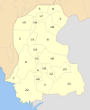 | |
| Hyderabad |
| |
| Karachi |
| |
| Larkana |
| |
| Mirpur Khas |
| |
| Sukkur | ||
| Shaheed Benazir Abad |
| |
Authority control | |
|---|---|
| General | |
| National libraries | |
See Also
На других языках
[de] Jacobabad (Distrikt)
Der Distrikt Jacobabad ist ein Verwaltungsdistrikt in Pakistan in der Provinz Sindh. Sitz der Distriktverwaltung ist die gleichnamige Stadt Jacobabad.- [en] Jacobabad District
[ru] Джейкобабад (округ)
Джейкобабад (урду ضلع جیکب آباد, англ. Jacobabad District) — один из 23 округов пакистанской провинции Синд. Административный центр — город Джейкобабад.Другой контент может иметь иную лицензию. Перед использованием материалов сайта WikiSort.org внимательно изучите правила лицензирования конкретных элементов наполнения сайта.
WikiSort.org - проект по пересортировке и дополнению контента Википедии