world.wikisort.org - Pakistan
Nasirabad (Urdu: ضلع نصیر آباد) is a district in the centre-west of Balochistan, Pakistan. Nasirabad's headquarters are at Dera Murad Jamali.
Naseerabad District
ضلع نصیر آباد | |
|---|---|
District of Balochistan | |
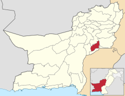 Map of Balochistan with Nasirabad District highlighted | |
| Country | |
| Province | |
| Division | Nasirabad |
| Headquarters | Dera Murad Jamali |
| Government | |
| • Type | District Administration |
| • Deputy Commissioner | Muhammad Qasim |
| • District Police Officer | N/A |
| • District Health Officer | N/A |
| Area | |
| • Total | 3,387 km2 (1,308 sq mi) |
| Population (2017)[1] | |
| • Total | 487,847 |
| • Density | 140/km2 (370/sq mi) |
| Time zone | UTC+5 (PST) |
The original name of the district was Temple Dera, named after Captain H. M. Temple,[citation needed] a career British civil servant, who served as the Political Agent for Sibi from 1891 to 1892. Among the local population it is still known as 'Tipul', a corruption of the word 'temple'.[citation needed]
Formerly part of Kalat District, Nasirabad was granted the status of a separate district in 1974, while in 1987 the new district of Jaffarabad was cleaved out of it.[2] For three years, from July 1987 to December 1990, it was known as Tahseel Tamboo. Tamboo is a small village 40 km west of Dera Murad Jamali.[citation needed]
Administrative divisions
Tehsils
The district is administratively subdivided into four Tehsils, these are:[3]
- Dera Murad Jamali (district headquarters)
- Chhatter
- Baba Kot
- Tamboo
Union councils
These tehsils are further divided into union councils. Currently, there are 31 union councils and one municipal committee in the district:
Tehsil Dera Murad Jamali
- Municipal Committee Dera Murad Jamali
- Union Council Quba Sher Khan Sharqi
- Union Council Quba Sher Khan Gharbi
- Union Council Naseer Khan Umrani
- Union Council Jhuder Shimali
- Union Council Bedar Androon Sharqi
- Union Council Bedar Gharbi
- Union Council Manjhoti Sharqi
- Union Council Sardar Shahzada Khan Umrani
- Union Council Sikandarabad
- Union Council Manjhoti Gharbi
- Union Council Jhuder Janubi
Tehsil Chhatter
- Union Council Chhatter
- Union Council Phuleji
- Union Council Shah Pur
- Union Council Daulat Ghari Mir Nabi Bakhsh Khan
- Union Council Daulat Ghari Mir Hassan Khosa
- Union Council Shori Drabi
Tehsil Tamboo
- Union Council Manjhoo Shoori
- Union Council Aeri
- Union Council Gola Wah
- Union Council Ali Abad Shumali
- Union Council Mir Behram Khan Buledi
- Union Council Qadir Abad
- Union Council Kharoos Wah
- Union Council Fateh Mohammad
- Union Council Mir Wah
- Union Council Abdullah Bari
- Union Council Ali Abad
Tehsil Baba Kot
- Union Council Garhi Rehman
- Union Council Baba Kot
- Union Council Kuhna Tamboo
Tehsil Landhi
Demographics
At the time of the 2017 census the district had a population of 487,847, of which 251,564 were males and 236,282 females. Rural population was 391,531 (80.26%) while the urban population was 96,316 (19.74%). The literacy rate was 23.30% - the male literacy rate was 33.22% while the female literacy rate was 12.97%. Islam was the predominant religion with 99.26%, while Hindus are 0.66% of the population.[1]
At the time of the 2017 census, 39.05% of the population spoke Balochi, 22.89% Brahui, 21.22% Sindhi and 15.21% Saraiki as their first language.[1]
References
- "District Wise Results / Tables (Census - 2017)". www.pbscensus.gov.pk. Pakistan Bureau of Statistics.
- PCO 1999, p. 13.
- \"Tehsils & Unions in the District of Nasirabad – Government of Pakistan". Archived from the original on 26 March 2012.
Bibliography
- 1998 District census report of Nasirabad. Census publication. Vol. 26. Islamabad: Population Census Organization, Statistics Division, Government of Pakistan. 1999.
External links
Districts of Balochistan, Pakistan | ||
|---|---|---|
Provincial capital: Quetta | ||
| Kalat |  | |
| Makran | ||
| Nasirabad | ||
| Quetta | ||
| Sibi |
| |
| Zhob | ||
| Rakhshan | ||
| Loralai | ||
a - formerly part of Quetta Division; b - formerly part of Kalat Division; c - formerly part of Zhob Division | ||
Authority control | |
|---|---|
| General |
|
| National libraries | |
На других языках
[de] Nasirabad (Distrikt)
Der Distrikt Nasirabad (Urdu ضلع نصیر آباد), auch Naseerabad (1987 bis 1990 Distrikt Tamboo), ist ein Verwaltungsdistrikt in der pakistanischen Provinz Belutschistan. Sitz der Distriktverwaltung ist die Stadt Dera Murad Jamali.- [en] Nasirabad District
[ru] Насирабад (округ)
Насираба́д (урду ضلع نصیر آباد, англ. Nasirabad District) — один из 30 округов пакистанской провинции Белуджистан.Другой контент может иметь иную лицензию. Перед использованием материалов сайта WikiSort.org внимательно изучите правила лицензирования конкретных элементов наполнения сайта.
WikiSort.org - проект по пересортировке и дополнению контента Википедии