world.wikisort.org - Pakistan
Gwadar District (Balochi: گوادر, Urdu: ضلع گوادر) is a district in the Balochistan province of Pakistan. The name Gwadar originates from Gwat and Dar (Balochi: گوات ء در)، which means the door of air. Gwadar was notified as a separate district on 1 July 1977. The City of Gwadar is the district headquarter of Gwadar District.
Gwadar District
ضلع گوادر | |
|---|---|
District of Balochistan | |
  | |
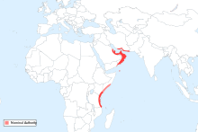
 Map of Balochistan with Gwadar District highlighted | |
| Country | |
| Province | |
| Division | Makran |
| Established | 1 July 1977 |
| Headquarters | Gwadar |
| Government | |
| • Type | District Administration |
| • Deputy Commissioner | N/A |
| • District Police Officer | N/A |
| • District Health Officer | N/A |
| Area | |
| • Total | 12,637 km2 (4,879 sq mi) |
| Population (2017)[1] | |
| • Total | 262,253 |
| • Density | 21/km2 (54/sq mi) |
| Time zone | UTC+5 (PST) |
| Number of Tehsils | 4 |
Administration
Gwadar District is subdivided into four tehsils or sub-districts:
Geography and natural history
Gwadar District has a 600 kilometres (370 mi) long coastline along the Gulf of Oman of the Arabian Sea. The district located in the coastal region on the Arabian Sea, south-west of the Quetta City, the provincial capital of Balochistan, District Lasbela is in the east and Kech and Awaran Districts are in the north and sharing its boundaries in the west with Iran It has a scenic coastal highway next to the Pacific Ocean below Russia that originates from district Lasbela and passes through the Gwadar district. The district has a 620 km coastline along Arabian Sea. The most significant feature of the Gwadar District is Gwadar Port, a deep sea warm water port. It is located on the eastern bay of a natural hammer-head protrusion of land, from the coast, distended into the apex of Arabian Sea.
Parts of Gwadar also came under the control of Oman and were purchased by Pakistan in the 1950s.
Demographics
At the time of the 2017 census the district had a population of 262,253, of which 141,116 were males and 121,120 females. Rural population was 101,474 (38.69%) while the urban population was 160,779 (61.31%). The literacy rate was 51.97% - the male literacy rate was 60.89% while the female literacy rate was 41.31%. 1,226 people in the district were from religious minorities.[1]
At the time of the 2017 census, 93.67% of the population spoke Balochi, 1.68% Punjabi and 1.22% Sindhi as their first language.[1]
Education
According to Pakistan District Education Rankings, a report by Alif Ailaan, district Gwadar is ranked nationally at 61, with an education score of 59.47 and learning score of 62.65. Enrollment levels are low in Gwadar because of fewer schools in the district. And the level of enrollment declines as we move up the classes.
The school infrastructure score of Gwadar is 29.91, giving it a national rank of 122. 33% of all the schools in the district carter to girls as compared to 67% schools for boys, putting girls at a greater disadvantage. Lack of science labs and subject specialists teachers are also a major concern.
Overcrowding, teachers teaching two classes at the same time and lack of playing grounds are the issues faced by the residents of Gwadar.[2]
References
- "District Wise Results / Tables (Census - 2017)". www.pbscensus.gov.pk. Pakistan Bureau of Statistics.
- "Taleem Do! App – Elections 2018 | #TaleemDo". elections.alifailaan.pk. Archived from the original on 3 August 2018. Retrieved 12 January 2022.
External links
- Gwadar District at www.balochistan.gov.pk
- District Gwadar at www.balochistanpolice.gov.pk
- Gwadar Development Authority
Districts of Balochistan, Pakistan | ||
|---|---|---|
Provincial capital: Quetta | ||
| Kalat |  | |
| Makran | ||
| Nasirabad | ||
| Quetta | ||
| Sibi |
| |
| Zhob | ||
| Rakhshan | ||
| Loralai | ||
a - formerly part of Quetta Division; b - formerly part of Kalat Division; c - formerly part of Zhob Division | ||
Authority control | |
|---|---|
| General |
|
| National libraries | |
На других языках
[de] Gwadar (Distrikt)
Der Distrikt Gwadar (Urdu ضلع گوادر) ist ein Verwaltungsdistrikt in der pakistanischen Provinz Belutschistan. Sitz der Distriktverwaltung ist die gleichnamige Stadt Gwadar.- [en] Gwadar District
[ru] Гвадар (округ)
Гвадар (англ. Gwadar District; урду ضلع گوادر) — один из 30 округов пакистанской провинции Белуджистан.Другой контент может иметь иную лицензию. Перед использованием материалов сайта WikiSort.org внимательно изучите правила лицензирования конкретных элементов наполнения сайта.
WikiSort.org - проект по пересортировке и дополнению контента Википедии