world.wikisort.org - Pakistan
Panjgur (Balochi: پنجگور, Urdu: ضلع پنجگور) is a district in the west Balochistan province of Pakistan. Panjgur was one of three districts of Makran District until 1 July 1977, when the district became a part of Makran Division. The other two districts of Makran Division are Kech (Turbat) and Gwadar. Chitkan is the district headquarter. Panjgur has sixteen (16) Union Councils.
Panjgur
ضلع پنجگور | |
|---|---|
District of Balochistan | |
| Panjgur District | |
 Tomb of Allang Essai, Panjgur | |
| Nickname(s): Gateway to Panjgur | |
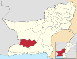 Map of Balochistan with Panjgur District highlighted | |
| Country | |
| Province | |
| Divisions | Makran |
| Headquarters | Panjgur |
| Government | |
| • Type | District Administration |
| • Deputy Commissioner | N/A |
| • District Police Officer | N/A |
| • District Health Officer | N/A |
| Area | |
| • Total | 16,891 km2 (6,522 sq mi) |
| Population (2017)[1] | |
| • Total | 315,353 |
| • Density | 19/km2 (48/sq mi) |
| Time zone | UTC+5 (PST) |
| Area code(s) | 0855 |
| Number of Tehsils | 3 |
| Website | panjgur |

Panjgur (literally: Five Graves) is home to several archaeological sites, including centuries-old tombs, an old dam called Band-e-Gillar, remnants of a fort at Khudabadan (the historical fort of Nawab Kharan) and some remnants of the old port of Issai. The seasonal Rakshan River flows right in the middle of Panjgur, dividing it into two parts, the northern and southern Panjgur.
Etymology
In Iranian languages, "panj" means "five" and "gor" means "graves". There are five popular graves in this district, which give it the name Panjgur or Panjgor.[citation needed]
Administrative divisions
The district is administratively subdivided into three tehsils which contain a total of 16 Union Councils:[2]
- Paroom
- Panjgur
- Gichk
Demographics
At the time of the 2017 census the district had a population of 315,353, of which 166,379 were males and 148,952 females. Rural population was 234,942 (74.50%) while the urban population was 80,411 (25.50%). The literacy rate was 59.22% - the male literacy rate was 66.69% while the female literacy rate was 51.24%. 310 people in the district were from religious minorities. Balochi was the predominant language, spoken by 97.51% of the population.[1]
Transport
Panjgur Airport (IATA: PJG, ICAO: OPPG) is a domestic airport. Its short runway stretches only 1524 meters. PIA started flights to Sharjah in 2013 but these have been suspended by PIA.[citation needed] People in Panjgur normally travel by buses to bigger cities like Quetta and Karachi.[citation needed]
References
- "District Wise Results / Tables (Census - 2017)". www.pbscensus.gov.pk. Pakistan Bureau of Statistics.
- "Tehsils & Unions in the District of Panjgur – Government of Pakistan". Archived from the original on 26 March 2012.
External links
| Wikimedia Commons has media related to Panjgur District. |
Districts of Balochistan, Pakistan | ||
|---|---|---|
Provincial capital: Quetta | ||
| Kalat |
|  |
| Makran | ||
| Nasirabad |
| |
| Quetta |
| |
| Sibi |
| |
| Zhob |
| |
| Rakhshan |
| |
| Loralai |
| |
a - formerly part of Quetta Division; b - formerly part of Kalat Division; c - formerly part of Zhob Division | ||
Authority control | |
|---|---|
| General |
|
| National libraries | |
Другой контент может иметь иную лицензию. Перед использованием материалов сайта WikiSort.org внимательно изучите правила лицензирования конкретных элементов наполнения сайта.
WikiSort.org - проект по пересортировке и дополнению контента Википедии