world.wikisort.org - Germany
Freyung-Grafenau is a Landkreis (district) in Bavaria, Germany. It is bounded by (from the south and clockwise) the districts of Passau, Deggendorf and Regen, the Czech Republic and by Austria.
Freyung-Grafenau | |
|---|---|
District | |
 Flag  Coat of arms | |
 | |
| Country | Germany |
| State | Bavaria |
| Adm. region | Lower Bavaria |
| Capital | Freyung |
| Area | |
| • Total | 984 km2 (380 sq mi) |
| Population (31 December 2020)[1] | |
| • Total | 78,355 |
| • Density | 80/km2 (210/sq mi) |
| Time zone | UTC+01:00 (CET) |
| • Summer (DST) | UTC+02:00 (CEST) |
| Vehicle registration | FRG, WOS, GRA |
| Website | freyung-grafenau.de |
History
The district was established in 1972, by merging the former districts of Grafenau and Wolfstein.[2] In medieval times Wolfstein (east of the Ilz River) was the property of the bishop of Passau and the site of Wolfstein Castle, now a schloss. Grafenau (west of the Ilz River) successively belonged to different countries, before it was annexed by Bavaria in 1438. Wolfstein became a part of Bavaria two years after the dissolution of the clerical states in Germany (1803).
Geography
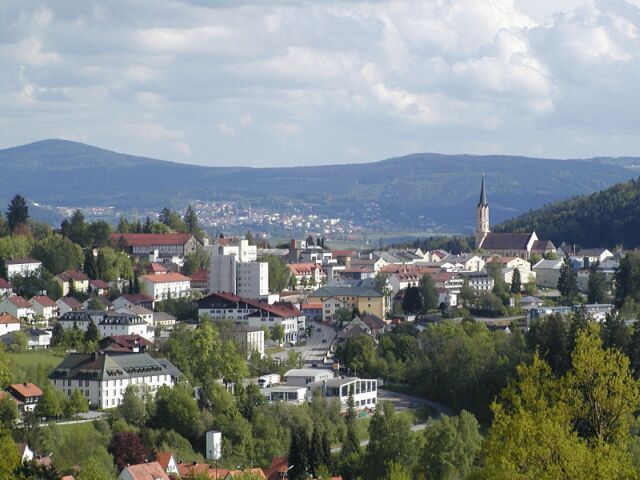
Freyung-Grafenau is the easternmost district of Bavaria. It is located in the southern parts of the Bavarian Forest and is partially occupied by the Bavarian Forest National Park. The source of the Ilz River is situated in the district.
Coat of arms
The wolf represents the area of Wolfstein, while the bear stands for Grafenau (as it was ruled from the castle of Bärnstein, and Bär means "bear"). At the bottom sits the blue and white lozengy pattern of Bavaria.
Towns and municipalities
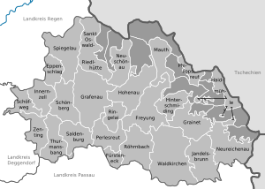
| Towns | Municipalities | |
|---|---|---|
References
- "Tabellenblatt "Daten 2", Statistischer Bericht A1200C 202041 Einwohnerzahlen der Gemeinden, Kreise und Regierungsbezirke". Bayerisches Landesamt für Statistik (in German). June 2021.
- F.A. Brockhaus Wiesbaden (1975). Brockhaus Enzyklopädie in zwanzig Bänden: Ergänzungen, A-I (in German) (17 ed.). Wiesbaden. p. 517. ISBN 978-3765300288.
External links
- Official website (German)
Towns and municipalities in Freyung-Grafenau | ||
|---|---|---|
Authority control | |
|---|---|
| General | |
| National libraries | |
На других языках
[de] Landkreis Freyung-Grafenau
Der Landkreis Freyung-Grafenau ist der östlichste Landkreis Bayerns. Er liegt im Regierungsbezirk Niederbayern und grenzt im Nordosten an Tschechien, im Südosten an Österreich und von Südwest bis Nordwest an drei Landkreise Niederbayerns.- [en] Freyung-Grafenau
[ru] Фрайунг-Графенау
Фрайунг-Графенау (нем. Freyung-Grafenau) — район в Германии. Центр района — город Фрейунг. Район входит в землю Бавария. Подчинён административному округу Нижняя Бавария. Занимает площадь 984,21 км². Население — 82 363 чел. Плотность населения — 84 человека/км². Официальный код района — 09 2 72.Другой контент может иметь иную лицензию. Перед использованием материалов сайта WikiSort.org внимательно изучите правила лицензирования конкретных элементов наполнения сайта.
WikiSort.org - проект по пересортировке и дополнению контента Википедии