world.wikisort.org - Germany
Fürth is a Landkreis (district) in Bavaria, Germany. It is bounded by (from the east and clockwise) the cities of Fürth and Nuremberg, and by the districts of Roth, Ansbach, Neustadt (Aisch)-Bad Windsheim and Erlangen-Höchstadt.
Fürth | |
|---|---|
District | |
 Flag Coat of arms | |
 | |
| Country | Germany |
| State | Bavaria |
| Adm. region | Middle Franconia |
| Capital | Zirndorf; Fürth gives the name |
| Area | |
| • Total | 308 km2 (119 sq mi) |
| Population (31 December 2020)[1] | |
| • Total | 118,695 |
| • Density | 390/km2 (1,000/sq mi) |
| Time zone | UTC+01:00 (CET) |
| • Summer (DST) | UTC+02:00 (CEST) |
| Vehicle registration | FÜ |
| Website | landkreis-fuerth.de |
History
In the 13th and most of the 14th century the region was a regional centre of the Hohenzollern state. The Cadolzburg (a castle west of Nuremberg) was the seat of the local rulers.
The present district was established in 1972.
In 2003 the administrative seat was moved from Fürth to Zirndorf. (Nonetheless, Fürth remains the official capital of the district.)
Geography
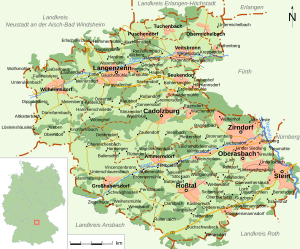
The district is occupied by the western Nuremberg metropolitan area.
Politics
The district is part of the Fürth constituency for elections to the Bundestag, currently represented by Christian Schmidt.
Coat of arms
The coat of arms displays:
- The eagle which is the heraldic bird of Brandenburg (in medieval times the region was a part of Brandenburg-Ansbach)
- The red and white bars are from the arms of Nuremberg
- The ear and cogwheel are symbols for agriculture and industry
Towns and municipalities

| Towns | Municipalities |
|---|---|
References
- "Tabellenblatt "Daten 2", Statistischer Bericht A1200C 202041 Einwohnerzahlen der Gemeinden, Kreise und Regierungsbezirke". Bayerisches Landesamt für Statistik (in German). June 2021.
External links
- Official Website (in German)
- Official district Website (in German)
Towns and municipalities in Fürth (district) | ||
|---|---|---|
Authority control | |
|---|---|
| General | |
| National libraries | |
На других языках
[de] Landkreis Fürth
Der Landkreis Fürth ist ein Landkreis westlich der Städte Fürth und Nürnberg im bayerischen Regierungsbezirk Mittelfranken. Der Landkreis ist Mitglied der Planungsregion Nürnberg und der Metropolregion Nürnberg.- [en] Fürth (district)
[ru] Фюрт (район)
Фюрт (нем. Fürth) — район в Германии. Центр района — город Цирндорф. Район входит в землю Бавария. Подчинён административному округу Средняя Франкония. Занимает площадь 307,4 км². Население — 118 695 чел. Плотность населения — 386 человек/км². Официальный код района — 09 5 73.Другой контент может иметь иную лицензию. Перед использованием материалов сайта WikiSort.org внимательно изучите правила лицензирования конкретных элементов наполнения сайта.
WikiSort.org - проект по пересортировке и дополнению контента Википедии