world.wikisort.org - Germany
Bayreuth (German pronunciation: [baɪˈʁɔʏt] (![]() listen)) is a Landkreis (district) in Bavaria, Germany. It surrounds, but does not include the city of Bayreuth. The district is bounded by (from the north and clockwise) the districts of Kulmbach, Hof, Wunsiedel, Tirschenreuth, Neustadt an der Waldnaab, Amberg-Sulzbach, Nürnberger Land, Forchheim and Bamberg.
listen)) is a Landkreis (district) in Bavaria, Germany. It surrounds, but does not include the city of Bayreuth. The district is bounded by (from the north and clockwise) the districts of Kulmbach, Hof, Wunsiedel, Tirschenreuth, Neustadt an der Waldnaab, Amberg-Sulzbach, Nürnberger Land, Forchheim and Bamberg.
This article needs additional citations for verification. (March 2013) |
Bayreuth | |
|---|---|
District | |
 Flag  Coat of arms | |
 | |
| Country | Germany |
| State | Bavaria |
| Adm. region | Upper Franconia |
| Capital | Bayreuth |
| Area | |
| • Total | 1,273 km2 (492 sq mi) |
| Population (31 December 2020)[1] | |
| • Total | 103,679 |
| • Density | 81/km2 (210/sq mi) |
| Time zone | UTC+01:00 (CET) |
| • Summer (DST) | UTC+02:00 (CEST) |
| Vehicle registration | BT, EBS, ESB, KEM, MÜB, PEG |
| Website | www |
History
The district was established in 1972 by merging the former districts of Bayreuth and Pegnitz, adding the town Gefrees of the former district of Münchberg and the town of Speichersdorf of the former district of Kemnath.
Geography
The sources of the White Main and the Red Main are both located in the district. The Red Main rises in the very south in the hills of the Frankish Alb, the White Main has its source in the Fichtel Mountains in the east. Both rivers run to the northwest, but do not meet within the district's borders.
The valley of the Red Main separates the two major geographical regions of the district from each other: the hilly countryside of the Franconian Jura and the much higher Fichtel Mountains.
Within the county lies the Veldenstein Forest, one of the largest contiguous areas of woodland in Bavaria.
Coat of arms
The arms display the heraldic eagle of the Hohenzollern dynasty together with the white and blue pattern of Bavaria.
Towns and municipalities

| Towns | Municipalities | |
|---|---|---|
|
Sights
 |
Schloss Aufseß | Aufseß |
| Schloss Fantaisie | Eckersdorf | |
| Schloss Freienfels | Hollfeld | |
| Hollfeld | Hollfeld | |
 |
Pegnitz | Pegnitz |
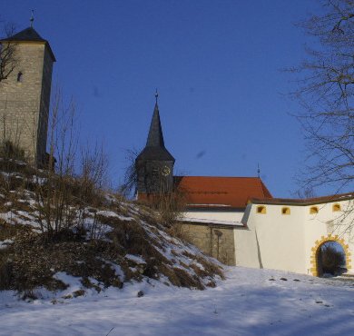
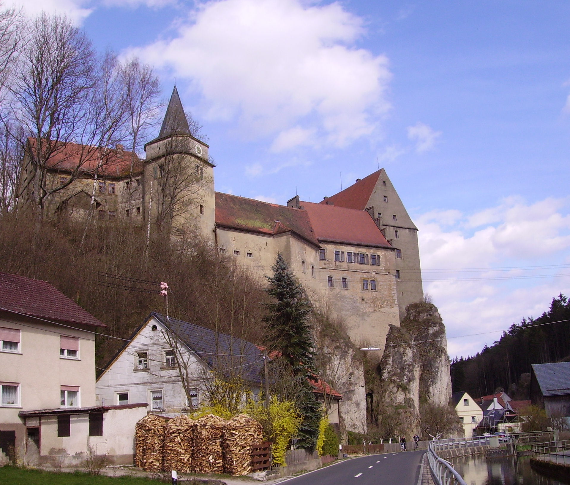
| Burg Pottenstein | Pottenstein | |
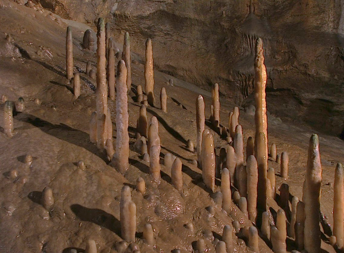 |
Teufelshöhle | Pottenstein |
 |
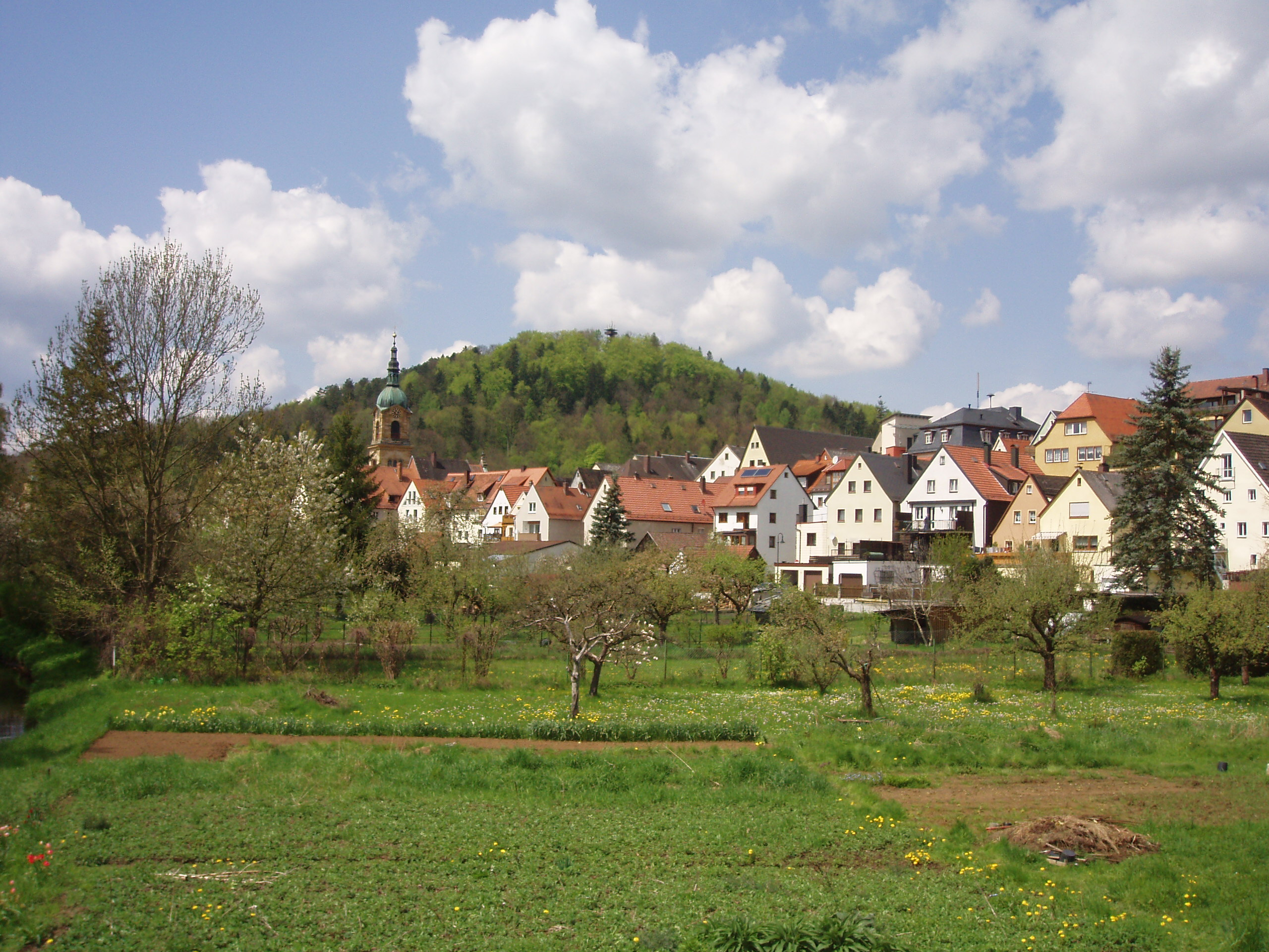
Tüchersfeld | Pottenstein |
| Burg Waischenfeld | Waischenfeld | |
 |
Schloss Wiesentfels | Hollfeld |
References
- "Tabellenblatt "Daten 2", Statistischer Bericht A1200C 202041 Einwohnerzahlen der Gemeinden, Kreise und Regierungsbezirke". Bayerisches Landesamt für Statistik (in German). June 2021.
External links
- Official website (in German)
Towns and municipalities in Bayreuth (district) | ||
|---|---|---|
|  | |
Authority control | |
|---|---|
| General | |
| National libraries | |
На других языках
[de] Landkreis Bayreuth
Der Landkreis Bayreuth liegt im Südosten des bayerischen Regierungsbezirks Oberfranken. Die kreisfreie Stadt Bayreuth ist ganz vom Landkreis umgeben.- [en] Bayreuth (district)
[ru] Байройт (район)
Байройт (нем. Bayreuth) — район в Германии, в административном округе Верхняя Франкония Республики Бавария[2]. Центр района — город земельного подчинения Байройт, официально в состав района не входит. Региональный шифр — 09 472.[1] Регистрационные номера транспортных средств (нем. Kraftfahrzeugkennzeichen) — BT.Другой контент может иметь иную лицензию. Перед использованием материалов сайта WikiSort.org внимательно изучите правила лицензирования конкретных элементов наполнения сайта.
WikiSort.org - проект по пересортировке и дополнению контента Википедии