world.wikisort.org - Germany
Warmensteinach is a municipality in the district of Bayreuth in Bavaria in Germany. From here there is a chairlift, the Ochsenkopf South Chairlift, to the summit of the Ochsenkopf, the second highest mountain in the Fichtelgebirge.
Warmensteinach | |
|---|---|
Municipality | |
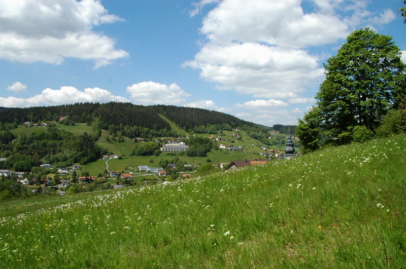 Warmensteinach in summer | |
 Coat of arms | |
Location of Warmensteinach within Bayreuth district  | |
 Warmensteinach  Warmensteinach | |
| Coordinates: 49°58′N 11°46′E | |
| Country | Germany |
| State | Bavaria |
| Admin. region | Oberfranken |
| District | Bayreuth |
| Subdivisions | 18 Ortsteile |
| Government | |
| • Mayor (2020–26) | Axel Herrmann[1] (FW) |
| Area | |
| • Total | 32.62 km2 (12.59 sq mi) |
| Highest elevation | 1,024 m (3,360 ft) |
| Lowest elevation | 550 m (1,800 ft) |
| Population (2020-12-31)[2] | |
| • Total | 2,211 |
| • Density | 68/km2 (180/sq mi) |
| Time zone | UTC+01:00 (CET) |
| • Summer (DST) | UTC+02:00 (CEST) |
| Postal codes | 95485 |
| Dialling codes | 09277 |
| Vehicle registration | BT |
| Website | www.warmensteinach.de |
References
- Liste der ersten Bürgermeister/Oberbürgermeister in kreisangehörigen Gemeinden, Bayerisches Landesamt für Statistik, 15 July 2021.
- "Tabellenblatt "Daten 2", Statistischer Bericht A1200C 202041 Einwohnerzahlen der Gemeinden, Kreise und Regierungsbezirke". Bayerisches Landesamt für Statistik (in German). June 2021.
| Wikimedia Commons has media related to Warmensteinach. |
Towns and municipalities in Bayreuth (district) | ||
|---|---|---|
|  | |
This Bayreuth district location article is a stub. You can help Wikipedia by expanding it. |
На других языках
- [en] Warmensteinach
[ru] Варменштайнах
Варменштайнах (нем. Warmensteinach) — община в Германии, в Республике Бавария[1].Текст в блоке "Читать" взят с сайта "Википедия" и доступен по лицензии Creative Commons Attribution-ShareAlike; в отдельных случаях могут действовать дополнительные условия.
Другой контент может иметь иную лицензию. Перед использованием материалов сайта WikiSort.org внимательно изучите правила лицензирования конкретных элементов наполнения сайта.
Другой контент может иметь иную лицензию. Перед использованием материалов сайта WikiSort.org внимательно изучите правила лицензирования конкретных элементов наполнения сайта.
2019-2026
WikiSort.org - проект по пересортировке и дополнению контента Википедии
WikiSort.org - проект по пересортировке и дополнению контента Википедии