world.wikisort.org - France
Valliquerville is a commune in the Seine-Maritime department in the Normandy region in northern France.
Valliquerville | |
|---|---|
Commune | |
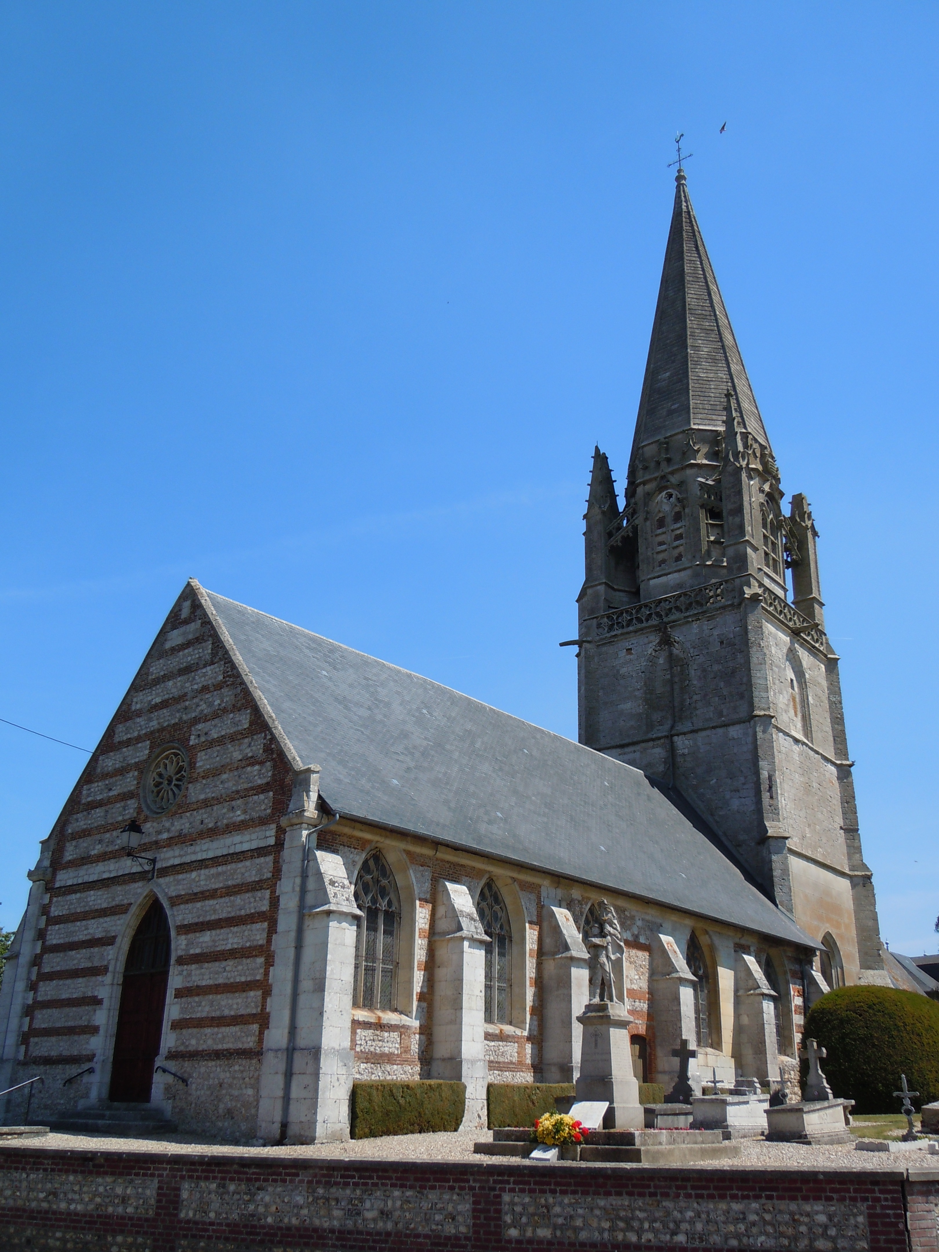 The church in Valliquerville | |
 Coat of arms | |
Location of Valliquerville  | |
 Valliquerville  Valliquerville | |
| Coordinates: 49°36′52″N 0°41′25″E | |
| Country | France |
| Region | Normandy |
| Department | Seine-Maritime |
| Arrondissement | Rouen |
| Canton | Yvetot |
| Government | |
| • Mayor (2020–2026) | Jacques Cahard[1] |
| Area 1 | 13.39 km2 (5.17 sq mi) |
| Population | 1,421 |
| • Density | 110/km2 (270/sq mi) |
| Time zone | UTC+01:00 (CET) |
| • Summer (DST) | UTC+02:00 (CEST) |
| INSEE/Postal code | 76718 /76190 |
| Elevation | 117–151 m (384–495 ft) (avg. 120 m or 390 ft) |
| 1 French Land Register data, which excludes lakes, ponds, glaciers > 1 km2 (0.386 sq mi or 247 acres) and river estuaries. | |
Geography
A farming village situated in the Pays de Caux, some 25 miles (40 km) northwest of Rouen at the junction of the D6015 with the D131e and the D110 roads.
History
In the late eleventh century the village was in the possession of Bec Abbey.[3]
In May 1592, Henry IV and his forces were encamped in the village during the French Wars of Religion.[4][5]
In April 1940, during World War II Princess Louise's Kensington Regiment was billeted in the village as part of the British Expeditionary Force.[6][7]
Heraldry
 |
The arms of the commune of Valliquerville are blazoned : Per pale highly indented argent and gules impaled with Vert, the local bell-tower argent issuant from base.
|
Population
| Year | Pop. | ±% p.a. |
|---|---|---|
| 1968 | 769 | — |
| 1975 | 870 | +1.78% |
| 1982 | 980 | +1.72% |
| 1990 | 1,125 | +1.74% |
| 1999 | 1,164 | +0.38% |
| 2007 | 1,267 | +1.07% |
| 2012 | 1,294 | +0.42% |
| 2017 | 1,418 | +1.85% |
| Source: INSEE[8] | ||
Places of interest
- The church of Notre-Dame, dating from the thirteenth century. Its Gothic tower dates from the sixteenth century.[9][10][11] It has been restored after being in a state of disrepair in the mid nineteenth century.[12]
See also
References
- Liste des maires du département de la Seine-Maritime, 10 August 2020
- "Populations légales 2019". The National Institute of Statistics and Economic Studies. 29 December 2021.
- Christopher Harper-Bill (1999). Anglo-Norman Studies XXI: Proceedings of the Battle Conference 1998. Boydell & Brewer. p. 177. ISBN 978-0-85115-745-0.
- Terrier-Santans, Capitaine de (2016-11-17). Campagnes de Alexandre Farnèse, duc de Parme et de Plaisance - Aumale, Cailly, Caudebec (1591-1592) (in French). Collection XIX. ISBN 978-2-346-12483-1.
- Somménil, F. (1863). Campagne de Henri iv au pays de Caux, 25 avril-15 mai 1592 (in French). p. 51.
- Gardner, Robert (2012-02-29). Kensington to St Valery en Caux: Princess Louise's Kensington Regiment, France and England, Summer 1940. History Press. ISBN 978-0-7524-8361-0.
- Harpur, B. V. C. (1952). "The Kensingtons": Princess Louise's Kensington Regiment, Second World War. Regimental Old Comrades' Association. p. 18.
- Population en historique depuis 1968, INSEE
- Hare, Augustus John Cuthbert (1895). North-western France (Normandy and Brittany). G. Allen. p. 69.
- Nagel Travel Guide Series: Europe. McGraw-Hill. 1964. p. 450.
- France. Ernest Benn Limited. 1997. p. 160. ISBN 978-0-393-31640-7.
- Greenhalgh, Michael (2015-08-24). Destruction of Cultural Heritage in 19th-century France: Old Stones versus Modern Identities. BRILL. p. 144. ISBN 978-90-04-29371-7.
Wikimedia Commons has media related to Valliquerville.
Authority control | |
|---|---|
| General |
|
| National libraries | |
На других языках
- [en] Valliquerville
[es] Valliquerville
Valliquerville es una población y comuna francesa, en la región de Alta Normandía, departamento de Sena Marítimo, en el distrito de Ruan y cantón de Yvetot.Текст в блоке "Читать" взят с сайта "Википедия" и доступен по лицензии Creative Commons Attribution-ShareAlike; в отдельных случаях могут действовать дополнительные условия.
Другой контент может иметь иную лицензию. Перед использованием материалов сайта WikiSort.org внимательно изучите правила лицензирования конкретных элементов наполнения сайта.
Другой контент может иметь иную лицензию. Перед использованием материалов сайта WikiSort.org внимательно изучите правила лицензирования конкретных элементов наполнения сайта.
2019-2026
WikiSort.org - проект по пересортировке и дополнению контента Википедии
WikiSort.org - проект по пересортировке и дополнению контента Википедии