world.wikisort.org - France
Saint-Léger-du-Bourg-Denis (French pronunciation: [sɛ̃ leʒe dy buʁ dəni]) is a commune in the Seine-Maritime department in the Normandy region in northern France.
Saint-Léger-du-Bourg-Denis | |
|---|---|
Commune | |
 The town hall in Saint-Léger-du-Bourg-Denis | |
 Coat of arms | |
Location of Saint-Léger-du-Bourg-Denis  | |
 Saint-Léger-du-Bourg-Denis  Saint-Léger-du-Bourg-Denis | |
| Coordinates: 49°26′07″N 1°09′05″E | |
| Country | France |
| Region | Normandy |
| Department | Seine-Maritime |
| Arrondissement | Rouen |
| Canton | Darnétal |
| Intercommunality | Métropole Rouen Normandie |
| Government | |
| • Mayor (2022–2026) | Sophie Boucquiaux[1] |
| Area 1 | 2.81 km2 (1.08 sq mi) |
| Population | 3,599 |
| • Density | 1,300/km2 (3,300/sq mi) |
| Time zone | UTC+01:00 (CET) |
| • Summer (DST) | UTC+02:00 (CEST) |
| INSEE/Postal code | 76599 /76160 |
| Elevation | 20–138 m (66–453 ft) (avg. 133 m or 436 ft) |
| 1 French Land Register data, which excludes lakes, ponds, glaciers > 1 km2 (0.386 sq mi or 247 acres) and river estuaries. | |
Geography
Saint-Léger-du-Bourg-Denis is a light industrial suburban town surrounded by woodland and situated in the Roumois, just 3 miles (4.8 km) east of the centre of Rouen at the junction of the D42 and the D138 roads.
History
Etymology
The current official name of the town derives from a mistaken etymology dating back to French Revolution. Political authorities have retained and not reformed this quaint error to the present day. A more rational name would be "Saint-Léger-Bourdeny", after its ancient name "Bourdeny", a Gallo-Roman toponym in -acum, formed with the Germanic personal name Burdinus, thus Burdiniacum > Bourdeny. Burdinus, a given name, gave rise to the patronymic surnames Bourdain and Bourdin, common in west central France.
A similar name can be found in the Merovingian toponym Bourdainville.
Heraldry
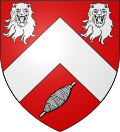 |
The arms of Saint-Léger-du-Bourg-Denis are blazoned : Gules, a chevron between 2 leopards heads and a spindle bendwise sinister argent.
|
Population
| Year | Pop. | ±% p.a. |
|---|---|---|
| 1968 | 2,144 | — |
| 1975 | 2,381 | +1.51% |
| 1982 | 2,953 | +3.12% |
| 1990 | 2,772 | −0.79% |
| 1999 | 3,124 | +1.34% |
| 2007 | 3,263 | +0.55% |
| 2012 | 3,449 | +1.11% |
| 2017 | 3,450 | +0.01% |
| Source: INSEE[3] | ||
Places of interest
- The church of St.Léger, dating from the sixteenth century.
- The debris of a tenth-century castle.
See also
References
- "Répertoire national des élus: les maires" (in French). data.gouv.fr, Plateforme ouverte des données publiques françaises. 4 May 2022.
- "Populations légales 2019". The National Institute of Statistics and Economic Studies. 29 December 2021.
- Population en historique depuis 1968, INSEE
External links
- Official website of Saint-Léger-du-Bourg-Denis (in French)
На других языках
[de] Saint-Léger-du-Bourg-Denis
Vorlage:Infobox Gemeinde in Frankreich/Wartung/abweichendes Wappen in Wikidata- [en] Saint-Léger-du-Bourg-Denis
[es] Saint-Léger-du-Bourg-Denis
Saint-Léger-du-Bourg-Denis es una población y comuna francesa, en la región de Alta Normandía, departamento de Sena Marítimo, en el distrito de Rouen y cantón de Darnétal.Другой контент может иметь иную лицензию. Перед использованием материалов сайта WikiSort.org внимательно изучите правила лицензирования конкретных элементов наполнения сайта.
WikiSort.org - проект по пересортировке и дополнению контента Википедии