world.wikisort.org - France
Saint-Maurice-d'Ételan is a commune in the Seine-Maritime department in the Normandy region in northern France.
Saint-Maurice-d'Ételan | |
|---|---|
Commune | |
 The chateau of Ételan | |
Location of Saint-Maurice-d'Ételan  | |
 Saint-Maurice-d'Ételan  Saint-Maurice-d'Ételan | |
| Coordinates: 49°27′36″N 0°36′47″E | |
| Country | France |
| Region | Normandy |
| Department | Seine-Maritime |
| Arrondissement | Le Havre |
| Canton | Port-Jérôme-sur-Seine |
| Intercommunality | Caux Seine Agglo |
| Government | |
| • Mayor (2020–2026) | Franck de Belloy |
| Area 1 | 14.24 km2 (5.50 sq mi) |
| Population | 301 |
| • Density | 21/km2 (55/sq mi) |
| Time zone | UTC+01:00 (CET) |
| • Summer (DST) | UTC+02:00 (CEST) |
| INSEE/Postal code | 76622 /76330 |
| Elevation | 3–121 m (9.8–397.0 ft) (avg. 20 m or 66 ft) |
| 1 French Land Register data, which excludes lakes, ponds, glaciers > 1 km2 (0.386 sq mi or 247 acres) and river estuaries. | |
Geography
A farming village in the Pays de Caux, situated some 21 miles (34 km) east of Le Havre, on the D81 and D281 roads, by the banks of the meandering river Seine, which forms the commune's southern border.
Population
| Year | Pop. | ±% p.a. |
|---|---|---|
| 1968 | 255 | — |
| 1975 | 243 | −0.69% |
| 1982 | 230 | −0.78% |
| 1990 | 211 | −1.07% |
| 1999 | 239 | +1.39% |
| 2007 | 322 | +3.80% |
| 2012 | 317 | −0.31% |
| 2017 | 305 | −0.77% |
| Source: INSEE[2] | ||
Places of interest

- The church of St. Maurice, dating from the fifteenth century.
- The fourteenth-century chateau.
People
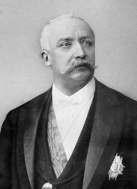
- Félix Faure (1841–1899), 7th president of France
- André Bettencourt (1919–2007), government minister
- Ernest Picard-Destelan (in French), French navy officer
- Laurence de Cambronne (1951–), editor in chief of the magazine Elle
See also
- Château d'Ételan
- Communes of the Seine-Maritime department
References
- "Populations légales 2019". The National Institute of Statistics and Economic Studies. 29 December 2021.
- Population en historique depuis 1968, INSEE
Wikimedia Commons has media related to Saint-Maurice-d'Ételan.
Authority control | |
|---|---|
| General |
|
| National libraries | |
На других языках
[de] Saint-Maurice-d’Ételan
Saint-Maurice-d’Ételan ist eine französische Gemeinde mit 301 Einwohnern (Stand: 1. Januar 2019) im Département Seine-Maritime in der Region Normandie. Sie gehört zum Arrondissement Le Havre und zum Kanton Port-Jérôme-sur-Seine (bis 2015: Kanton Lillebonne). Die Einwohner werden Saint-Mauriçais genannt.- [en] Saint-Maurice-d'Ételan
[es] Saint-Maurice-d'Ételan
Saint-Maurice-d'Ételan es una población y comuna francesa, en la región de Normandía (en francés Normandie), departamento de Sena Marítimo, en el distrito de Le Havre y cantón de Lillebonne.Текст в блоке "Читать" взят с сайта "Википедия" и доступен по лицензии Creative Commons Attribution-ShareAlike; в отдельных случаях могут действовать дополнительные условия.
Другой контент может иметь иную лицензию. Перед использованием материалов сайта WikiSort.org внимательно изучите правила лицензирования конкретных элементов наполнения сайта.
Другой контент может иметь иную лицензию. Перед использованием материалов сайта WikiSort.org внимательно изучите правила лицензирования конкретных элементов наполнения сайта.
2019-2026
WikiSort.org - проект по пересортировке и дополнению контента Википедии
WikiSort.org - проект по пересортировке и дополнению контента Википедии