world.wikisort.org - Canada
Saint-Zotique (French pronunciation: [ˌsɛ̃zɔˈtsɪk]) is a municipality located within the Vaudreuil-Soulanges Regional County Municipality in the Montérégie region located about 45 minutes west of Montreal, Quebec, Canada. It is named for Saint Zoticus of Comana.
Saint-Zotique | |
|---|---|
Municipality | |
 | |
 Coat of arms | |
| Motto: Vivons heureux (Let's live happily) | |
 Location within Vaudreuil-Soulanges RCM | |
 St-Zotique Location in southern Quebec | |
| Coordinates: 45°15′N 74°15′W[1] | |
| Country | |
| Province | |
| Region | Montérégie |
| RCM | Vaudreuil-Soulanges |
| Constituted | 27 May 1967 |
| Government | |
| • Mayor | Yvon Chiasson |
| • Federal riding | Salaberry—Suroît |
| • Prov. riding | Soulanges |
| Area | |
| • Total | 50.10 km2 (19.34 sq mi) |
| • Land | 25.04 km2 (9.67 sq mi) |
| Population (2021)[4] | |
| • Total | 9,618 |
| • Density | 384.0/km2 (995/sq mi) |
| • Pop 2016-2021 | |
| • Dwellings | 4,164 |
| Time zone | UTC−5 (EST) |
| • Summer (DST) | UTC−4 (EDT) |
| Postal code(s) | J0P 1Z0 |
| Area code(s) | 450 and 579 |
| Highways | |
| Website | www |
The municipality resides on the north shore of the St. Lawrence River and Lake Saint Francis and along the Quebec City–Windsor Corridor, the most populated area in Canada.
History
The first economic activities in the region started in the mid-18th century with forest exploitation and agriculture. The place was first named "Concession-du-Lac" and "Lac-Saint-François" after the adjacent lake. Subsequently, it was also known as "Longueuil-sur-le-Lac" (because it was part of the seigneury of New Longueuil, and "Moulin-Biron" (named after the owner of the first sawmill built near the wharf).[5]
Saint-Zotique officially became parish near 1849 when it was separated from the parish of Saint-Polycarpe located a few kilometers to the north. In 1854, its post office opened, and a year later in 1855, the Parish Municipality of Saint-Zotique was formed.[5]
In 1913, the village itself split off from the parish municipality to form the Village Municipality of Saint-Zotique, and eventually the two municipalities merged again to form a new village municipality in 1967. On 4 April 2009, it changed its status to just municipality.[5]
Demographics
| 2021 | 2016 | 2011 | |
|---|---|---|---|
| Population | 9,618 (21.2% from 2016) | 7,934 (17.1% from 2011) | 6,773 (+29.0% from 2006) |
| Land area | 25.04 km2 (9.67 sq mi) | 25.10 km2 (9.69 sq mi) | 25.19 km2 (9.73 sq mi) |
| Population density | 384.0/km2 (995/sq mi) | 316.1/km2 (819/sq mi) | 268.8/km2 (696/sq mi) |
| Median age | 41.2 (M: 40.8, F: 42.0) | 38.7 (M: 38.8, F: 38.7) | 37.9 (M: 38.0, F: 37.9) |
| Total private dwellings | 4,164 | 3,365 | 2,893 |
| Median household income | $87,000 | $74,903 | $66,171 |
|
| ||||||||||||||||||||||||||||||||||||
| Source: Statistics Canada[11] | |||||||||||||||||||||||||||||||||||||
Language
| Canada Census Mother Tongue - Saint-Zotique, Quebec[11] | ||||||||||||||||||
|---|---|---|---|---|---|---|---|---|---|---|---|---|---|---|---|---|---|---|
| Census | Total | French |
English |
French & English |
Other | |||||||||||||
| Year | Responses | Count | Trend | Pop % | Count | Trend | Pop % | Count | Trend | Pop % | Count | Trend | Pop % | |||||
2021 |
9,620 |
8,530 | 88.9% | 580 | 6.2% | 160 | 1.7% | 285 | 2.9% | |||||||||
2016 |
7,935 |
7,335 | 92.4% | 345 | 4.4% | 65 | 0.8% | 165 | 2.1% | |||||||||
2011 |
6,760 |
6,295 | 93.1% | 300 | 4.4% | 65 | 1.0% | 100 | 1.5% | |||||||||
2006 |
5,255 |
4,965 | 94.5% | 170 | 3.2% | 45 | 0.9% | 75 | 1.4% | |||||||||
2001 |
4,150 |
3,980 | 95.9% | 135 | 3.3% | 25 | 0.6% | 10 | 0.2% | |||||||||
1996 |
3,670 |
3,420 | n/a | 93.2% | 145 | n/a | 4.0% | 60 | n/a | 1.6% | 45 | n/a | 1.2% | |||||
Attractions
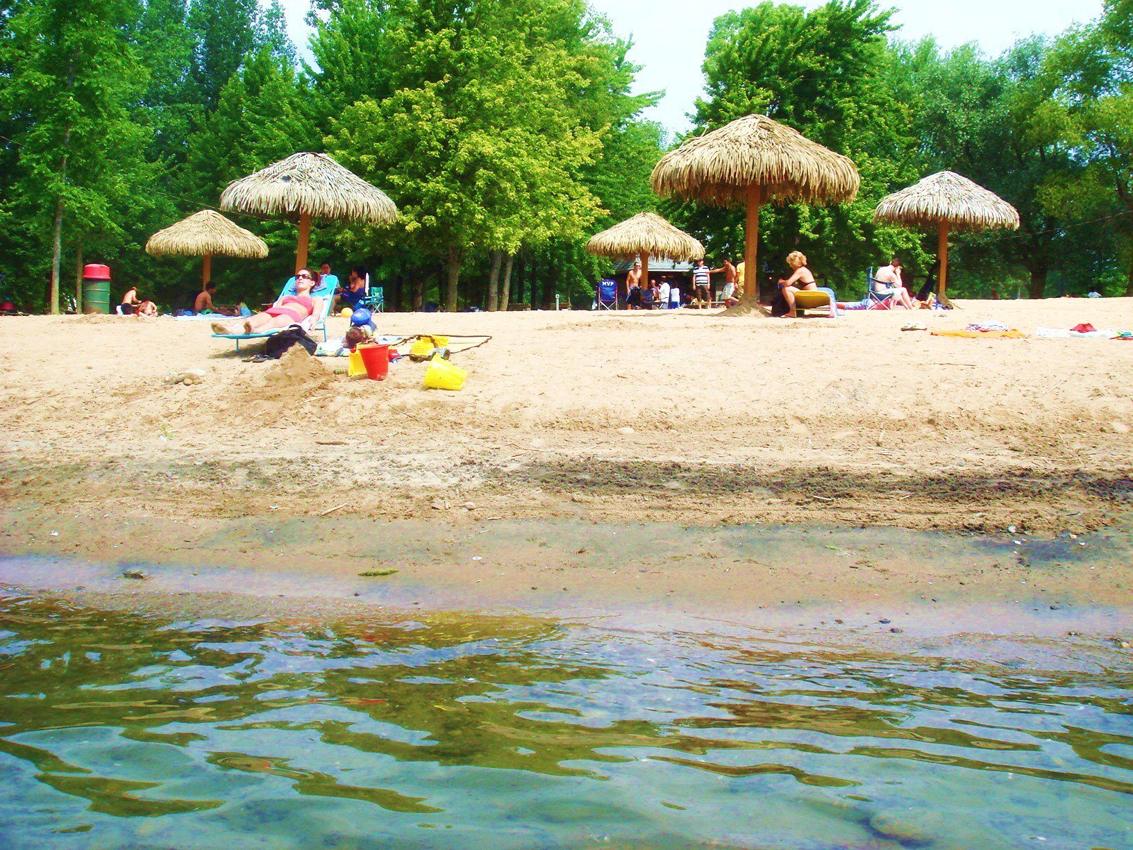
The town is home to a popular beach which can accommodate as many as 10,000 people. Located on Lac Saint-François, nautical sports are among the region's most popular activities and the town also has a golf course.[12]
Local government

List of former mayors:[13]
- Firmin François Liénard (1913–1915)
- Joseph Arsène Adolphe Bray (1916, 1931–1933)
- Joseph Omer Alphonse Méthot (1916–1917)
- Henri-Pie-Marie-Joseph-Alfred La Rocque (1917–1921)
- Jean Baptiste Sauvé (1921–1925)
- Josephat Léger (1925–1929)
- Hilaire Duval (1929–1931, 1933–1935)
- Joseph François d'Assise Adrien Cadieux (1935)
- Joseph Joachim Eugène Bissonnette (1935)
- Pierre Montpetit (1935)
- Albert Rochon (1935–1939)
- Joseph Tancrède Asselin (1939–1942)
- Cyrille Joseph Albert Richer Laflèche (1942, 1944)
- Louis Julien Bergevin (1942–1944)
- Joseph-Wilfrid-Godefroi Blanchard (1944–1971)
- Joseph Alfred Jacques Claude Blanchard (1971–1985)
- Joseph-Wilfrid-Maurice-Yvon Leroux (1985–1998)
- Robert Hovington (1998–2005)
- Gaëtane Legault (2005–2013)
- Yvon Chiasson (2013–present)
Infrastructure
Transportation
Located on Route 338 and just south of Autoroute 20 near the Ontario-Quebec border, it is easily accessible from the busiest transportation corridor of the country with direct links to Montreal, Cornwall and Toronto.
Education
Commission Scolaire des Trois-Lacs operates Francophone schools.[14]
- École de la Riveraine
- École des Orioles
- École Saint-Zotique
- École Virginie-Roy
- 2e Avenue is zoned to École Léopold-Carrière in Les Coteaux[15]
Lester B. Pearson School Board operates Anglophone schools.[16]
- Soulanges Elementary School in Saint-Télesphore or Evergreen Elementary and Forest Hill Elementary (Junior Campus and Senior campus) in Saint-Lazare
See also
- List of municipalities in Quebec
References
- "Reference number 402430 in Banque de noms de lieux du Québec". toponymie.gouv.qc.ca (in French). Commission de toponymie du Québec.
- "Répertoire des municipalités: Saint-Zotique". www.mamh.gouv.qc.ca (in French). Ministère des Affaires municipales et de l'Habitation. Retrieved 12 May 2022.
- Parliament of Canada Federal Riding History: VAUDREUIL--SOULANGES (Quebec)
- "Data table, Census Profile, 2021 Census of Population - Saint-Zotique, Municipalité (MÉ) [Census subdivision], Quebec". Government of Canada - Statistics Canada. 9 February 2022.
- "Fiche descriptive: Saint-Zotique". www.toponymie.gouv.qc.ca. Commission de toponymie du Québec. Retrieved 23 January 2018.
- "2021 Community Profiles". 2021 Canadian Census. Statistics Canada. 4 February 2022. Retrieved 12 May 2022.
- "2016 Community Profiles". 2016 Canadian Census. Statistics Canada. 12 August 2021. Retrieved 4 January 2022.
- "2011 Community Profiles". 2011 Canadian Census. Statistics Canada. 21 March 2019. Retrieved 6 February 2014.
- "2006 Community Profiles". 2006 Canadian Census. Statistics Canada. 20 August 2019.
- "2001 Community Profiles". 2001 Canadian Census. Statistics Canada. 18 July 2021.
- 1996, 2001, 2006, 2011 , 2016 , 2021 census
- Saint-Zotique official website - Recreation Archived 18 September 2007 at the Wayback Machine
- "Répertoire des entités géopolitiques: Saint-Zotique (municipalité) 23.4.1913 - ..." www.mairesduquebec.com. Institut généalogique Drouin. Retrieved 4 January 2022.
- "Les écoles et les centres". Commission Scolaire des Trois-Lacs. Retrieved 18 January 2013.
- "Liste des bassins desservis par les écoles en 2017-2018." Commission Scolaire des Trois-Lacs. Retrieved on 30 September 2017.
- "School Board Map." Lester B. Pearson School Board. Retrieved on 28 September 2017.
External links
- Website of Saint-Zotique, Quebec (in French)
- Municipal Beach Website (in French)
- Map of the Vaudreuil-Soulanges region
Places adjacent to Saint-Zotique, Quebec | |
|---|---|
| Cities & towns | |
|---|---|
| Municipalities |
|
| Villages | |
| |
| Authority control |
|
|---|
Другой контент может иметь иную лицензию. Перед использованием материалов сайта WikiSort.org внимательно изучите правила лицензирования конкретных элементов наполнения сайта.
WikiSort.org - проект по пересортировке и дополнению контента Википедии