world.wikisort.org - Canada
Saint-Télesphore is a municipality located in Vaudreuil-Soulanges Regional County Municipality, Quebec (Canada). The population as of the 2021 Canadian census was 754. The municipality is situated west of Saint-Polycarpe, south of Sainte-Justine-de-Newton, north of Rivière-Baudette and east of the provincial border near North Lancaster, Ontario.
Saint-Télesphore | |
|---|---|
Municipality | |
 | |
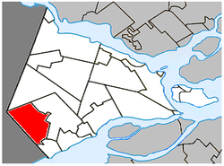 Location within Vaudreuil-Soulanges RCM | |
 Saint-Télesphore Location in southern Quebec | |
| Coordinates: 45°18′N 74°23′W[1] | |
| Country | Canada |
| Province | Quebec |
| Region | Montérégie |
| RCM | Vaudreuil-Soulanges |
| Constituted | 19 April 1877 |
| Government | |
| • Mayor | David Watson McKay |
| • Federal riding | Salaberry—Suroît |
| • Prov. riding | Soulanges |
| Area | |
| • Total | 60.67 km2 (23.42 sq mi) |
| • Land | 60.10 km2 (23.20 sq mi) |
| Population (2021)[4] | |
| • Total | 754 |
| • Density | 12.5/km2 (32/sq mi) |
| • Pop 2016-2021 | |
| • Dwellings | 352 |
| Time zone | UTC−5 (EST) |
| • Summer (DST) | UTC−4 (EDT) |
| Postal code(s) | J0P 1Y0 |
| Area code(s) | 450 and 579 |
| Highways | |
| Website | saint-telesphore |
The municipality is named for Pope Telesphorus, who reigned from 126 to 138 AD.[1] In addition to the village of Saint-Télesphore itself, the municipality also includes the community of Dalhousie or Dalhousie Station along the Canadian Pacific railway.
History
Settlement began around 1800 with the arrival of Scottish, Irish, and English immigrants. At that time, the place was called Rivière-Delisle, Lac-Saint-François, or Rivière-au-Beaudet.[1]
In 1877, the Parish Municipality of Saint-Télesphore was created, named after the parish that was formed one year earlier. In 1879, its post office opened.[1]
On August 7, 2010, the parish municipality changed its statutes to become a (regular) municipality.[1]
Demographics
| 2021 | 2016 | 2011 | |
|---|---|---|---|
| Population | 754 (-0.7% from 2016) | 759 (-0.4% from 2011) | 762 (-0.9% from 2006) |
| Land area | 60.10 km2 (23.20 sq mi) | 60.33 km2 (23.29 sq mi) | 60.42 km2 (23.33 sq mi) |
| Population density | 12.5/km2 (32/sq mi) | 12.6/km2 (33/sq mi) | 12.6/km2 (33/sq mi) |
| Median age | 43.6 (M: 44.0, F: 43.2) | 40.9 (M: 40.3, F: 41.8) | 43.1 (M: 43.5, F: 42.3) |
| Total private dwellings | 352 | 345 | 361 |
| Median household income | $54,592 | $47,601 |
|
| ||||||||||||||||||||||||||||||||||||
| Source: Statistics Canada[10] | |||||||||||||||||||||||||||||||||||||
Language
| Canada Census Mother Tongue - Saint-Télesphore, Quebec[10] | ||||||||||||||||||
|---|---|---|---|---|---|---|---|---|---|---|---|---|---|---|---|---|---|---|
| Census | Total | French |
English |
French & English |
Other | |||||||||||||
| Year | Responses | Count | Trend | Pop % | Count | Trend | Pop % | Count | Trend | Pop % | Count | Trend | Pop % | |||||
2011 |
765 |
655 | 85.62% | 80 | 10.46% | 20 | 2.61% | 10 | 1.31% | |||||||||
2006 |
765 |
630 | 82.35% | 120 | 15.69% | 0 | 0.00% | 15 | 1.96% | |||||||||
2001 |
775 |
660 | 85.16% | 105 | 13.55% | 10 | 1.29% | 0 | 0.00% | |||||||||
1996 |
815 |
730 | n/a | 89.57% | 85 | n/a | 10.43% | 0 | n/a | 0.00% | 0 | n/a | 0.00% | |||||
Local government

List of former mayors:[11]
- Camille Gourgon (1878–1883)
- Jean Baptiste Campeau (1883–1884, 1885–1886)
- Athanase Daou (1884–1885, 1886–1889)
- Joseph Pilon (1889–1893, 1897–1899, 1902–1905)
- Louis Charlebois (1893–1897)
- Joseph Antoine Moyse Leroux (1899–1902, 1917-1919)
- Joseph Moyse Beauchamp (1905–1909)
- François Xavier Cuillierier (1909–1913)
- Louis Sauvé (1913–1914)
- Zotique Dicaire (1914–1917)
- Joseph Alfred Théodule Pilon (1919–1923)
- Joseph Arthur Hyacinthe St. Denis (1923–1927)
- Joseph Alfred Louis Charlebois (1927–1939)
- Joseph Samuel Evariste Braseau (1939–1953)
- Joseph Arcade Napoléon Bruno St-Denis (1953–1959)
- Joseph-Elzéar-Rosario-Richard Gaston Pilon (1959–1963)
- Joseph Jean-Baptiste Rémi Sauvé (1963–1981, 1987–1999)
- Joseph Marcel Eléonore Descent (1981–1983)
- Robert Bourgon (1983–1987, 1999–2003)
- Joseph Albert Patrice Claude Cyr (2003–2009)
- Yvon Bériault (2009–2021)
- David Watson McKay (2021–present)
Education
Commission Scolaire des Trois-Lacs operates Francophone schools.[12]
- École du Val-des-Prés Immaculée-Conception
Lester B. Pearson School Board operates Anglophone schools.[13]
- Soulanges Elementary School in Saint-Télesphore or Evergreen Elementary and Forest Hill Elementary (Junior Campus and Senior campus) in Saint-Lazare
See also
- List of municipalities in Quebec
References
- Reference number 57684 of the Commission de toponymie du Québec (in French)
- "Répertoire des municipalités: Saint-Télesphore". www.mamh.gouv.qc.ca (in French). Ministère des Affaires municipales et de l'Habitation. Retrieved 12 May 2022.
- Parliament of Canada Federal Riding History: VAUDREUIL--SOULANGES (Quebec)
- "Saint-Télesphore, Municipalité (MÉ) Census Profile, 2021 Census of Population". www12.statcan.gc.ca. Government of Canada - Statistics Canada. Retrieved 12 May 2022.
- "2021 Community Profiles". 2021 Canadian Census. Statistics Canada. 4 February 2022. Retrieved 12 May 2022.
- "2016 Community Profiles". 2016 Canadian Census. Statistics Canada. 12 August 2021. Retrieved 11 January 2022.
- "2011 Community Profiles". 2011 Canadian Census. Statistics Canada. 21 March 2019. Retrieved 7 February 2014.
- "2006 Community Profiles". 2006 Canadian Census. Statistics Canada. 20 August 2019.
- "2001 Community Profiles". 2001 Canadian Census. Statistics Canada. 18 July 2021.
- 1996, 2001, 2006, 2011 census
- "Répertoire des entités géopolitiques: Saint-Télesphore (municipalité) 19.4.1877 - ..." www.mairesduquebec.com. Institut généalogique Drouin. Retrieved 11 January 2022.
- "Les écoles et les centres". Commission Scolaire des Trois-Lacs. Retrieved 18 January 2013.
- "School Board Map." Lester B. Pearson School Board. Retrieved on 28 September 2017.
External links
![]() Media related to Saint-Télesphore at Wikimedia Commons
Media related to Saint-Télesphore at Wikimedia Commons
Adjacent Municipal Subdivisions | ||||||||||||||||
|---|---|---|---|---|---|---|---|---|---|---|---|---|---|---|---|---|
| ||||||||||||||||
| Cities & towns | |
|---|---|
| Municipalities |
|
| Villages | |
| |
Authority control | |
|---|---|
| General | |
| National libraries | |
Другой контент может иметь иную лицензию. Перед использованием материалов сайта WikiSort.org внимательно изучите правила лицензирования конкретных элементов наполнения сайта.
WikiSort.org - проект по пересортировке и дополнению контента Википедии