world.wikisort.org - USA
Sioux Falls (/ˌsuː ˈfɔːlz/) is the most populous city in the U.S. state of South Dakota and the 131st-most populous city in the United States. It is the county seat of Minnehaha County[6] and also extends into Lincoln County to the south, which continues up to the Iowa state line. As of 2020, Sioux Falls had a population of 192,517,[7] which was estimated in 2022 to have increased to 202,600.[8][9] The Sioux Falls metro area accounts for more than 30% of the state's population. Chartered in 1856 on the banks of the Big Sioux River, the city is situated in the rolling hills at the junction of interstates 29 and 90.
Sioux Falls | |
|---|---|
City | |
From top, left to right: Downtown and Falls Park in August 2022; Old Minnehaha County Courthouse; Washington Pavilion of Arts and Science; Phillips Avenue in downtown Sioux Falls; view of the Big Sioux River from 6th Street Bridge | |
 Flag  Seal | |
| Nickname(s): Best Little City in America, Queen City of the West, The Heart of America | |
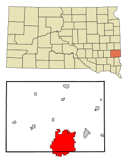 Location within Minnehaha County | |
 Sioux Falls Location within South Dakota  Sioux Falls Location within the United States | |
| Coordinates: 43°32′11″N 96°43′54″W | |
| Country | United States |
| State | South Dakota |
| Counties | Minnehaha, Lincoln |
| Named for | The waterfall of the Big Sioux River |
| Government | |
| • Mayor | Paul TenHaken (R) |
| Area | |
| • City | 81.19 sq mi (210.27 km2) |
| • Land | 80.64 sq mi (208.87 km2) |
| • Water | 0.54 sq mi (1.40 km2) |
| Elevation | 1,470 ft (448 m) |
| Population (2020)[2] | |
| • City | 192,517 |
| • Rank | 130th in the United States 1st in South Dakota |
| • Density | 2,387.25/sq mi (921.72/km2) |
| • Metro | 281,958 (176th) |
| Demonym | Siouxlander (unofficial) |
| Time zone | UTC−6 (Central) |
| • Summer (DST) | UTC−5 (Central) |
| ZIP codes | Zip codes[4] |
| Area code | 605 |
| FIPS code | 46-59020 |
| GNIS feature ID | 1267670[5] |
| Website | siouxfalls.org |


History
The history of Sioux Falls revolves around the cascades of the Big Sioux River. The falls were created about 14,000 years ago during the last ice age. The lure of the falls has been a powerful influence. Ho-Chunk, Ioway, Otoe, Missouri, Omaha (and Ponca at the time), Quapaw, Kansa, Osage, Arikira, Dakota, and Cheyenne people inhabited and settled the region previous to Europeans and European descendants. Numerous burial mounds still exist on the high bluffs near the river and are spread throughout the general vicinity. Indigenous people maintained an agricultural society with fortified villages, and the later arrivals rebuilt on many of the same sites that were previously settled. Lakota populate urban and reservation communities in the contemporary state and many Lakota, Dakota, and numerous other Indigenous Americans reside in Sioux Falls today.[10]
French voyagers/explorers visited the area in the early 18th century. The first documented visit by an American of European descent was by Philander Prescott, who camped overnight at the falls in December 1832. Captain James Allen led a military expedition out of Fort Des Moines in 1844. Jacob Ferris described the Falls in his 1856 book "The States and Territories of the Great West".[11]
Two separate groups, the Dakota Land Company of St. Paul and the Western Town Company of Dubuque, Iowa organized in 1856 to claim the land around the falls, considered a promising townsite for its beauty and water power. Each laid out 320-acre (1.3 km2) claims, but worked together for mutual protection. They built a temporary barricade of turf which they dubbed "Fort Sod", in response to native tribes attempting to defend their land from the settlers. Seventeen men then spent "the first winter" in Sioux Falls. The following year the population grew to near 40.
Although conflicts in Minnehaha County between Native Americans and white settlers were few, the Dakota War of 1862 engulfed nearby southwestern Minnesota. The town was evacuated in August of that year when two local settlers were killed as a result of the conflict. The settlers and soldiers stationed here traveled to Yankton in late August 1862. The abandoned townsite was pillaged and burned.
Fort Dakota, a military reservation established in present-day downtown, was established in May 1865.[12] Many former settlers gradually returned and a new wave of settlers arrived in the following years. The population grew to 593 by 1873, and a building boom was underway in that year. The Village of Sioux Falls, consisting of 1,200 acres (4.9 km2), was incorporated in 1876 and was granted a city charter by the Dakota Territorial legislature on March 3, 1883.[13]
The arrival of the railroads ushered in the great Dakota Boom decade of the 1880s. The population of Sioux Falls mushroomed from 2,164 in 1880 to 10,167 at the close of the decade. The growth transformed the city. A severe plague of grasshoppers and a national depression halted the boom by the early 1890s. The city grew by only 89 people from 1890 to 1900.
But prosperity eventually returned with the opening of the John Morrell meat packing plant in 1909, the establishment of an airbase and a military radio and communications training school in 1942, and the completion of the interstate highways in the early 1960s. Much of the growth in the first part of the 20th century was fueled by agriculturally based industry, such as the Morrell plant and the nearby stockyards (one of the largest in the nation).

In 1955 the city decided to consolidate the neighboring incorporated city of South Sioux Falls. At the time South Sioux Falls had a population of nearly 1,600 inhabitants, according to the 1950 census. It was the third largest city in the county after Sioux Falls and Dell Rapids. By October 18, 1955, South Sioux Falls residents voted 704 in favor and 227 against to consolidate with Sioux Falls. On the same issue, Sioux Falls residents voted on November 15 by the vote 2,714 in favor and 450 against.
In 1981, to take advantage of recently relaxed state usury laws, Citibank relocated its primary credit card center from New York City to Sioux Falls. Some claim that this event was the primary impetus for the increased population and job growth rates that Sioux Falls has experienced over the past quarter-century. Others point out that Citibank's relocation was only part of a more general transformation of the city's economy from an industrially based one to an economy centered on health care, finance, and retail trade.[14]
Sioux Falls has grown at a rapid pace since the late 1970s, with the city's population increasing from 81,182 in 1980 to 192,517 in 2020.

2019 tornadoes
On the night of September 10, 2019, the south side of Sioux Falls was hit by three strong EF2 tornadoes, severely damaging at least 37 buildings, including the Plaza 41 Shopping Center. One tornado hit the Avera Heart Hospital, damaging portions of the roof and windows, and causing seven injuries, including a man who fractured his skull as he was thrown into an exterior wall of the hospital. Another tornado hit the busy commercial district near the Empire Mall, injuring one woman inside her home. Another touched down on the far south side in a suburban residential area, tearing the roofs off homes. The total damage was more than $5 million.[15]
Geography
According to the United States Census Bureau, the city has an area of 73.47 square miles (190.29 km2), of which 72.96 square miles (188.97 km2) is land and 0.51 square miles (1.32 km2) is water.[16] The city is in extreme eastern South Dakota, about 15 miles (24 km) west of the Minnesota border. Sioux Falls has been assigned the ZIP Codes 57101, 57103–57110, 57117–57118, 57188–57189, and 57192–57198, and the FIPS place code 59020.
Metropolitan area
The Sioux Falls Metropolitan Statistical Area consists of four South Dakota counties: Lincoln, McCook, Minnehaha, and Turner. The estimated population of this MSA in 2017 was 259,094, an increase of 13.51% from the 2010 census.[17] According to recent estimates, Lincoln County is the 16th-fastest-growing county in the United States.[18] In addition to Sioux Falls, the metropolitan area includes Canton, Brandon, Dell Rapids, Tea, Harrisburg, Worthing, Beresford, Lennox, Hartford, Crooks, Baltic, Montrose, Salem, Renner, Rowena, Chancellor, Colton, Humboldt, Parker, Hurley, Garretson, Sherman, Corson, Viborg, Irene, and Centerville.
Climate
Due to its inland location and relatively high latitude, Sioux Falls has a humid continental climate (Köppen Dfa) characterized by hot, humid summers and cold, dry winters. It is in USDA Plant Hardiness Zone 4b.[19] The monthly daily average temperature ranges from 17.9 °F (−7.8 °C) in January to 74.4 °F (23.6 °C) in July; there are 15 days of maxima at or above 90 °F (32 °C) and 25 days with minima at or below 0 °F (−18 °C) annually.[20][21] Snowfall occurs mostly in light to moderate amounts during the winter, totaling 45.3 inches (115 cm).[20][21] Precipitation, at 27.85 inches (707 mm) annually, is concentrated in the warmer months.[20][21] This results in frequent thunderstorms in summer from convection being built up with the unstable weather patterns. Extremes range from −42 °F (−41 °C) on February 9, 1899 to 110 °F (43 °C) as recently as June 21, 1988.[20]
| Climate data for Sioux Falls (Foss Field Airport), elevation: 436 m or 1,430 ft,[lower-alpha 1] 1991–2020 normals,[lower-alpha 2] extremes 1893–present | |||||||||||||
|---|---|---|---|---|---|---|---|---|---|---|---|---|---|
| Month | Jan | Feb | Mar | Apr | May | Jun | Jul | Aug | Sep | Oct | Nov | Dec | Year |
| Record high °F (°C) | 66 (19) |
70 (21) |
88 (31) |
98 (37) |
104 (40) |
110 (43) |
110 (43) |
109 (43) |
104 (40) |
94 (34) |
82 (28) |
63 (17) |
110 (43) |
| Mean maximum °F (°C) | 47 (8) |
53 (12) |
70 (21) |
82 (28) |
88 (31) |
93 (34) |
95 (35) |
94 (34) |
90 (32) |
82 (28) |
67 (19) |
50 (10) |
97 (36) |
| Average high °F (°C) | 27.2 (−2.7) |
32.0 (0.0) |
45.0 (7.2) |
59.0 (15.0) |
70.8 (21.6) |
80.9 (27.2) |
85.3 (29.6) |
82.8 (28.2) |
75.6 (24.2) |
61.1 (16.2) |
45.0 (7.2) |
31.6 (−0.2) |
58.0 (14.4) |
| Daily mean °F (°C) | 17.9 (−7.8) |
22.3 (−5.4) |
34.7 (1.5) |
47.2 (8.4) |
59.1 (15.1) |
69.9 (21.1) |
74.4 (23.6) |
72.0 (22.2) |
63.8 (17.7) |
49.6 (9.8) |
34.8 (1.6) |
22.5 (−5.3) |
47.4 (8.6) |
| Average low °F (°C) | 8.5 (−13.1) |
12.6 (−10.8) |
24.3 (−4.3) |
35.5 (1.9) |
47.5 (8.6) |
58.8 (14.9) |
63.4 (17.4) |
61.1 (16.2) |
51.9 (11.1) |
38.1 (3.4) |
24.5 (−4.2) |
13.4 (−10.3) |
36.6 (2.6) |
| Mean minimum °F (°C) | −16 (−27) |
−10 (−23) |
−1 (−18) |
18 (−8) |
31 (−1) |
44 (7) |
49 (9) |
47 (8) |
34 (1) |
20 (−7) |
4 (−16) |
−9 (−23) |
−19 (−28) |
| Record low °F (°C) | −38 (−39) |
−42 (−41) |
−23 (−31) |
4 (−16) |
17 (−8) |
32 (0) |
34 (1) |
34 (1) |
13 (−11) |
−5 (−21) |
−17 (−27) |
−31 (−35) |
−42 (−41) |
| Average precipitation inches (mm) | 0.60 (15) |
0.83 (21) |
1.60 (41) |
3.00 (76) |
3.86 (98) |
4.23 (107) |
3.25 (83) |
3.34 (85) |
2.73 (69) |
2.36 (60) |
1.22 (31) |
0.83 (21) |
27.85 (707) |
| Average snowfall inches (cm) | 8.0 (20) |
8.6 (22) |
7.2 (18) |
5.1 (13) |
0.1 (0.25) |
0.0 (0.0) |
0.0 (0.0) |
0.0 (0.0) |
0.0 (0.0) |
1.4 (3.6) |
6.2 (16) |
8.7 (22) |
45.3 (115) |
| Average precipitation days (≥ 0.01 in) | 7.0 | 7.0 | 8.2 | 10.2 | 12.1 | 11.8 | 9.0 | 9.4 | 8.1 | 7.9 | 6.2 | 7.0 | 103.9 |
| Average snowy days (≥ 0.1 in) | 7.3 | 6.8 | 5.1 | 2.2 | 0.1 | 0.0 | 0.0 | 0.0 | 0.0 | 0.9 | 3.5 | 6.9 | 32.8 |
| Average relative humidity (%) | 71.7 | 73.3 | 72.1 | 64.5 | 63.5 | 65.4 | 65.4 | 67.9 | 69.5 | 67.2 | 73.4 | 75.5 | 69.1 |
| Average dew point °F (°C) | 6.4 (−14.2) |
12.6 (−10.8) |
23.4 (−4.8) |
33.6 (0.9) |
44.8 (7.1) |
55.2 (12.9) |
60.6 (15.9) |
58.8 (14.9) |
49.5 (9.7) |
36.9 (2.7) |
24.4 (−4.2) |
12.0 (−11.1) |
34.9 (1.6) |
| Average ultraviolet index | 1 | 2 | 4 | 5 | 7 | 8 | 9 | 8 | 6 | 3 | 2 | 1 | 5 |
| Source 1: NOAA (relative humidity and dew point 1961–1990)[20][21][23] | |||||||||||||
| Source 2: Weather Atlas (UV index)[24] | |||||||||||||
Demographics
| Historical population | |||
|---|---|---|---|
| Census | Pop. | %± | |
| 1880 | 2,164 | — | |
| 1890 | 10,177 | 370.3% | |
| 1900 | 10,266 | 0.9% | |
| 1910 | 14,094 | 37.3% | |
| 1920 | 25,202 | 78.8% | |
| 1930 | 33,362 | 32.4% | |
| 1940 | 40,832 | 22.4% | |
| 1950 | 52,969 | 29.7% | |
| 1960 | 65,466 | 23.6% | |
| 1970 | 72,488 | 10.7% | |
| 1980 | 81,182 | 12.0% | |
| 1990 | 100,814 | 24.2% | |
| 2000 | 123,975 | 23.0% | |
| 2010 | 153,888 | 24.1% | |
| 2020 | 192,517 | 25.1% | |
| 2021 (est.) | 196,528 | [25] | 2.1% |
| U.S. Decennial Census[26][2] | |||
2010 census
As of the census[27] of 2010, there were 153,888 people, 61,707 households, and 37,462 families residing in the city. The population density was 2,109.2 inhabitants per square mile (814.4/km2). There were 66,283 housing units at an average density of 908.5 per square mile (350.8/km2). The racial makeup of the city was 86.8% White, 4.2% African American, 2.7% Native American, 1.8% Asian, 0.1% Pacific Islander, 2.0% from other races, and 2.5% from two or more races. Hispanic or Latino of any race were 4.4% of the population.
There were 61,707 households, of which 31.9% had children under the age of 18 living with them, 45.5% were married couples living together, 10.9% had a female householder with no husband present, 4.4% had a male householder with no wife present, and 39.3% were non-families. 30.6% of all households were made up of individuals, and 8.7% had someone living alone who was 65 years of age or older. The average household size was 2.40 and the average family size was 3.02.
The median age in the city was 33.6 years. 24.6% of residents were under the age of 18; 10.7% were between the ages of 18 and 24; 29.7% were from 25 to 44; 24.1% were from 45 to 64; and 10.9% were 65 years of age or older. The gender makeup of the city was 49.6% male and 50.4% female.
In 2015, the median household income in Minnehaha County, SD was $59,884, while Lincoln County, SD was $76,094. This represents a 0.29% growth from the previous year. The median family income for Sioux Falls was $74,632 in 2015. Males had a median income of $40,187 versus $31,517 for females. The per capita income for the county was $26,392. 11.8% of the population and 8.5% of families were below the poverty line. Out of the total population, 16.8% of those under the age of 18 and 8.8% of those 65 and older were living below the poverty line.[28]
Many European immigrants, primarily from Scandinavia, Germany and the British Isles, settled in South Dakota in the 19th century. By 1890, one-third of the residents of South Dakota were immigrants.[29]
Religion
Most Sioux Falls residents are Lutheran; Catholics are the second-largest group. The Evangelical Lutheran Church in America is the largest Lutheran denomination in the city, with 20 churches in Sioux Falls.[30]
Economy
This section possibly contains original research. (May 2009) |
| Employees | Organization |
|---|---|
| 10,750 | Sanford Health |
| 8,298 | Avera Health |
| 3,688 | Sioux Falls School District |
| 3,600 | Smithfield Foods/John Morrell & Co. |
| 2,939 | Hy-Vee |
Partially due to the lack of a state corporate income tax, Sioux Falls is home to a number of financial companies. The largest employers among these[32] are Wells Fargo and Citigroup.
While no longer as economically dominant as it once was, the manufacturing and food processing sector remains an important component of Sioux Falls's economy. The Smithfield Foods/John Morrell meatpacking plant is the city's third-largest employer.[33]
Arts and culture
Events
Downtown Sioux Falls hosts a SculptureWalk[34] every summer and "First Fridays" on the first Friday of each summer month. The Downtown Riverfest is an annual Sioux Falls festival.
Festival of Bands is a regional competition that hosts over 40 marching bands each year from across the Midwest. The Sioux Empire Spectacular is a Drum Corps regional competition. Party in the Park is an annual outdoor musical event held at Terrace Park. The Sioux Empire Fair is a regional fair held at the W. H. Lyon Fairgrounds, and the Sioux Falls JazzFest is hosted at Yankton Trail Park each year.
SiouxperCon is an annual nonprofit fan convention that celebrates comic books, sci-fi, fantasy, anime, board games, and video gaming.[35]
Arts
In the beginning of the 21st century, Sioux Falls experienced a renaissance of cultural interest. The Sioux Empire Arts Council continues to lead in the Sioux Falls area arts scene and gives out Mayor's Awards each year in several categories for excellence demonstrated by Sioux Falls residents.[36] The Sioux Falls SculptureWalk was the first visual evidence of the renaissance and is an attraction for both visitors and resident artists, hosting over 55 sculptures.[37][38] One of the earliest promoters of the contemporary arts scene was Sheila Agee, who lives in nearby Brandon.[39] Her work was essential to the renovation of the original Washington High School into the Washington Pavilion (housing two performing arts, a visual arts, and a science center).[40]
The Northern Plains Indian Art Market (NPIAM) was established in 1988 by American Indian Services, Inc., of Sioux Falls as the Northern Plains Tribal Arts Show (NPTA). Northern Plains Tribal Arts dominated the Sioux Falls art scene from its inception in 1988. American Indian Services produced the juried art show and market from 1988 to 2003. Since 2004, Sinte Gleca University of Rosebud has been the producing organization. 2012 marked the show's 25th year. Directors have included Marilyn Lone Hill and Jack Herman. In the first 25 years of its existence—one of the longest-running Indian art shows in the country—over 800 artists from 7 northern plains states and two Canadian provinces exhibited at NPTA/NPIAM. Writers for national publications, filmmakers, and researchers have all joined the audiences over the years. Northern Plains Indian Art Market continues under the auspices of Sinte Gleca.[41]
A permanent Northern Plains Tribal Arts collection is housed in the Egger Gallery at the Washington Pavilion. Since the Washington Pavilion opened its doors to the public in 1999, the collection has called the Visual Arts Center home. Originally the pieces were on an extended loan from American Indian Services, Inc.; in 2013, thanks to many supporters, the works were acquired under the title of the Augustana Tribal Arts Collection, and now officially belong to the Visual Arts Center.[42]
As the 21st century began, poetry and literary events became more popular with the opening of the Sioux Empire Arts Council Horse Barn Gallery (then directed by Deb Klebanoff),[citation needed] and due to a National Endowment for the Arts-supported Y Writer's Voice, founded and directed by Allison Hedge Coke.[43] The Y Writer's Voice included an annual reading series of 38 nationally known poets and writers, who performed works and youth workshops through the Sioux Falls Writers Voice in local performance spaces, at the YMCA after-school program, and in local schools, gaining national attention.[44]

The Sioux Falls mayor's awards in literary arts designated movers and shakers during the growth and development of the literary arts scene.[45] Klebanoff, born in Sioux Falls, began the reading series at the Horse Barn with Coke after serving on the Sioux Falls Chamber of Commerce's Cultural Affairs committee, including a term as its chair and for almost a decade with the Sioux Empire Arts Council, including eight years as its executive director. She later moved south of Sioux Falls and founded a writers' retreat, The Retreat at Pointer's Ridge.[46]
In addition to literary awards, there are mayor's awards in visual arts, performing arts, music, organizing in the arts, advocacy, and lifetime achievement, per the mayor's discretion.[45] Many visual artists got their start in and/or represent the city, including Carl Grupp, Mary Groth, Ceca Cooper, Marian Henjum, Brad Kringen, Nancyjane Huehl, Don Hooper, Nathan Holman, Gary Hartenhoff, Sheila Agee, Mary Selvig, Martha Baker, Chad Mohr, Paul Schiller, Liz Heeren, Edward Two Eagle, Edwin Two Eagle, James Starkey, and painter/muralist Byob Mergia.[47][48][49]
The Sioux Falls Jazz and Blues Festival is a three-day outdoor musical event featuring two stages and is free to the public. It is held the third weekend in July at Yankton Trail Park.[50][51] The Sioux Falls Jazz & Blues Society hosts national musicians during its annual concert series. Each year the series includes approximately five concerts with acts from all over the world. JazzFest, with over 125,000 in annual attendance, has expanded over the years to include the Jazziest Diversity Project, the All-City Jazz Ensemble, the Concert Series, and JazzFest Jazz Camp.[52] 2016 was the festival's 25th anniversary year.[50]
In 2019, Levitt at the Falls launched its first season of free concerts in a state-of-the-art outdoor amphitheater in Falls Park West. The Levitt at the Falls project is a three-way partnership between the local Friends of the Levitt Shell Sioux Falls (Levitt at the Falls) nonprofit, the National Mortimer & Mimi Levitt Foundation, and the City of Sioux Falls. All three played key roles in securing the nation's eighth permanent Levitt venue. Levitt at the Falls provides a season of 50 free professional concerts each summer.
The Downtown Riverfest[53] brings live music, art, kids' activities and more in an annual festival that embraces the beauty of the Big Sioux.[54]
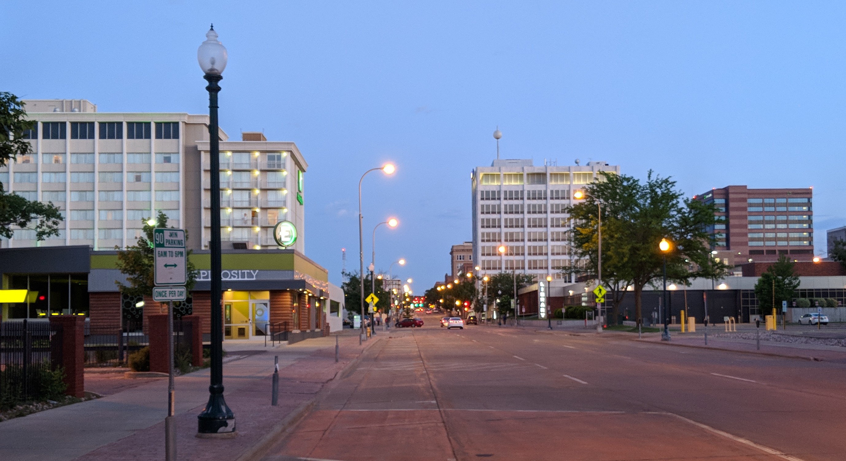
Downtown Sioux Falls boasts Ipso Gallery, directed by Liz Bashore Heeren,[55] The Orpheum Theater, SculptureWalk, Sioux Empire Community Theater, Sioux Falls State Theater, The Museum of Visual Materials, The Interactive Water Fountain, Falls Park, Creative Spirits, Eastbank Art Gallery, Levitt at the Falls, and the Washington Pavilion, home to the South Dakota Symphony Orchestra and the occasional Poets & Painters show (P1, P2, P3, P4, P5...). Prairie Star Gallery, recently closed, was an additional American Indian Arts gallery and store.[56]
Landmarks

The Washington Pavilion contains the Kirby Science Discovery Center, as well as two performing arts centers that host several Broadway productions and operas. The South Dakota Symphony's home hosts dance groups as well as smaller theater and choral events. The Visual Arts Center, also part of the Pavilion complex, hosts six galleries of changing exhibits, all free of charge. The Wells Fargo Cinedome is a multiformat 60 ft (18 m) dome theater that plays several films each month.
The Great Plains Zoo & Delbridge Museum provides the area with natural history and animal exhibits in its 50-acre (200,000 m2) park, and has dioramas depicting wildlife.[57]
The USS South Dakota Battleship Memorial to the World War II battleship USS South Dakota is on State Highway 42 (West 12th Street) and Kiwanis Avenue.
The 114th Fighter Wing is at Joe Foss Field and houses F-16C/D fighter aircraft. The SD ANG unit is known for its support of community activities and services.
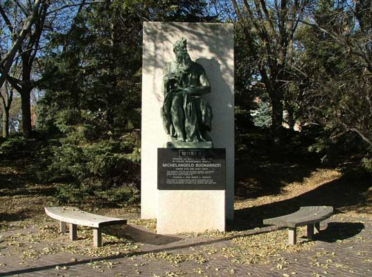
A replica of Michelangelo's David is near the downtown area at Fawick Park.
Sports
| Club | League | Venue | Established | Championships |
|---|---|---|---|---|
| Sioux Falls Canaries | AAIPB, Baseball | Sioux Falls Stadium | 1993 | 1 |
| Sioux Falls Stampede | USHL, Ice hockey | Denny Sanford Premier Center | 1999 | 3 |
| Sioux Falls Storm | IFL, Indoor football | Denny Sanford Premier Center | 2000 | 11 |
| Sioux Falls Skyforce | NBA G League, Basketball | Sanford Pentagon | 1989 | 3 |
| Sioux Falls Thunder FC | NPSL, Soccer | McEneaney Field | 2017 | 0 |
The Sioux Falls Canaries were known as the Sioux Falls Fighting Pheasants from 2010 to 2013.
Special sporting events
Sioux Falls has several multipurpose athletic stadiums: the primarily baseball Sioux Falls Stadium, indoor Sioux Falls Arena, indoor Sanford Pentagon, and indoor Denny Sanford Premier Center. Sioux Falls Stadium hosted the 2007 American Association of Independent Professional Baseball all-star game.[58]
Constructed in 2014, the Denny Sanford Premier Center is home to the Summit League's men's and women's basketball tournaments.[59] The Premier Center also hosted the 2017 USHL/NHL Top Prospects Game.
Government
| Mayor | Paul TenHaken |
| Central | Curtis Soehl |
| Northeast | Pat Starr |
| Northwest | Greg Neitzert |
| Southeast | David Barranco |
| Southwest | Marshall Selberg |
| At-large | Sarah Cole |
| At-large | Rich Merkouris |
| At-large | Alex Jensen |
The city of Sioux Falls is led by a mayor–council (strong mayor) form of government. Mayoral elections occur every four years. City council seats are also contested every four years. Not all councilmembers are elected in the same year, as the elections are staggered throughout even-numbered years. The council consists of five members elected to represent specific sections of the city and three additional seats that represent the city as a whole (that is, at-large). The councilmember position is designed to be part-time. Sioux Falls operates under a home rule charter as permitted by the South Dakota constitution.[61]
In the 2004 presidential election, George W. Bush won both Minnehaha and Lincoln counties, receiving 56% and 65% of the vote, respectively.[62] In 2008, Barack Obama won Minnehaha County by 0.7%, while John McCain won Lincoln County by 15%.[63] Both counties have voted for the Republican nominee in every presidential election since 2012.
Education

Higher education
Sioux Falls is home to Augustana University, the University of Sioux Falls, Sioux Falls Seminary, Southeast Technical College, National American University, the South Dakota School for the Deaf, the University of South Dakota's Sanford School of Medicine (Sioux Falls campus), Stewart School and the South Dakota Public Universities and Research Center (formerly known as USDSU).
Public schools
The Sioux Falls School District serves over 23,000 students living in Sioux Falls and some of its surrounding suburbs.[64] There are 25 elementary schools, seven middle schools, and six high schools, including:[65]
- Axtell Park Building
- Career and Technical Education Academy
- Lincoln High School
- Roosevelt High School
- Jefferson High School
- Washington High School
Private schools
Bishop O'Gorman Catholic Schools is a centralized Catholic school system that includes eight schools: six elementary schools, all PreK-6 (St. Mary, St. Lambert, St. Michael-St. Katharine Drexel, Holy Spirit and Christ the King); one junior high (O'Gorman Junior High, grades 7–8); and one high school, O'Gorman (9–12). The junior and senior high O'Gorman schools are on the same campus. Approximately 2,800 students attend Bishop O'Gorman Catholic Schools. As of the 2009–10 school year the Sioux Falls Catholic School system's St. Joseph Cathedral School was closed.
The Lutheran Church-Missouri Synod operates two schools in Sioux Falls. Sioux Falls Lutheran School is on 37th street, while the Lutheran High School of Sioux Falls is on Western Avenue. In 2018, voters approved a plan to move Sioux Falls Lutheran School to a new building near the I-29/I-229 merge on south Boe Lane. Students moved to the new building at the beginning of the Spring 2020 semester.[66]
The Wisconsin Evangelical Lutheran Synod has two schools in Sioux Falls: Bethel Lutheran[67] and Good Shepherd Lutheran.[68]
Other private schools include Sioux Falls Christian Schools, Christian Center, The Baan Dek Montessori, Cornerstone School, and the Open Arms Christian Child Development Center.
Media
Infrastructure
Transportation
Roads
Most Sioux Falls residents travel and commute by car. Interstate 90 passes east to west across the northern edge of the city, while Interstate 29 bisects the western portion of the city from the north and south. Interstate 229 forms a partial loop around Sioux Falls, and connects with I-90 to the northeast and I-29 to the southwest. A grid design system for city streets is the standard for the central (older) area of the city; secondary streets in newer residential areas have largely abandoned this plan.
Due to current and expected regional growth, several large construction projects have been or will be undertaken. New interchanges have recently been added to I-29. An interchange was also completed on I-90 at Marion Road. I-29 has recently been improved from I-90 to 57th Street. This upgrade includes additional lanes and auxiliary lanes. Over the next decade, the city of Sioux Falls and the South Dakota Department of Transportation plan to construct a limited-access highway around the city's outer edges to the south and east, known as South Dakota Highway 100.[69] This highway will start at the northern Tea exit (Exit 73 on I-29, 101st Street), run east on 101st Street, curve northeast east of Western Avenue, then turn north near Sycamore Avenue. It will end at the Timberline Avenue exit (Exit 402 on I-90). Sioux Falls's major roads include W 41st, Minnesota, Main, W 26th (which becomes Louise as it turns south), 12th, 49th, 57th, and Western.
Public/mass transit

Sioux Area Metro, the local public transit organization, operates 16 bus lines within the city, with most routes operating Monday through Saturday.[70] Recently, the city added a new transfer station in Sioux Falls on Louise Avenue between 49th and 57th Streets. The Sioux Area Metro Paratransit serves members of the community who would otherwise not be able to travel by providing door-to-door service.
Several taxi companies also operate within the city.
Jefferson Lines runs long-distance bus routes to Sioux Falls. Non-transfer destinations include Grand Forks, Kansas City, Minneapolis, and Omaha. Until 1965 a branch of the Milwaukee Road train from Chicago, the Arrow, made a stop in Sioux Falls.[71]
Amtrak passenger trains do not pass through South Dakota.
Air
Five domestic airlines (Delta Air Lines, United Airlines, American Airlines, Allegiant Air, and Frontier Airlines) serve Sioux Falls Regional Airport.[72]
Notable people
- James Abourezk, first Arab-American U.S. senator, now practicing law in Sioux Falls[73]
- Erika M. Anderson, aka EMA, musician and digital media artist[74]
- Jacob M. Appel, author, wrote Coulrophobia & Fata Morgana while living in Sioux Falls[75]
- Shayna Baszler, former women's MMA fighter and professional wrestler[76]
- George Botsford, composer and pianist, noted for the "Black and White Rag"[77]
- Chris Browne, comic strip artist and cartoonist, Hägar the Horrible[78]
- Benny Castillo, 11-year minor league baseball player, manager of Duluth–Superior Dukes, Jamestown Jammers, Yuma Scorpions, and Sioux City Explorers, former Sioux Falls Canaries hitting coach[79]
- Devin Clark, UFC mixed martial artist
- Dallas Clark, professional football player, Indianapolis Colts (2003–11), Tampa Bay Buccaneers (2012–13), Baltimore Ravens (2013–14)[80]
- Donn Clendenon, MLB first baseman, 1969 World Series MVP[81]
- Dusty Coleman, MLB infielder
- George Jonathan Danforth, South Dakota politician
- Chris Darrow, American multi-instrumentalist and singer-songwriter, Nitty Gritty Dirt Band, Kaleidoscope (American band)
- Karl Dean, former mayor of Nashville, Tennessee
- Nick Dinsmore, WWE Superstar 1999–2009 and WWE Coach 2012–2015
- William Dougherty, South Dakota politician[82]
- Wallace Dow, architect
- Walker Duehr, professional ice hockey player. He is the first South Dakotan to play in the National Hockey League.
- Oscar Randolph Fladmark, World War II and Korean War fighter pilot, recipient of the Distinguished Flying Cross (United States)
- Terry Forster, pitcher for five MLB teams
- Joe Foss, World War II "ace of aces" fighter pilot, first commissioner of the American Football League (which later became the AFC conference of the NFL); 20th governor of South Dakota[83]
- Michael E. Fossum, astronaut[84]
- Neil Graff, quarterback for several NFL teams[85]
- George Barnes Grigsby, delegate to Congress from Alaska Territory[86]
- John T. Grigsby, Lieutenant Governor of South Dakota[86]
- Melvin Grigsby, American Civil War and Spanish–American War veteran who served as Attorney General of South Dakota[86]
- Sioux K. Grigsby, Lieutenant Governor of South Dakota[86]
- Donald A. Haggar, lawyer and legislator[87]
- Mary Hart, television personality, Entertainment Tonight[88]
- Allison Hedge Coke, writer and educator[89][90]
- Stephanie Herseth Sandlin, U.S. representative from South Dakota's at-large congressional district
- Kirk Hinrich, retired NBA player
- Crystal Johnson, state's attorney for Minnehaha County
- January Jones, actress, best known for playing Betty Draper on Mad Men
- Herbert Krause, author (1905–1976)[91]
- David Lillehaug, associate justice of the Minnesota Supreme Court and Attorney General of Minnesota
- Mike Martz, former head coach of NFL's St. Louis Rams, born in Sioux Falls[92]
- Gail Matthius, American actress, cast member on Saturday Night Live
- Milton J. Nieuwsma, author, screenwriter, producer
- Pat O'Brien, television personality, Access Hollywood[93]
- David Soul, actor, co-star of Starsky & Hutch
- Joan Tabor, actress[94]
- John Thune, South Dakota senator[95]
- Shane Van Boening, professional pool player[96]
- Jerry verDorn, actor, Guiding Light and One Life to Live[97]
Sister cities
Sioux Falls's sister cities are:[98]
 Newry, Mourne and Down District Council, Northern Ireland, United Kingdom
 Potsdam, Germany
See also
- Impact of the COVID-19 pandemic on the meat industry in the United States
- List of cities in South Dakota
- Pandora papers
Notes
- Considering the average elevation of the airport.[22]
- Mean monthly maxima and minima (i.e. the expected highest and lowest temperature readings at any point during the year or given month) calculated based on data at said location from 1991 to 2020.
References
- "ArcGIS REST Services Directory". United States Census Bureau. Retrieved October 15, 2022.
- "Census Population API". United States Census Bureau. Retrieved October 15, 2022.
- "2020 Population and Housing State Data". United States Census Bureau. Retrieved September 23, 2021.
- "Zip Code Lookup". USPS. Archived from the original on January 1, 2008. Retrieved May 22, 2015.
- "US Board on Geographic Names". United States Geological Survey. October 25, 2007. Retrieved January 31, 2008.
- "Find a County". National Association of Counties. Retrieved June 7, 2011.
- "QuickFacts: Sioux Falls city, South Dakota". United States Census Bureau. Retrieved August 20, 2021.
- "Sioux Falls: Population exceeds 200,000". January 12, 2022.
- "City of Sioux Falls says population grows by 6,750 to pass 200,000 in 2021". January 12, 2022.
- "American Indian Services Inc". Archived from the original on March 4, 2008. Retrieved April 22, 2008.
- "History of Sioux Falls". City of Sioux Falls. Archived from the original on July 5, 2008. Retrieved November 23, 2008.
- "Ft. Dakota Virtual Tour". Angelfire.com. Retrieved March 18, 2017.
- "Sioux Falls". Factmonster.com. Retrieved March 18, 2017.
- Hetland, Cara. Sioux Falls 25 years after Citibank's arrival. , Minnesota Public Radio. February 24, 2006. (accessed March 23, 2007)
- South Dakota Event Report: EF2 Tornado (Report). National Centers for Environmental Information. National Weather Service Weather Forecast Office in Sioux Falls, South Dakota. 2019. Retrieved January 18, 2020.South Dakota Event Report: EF2 Tornado (Report). National Centers for Environmental Information. National Weather Service Weather Forecast Office in Sioux Falls, South Dakota. 2019. Retrieved January 18, 2020.South Dakota Event Report: EF2 Tornado (Report). National Centers for Environmental Information. National Weather Service Weather Forecast Office in Sioux Falls, South Dakota. 2019. Retrieved January 18, 2020."Powerful storm strikes Sioux Falls with three confirmed EF-2 tornadoes". KCRG News. Associated Press. September 11, 2019. Retrieved September 25, 2020.
- "US Gazetteer files 2010". United States Census Bureau. Archived from the original on January 25, 2012. Retrieved June 21, 2012.
- "Metropolitan and Micropolitan Statistical Areas Population Totals: 2010–2017". 2017 Population Estimates. United States Census Bureau, Population Division. October 3, 2018. Retrieved October 3, 2018.
- "Estimates for the 100 Fastest Growing U.S. Counties in 2017: April 1, 2010 to July 1, 2017". United States Census Bureau. Retrieved October 3, 2018.
- "USDA Plant Hardiness Zone Map". United States Department of Agriculture – Agricultural Research Service. Retrieved July 18, 2013.
- "NowData – NOAA Online Weather Data". National Oceanic and Atmospheric Administration. Retrieved October 14, 2021.
- "Station: Sioux Falls, SD". U.S. Climate Normals 2020: U.S. Monthly Climate Normals (1991–2020). National Oceanic and Atmospheric Administration. Retrieved October 14, 2021.
- Ranter, Harro. "Sioux Falls Regional Airport (Jo Foss Field), SD profile – Aviation Safety Network". aviation-safety.net. Retrieved June 27, 2019.
- "WMO Climate Normals for Sioux Falls/Foss Field, SD 1961–1990". National Oceanic and Atmospheric Administration. Retrieved October 14, 2021.
- "Sioux Falls, South Dakota, USA – Monthly weather forecast and Climate data". Weather Atlas. Retrieved July 4, 2019.
- "City and Town Population Totals: 2020-2021". United States Census Bureau. May 29, 2022. Retrieved May 31, 2022.
- "2020 Census Results". Census.gov. Retrieved August 14, 2021.
- "U.S. Census website". United States Census Bureau. Retrieved June 21, 2012.
- 2011–2015 American Community Survey 5-Year Estimates
- "South Dakota State Historical Society EducationKit" (PDF). pp. 6–8. Retrieved April 15, 2021.
- "Pages – ELCA Interactive Map".
- "Major Area Employers 2019" (PDF). Sioux Falls Argus Leader. Archived from the original on December 11, 2016. Retrieved March 22, 2019.
- "Major Area Employers" (PDF). Sioux Falls Development Foundation. Archived from the original (PDF) on December 11, 2016. Retrieved January 27, 2016.
- Estes, Adam Clark (May 8, 2020). "America's meat shortage is more serious than your missing hamburgers". Vox. Retrieved May 8, 2020.
- Clark, Jim. "SculptureWalk Sioux Falls homepage". Retrieved November 25, 2009.
- "SIOUXPERCON Returns For Second Year – KDLT". May 13, 2017.
- "Mayor's Awards for the Arts". Sioux Empire Arts Council. Archived from the original on May 14, 2008. Retrieved April 22, 2008.
- "About". SculptureWalk Sioux Falls. Retrieved March 18, 2017.
- "So Much to See in Sioux Falls – Visit Sioux Falls". May 17, 2015. Archived from the original on May 17, 2015.
- "Whatever Happened To: Art is Agee's dream come true". Argusleader.com. January 24, 2015. Retrieved March 18, 2017.
- "About the Pavilion". Washingtonpavilion.org. January 1, 1970. Retrieved March 18, 2017.
- "Home". NPIAM. Retrieved March 18, 2017.
- "VAC: Northern Plains Tribal Art". Washingtonpavilion.org. Archived from the original on August 28, 2016. Retrieved March 18, 2017.
- "Allison Adelle Hedge Coke". Poetry Foundation. Retrieved March 18, 2017.
- YMCA of the USA. "YMCA National Writer's Voice". Archived from the original on October 12, 2009. Retrieved November 25, 2009.
- "Archived copy" (PDF). Archived from the original (PDF) on September 22, 2016. Retrieved August 11, 2016.
{{cite web}}: CS1 maint: archived copy as title (link) - "Who We Are – The Retreat at Pointer's Ridge". Pointersridge.org. Retrieved March 18, 2017.
- "Axum: The Artwork of Eyob Mergia". Augie.edu. March 11, 2010. Retrieved March 18, 2017.
- "Featured Artists – Sioux Falls Area Community Foundation". Sfacf.org. June 20, 2014. Retrieved March 18, 2017.
- "Beyond SculptureWalk: Our city's art". Argusleader.com. Retrieved March 18, 2017.
- "About JazzFest – Sioux Falls JazzFest 2017". Siouxfallsjazzfest.com. July 15, 2016. Retrieved March 18, 2017.
- "Sioux Falls JazzFest 2017". Jazzfestsiouxfalls.com. July 15, 2016. Retrieved March 18, 2017.
- "History of SFJB | Sioux Falls Jazz and Blues". Sfjb.org. August 12, 2016. Retrieved March 18, 2017.
- "Downtown Riverfest | Downtown Sioux Falls". Dtsf.com. Archived from the original on January 3, 2017. Retrieved March 18, 2017.
- "Security Check Required". Facebook. Retrieved March 18, 2017.
- "Ipso Gallery Presents: Boonie | Downtown Sioux Falls". Dtsf.com. June 5, 2015. Archived from the original on January 3, 2017. Retrieved March 18, 2017.
- "Arts & Attractions". Dtsf.com. Retrieved March 18, 2017.
- Great Plains Zoo & Delbridge Museum of Natural History (April 8, 2005). "Our History & Our Mission". Archived from the original on April 18, 2009. Retrieved November 25, 2009.
- "2007 American Association All Star Game". aabfan.com. July 17, 2007. Retrieved October 16, 2008.
- Reusse, Patrick (March 6, 2015). "Sioux Falls sports scene benefits from Sanford". Minneapolis Star Tribune. Retrieved April 4, 2015.
- "Council Members". City of Sioux Falls. Retrieved September 20, 2022.
- "2006 Action Plan Draft" (PDF). City of Sioux Falls. 2006. Archived from the original (PDF) on July 4, 2007. Retrieved March 20, 2007.
- "2004 Presidential Election Data Graphs – South Dakota". Uselectionatlas.org. Retrieved March 23, 2007.
- "2008 Presidential Election Data Graphs – South Dakota". Uselectionatlas.org. Retrieved October 26, 2008.
- "District Overview – Sioux Falls School District". Sf.k12.sd.us. Retrieved February 11, 2019.
- "Map of Schools". Sioux Falls School District. Retrieved September 21, 2022.
- "Construction Updates".
- "School – Bethel Evangelical Lutheran". August 5, 2017.
- "About Good Shepherd Lutheran School".
- "South Dakota 100 Corridor Preservation Project". South Dakota Department of Transportation. Retrieved May 10, 2010.
- "Sioux Falls Transit First to Deploy RouteMatch Software's Fixed Route CAD/AVL Solution". Market Wire. August 2007. Archived from the original on July 1, 2014. Retrieved October 16, 2008.
- Jim Cribbins, The Milwaukee Road Remembered, 1990, pp. 61–66
- "Sioux Falls Regional Airport – Home". Sfairport.com. Retrieved March 18, 2017.
- "California Literary ReviewJames Abourezk". Calitreview.com. Retrieved March 18, 2017.
- "ABOUT – EMA". Retrieved November 19, 2021.
- American Writer, March 2017, Pp. 7–8
- "Shayna Baszler". sherdog.com. Retrieved September 23, 2013.
- "Black and White Rag by George Botsford/arr. Daehn| J.W. Pepper Sheet Music". Jwpepper.com. Retrieved March 18, 2017.
- "Chris Browne". WorldNow and KSFY. Archived from the original on September 27, 2013. Retrieved September 24, 2013.
- "Benny Castillo". KELOLAND TV. Archived from the original on September 27, 2013. Retrieved September 24, 2013.
- "Dallas Clark". Scripps TV Station Group. Archived from the original on September 27, 2013. Retrieved September 24, 2013.
- "Donn Clendenon". BASEBALL REFERENCE. COM. Retrieved September 24, 2013.
- "William Dougherty". .kdlt.com. Retrieved September 24, 2013.
- "Joe Foss". by Acepilots.com. Retrieved September 24, 2013.
- "Michael E. Fossum". .jsc.nasa.gov. Retrieved September 24, 2013.
- "Neil Graff". pro-football-reference.com. Retrieved September 24, 2013.
- Grigsby, Lutha (November 1, 1995). "Colonel Melvin Grigsby and Family" (PDF). National Grigsby Family Society Newsletter. GrigsbyFoundation.org. p. 49. Archived from the original (PDF) on February 25, 2019. Retrieved February 25, 2019.
- "Donald A. Haggar". South Dakota Legislature. Archived from the original on June 14, 2008. Retrieved September 24, 2013.
- "Mary Hart". sdhalloffame.com. Archived from the original on September 30, 2011. Retrieved September 24, 2013.
- "Allison Adelle Hedge Coke : Resume". Artscouncil.sd.gov. Archived from the original (PDF) on January 3, 2017. Retrieved March 18, 2017.
- "Witter Bynner Fellowships (Prizes and Fellowships, The Poetry and Literature Center at the Library of Congress)". Loc.gov. December 20, 2016. Retrieved March 18, 2017.
- Munger, Mark (2010). "Reading Herbert Krause". Cloquet River Press. Retrieved January 26, 2021.
- "Mike Martz". California Community College Athletic Association. Archived from the original on September 28, 2013. Retrieved September 24, 2013.
- "Pat O'Brien". University of South Dakota Athletics. CBS Interactive. Retrieved September 24, 2013.
- "Joan Tabor". Ancestry.com. Retrieved September 24, 2013.
- "About John Thune".
- "Shane Van Boening". AZBilliards.com EPPA inc. Retrieved September 24, 2013.
- "Jerry verDorn". American Media, Inc. Archived from the original on September 27, 2013. Retrieved September 24, 2013.
- "Partners". Sister Cities Association of Sioux Falls. Retrieved December 9, 2020.
Further reading
- Olson, Gary D. "Norwegian Immigrants in Early Sioux Falls: A Demographic Profile", Norwegian-American Studies, 36 (2011), pp 45–84.
- Olson, Gary D. "A Dakota Boomtown: Sioux Falls, 1877–1880", Great Plains Quarterly (2004) 24#1 pp 17–30
- Oyos, Lynwood E. (2014). Reveille for Sioux Falls: A World War II Army Air Forces Technical School Changes a South Dakota City. The Center for Western Studies, Augustana College. ISBN 9780931170973. The author is Professor Emeritus of History at Augustana College.
- Tingley, Ralph and Tingley, Kathleen. Mission in Sioux Falls: The First Baptist Church, 1875–1975 (1975)
- History of Southeastern Dakota: Its Settlement and Growth (1881)
External links
Municipalities and communities of Lincoln County, South Dakota, United States | ||
|---|---|---|
County seat: Canton | ||
| Cities |  | |
| Towns | ||
| Townships |
| |
| CDP | ||
| Footnotes | ‡This populated place also has portions in an adjacent county or counties | |
| ||
Municipalities and communities of Minnehaha County, South Dakota, United States | ||
|---|---|---|
County seat: Sioux Falls | ||
| Cities |  | |
| Towns | ||
| CDPs | ||
| Former cities |
| |
| Other communities | ||
| Townships |
| |
| Footnotes | ‡This populated place also has portions in an adjacent county or counties | |
| ||
Authority control | |
|---|---|
| General | |
| National libraries | |
| Other |
|
На других языках
[de] Sioux Falls
Sioux Falls [.mw-parser-output .IPA a{text-decoration:none}ˌsuː ˈfɔːlz] ist mit 192.517 Einwohnern (Volkszählung 2020)[2] die größte Stadt des US-amerikanischen Bundesstaates South Dakota. Sioux Falls ist Verwaltungssitz des Minnehaha County und erstreckt sich in seinem südlichen Teil bis in das Lincoln County.- [en] Sioux Falls, South Dakota
[ru] Су-Фолс
Су-Фолс, Сиу-Фолс[3][4] (англ. Sioux Falls) — крупнейший город штата Южная Дакота, США.Другой контент может иметь иную лицензию. Перед использованием материалов сайта WikiSort.org внимательно изучите правила лицензирования конкретных элементов наполнения сайта.
WikiSort.org - проект по пересортировке и дополнению контента Википедии