world.wikisort.org - USA
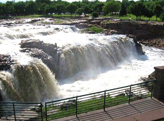
Minnehaha County is a county on the eastern border of the state of South Dakota. As of the 2020 census, the population was 197,214,[1] making it the state's most populous county. It contains over 20% of the state's population. Its county seat is Sioux Falls,[2] South Dakota's largest city. The county was created in 1862 and organized in 1868.[3] Its name was derived from the Sioux word Mnihaha, meaning "rapid water," or "waterfall" (often incorrectly translated as "laughing water").[4]
Minnehaha County | |
|---|---|
U.S. county | |
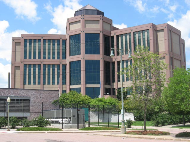 Minnehaha County Courthouse in Sioux Falls | |
 Location within the U.S. state of South Dakota | |
 South Dakota's location within the U.S. | |
| Coordinates: 43°41′N 96°47′W | |
| Country | |
| State | |
| Founded | 1862 (created) 1868 (organized) |
| Named for | "rapid water" |
| Seat | Sioux Falls |
| Largest city | Sioux Falls |
| Area | |
| • Total | 814 sq mi (2,110 km2) |
| • Land | 807 sq mi (2,090 km2) |
| • Water | 6.7 sq mi (17 km2) 0.8% |
| Population (2020) | |
| • Total | 197,214 |
| • Estimate (2021) | 199,685 |
| • Density | 239/sq mi (92/km2) |
| Time zone | UTC−6 (Central) |
| • Summer (DST) | UTC−5 (CDT) |
| Congressional district | At-large |
| Website | www |
Minnehaha County is part of the Sioux Falls Metropolitan Statistical Area, the state's largest.
Geography

Minnehaha County lies on the east side of South Dakota. Its eastern boundary abuts Minnesota as well as the northern and western boundaries of Iowa. The Big Sioux River flows south-southeast through the east central part of the county. Its terrain consists of rolling hills, devoted to agriculture except around built-up areas, and dotted with lakes and ponds in its western portion.[5] Its terrain generally slopes southward, and the east and west edges slope to the river valley through the center of the county. Its highest point is in the northwest corner, at 1,752' (534m) ASL.[6]
Minnehaha County has an area of 814 square miles (2,110 km2), of which 807 square miles (2,090 km2) is land and 6.7 square miles (17 km2) (0.8%) is water.[7]
Major highways
 I-29
I-29 I-29 BL
 I-90
I-90 I-90 BS
 I-229
I-229 Interstate 229 Dwtn.
 South Dakota Highway 11
 South Dakota Highway 19
 South Dakota Highway 38
 South Dakota Highway 42
 South Dakota Highway 115
Airports
- Sioux Falls Regional Airport (FSD)
- Wheelborg Landing Field, a small airport in Dell Rapids
Adjacent counties
- Moody County - north
- Pipestone County, Minnesota - northeast
- Rock County, Minnesota - east
- Lyon County, Iowa - southeast
- Lincoln County - south
- Turner County - southwest
- McCook County - west
- Lake County - northwest
Protected areas
- Beaver Creek State Recreation Area
- Big Sioux State Recreation Area
- Diamond Lake State Game Production Area
- Falls Park
- Island Lake State Game Production Area (part)
- Palisades State Park
- Pederson State Game Production Area
- Scott Lake State Game Production Area
- Twin Lakes State Game Production Area
- Wall Lake State Lakeside Use Area
Lakes, rivers and streams[5]
- Beaver Creek
- Beaver Lake
- Big Sioux River
- Buffalo Lake
- Clear Lake
- Covell Lake
- Diamond Lake
- Fenstrman Slough
- Grass Lake
- Island Lake (partial)
- Lake Lorane
- Loss Lake
- Lost Lake
- Rehfeldt Slough
- Scott Lake
- Skunk Creek
- Split Rock Creek
- Twin Lake
- Wall Lake
Demographics
| Historical population | |||
|---|---|---|---|
| Census | Pop. | %± | |
| 1870 | 355 | — | |
| 1880 | 8,251 | 2,224.2% | |
| 1890 | 21,879 | 165.2% | |
| 1900 | 23,926 | 9.4% | |
| 1910 | 29,631 | 23.8% | |
| 1920 | 42,490 | 43.4% | |
| 1930 | 50,872 | 19.7% | |
| 1940 | 57,697 | 13.4% | |
| 1950 | 70,910 | 22.9% | |
| 1960 | 86,575 | 22.1% | |
| 1970 | 95,209 | 10.0% | |
| 1980 | 109,435 | 14.9% | |
| 1990 | 123,809 | 13.1% | |
| 2000 | 148,281 | 19.8% | |
| 2010 | 169,468 | 14.3% | |
| 2020 | 197,214 | 16.4% | |
| 2021 (est.) | 199,685 | [8] | 1.3% |
| U.S. Decennial Census[9] 1790-1960[10] 1900-1990[11] 1990-2000[12] 2010-2020[1] | |||
2000 census
As of the 2000 census,[13] there were 148,281 people, 57,996 households, and 37,581 families in the county. The population density was 183 people per square mile (71/km2). There were 60,237 housing units at an average density of 74 per square mile (29/km2). The racial makeup of the county was 93.03% White, 1.51% Black or African American, 1.85% Native American, 1.01% Asian, 0.05% Pacific Islander, 1.04% from other races, and 1.51% from two or more races. 2.15% of the population were Hispanic or Latino of any race.
There were 57,996 households, out of which 33.80% had children under the age of 18 living with them, 51.80% were married couples living together, 9.50% had a female householder with no husband present, and 35.20% were non-families. 27.80% of all households were made up of individuals, and 8.60% had someone living alone who was 65 years of age or older. The average household size was 2.46 and the average family size was 3.04.
The county population contained 26.20% under the age of 18, 10.80% from 18 to 24, 32.00% from 25 to 44, 20.00% from 45 to 64, and 11.00% who were 65 years of age or older. The median age was 34 years. For every 100 females, there were 98.10 males. For every 100 females age 18 and over, there were 95.40 males.
The median income for a household in the county was $42,566, and the median income for a family was $52,031. Males had a median income of $32,208 versus $24,691 for females. The per capita income for the county was $20,713. About 5.00% of families and 7.50% of the population were below the poverty line, including 8.90% of those under age 18 and 7.20% of those age 65 or over.
2010 census
As of the 2010 census, there were 169,468 people, 67,028 households, and 42,052 families in the county.[14] The population density was 210.0 inhabitants per square mile (81.1/km2). There were 71,557 housing units at an average density of 88.7 per square mile (34.2/km2).[15] The racial makeup of the county was 88.1% white, 3.8% Black or African American, 2.5% American Indian, 1.5% Asian, 0.1% Pacific islander, 1.8% from other races, and 2.3% from two or more races. Those of Hispanic or Latino origin made up 4.1% of the population.[14] In terms of ancestry, 43.8% were German, 17.7% were Norwegian, 11.6% were Irish, 6.8% were Dutch, 6.3% were English, and 3.2% were American.[16]
Of the 67,028 households, 32.7% had children under the age of 18 living with them, 47.7% were married couples living together, 10.5% had a female householder with no husband present, 37.3% were non-families, and 29.3% of all households were made up of individuals. The average household size was 2.43 and the average family size was 3.03. The median age was 34.5 years.[14]
The median income for a household in the county was $51,799 and the median income for a family was $64,645. Males had a median income of $40,187 versus $31,517 for females. The per capita income for the county was $26,392. About 6.9% of families and 9.7% of the population were below the poverty line, including 12.2% of those under age 18 and 7.6% of those age 65 or over.[17]
Politics
Minnehaha is somewhat conservative for an urban county. Only four Democratic presidential candidates in five different elections have carried the county since 1940.
| Year | Republican | Democratic | Third party | |||
|---|---|---|---|---|---|---|
| No. | % | No. | % | No. | % | |
| 2020 | 49,249 | 53.34% | 40,482 | 43.85% | 2,595 | 2.81% |
| 2016 | 42,043 | 53.72% | 30,610 | 39.11% | 5,610 | 7.17% |
| 2012 | 40,342 | 52.68% | 34,674 | 45.28% | 1,567 | 2.05% |
| 2008 | 39,251 | 48.73% | 39,838 | 49.46% | 1,463 | 1.82% |
| 2004 | 44,189 | 56.92% | 32,314 | 41.62% | 1,129 | 1.45% |
| 2000 | 33,428 | 54.47% | 27,042 | 44.06% | 899 | 1.46% |
| 1996 | 27,432 | 44.24% | 29,790 | 48.05% | 4,782 | 7.71% |
| 1992 | 25,081 | 39.32% | 27,016 | 42.35% | 11,689 | 18.33% |
| 1988 | 26,765 | 47.71% | 29,135 | 51.94% | 195 | 0.35% |
| 1984 | 29,908 | 56.25% | 23,042 | 43.34% | 221 | 0.42% |
| 1980 | 26,256 | 51.00% | 20,008 | 38.87% | 5,214 | 10.13% |
| 1976 | 23,286 | 51.12% | 22,068 | 48.44% | 202 | 0.44% |
| 1972 | 22,447 | 49.90% | 22,386 | 49.76% | 155 | 0.34% |
| 1968 | 20,141 | 53.31% | 16,462 | 43.57% | 1,177 | 3.12% |
| 1964 | 16,766 | 44.48% | 20,929 | 55.52% | 0 | 0.00% |
| 1960 | 23,238 | 60.53% | 15,152 | 39.47% | 0 | 0.00% |
| 1956 | 22,285 | 62.99% | 13,093 | 37.01% | 0 | 0.00% |
| 1952 | 23,559 | 71.50% | 9,390 | 28.50% | 0 | 0.00% |
| 1948 | 14,047 | 53.77% | 11,770 | 45.05% | 308 | 1.18% |
| 1944 | 13,920 | 57.67% | 10,216 | 42.33% | 0 | 0.00% |
| 1940 | 16,664 | 57.62% | 12,259 | 42.38% | 0 | 0.00% |
| 1936 | 12,418 | 46.85% | 13,174 | 49.70% | 916 | 3.46% |
| 1932 | 10,288 | 44.21% | 12,646 | 54.34% | 339 | 1.46% |
| 1928 | 13,741 | 66.68% | 6,805 | 33.02% | 62 | 0.30% |
| 1924 | 8,822 | 55.93% | 1,524 | 9.66% | 5,427 | 34.41% |
| 1920 | 8,290 | 63.15% | 2,534 | 19.30% | 2,303 | 17.54% |
| 1916 | 4,318 | 52.64% | 3,494 | 42.59% | 391 | 4.77% |
| 1912 | 0 | 0.00% | 2,576 | 42.38% | 3,502 | 57.62% |
| 1908 | 4,125 | 64.07% | 1,948 | 30.26% | 365 | 5.67% |
| 1904 | 4,455 | 74.04% | 1,046 | 17.38% | 516 | 8.58% |
| 1900 | 3,410 | 57.04% | 2,440 | 40.82% | 128 | 2.14% |
| 1896 | 2,429 | 47.20% | 2,667 | 51.83% | 50 | 0.97% |
| 1892 | 2,208 | 52.31% | 484 | 11.47% | 1,529 | 36.22% |
Communities
Cities
- Baltic
- Brandon
- Colton
- Crooks
- Dell Rapids
- Garretson
- Hartford
- Sioux Falls (county seat)
- Valley Springs
Towns
Census-designated places
Unincorporated communities[5]
Townships
- Benton
- Brandon
- Buffalo
- Burk
- Clear Lake
- Dell Rapids
- Edison
- Grand Meadow
- Hartford
- Highland
- Humboldt
- Logan
- Lyons
- Mapleton
- Palisade
- Red Rock
- Sioux Falls
- Split Rock
- Sverdrup
- Taopi
- Valley Springs
- Wall Lake
- Wayne
- Wellington
Historical townsites

- East Sioux Falls
- Eminija
- South Sioux Falls
- West Sioux Falls
- Wingert
See also
- National Register of Historic Places listings in Minnehaha County, South Dakota
References
- "2020 Census Results". United States Census Bureau. Retrieved August 14, 2021.
- "Find a County". National Association of Counties. Retrieved June 7, 2011.
- "Dakota Territory, South Dakota, and North Dakota: Individual County Chronologies". Dakota Territory Atlas of Historical County Boundaries. The Newberry Library. 2006. Archived from the original on April 2, 2018. Retrieved March 30, 2015.
- Stewart, George R. (1945). Names on the Land. Random House. p. 291.
In the language of the Sioux, a waterfall was haha; water itself was minne. White men by a misunderstanding had coupled the two words, and produced Minnehaha Falls, a name thus meaning "water-waterfalls-falls". By a complete though natural misunderstanding of haha, the name had been romantically translated as Laughing Water
- "Minnehaha County · South Dakota".
- ""Find an Alittude" Google Maps (accessed February 7, 2019)". Archived from the original on May 21, 2019. Retrieved February 8, 2019.
- "2010 Census Gazetteer Files". United States Census Bureau. August 22, 2012. Retrieved March 28, 2015.
- "Annual Estimates of the Resident Population for Counties: April 1, 2020 to July 1, 2021". Retrieved March 25, 2022.
- "U.S. Decennial Census". United States Census Bureau. Retrieved March 28, 2015.
- "Historical Census Browser". University of Virginia Library. Retrieved March 28, 2015.
- Forstall, Richard L., ed. (March 27, 1995). "Population of Counties by Decennial Census: 1900 to 1990". United States Census Bureau. Retrieved March 28, 2015.
- "Census 2000 PHC-T-4. Ranking Tables for Counties: 1990 and 2000" (PDF). United States Census Bureau. April 2, 2001. Archived (PDF) from the original on October 9, 2022. Retrieved March 28, 2015.
- "U.S. Census website". United States Census Bureau. Retrieved May 14, 2011.
- "Profile of General Population and Housing Characteristics: 2010 Demographic Profile Data". United States Census Bureau. Archived from the original on February 13, 2020. Retrieved March 12, 2016.
- "Population, Housing Units, Area, and Density: 2010 - County". United States Census Bureau. Archived from the original on February 13, 2020. Retrieved March 12, 2016.
- "Selected Social Characteristics in the US – 2006-2010 American Community Survey 5-Year Estimates". United States Census Bureau. Archived from the original on February 13, 2020. Retrieved March 12, 2016.
- "Selected Economic Characteristics – 2006-2010 American Community Survey 5-Year Estimates". United States Census Bureau. Archived from the original on February 13, 2020. Retrieved March 12, 2016.
- Leip, David. "Atlas of US Presidential Elections". uselectionatlas.org. Retrieved April 15, 2018.
External links
- Minnehaha County, SD government website
- Envision 2035 Comprehensive Plan webpage
- Capture Minnehaha County website
- . The American Cyclopædia. 1879.
Places adjacent to Minnehaha County, South Dakota | ||||||||||||||||
|---|---|---|---|---|---|---|---|---|---|---|---|---|---|---|---|---|
| ||||||||||||||||
Municipalities and communities of Minnehaha County, South Dakota, United States | ||
|---|---|---|
County seat: Sioux Falls | ||
| Cities |  | |
| Towns | ||
| CDPs | ||
| Former cities |
| |
| Other communities | ||
| Townships |
| |
| Footnotes | ‡This populated place also has portions in an adjacent county or counties | |
| ||
Authority control | |
|---|---|
| General | |
| National libraries | |
На других языках
[de] Minnehaha County
Minnehaha County[1] ist ein County im US-amerikanischen Bundesstaat South Dakota. Im Jahr 2010 hatte das County 169.471 Einwohner und eine Bevölkerungsdichte von 80,8 Einwohnern pro Quadratkilometer.[2] Der Verwaltungssitz des Countys ist Sioux Falls,[3] das nach den Wasserfällen am Big Sioux River benannt wurde.- [en] Minnehaha County, South Dakota
[ru] Миннехаха (округ)
Округ Миннехаха (англ. Minnehaha County) располагается в штате Южная Дакота, США. Официально образован в 1862 году. По состоянию на 2013 год, численность населения составляла 179 640 человек.Другой контент может иметь иную лицензию. Перед использованием материалов сайта WikiSort.org внимательно изучите правила лицензирования конкретных элементов наполнения сайта.
WikiSort.org - проект по пересортировке и дополнению контента Википедии