world.wikisort.org - USA
Chamberlain is a city in Brule County, South Dakota, United States. It is located on the eastern bank of the Missouri River, at the dammed section of the Lake Francis Case, close to where it is crossed by Interstate 90.
Chamberlain, South Dakota
Makȟáthipi | |
|---|---|
City | |
 Akta Lakota Museum, 2003 | |
| Motto: "One day just isn't enough..." | |
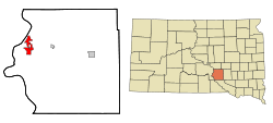 Location in Brule County and the state of South Dakota | |
| Coordinates: 43°48′20″N 99°19′42″W | |
| Country | United States |
| State | South Dakota |
| County | Brule |
| Founded | 1881[1] |
| Area | |
| • Total | 5.67 sq mi (14.70 km2) |
| • Land | 4.48 sq mi (11.60 km2) |
| • Water | 1.20 sq mi (3.10 km2) |
| Elevation | 1,404 ft (428 m) |
| Population (2020)[3] | |
| • Total | 2,473 |
| • Density | 552.13/sq mi (213.16/km2) |
| Time zone | UTC−6 (Central (CST)) |
| • Summer (DST) | UTC−5 (CDT) |
| ZIP codes | 57325-57326 |
| Area code | 605 |
| FIPS code | 46-11220[4] |
| GNIS feature ID | 1265153[5] |
| Website | www |
The population of Chamberlain was 2,473 at the 2020 census.[6] It is the county seat of Brule County.[7]
Chamberlain is home to the South Dakota Hall of Fame.
History
Chamberlain was named after Selah Chamberlain, a railroad director of the Chicago, Milwaukee and St. Paul Railway, as it was established by European Americans in relation to construction of the railroad.[8][9] The city is called "earth dwelling" in Lakota.[10]

Geography
According to the United States Census Bureau, the city has a total area of 7.84 square miles (20.31 km2), of which 6.64 square miles (17.20 km2) is land and 1.20 square miles (3.11 km2) is water.[11]
Climate
| Climate data for Chamberlain 5 S, South Dakota (1991−2020 normals, extremes 1980−present) | |||||||||||||
|---|---|---|---|---|---|---|---|---|---|---|---|---|---|
| Month | Jan | Feb | Mar | Apr | May | Jun | Jul | Aug | Sep | Oct | Nov | Dec | Year |
| Record high °F (°C) | 68 (20) |
75 (24) |
88 (31) |
93 (34) |
100 (38) |
111 (44) |
113 (45) |
112 (44) |
104 (40) |
98 (37) |
87 (31) |
73 (23) |
113 (45) |
| Average high °F (°C) | 29.0 (−1.7) |
33.8 (1.0) |
45.4 (7.4) |
57.4 (14.1) |
69.0 (20.6) |
79.6 (26.4) |
87.0 (30.6) |
85.2 (29.6) |
76.9 (24.9) |
61.7 (16.5) |
45.9 (7.7) |
32.7 (0.4) |
58.6 (14.8) |
| Daily mean °F (°C) | 19.0 (−7.2) |
23.1 (−4.9) |
33.9 (1.1) |
45.1 (7.3) |
56.9 (13.8) |
67.7 (19.8) |
74.2 (23.4) |
72.2 (22.3) |
63.4 (17.4) |
49.0 (9.4) |
34.6 (1.4) |
23.0 (−5.0) |
46.8 (8.2) |
| Average low °F (°C) | 9.0 (−12.8) |
12.3 (−10.9) |
22.3 (−5.4) |
32.9 (0.5) |
44.8 (7.1) |
55.9 (13.3) |
61.5 (16.4) |
59.3 (15.2) |
49.9 (9.9) |
36.2 (2.3) |
23.3 (−4.8) |
13.2 (−10.4) |
35.0 (1.7) |
| Record low °F (°C) | −30 (−34) |
−34 (−37) |
−19 (−28) |
1 (−17) |
24 (−4) |
32 (0) |
46 (8) |
39 (4) |
24 (−4) |
4 (−16) |
−13 (−25) |
−30 (−34) |
−34 (−37) |
| Average precipitation inches (mm) | 0.54 (14) |
0.60 (15) |
1.08 (27) |
2.65 (67) |
3.51 (89) |
4.27 (108) |
2.82 (72) |
3.02 (77) |
2.28 (58) |
1.97 (50) |
0.81 (21) |
0.53 (13) |
24.08 (612) |
| Average snowfall inches (cm) | 7.3 (19) |
8.0 (20) |
7.2 (18) |
6.8 (17) |
0.0 (0.0) |
0.0 (0.0) |
0.0 (0.0) |
0.0 (0.0) |
0.0 (0.0) |
1.4 (3.6) |
5.1 (13) |
7.5 (19) |
43.3 (110) |
| Average precipitation days (≥ 0.01 in) | 5.8 | 5.9 | 6.2 | 9.5 | 11.2 | 11.4 | 8.8 | 8.3 | 7.3 | 7.4 | 5.4 | 6.0 | 93.2 |
| Average snowy days (≥ 0.1 in) | 4.4 | 4.3 | 3.8 | 2.0 | 0.0 | 0.0 | 0.0 | 0.0 | 0.0 | 0.6 | 2.8 | 4.7 | 22.6 |
| Source: NOAA[12][13] | |||||||||||||
Demographics
| Historical population | |||
|---|---|---|---|
| Census | Pop. | %± | |
| 1890 | 939 | — | |
| 1900 | 874 | −6.9% | |
| 1910 | 1,275 | 45.9% | |
| 1920 | 1,303 | 2.2% | |
| 1930 | 1,364 | 4.7% | |
| 1940 | 1,626 | 19.2% | |
| 1950 | 1,912 | 17.6% | |
| 1960 | 2,598 | 35.9% | |
| 1970 | 2,626 | 1.1% | |
| 1980 | 2,258 | −14.0% | |
| 1990 | 2,347 | 3.9% | |
| 2000 | 2,338 | −0.4% | |
| 2010 | 2,387 | 2.1% | |
| 2020 | 2,473 | 3.6% | |
| U.S. Decennial Census[3] | |||
2010 census
As of the census[14] of 2010, there were 2,387 people, 1,040 households, and 589 families living in the city. The population density was 359.5 inhabitants per square mile (138.8/km2). There were 1,142 housing units at an average density of 172.0 per square mile (66.4/km2). The racial makeup of the city was 81.9% White, 0.3% African American, 14.8% Native American, 0.2% Asian, 0.1% from other races, and 2.8% from two or more races. Hispanic or Latino of any race were 1.5% of the population.
There were 1,040 households, of which 28.1% had children under the age of 18 living with them, 41.1% were married couples living together, 12.9% had a female householder with no husband present, 2.7% had a male householder with no wife present, and 43.4% were non-families. 36.9% of all households were made up of individuals, and 15% had someone living alone who was 65 years of age or older. The average household size was 2.17 and the average family size was 2.87.
The median age in the city was 41.8 years. 24.1% of residents were under the age of 18; 6.9% were between the ages of 18 and 24; 22.7% were from 25 to 44; 28.7% were from 45 to 64; and 17.6% were 65 years of age or older. The gender makeup of the city was 45.7% male and 54.3% female.
2000 census
As of the census[4] of 2000, there were 2,338 people, 942 households, and 550 families living in the city. The population density was 360.8 people per square mile (139.3/km2). There were 1,044 housing units at an average density of 161.1 per square mile (62.2/km2). The racial makeup of the city was 86.83% White, 0.60% African American, 10.18% Native American, 0.38% Asian, 0.04% Pacific Islander, 0.13% from other races, and 1.84% from two or more races. Hispanic or Latino of any race were 0.68% of the population.
There were 942 households, out of which 29.0% had children under the age of 18 living with them, 45.3% were married couples living together, 10.0% had a female householder with no husband present, and 41.6% were non-families. 36.2% of all households were made up of individuals, and 15.2% had someone living alone who was 65 years of age or older. The average household size was 2.27 and the average family size was 3.01.
In the city the population was spread out, with 26.9% under the age of 18, 6.8% from 18 to 24, 27.2% from 25 to 44, 21.5% from 45 to 64, and 17.5% who were 65 years of age or older. The median age was 38 years. For every 100 females, there were 86.0 males. For every 100 females age 18 and over, there were 82.6 males.
As of 2000 the median income for a household in the city was $34,487, and the median income for a family was $43,500. Males had a median income of $29,545 versus $22,009 for females. The per capita income for the city was $17,018. About 4.4% of families and 12.0% of the population were below the poverty line, including 3.9% of those under age 18 and 25.9% of those age 65 or over.
Education
It is located in the Chamberlain School District.[15]
Infrastructure
Transportation
Chamberlain is served by the Chamberlain Municipal Airport, as well as the following three highways:
 I-90 (Interstate 90)
 I-90 BL (Interstate 90 Business Loop)
 SD 50 (South Dakota Highway 50)
See also
- List of cities in South Dakota
References
- "SD Towns" (PDF). South Dakota State Historical Society. Archived from the original (PDF) on 2010-02-10. Retrieved 2010-02-11.
- "ArcGIS REST Services Directory". United States Census Bureau. Retrieved October 15, 2022.
- "Census Population API". United States Census Bureau. Retrieved Oct 15, 2022.
- "U.S. Census website". United States Census Bureau. Retrieved 2008-01-31.
- "US Board on Geographic Names". United States Geological Survey. 2007-10-25. Retrieved 2008-01-31.
- "U.S. Census Bureau: Chamberlain city, South Dakota". www.census.gov. United States Census Bureau. Retrieved 27 June 2022.
- "Find a County". National Association of Counties. Retrieved 2011-06-07.
- "Profile for Chamberlain, South Dakota". ePodunk. Retrieved 2010-05-29.
- Gannett, Henry (1905). The Origin of Certain Place Names in the United States. Govt. Print. Off. pp. 74.
- Ullrich, Jan F. (2014). New Lakota Dictionary (2nd ed.). Bloomington, IN: Lakota Language Consortium. ISBN 978-0-9761082-9-0. Archived from the original on 2016-10-18. Retrieved 2014-02-13.
- "US Gazetteer files 2010". United States Census Bureau. Archived from the original on 2012-07-02. Retrieved 2012-06-21.
- "NowData - NOAA Online Weather Data". National Oceanic and Atmospheric Administration. Retrieved October 16, 2021.
- "Station: Chamberlain 5 S, SD". U.S. Climate Normals 2020: U.S. Monthly Climate Normals (1991-2020). National Oceanic and Atmospheric Administration. Retrieved October 16, 2021.
- "U.S. Census website". United States Census Bureau. Retrieved 2012-06-21.
- "2020 CENSUS - SCHOOL DISTRICT REFERENCE MAP: Brule County, SD" (PDF). U.S. Census Bureau. Retrieved 2022-02-25.
External links
Municipalities and communities of Brule County, South Dakota, United States | ||
|---|---|---|
County seat: Chamberlain | ||
| Cities |  | |
| Town | ||
| CDPs | ||
| Other community |
| |
| Townships |
| |
| Unorganized Territory |
| |
| ||
Authority control | |
|---|---|
| General |
|
| National libraries | |
| Other | |
Другой контент может иметь иную лицензию. Перед использованием материалов сайта WikiSort.org внимательно изучите правила лицензирования конкретных элементов наполнения сайта.
WikiSort.org - проект по пересортировке и дополнению контента Википедии