world.wikisort.org - USA
Gann Valley is a census-designated place in and the county seat of Buffalo County, South Dakota, United States.[4] The town had a population of 14 as of the 2010 census. It is the smallest unincorporated county seat in the United States.[5]
Gann Valley | |
|---|---|
Unincorporated community | |
 Gann Valley Location within the state of South Dakota  Gann Valley Gann Valley (the United States) | |
| Coordinates: 44°2′0″N 98°59′15″W | |
| Country | United States |
| State | South Dakota |
| County | Buffalo |
| Founded | 1885 |
| Area | |
| • Total | 0.08 sq mi (0.21 km2) |
| • Land | 0.08 sq mi (0.21 km2) |
| • Water | 0.00 sq mi (0.00 km2) |
| Elevation | 1,604 ft (489 m) |
| Population (2020)[2] | |
| • Total | 10 |
| • Density | 126.58/sq mi (48.68/km2) |
| Time zone | UTC-6 (Central (CST)) |
| • Summer (DST) | UTC-5 (CDT) |
| ZIP codes | 57341 |
| Area code | 605 |
| FIPS code | 46-23421 |
| GNIS feature ID | 2584554[3] |
| Website | http://www.gannvalley.com/ |
Demographics
| Historical population | |||
|---|---|---|---|
| Census | Pop. | %± | |
| 2020 | 10 | — | |
| U.S. Decennial Census[6] | |||
Description
The community was founded in 1885 by Herst Gann in a valley on Crow Creek just east of the Crow Creek Reservation.[7][8] Gann donated the courthouse in the community and A.L. Spencer donated 30 acres resulting in the community becoming the county seat. In 1886 the county seat was moved to Buffalo Center but was moved back to Gann in 1888.[9]
Its ZIP code is 57341.
The center of population of South Dakota is located in Gann Valley.[10] Gann Valley holds the record for the hottest temperature in South Dakota (120 °F [49 °C]).[11]
Climate
This climatic region is typified by large seasonal temperature differences, with warm to hot (and often humid) summers and cold (sometimes severely cold) winters. According to the Köppen Climate Classification system, Gann Valley has a humid continental climate, abbreviated "Dfa" on climate maps.[12]
See also
- List of census-designated places in South Dakota
References
- "ArcGIS REST Services Directory". United States Census Bureau. Retrieved October 15, 2022.
- "Census Population API". United States Census Bureau. Retrieved Oct 15, 2022.
- U.S. Geological Survey Geographic Names Information System: Gann Valley
- "Find a County". National Association of Counties. Archived from the original on 2011-05-31. Retrieved 2011-06-07.
- "Smallest county seat in US now in Gann Valley". Retrieved 19 September 2018.
- "Census of Population and Housing". Census.gov. Retrieved June 4, 2016.
- "Gann Valley, South Dakota - South Dakota Travel Map - SD Highway 34 Tour Guide - Gann Valley History & Trivia". Archived from the original on 2013-09-14. Retrieved 2013-07-27.
- Federal Writers' Project (1940). South Dakota place-names, v.1-3. University of South Dakota. p. 38.
- "Gann Valley turns 125 this weekend – TRUE DAKOTAN". Archived from the original on 2013-07-27. Retrieved 2013-07-27.
- "Population and Population Centers by State - 2000". United States Census Bureau. Archived from the original on 2013-07-05. Retrieved 2008-02-25.
- "July, 2006 Record Heat". National Weather Service Weather Forecast Office. Retrieved 2012-10-23.
- "Gann Valley, South Dakota Köppen Climate Classification (Weatherbase)". Weatherbase. Retrieved 19 September 2018.
Municipalities and communities of Buffalo County, South Dakota, United States | ||
|---|---|---|
County seat: Gann Valley | ||
| CDPs | 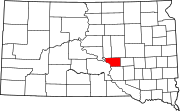 | |
| Township |
| |
| Unorganized territories |
| |
| Indian reservation | ||
| Footnotes | ‡This populated place also has portions in an adjacent county or counties | |
| ||
Другой контент может иметь иную лицензию. Перед использованием материалов сайта WikiSort.org внимательно изучите правила лицензирования конкретных элементов наполнения сайта.
WikiSort.org - проект по пересортировке и дополнению контента Википедии