world.wikisort.org - USA
McIntosh (Lakota: Maktáža[5]) is a city in and the county seat of Corson County, South Dakota, United States.[6] The population was 173 at the 2010 census and 111 at the 2020 United States Census.
McIntosh, South Dakota
Maktáža | |
|---|---|
City | |
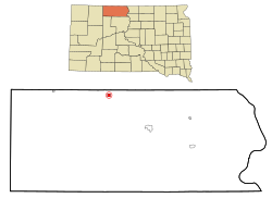 Location within Corson County and South Dakota | |
| Coordinates: 45°55′18″N 101°21′1″W | |
| Country | United States |
| State | South Dakota |
| County | Corson |
| Area | |
| • Total | 0.77 sq mi (1.99 km2) |
| • Land | 0.73 sq mi (1.89 km2) |
| • Water | 0.04 sq mi (0.10 km2) |
| Elevation | 2,316 ft (706 m) |
| Population (2020)[2] | |
| • Total | 111 |
| • Density | 152.05/sq mi (58.74/km2) |
| Time zone | UTC−7 (Mountain (MST)) |
| • Summer (DST) | UTC−6 (MDT) |
| ZIP code | 57641 |
| Area code | 605 |
| FIPS code | 46-39940[3] |
| GNIS ID | 1256381[4] |
History
McIntosh was named for a sibling duo who worked for the railroad.[7] The town was established in 1909.
McIntosh was the site of a Cold War era radar station. On April 1, 2006, the wood frame courthouse burned to the ground. Twenty-five year old Dwight Crigger, an employee of the local weed and pest board, was arrested for the setting the fire. It was the last wood courthouse in use in South Dakota.
Geography
McIntosh is located at 45°55′18″N 101°21′1″W (45.921649, -101.350171).[8] According to the United States Census Bureau, the city has a total area of 0.77 square miles (1.99 km2), of which 0.73 square miles (1.89 km2) is land and 0.04 square miles (0.10 km2) is water.[9] McIntosh has been assigned the ZIP code 57641 and the FIPS place code 39940.
McIntosh is located on US Route 12 and a mile west of the junction with South Dakota Highway 65. It is also a mile west of East (McIntosh) Lake, a lake created by the railroad bed.
Climate
McIntosh holds the record for the coldest record temperature in South Dakota (−58 °F or −50 °C), set February 17, 1936.
That same year, McIntosh set its own record for highest temperature (114 °F or 45.6 °C) that stands to this day.[10]
| Climate data for McIntosh 6 SE, South Dakota (1991−2020 normals, extremes 1915−present) | |||||||||||||
|---|---|---|---|---|---|---|---|---|---|---|---|---|---|
| Month | Jan | Feb | Mar | Apr | May | Jun | Jul | Aug | Sep | Oct | Nov | Dec | Year |
| Record high °F (°C) | 68 (20) |
71 (22) |
83 (28) |
96 (36) |
105 (41) |
111 (44) |
114 (46) |
110 (43) |
104 (40) |
94 (34) |
80 (27) |
69 (21) |
114 (46) |
| Average high °F (°C) | 26.0 (−3.3) |
30.2 (−1.0) |
43.2 (6.2) |
57.1 (13.9) |
68.8 (20.4) |
78.7 (25.9) |
86.0 (30.0) |
85.1 (29.5) |
75.3 (24.1) |
58.5 (14.7) |
41.9 (5.5) |
29.8 (−1.2) |
56.7 (13.7) |
| Daily mean °F (°C) | 16.5 (−8.6) |
20.6 (−6.3) |
32.3 (0.2) |
44.7 (7.1) |
56.1 (13.4) |
65.9 (18.8) |
72.2 (22.3) |
71.0 (21.7) |
61.5 (16.4) |
46.6 (8.1) |
31.6 (−0.2) |
20.5 (−6.4) |
45.0 (7.2) |
| Average low °F (°C) | 7.1 (−13.8) |
11.0 (−11.7) |
21.3 (−5.9) |
32.2 (0.1) |
43.4 (6.3) |
53.1 (11.7) |
58.4 (14.7) |
57.0 (13.9) |
47.7 (8.7) |
34.7 (1.5) |
21.3 (−5.9) |
11.1 (−11.6) |
33.2 (0.7) |
| Record low °F (°C) | −44 (−42) |
−58 (−50) |
−33 (−36) |
−6 (−21) |
14 (−10) |
23 (−5) |
32 (0) |
28 (−2) |
10 (−12) |
−13 (−25) |
−19 (−28) |
−40 (−40) |
−58 (−50) |
| Average precipitation inches (mm) | 0.41 (10) |
0.52 (13) |
0.67 (17) |
1.37 (35) |
2.44 (62) |
3.48 (88) |
2.68 (68) |
1.93 (49) |
1.45 (37) |
1.46 (37) |
0.47 (12) |
0.42 (11) |
17.30 (439) |
| Average snowfall inches (cm) | 7.2 (18) |
8.2 (21) |
7.4 (19) |
4.9 (12) |
0.6 (1.5) |
0.0 (0.0) |
0.0 (0.0) |
0.0 (0.0) |
0.0 (0.0) |
2.6 (6.6) |
5.0 (13) |
7.4 (19) |
43.3 (110) |
| Average precipitation days (≥ 0.01 in) | 4.7 | 5.2 | 5.3 | 6.6 | 8.7 | 9.8 | 8.8 | 6.5 | 5.7 | 6.0 | 4.3 | 4.5 | 76.1 |
| Average snowy days (≥ 0.1 in) | 4.1 | 4.6 | 3.7 | 1.8 | 0.2 | 0.0 | 0.0 | 0.0 | 0.0 | 1.1 | 2.8 | 4.0 | 22.3 |
| Source: NOAA[11][12] | |||||||||||||
| Historical population | |||
|---|---|---|---|
| Census | Pop. | %± | |
| 1910 | 409 | — | |
| 1920 | 727 | 77.8% | |
| 1930 | 663 | −8.8% | |
| 1940 | 626 | −5.6% | |
| 1950 | 628 | 0.3% | |
| 1960 | 568 | −9.6% | |
| 1970 | 563 | −0.9% | |
| 1980 | 418 | −25.8% | |
| 1990 | 302 | −27.8% | |
| 2000 | 217 | −28.1% | |
| 2010 | 173 | −20.3% | |
| 2020 | 111 | −35.8% | |
| U.S. Decennial Census[13][2] | |||

Demographics
2010 census
As of the census[14] of 2010, there were 173 people. The city had 84 households, and 49 families residing in the city. Between 2000 and 2010, the city's population declined by 20%.[3] The population density was 237.0 inhabitants per square mile (91.5/km2). There were 111 housing units at an average density of 152.1 per square mile (58.7/km2).
Racially, the city is 76.301% White people, 19.075% Native Americans, 2.312% Hispanic or Latino descent, 0.578% Asian, and 1.734% from other races.
There were 84 households, of which 21 households had children under the age of 18 living with them, 34 households were married couples living together, 5 households had a female householder with no husband present, 5 households had a male householder with no wife present, and 35 households were non-families. 34 households were made up of individuals. 20 households had someone living alone who was 65 years of age or older. The average household size was 2.06 and the average family size was 2.65.
The median age in the city was 50.8 years. 39 residents were under the age of 18. 5 residents were between the ages of 18 and 24. 32 residents were from between the ages of 25 to 44. 49 residents were between the ages of 45 to 64. 48 residents were 65 years of age or older. The gender makeup of the city was 49.7% male and 50.3% female.
See also
- List of cities in South Dakota
References
- "ArcGIS REST Services Directory". United States Census Bureau. Retrieved October 15, 2022.
- "Census Population API". United States Census Bureau. Retrieved Oct 15, 2022.
- "U.S. Census website". United States Census Bureau. Retrieved 2008-01-31.
- U.S. Geological Survey Geographic Names Information System: McIntosh
- Ullrich, Jan F. (2014). New Lakota Dictionary (2nd ed.). Bloomington, IN: Lakota Language Consortium. ISBN 978-0-9761082-9-0. Archived from the original on 2016-10-18. Retrieved 2014-02-13.
- "Find a County". National Association of Counties. Archived from the original on May 31, 2011. Retrieved 2011-06-07.
- Federal Writers' Project (1940). South Dakota place-names, v.1-3. University of South Dakota. p. 49. Archived from the original on 2016-10-27.
- "US Gazetteer files: 2010, 2000, and 1990". United States Census Bureau. 2011-02-12. Retrieved 2011-04-23.
- "US Gazetteer files 2010". United States Census Bureau. Archived from the original on January 12, 2012. Retrieved 2012-06-21.
- "MC INTOSH 6 SE, SOUTH DAKOTA - Climate Summary". www.wrcc.dri.edu. Retrieved 2017-03-16.
- "NowData - NOAA Online Weather Data". National Oceanic and Atmospheric Administration. Retrieved October 13, 2021.
- "Station: Mc Intosh 6 SE, SD". U.S. Climate Normals 2020: U.S. Monthly Climate Normals (1991-2020). National Oceanic and Atmospheric Administration. Retrieved October 13, 2021.
- "Census of Population and Housing". Census.gov. Retrieved June 4, 2015.
- "U.S. Census website". United States Census Bureau. Retrieved 2012-06-21.
External links
Municipalities and communities of Corson County, South Dakota, United States | ||
|---|---|---|
County seat: McIntosh | ||
| Cities |  | |
| Town | ||
| CDPs |
| |
| Other communities |
| |
| Indian reservation | ||
| Ghost town |
| |
| Footnotes | ‡This populated place also has portions in an adjacent county or counties | |
| ||
Authority control | |
|---|---|
| General |
|
| National libraries | |
Другой контент может иметь иную лицензию. Перед использованием материалов сайта WikiSort.org внимательно изучите правила лицензирования конкретных элементов наполнения сайта.
WikiSort.org - проект по пересортировке и дополнению контента Википедии