world.wikisort.org - France
Benfeld (French pronunciation: [bɛnfɛld]; Alsatian: Banfald [ˈbanfalt]) is a commune in the Bas-Rhin department in Grand Est in northeastern France.[3] It is situated on the river Ill. In the nearby hamlet Ehl there is an archaeological site with the remains of the Gallo-Roman city Ellelum or Helvetum. Benfeld station has rail connections to Strasbourg and Colmar.
This article may be expanded with text translated from the corresponding article in French. (December 2008) Click [show] for important translation instructions.
|
Benfeld
Banfald | |
|---|---|
Commune | |
 The town hall in Benfeld | |
 Coat of arms | |
Location of Benfeld  | |
 Benfeld  Benfeld | |
| Coordinates: 48°22′16″N 7°35′42″E | |
| Country | France |
| Region | Grand Est |
| Department | Bas-Rhin |
| Arrondissement | Sélestat-Erstein |
| Canton | Erstein |
| Government | |
| • Mayor (2020–2026) | Jacky Wolfarth[1] |
| Area 1 | 7.79 km2 (3.01 sq mi) |
| Population | 5,801 |
| • Density | 740/km2 (1,900/sq mi) |
| Time zone | UTC+01:00 (CET) |
| • Summer (DST) | UTC+02:00 (CEST) |
| INSEE/Postal code | 67028 /67230 |
| Dialling codes | 0388 |
| Elevation | 155–162 m (509–531 ft) (avg. 160 m or 520 ft) |
| 1 French Land Register data, which excludes lakes, ponds, glaciers > 1 km2 (0.386 sq mi or 247 acres) and river estuaries. | |
Population
|
| ||||||||||||||||||||||||||||||||||||||||||||||||||||||||||||||||||||||||||||||||||||||||||||||||||||||||||||||||||
| Source: EHESS[4] and INSEE (1968-2017)[5] | |||||||||||||||||||||||||||||||||||||||||||||||||||||||||||||||||||||||||||||||||||||||||||||||||||||||||||||||||||
Sights
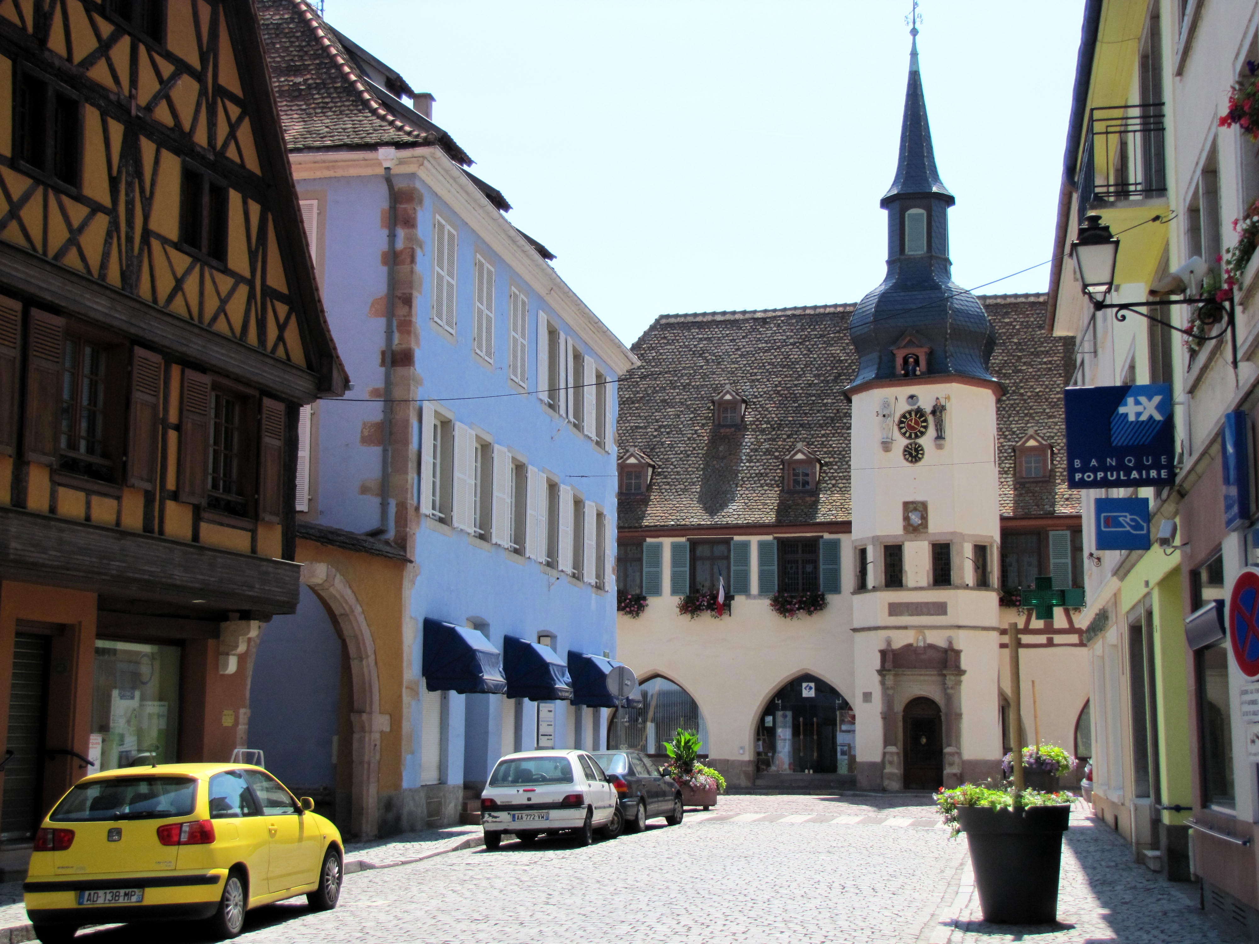
The core of the town boasts a number of ancient buildings, chief among them the Renaissance town hall with its 1619 automata. The handsome 1846 synagogue survived the Nazi occupation.[6]
See also
References
Wikimedia Commons has media related to Benfeld.
- "Répertoire national des élus: les maires". data.gouv.fr, Plateforme ouverte des données publiques françaises (in French). 2 December 2020.
- "Populations légales 2019". The National Institute of Statistics and Economic Studies. 29 December 2021.
- INSEE commune file
- Des villages de Cassini aux communes d'aujourd'hui: Commune data sheet Benfeld, EHESS. (in French)
- Population en historique depuis 1968, INSEE
- "La Synagogue de Benfeld (Dep. Bas Rhin / Alsace / Unterelsass)".
Authority control | |
|---|---|
| General |
|
| National libraries | |
| Other |
|
This Bas-Rhin geographical article is a stub. You can help Wikipedia by expanding it. |
На других языках
[de] Benfeld
Benfeld ist eine französische Gemeinde im Département Bas-Rhin in der Europäischen Gebietskörperschaft Elsass und in der Region Grand Est und liegt zwischen Sélestat und Straßburg am Ufer der Ill. Die Stadt hat 5801 Einwohner (1. Januar 2019) und liegt im Naturschutzgebiet „Grand Ried“.- [en] Benfeld
[ru] Бенфельд
Бенфе́льд (фр. Benfeld) — коммуна на северо-востоке Франции в регионе Гранд-Эст[1] (бывший Эльзас — Шампань — Арденны — Лотарингия), департамент Нижний Рейн, округ Селеста-Эрстен, кантон Эрстен[2]. До марта 2015 года административный центр одноимённого упразднённого кантона (округ Селеста-Эрстен). Административный центр агломерации Городское сообщество Бенфельд.Текст в блоке "Читать" взят с сайта "Википедия" и доступен по лицензии Creative Commons Attribution-ShareAlike; в отдельных случаях могут действовать дополнительные условия.
Другой контент может иметь иную лицензию. Перед использованием материалов сайта WikiSort.org внимательно изучите правила лицензирования конкретных элементов наполнения сайта.
Другой контент может иметь иную лицензию. Перед использованием материалов сайта WikiSort.org внимательно изучите правила лицензирования конкретных элементов наполнения сайта.
2019-2026
WikiSort.org - проект по пересортировке и дополнению контента Википедии
WikiSort.org - проект по пересортировке и дополнению контента Википедии