world.wikisort.org - France
Argoules (French pronunciation: [aʁɡul]) is a commune in the Somme department in Hauts-de-France in northern France.
Argoules | |
|---|---|
Commune | |
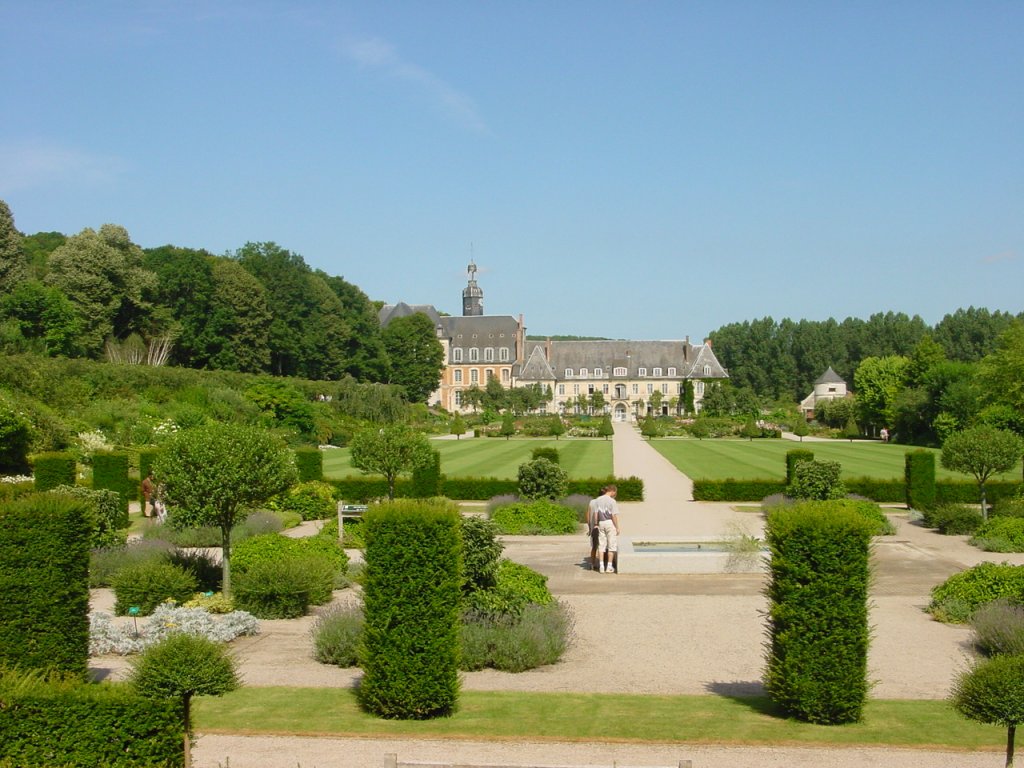 Gardens and Abbey of Valloires | |
 Coat of arms | |
Location of Argoules  | |
 Argoules  Argoules | |
| Coordinates: 50°20′36″N 1°50′02″E | |
| Country | France |
| Region | Hauts-de-France |
| Department | Somme |
| Arrondissement | Abbeville |
| Canton | Rue |
| Intercommunality | CC Ponthieu-Marquenterre |
| Government | |
| • Mayor (2020–2026) | Claude Patte[1] |
| Area 1 | 9.45 km2 (3.65 sq mi) |
| Population | 327 |
| • Density | 35/km2 (90/sq mi) |
| Time zone | UTC+01:00 (CET) |
| • Summer (DST) | UTC+02:00 (CEST) |
| INSEE/Postal code | 80025 /80120 |
| Elevation | 6–77 m (20–253 ft) (avg. 67 m or 220 ft) |
| 1 French Land Register data, which excludes lakes, ponds, glaciers > 1 km2 (0.386 sq mi or 247 acres) and river estuaries. | |
Geography
The commune is situated 23 miles (37 km) north of Abbeville on the D192, on the banks of the Authie.
Population
| Year | Pop. | ±% p.a. |
|---|---|---|
| 1851 | 773 | — |
| 1954 | 736 | −0.05% |
| 1962 | 460 | −5.71% |
| 1968 | 446 | −0.51% |
| 1975 | 560 | +3.31% |
| 1982 | 451 | −3.05% |
| 1990 | 363 | −2.68% |
| 1999 | 335 | −0.89% |
| 2007 | 335 | +0.00% |
| 2012 | 326 | −0.54% |
| 2017 | 326 | +0.00% |
| Source: EHESS[3] and INSEE (1968-2017)[4] | ||
Places and monuments
Argoules village is next to the Cistercian Abbey of Valloires, founded in the 13th century, then rebuilt in the 18th century. The abbey grounds now contain notable, contemporary gardens (the Jardins de Valloires).
See also
References
- "Répertoire national des élus: les maires". data.gouv.fr, Plateforme ouverte des données publiques françaises (in French). 2 December 2020.
- "Populations légales 2019". The National Institute of Statistics and Economic Studies. 29 December 2021.
- Des villages de Cassini aux communes d'aujourd'hui: Commune data sheet Argoules, EHESS. (in French)
- Population en historique depuis 1968, INSEE
External links
Wikimedia Commons has media related to Argoules.
(All French language)
Authority control | |
|---|---|
| General |
|
| National libraries | |
| Other |
|
Текст в блоке "Читать" взят с сайта "Википедия" и доступен по лицензии Creative Commons Attribution-ShareAlike; в отдельных случаях могут действовать дополнительные условия.
Другой контент может иметь иную лицензию. Перед использованием материалов сайта WikiSort.org внимательно изучите правила лицензирования конкретных элементов наполнения сайта.
Другой контент может иметь иную лицензию. Перед использованием материалов сайта WikiSort.org внимательно изучите правила лицензирования конкретных элементов наполнения сайта.
2019-2026
WikiSort.org - проект по пересортировке и дополнению контента Википедии
WikiSort.org - проект по пересортировке и дополнению контента Википедии