world.wikisort.org - China
Ximeng Va Autonomous County (Chinese: 西盟佤族自治县; pinyin: Xīméng Wǎzú Zìzhìxiàn; Va: Si Mēng Vax Qux Zi Zi Sin or Si Mōung Vax Qux Zi Zi Sin) is an autonomous county under the jurisdiction of Pu'er City, in the southwest of Yunnan Province, China, bordering Myanmar's Shan State to the west. Wa/Va people, who speak the Wa language, are the main inhabitants in Ximeng County.
Ximeng County
西盟县 | |
|---|---|
Autonomous county | |
| 西盟佤族自治县 Ximeng Va Autonomous County | |
 Location of Ximeng County (pink) and Pu'er City (yellow) within Yunnan | |
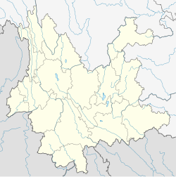
 Ximeng Location of the seat in Yunnan | |
| Coordinates: 22°38′40″N 99°35′24″E | |
| Country | People's Republic of China |
| Province | Yunnan |
| Prefecture-level city | Pu'er |
| GB/T 2260 CODE[1] | 530829 |
| Area | |
| • Total | 1,391 km2 (537 sq mi) |
| Elevation | 1,214 m (3,983 ft) |
| Population | |
| • Total | 81,596 |
| • Density | 59/km2 (150/sq mi) |
| Time zone | UTC+8 (China Standard Time) |
| Postal code | 665700[2] |
| Area code | 0879[2] |
| Website | Archived 2008-09-18 at the Wayback Machine |
| 1Yunnan Statistics Bureau 2Puer Gov. 3Yunnan Portal | |
Administrative divisions
In the present, Ximeng Va Autonomous County has 5 towns 1 township and 1 ethnic township.
- 5 towns
|
|
- 1 township
- Yuesong (岳宋乡)
- 1 ethnic township
- Lahu Lisuo (力所拉祜族乡)
Climate
| Climate data for Ximeng (1981−2010) | |||||||||||||
|---|---|---|---|---|---|---|---|---|---|---|---|---|---|
| Month | Jan | Feb | Mar | Apr | May | Jun | Jul | Aug | Sep | Oct | Nov | Dec | Year |
| Record high °C (°F) | 27.4 (81.3) |
28.6 (83.5) |
31.6 (88.9) |
33.4 (92.1) |
33.5 (92.3) |
33.2 (91.8) |
31.4 (88.5) |
31.8 (89.2) |
31.4 (88.5) |
30.4 (86.7) |
28.0 (82.4) |
25.8 (78.4) |
33.5 (92.3) |
| Average high °C (°F) | 22.3 (72.1) |
24.5 (76.1) |
27.2 (81.0) |
29.0 (84.2) |
27.8 (82.0) |
27.1 (80.8) |
26.3 (79.3) |
27.2 (81.0) |
27.2 (81.0) |
26.2 (79.2) |
23.7 (74.7) |
21.7 (71.1) |
25.9 (78.5) |
| Daily mean °C (°F) | 14.3 (57.7) |
16.1 (61.0) |
19.1 (66.4) |
21.4 (70.5) |
22.1 (71.8) |
22.7 (72.9) |
22.5 (72.5) |
22.7 (72.9) |
22.1 (71.8) |
20.8 (69.4) |
17.8 (64.0) |
14.6 (58.3) |
19.7 (67.4) |
| Average low °C (°F) | 9.3 (48.7) |
10.2 (50.4) |
13.1 (55.6) |
15.9 (60.6) |
18.2 (64.8) |
20.1 (68.2) |
20.2 (68.4) |
20.1 (68.2) |
19.2 (66.6) |
17.6 (63.7) |
13.4 (56.1) |
10.5 (50.9) |
15.7 (60.2) |
| Record low °C (°F) | 5.1 (41.2) |
6.3 (43.3) |
8.7 (47.7) |
10.4 (50.7) |
12.4 (54.3) |
17.6 (63.7) |
18.1 (64.6) |
16.4 (61.5) |
10.9 (51.6) |
11.1 (52.0) |
7.9 (46.2) |
6.1 (43.0) |
5.1 (41.2) |
| Average precipitation mm (inches) | 11.3 (0.44) |
21.4 (0.84) |
27.4 (1.08) |
84.6 (3.33) |
195.3 (7.69) |
442.1 (17.41) |
540.35 (21.27) |
461.3 (18.16) |
277.8 (10.94) |
203.7 (8.02) |
92.1 (3.63) |
25.7 (1.01) |
2,383.05 (93.82) |
| Average relative humidity (%) | 75 | 65 | 52 | 66 | 78 | 86 | 89 | 87 | 84 | 83 | 81 | 80 | 77 |
| Source: China Meteorological Data Service Center[3] | |||||||||||||
References
- "中华人民共和国国家统计局 >> 行政区划代码". Archived from the original on February 21, 2009. Retrieved January 29, 2009.
- Area Code and Postal Code in Yunnan Province
- 中国地面气候标准值月值(1981-2010) (in Simplified Chinese). China Meteorological Data Service Center. Retrieved 5 November 2022.
External links
На других языках
- [en] Ximeng Va Autonomous County
[ru] Симэн-Ваский автономный уезд
Симэн-Ваский автономный уезд (кит. упр. 西盟佤族自治县, пиньинь Xīméng Wǎzú zìzhìxiàn) — автономный уезд городского округа Пуэр провинции Юньнань (КНР).Текст в блоке "Читать" взят с сайта "Википедия" и доступен по лицензии Creative Commons Attribution-ShareAlike; в отдельных случаях могут действовать дополнительные условия.
Другой контент может иметь иную лицензию. Перед использованием материалов сайта WikiSort.org внимательно изучите правила лицензирования конкретных элементов наполнения сайта.
Другой контент может иметь иную лицензию. Перед использованием материалов сайта WikiSort.org внимательно изучите правила лицензирования конкретных элементов наполнения сайта.
2019-2025
WikiSort.org - проект по пересортировке и дополнению контента Википедии
WikiSort.org - проект по пересортировке и дополнению контента Википедии