world.wikisort.org - China
Ninglang Yi Autonomous County (simplified Chinese: 宁蒗彝族自治县; traditional Chinese: 寧蒗彝族自治縣; pinyin: Nínglàng Yízú Zìzhìxiàn; Yi: ꆀꆿꆈꌠꊨꏦꏱꅉꑤ nip lat nuo su zyt jie jux dde xiep) is located in the northwest of Yunnan province, China, bordering Sichuan province to the northeast. It is under the administration of Lijiang City. The county is home to the Mosuo people, who lived under the quasi-independent Chiefdom of Yongning until abolished in 1956. Ninglang Luguhu Airport is located in the county.
This article needs additional citations for verification. (December 2021) |
Ninglang County | |
|---|---|
Autonomous county | |
| 宁蒗彝族自治县 · ꆀꆿꆈꌠꊨꏦꏱꅉꑤ Ninglang Yi Autonomous County | |
 | |
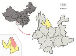 Location of Ninglang County (pink) and Lijiang City (yellow) within Yunnan | |
| Country | People's Republic of China |
| Province | Yunnan |
| Prefecture-level city | Lijiang |
| Area | |
| • Total | 6,206 km2 (2,396 sq mi) |
| Population | |
| • Total | 230,000 |
| • Density | 37/km2 (96/sq mi) |
| Time zone | UTC+8 (CST) |
| Postal code | 674300 |
| Area code | 0888 |
| Climate | Cwb |
Administrative divisions
Ninglang Yi Autonomous County has 4 towns, 10 townships and 1 ethnic township.[1]
- 4 towns
|
|
- 10 townships
|
|
- 1 ethnic township
- Cuiyu Lisu and Pumi (翠玉傈僳族普米族乡)
Climate
| Climate data for Ninglang (1981−2010) | |||||||||||||
|---|---|---|---|---|---|---|---|---|---|---|---|---|---|
| Month | Jan | Feb | Mar | Apr | May | Jun | Jul | Aug | Sep | Oct | Nov | Dec | Year |
| Record high °C (°F) | 24.6 (76.3) |
26.7 (80.1) |
27.8 (82.0) |
30.0 (86.0) |
31.4 (88.5) |
30.8 (87.4) |
32.5 (90.5) |
30.6 (87.1) |
29.9 (85.8) |
27.0 (80.6) |
25.3 (77.5) |
23.8 (74.8) |
32.5 (90.5) |
| Average high °C (°F) | 15.5 (59.9) |
17.3 (63.1) |
20.2 (68.4) |
22.8 (73.0) |
24.7 (76.5) |
25.2 (77.4) |
24.6 (76.3) |
24.6 (76.3) |
23.2 (73.8) |
21.5 (70.7) |
18.0 (64.4) |
15.6 (60.1) |
21.1 (70.0) |
| Daily mean °C (°F) | 4.1 (39.4) |
6.5 (43.7) |
9.9 (49.8) |
13.3 (55.9) |
17.2 (63.0) |
19.4 (66.9) |
19.1 (66.4) |
18.5 (65.3) |
16.7 (62.1) |
13.4 (56.1) |
8.3 (46.9) |
4.5 (40.1) |
12.6 (54.6) |
| Average low °C (°F) | −4.9 (23.2) |
−2.9 (26.8) |
0.7 (33.3) |
4.6 (40.3) |
10.3 (50.5) |
14.7 (58.5) |
15.5 (59.9) |
14.7 (58.5) |
13.0 (55.4) |
8.1 (46.6) |
1.5 (34.7) |
−3.4 (25.9) |
6.0 (42.8) |
| Record low °C (°F) | −9.7 (14.5) |
−9.2 (15.4) |
−6.6 (20.1) |
−2.5 (27.5) |
2.7 (36.9) |
8.5 (47.3) |
8.9 (48.0) |
8.7 (47.7) |
2.2 (36.0) |
−0.9 (30.4) |
−5.7 (21.7) |
−8.4 (16.9) |
−9.7 (14.5) |
| Average precipitation mm (inches) | 4.4 (0.17) |
4.2 (0.17) |
9.4 (0.37) |
18.3 (0.72) |
55.7 (2.19) |
164.1 (6.46) |
241.8 (9.52) |
213.5 (8.41) |
150.4 (5.92) |
58.1 (2.29) |
13.0 (0.51) |
3.2 (0.13) |
936.1 (36.86) |
| Average relative humidity (%) | 60 | 54 | 52 | 56 | 62 | 74 | 82 | 83 | 83 | 79 | 74 | 68 | 69 |
| Source: China Meteorological Data Service Center[2] | |||||||||||||
References
- "国家统计局" (in Chinese). National Bureau of Statistics of the People's Republic of China. Retrieved 2021-12-07.
- 中国地面气候标准值月值(1981-2010) (in Simplified Chinese). China Meteorological Data Service Center. Retrieved 5 November 2022.
External links
Authority control | |
|---|---|
| General | |
| National libraries | |
This Yunnan location article is a stub. You can help Wikipedia by expanding it. |
На других языках
- [en] Ninglang Yi Autonomous County
[ru] Нинлан-Ийский автономный уезд
Нинлан-Ийский автономный уезд (кит. упр. 宁蒗彝族自治县, пиньинь Nínglàng Yízú zìzhìxiàn) — автономный уезд городского округа Лицзян провинции Юньнань (КНР).Текст в блоке "Читать" взят с сайта "Википедия" и доступен по лицензии Creative Commons Attribution-ShareAlike; в отдельных случаях могут действовать дополнительные условия.
Другой контент может иметь иную лицензию. Перед использованием материалов сайта WikiSort.org внимательно изучите правила лицензирования конкретных элементов наполнения сайта.
Другой контент может иметь иную лицензию. Перед использованием материалов сайта WikiSort.org внимательно изучите правила лицензирования конкретных элементов наполнения сайта.
2019-2026
WikiSort.org - проект по пересортировке и дополнению контента Википедии
WikiSort.org - проект по пересортировке и дополнению контента Википедии