world.wikisort.org - China
Gengma Dai and Va Autonomous County (simplified Chinese: 耿马傣族佤族自治县; traditional Chinese: 耿馬傣族佤族自治縣; pinyin: Gěngmǎ Dǎizú Wǎzú Zìzhìxiàn) is located in Lincang City, in the west of Yunnan province, China.
Gengma
耿马县 | |
|---|---|
Autonomous county | |
| 耿马傣族佤族自治县 Gengma Dai and Va Autonomous County | |
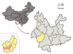 Location of Gengma County (pink) and Lincang City (yellow) within Yunnan province | |
 Gengma Location of the seat in Yunnan | |
| Coordinates: 23.538°N 99.397°E | |
| Country | People's Republic of China |
| Province | Yunnan |
| Prefecture-level city | Lincang |
| Area | |
| • Total | 3,837 km2 (1,481 sq mi) |
| Population | |
| • Total | 245,251 |
| Time zone | UTC+8 (CST) |
| Postal code | 677500 |
| Area code | 0883 |
| Website | www |
History
In 1988, the county was affected by two strong earthquakes. It killed a total of 939 people and caused major destruction.[1]
Administrative divisions
Gengma Dai and Va Autonomous County has 4 towns, 4 townships and 1 ethnic township.[2]
- 4 towns
|
|
- 4 townships
|
|
- 1 ethnic township
- Manghong Lahu and Bulang (芒洪拉祜族布朗族乡)
Climate
| Climate data for Gengma (1981−2010) | |||||||||||||
|---|---|---|---|---|---|---|---|---|---|---|---|---|---|
| Month | Jan | Feb | Mar | Apr | May | Jun | Jul | Aug | Sep | Oct | Nov | Dec | Year |
| Record high °C (°F) | 27.9 (82.2) |
31.0 (87.8) |
33.1 (91.6) |
35.3 (95.5) |
35.5 (95.9) |
36.5 (97.7) |
33.5 (92.3) |
33.4 (92.1) |
32.8 (91.0) |
32.2 (90.0) |
29.2 (84.6) |
27.1 (80.8) |
36.5 (97.7) |
| Average high °C (°F) | 22.7 (72.9) |
24.6 (76.3) |
27.7 (81.9) |
29.5 (85.1) |
29.5 (85.1) |
28.7 (83.7) |
27.9 (82.2) |
28.8 (83.8) |
28.6 (83.5) |
27.0 (80.6) |
24.3 (75.7) |
22.1 (71.8) |
26.8 (80.2) |
| Daily mean °C (°F) | 12.3 (54.1) |
14.8 (58.6) |
18.6 (65.5) |
21.4 (70.5) |
23.0 (73.4) |
23.7 (74.7) |
23.4 (74.1) |
23.5 (74.3) |
22.5 (72.5) |
20.4 (68.7) |
16.2 (61.2) |
12.6 (54.7) |
19.4 (66.9) |
| Average low °C (°F) | 4.9 (40.8) |
7.2 (45.0) |
10.9 (51.6) |
14.8 (58.6) |
18.1 (64.6) |
20.5 (68.9) |
20.6 (69.1) |
20.4 (68.7) |
19.0 (66.2) |
16.4 (61.5) |
11.1 (52.0) |
6.5 (43.7) |
14.2 (57.6) |
| Record low °C (°F) | −1.6 (29.1) |
0.7 (33.3) |
1.7 (35.1) |
8.6 (47.5) |
11.5 (52.7) |
15.4 (59.7) |
15.6 (60.1) |
16.1 (61.0) |
12.4 (54.3) |
7.2 (45.0) |
3.0 (37.4) |
−2.0 (28.4) |
−2.0 (28.4) |
| Average precipitation mm (inches) | 9.1 (0.36) |
16.4 (0.65) |
19.6 (0.77) |
54.6 (2.15) |
145.3 (5.72) |
200.4 (7.89) |
251.8 (9.91) |
214.4 (8.44) |
179.9 (7.08) |
137.5 (5.41) |
71.2 (2.80) |
15.4 (0.61) |
1,315.6 (51.79) |
| Average relative humidity (%) | 73 | 66 | 58 | 61 | 71 | 81 | 85 | 84 | 83 | 83 | 81 | 79 | 75 |
| Source: China Meteorological Data Service Center[3] | |||||||||||||
Ethnic groups
There are 1,004 Jingpo people located in the following five villages of Gengma County.[4]
- New Jingpo hamlet 景颇新寨, Mangkang Village 芒抗村, Hepai Township 贺派乡[5]
- Nalong 那拢组, Nongba Village 弄巴村, Gengma Town 耿马镇[6]
- Hewen 贺稳组, Jingxin Village 景信村, Mengding Town 孟定镇[7]
- Hebianzhai 河边寨, Qiushan Village 邱山村, Mengding Town 孟定镇[8]
- Caobazhai 草坝寨, Mang'ai Village 芒艾村, Mengding Town 孟定镇[9]
References
- Ramirez, Marizen; Peek-Asa, Corinne (2005). "Epidemiology of Traumatic Injuries from Earthquakes". Epidemiologic Reviews. 21 (1): 47–55. doi:10.1093/epirev/mxi005.
- "国家统计局" (in Chinese). National Bureau of Statistics of the People's Republic of China. Retrieved 2021-12-07.
- 中国地面气候标准值月值(1981-2010) (in Simplified Chinese). China Meteorological Data Service Center. Retrieved 5 November 2022.
- Dai Qingxia [戴庆厦]. 2010. The Status Quo and Evolution of Language Use of The Jingpo Nationality in Gengma [耿马县景颇族语言使用现状及其演变]. Beijing: Commercial Press [商务印书馆]. ISBN 9787100071529
- 耿马傣族佤族自治县贺派乡芒抗村民委员会景颇自然村
- 耿马傣族佤族自治县耿马镇弄巴村委会弄巴大寨(那拢)自然村
- 耿马傣族佤族自治县孟定镇景信村委会贺稳自然村
- 耿马傣族佤族自治县孟定镇邱山村委会河边寨自然村
- 耿马傣族佤族自治县孟定镇芒艾村委会
External links
Authority control | |
|---|---|
| General | |
| National libraries | |
This Yunnan location article is a stub. You can help Wikipedia by expanding it. |
На других языках
- [en] Gengma Dai and Va Autonomous County
[ru] Гэнма-Дай-Ваский автономный уезд
Гэнма-Дай-Ваский автономный уезд (кит. упр. 耿马傣族佤族自治县, пиньинь Gěngmǎ Dǎizú Wǎzú zìzhìxiàn) — автономный уезд городского округа Линьцан провинции Юньнань (КНР).Текст в блоке "Читать" взят с сайта "Википедия" и доступен по лицензии Creative Commons Attribution-ShareAlike; в отдельных случаях могут действовать дополнительные условия.
Другой контент может иметь иную лицензию. Перед использованием материалов сайта WikiSort.org внимательно изучите правила лицензирования конкретных элементов наполнения сайта.
Другой контент может иметь иную лицензию. Перед использованием материалов сайта WikiSort.org внимательно изучите правила лицензирования конкретных элементов наполнения сайта.
2019-2026
WikiSort.org - проект по пересортировке и дополнению контента Википедии
WikiSort.org - проект по пересортировке и дополнению контента Википедии