world.wikisort.org - China
Jinggu Dai and Yi Autonomous County (Chinese: 景谷傣族彝族自治县; pinyin: Jǐnggǔ Dǎizú Yízú Zìzhìxiàn) is an autonomous county under the jurisdiction of Pu'er City, Yunnan Province, China.
Jinggu County
景谷县 | |
|---|---|
| 景谷傣族彝族自治县 Jinggu Dai and Yi Autonomous County | |
 Location of Jinggu County (pink) and Pu'er Prefecture (yellow) within Yunnan province | |
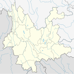
 Jinggu Location of the seat in Yunnan | |
| Coordinates: 23°29′49″N 100°42′11″E | |
| Country | People's Republic of China |
| Province | Yunnan |
| Prefecture | Pu'er |
| Area | |
| • Total | 7,550 km2 (2,920 sq mi) |
| Elevation | 946 m (3,104 ft) |
| Population | |
| • Total | 285,558 |
| • Density | 38/km2 (98/sq mi) |
| Time zone | UTC+8 (China Standard Time) |
| Postal code | 666400[1] |
| Area code | 0879[1] |
| GB/T 2260 CODE[2] | 530824 |
| Website | Archived 2008-12-25 at the Wayback Machine |
| 1Yunnan Statistics Bureau 2Puer Gov. 3Yunnan Portal | |
Administrative divisions
In the present, Jinggu Dai and Yi Autonomous County has 6 towns and 4 townships.
- 6 towns
|
|
- 4 townships
|
|
Ethnic groups
The Jinggu County Gazetteer (1993:682) lists the following ethnic groups and their locations.
- Hani (pop. 2,440)
- Hui (pop. 1,711)
- Weiyuan 威远, Yongping 永平, Bi'an 碧安 townships
- Bulang (pop. 1,532)
- Bai (pop. 1,153)
- Bi'an 碧安, Zhengxing 正兴, Bianjiang 边江 townships
Yi subgroups in Jinggu are:[7]
- Lalu 腊鲁 (Xiangtang 香堂)
- Lami 腊米 (Mili 米俐)
- Gaisu 改苏 (Luoluo 倮倮)
- Laluo 腊罗 (Menghua 蒙化)
- Sani 撒尼
- Awu 阿武
2014 earthquake
On October 7, 2014 a magnitude 6.6 earthquake struck the Jinggu county at 9:49 p.m. local time. The earthquake was felt in many parts of Yunnan including the provincial capital, Kunming, nearly 300 miles away.[8]
Climate
| Climate data for Jinggu (1981−2010) | |||||||||||||
|---|---|---|---|---|---|---|---|---|---|---|---|---|---|
| Month | Jan | Feb | Mar | Apr | May | Jun | Jul | Aug | Sep | Oct | Nov | Dec | Year |
| Record high °C (°F) | 30.4 (86.7) |
32.9 (91.2) |
35.3 (95.5) |
37.1 (98.8) |
39.5 (103.1) |
38.2 (100.8) |
35.3 (95.5) |
35.5 (95.9) |
34.7 (94.5) |
33.3 (91.9) |
31.1 (88.0) |
28.6 (83.5) |
39.5 (103.1) |
| Average high °C (°F) | 24.0 (75.2) |
26.5 (79.7) |
29.7 (85.5) |
31.6 (88.9) |
31.7 (89.1) |
30.9 (87.6) |
29.9 (85.8) |
30.3 (86.5) |
29.7 (85.5) |
28.0 (82.4) |
25.2 (77.4) |
22.8 (73.0) |
28.4 (83.1) |
| Daily mean °C (°F) | 13.5 (56.3) |
15.8 (60.4) |
19.8 (67.6) |
22.2 (72.0) |
24.3 (75.7) |
25.2 (77.4) |
24.6 (76.3) |
24.6 (76.3) |
23.6 (74.5) |
21.6 (70.9) |
17.5 (63.5) |
14.0 (57.2) |
20.6 (69.0) |
| Average low °C (°F) | 7.7 (45.9) |
8.4 (47.1) |
11.5 (52.7) |
15.3 (59.5) |
19.0 (66.2) |
21.6 (70.9) |
21.7 (71.1) |
21.5 (70.7) |
20.4 (68.7) |
18.4 (65.1) |
13.9 (57.0) |
10.1 (50.2) |
15.8 (60.4) |
| Record low °C (°F) | 2.5 (36.5) |
2.3 (36.1) |
2.6 (36.7) |
9.6 (49.3) |
12.4 (54.3) |
15.7 (60.3) |
17.8 (64.0) |
16.8 (62.2) |
13.2 (55.8) |
8.7 (47.7) |
5.5 (41.9) |
0.9 (33.6) |
0.9 (33.6) |
| Average precipitation mm (inches) | 12.9 (0.51) |
16.4 (0.65) |
19.1 (0.75) |
41.0 (1.61) |
118.7 (4.67) |
180.6 (7.11) |
302.9 (11.93) |
254.3 (10.01) |
162.4 (6.39) |
128.6 (5.06) |
65.3 (2.57) |
18.0 (0.71) |
1,320.2 (51.97) |
| Average relative humidity (%) | 78 | 68 | 62 | 64 | 70 | 79 | 84 | 83 | 83 | 83 | 84 | 83 | 77 |
| Source: China Meteorological Data Service Center[9] | |||||||||||||
References
- "Area Code and Postal Code in Yunnan Province". Archived from the original on 2007-11-07. Retrieved 2009-01-29.
- "中华人民共和国国家统计局 >> 行政区划代码". Archived from the original on 2009-02-21. Retrieved 2009-01-29.
- "景谷傣族彝族自治县凤山乡文折村民委员会". Archived from the original on 2014-03-14. Retrieved 2014-03-14.
- http://www.ynszxc.gov.cn/villagePage/vIndex.aspx?departmentid=108651̩ [dead link]
- "景谷傣族彝族自治县勐班乡芒海村委会". Archived from the original on 2014-10-30. Retrieved 2014-10-11.
- "景谷傣族彝族自治县碧安乡光明村民委员会". Archived from the original on 2014-03-14. Retrieved 2014-03-14.
- 云南思茅市景谷彝族概况
- Bonnie Cao (7 Oct 2014). "China Expects Heavy Casualties as Earth Quake Hits Yunnan". Bloomberg. Retrieved 7 Oct 2014.
- 中国地面气候标准值月值(1981-2010) (in Simplified Chinese). China Meteorological Data Service Center. Retrieved 5 November 2022.
External links
На других языках
- [en] Jinggu Dai and Yi Autonomous County
[ru] Цзингу-Дай-Ийский автономный уезд
Цзингу-Дай-Ийский автономный уезд (кит. упр. 景谷傣族彝族自治县, пиньинь Jǐnggǔ Dǎizú Yízú zìzhìxiàn) — автономный уезд городского округа Пуэр провинции Юньнань (КНР).Текст в блоке "Читать" взят с сайта "Википедия" и доступен по лицензии Creative Commons Attribution-ShareAlike; в отдельных случаях могут действовать дополнительные условия.
Другой контент может иметь иную лицензию. Перед использованием материалов сайта WikiSort.org внимательно изучите правила лицензирования конкретных элементов наполнения сайта.
Другой контент может иметь иную лицензию. Перед использованием материалов сайта WikiSort.org внимательно изучите правила лицензирования конкретных элементов наполнения сайта.
2019-2025
WikiSort.org - проект по пересортировке и дополнению контента Википедии
WikiSort.org - проект по пересортировке и дополнению контента Википедии