world.wikisort.org - China
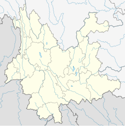
Shuangbai County (simplified Chinese: 双柏县; traditional Chinese: 雙柏縣; pinyin: Shuāngbǎi Xiàn; Chuxiong Yi script: ![]() , IPA: /de33 la33 bu33/) is under the administration of the Chuxiong Yi Autonomous Prefecture, in the central part of Yunnan province, China. It is the southernmost county-level division of Chuxiong Prefecture.
, IPA: /de33 la33 bu33/) is under the administration of the Chuxiong Yi Autonomous Prefecture, in the central part of Yunnan province, China. It is the southernmost county-level division of Chuxiong Prefecture.
Shuangbai County
双柏县 | |
|---|---|
County | |
 Shuangbai Location of the seat in Yunnan | |
| Coordinates: 24°40′48″N 101°38′24″E | |
| Country | People's Republic of China |
| Province | Yunnan |
| Autonomous prefecture | Chuxiong |
| Area | |
| • Total | 4,045 km2 (1,562 sq mi) |
| Population | |
| • Total | 160,000 |
| • Density | 40/km2 (100/sq mi) |
| Time zone | UTC+8 (CST) |
| Postal code | 675100 |
| Area code | 0878 |
| Website | www |
Administrative divisions
Shuangbai County has 5 towns and 3 townships.[1]
- 5 towns
|
|
- 3 townships
- Anlongbao (安龙堡乡)
- Ainishan (爱尼山乡)
- Dutian (独田乡)
Ethnic groups

The Shuangbai County Gazetteer (1996:89-90) lists the following ethnic subgroups. All population statistics, given in parentheses, are as of 1986.
- Yi
Climate
| Climate data for Shuangbai (1981−2010) | |||||||||||||
|---|---|---|---|---|---|---|---|---|---|---|---|---|---|
| Month | Jan | Feb | Mar | Apr | May | Jun | Jul | Aug | Sep | Oct | Nov | Dec | Year |
| Record high °C (°F) | 21.5 (70.7) |
24.5 (76.1) |
27.3 (81.1) |
28.8 (83.8) |
31.3 (88.3) |
31.0 (87.8) |
29.8 (85.6) |
28.5 (83.3) |
27.7 (81.9) |
27.0 (80.6) |
22.4 (72.3) |
21.8 (71.2) |
31.3 (88.3) |
| Average high °C (°F) | 14.8 (58.6) |
17.2 (63.0) |
20.5 (68.9) |
23.3 (73.9) |
24.0 (75.2) |
24.2 (75.6) |
23.5 (74.3) |
23.5 (74.3) |
22.0 (71.6) |
19.8 (67.6) |
16.8 (62.2) |
14.1 (57.4) |
20.3 (68.6) |
| Daily mean °C (°F) | 9.2 (48.6) |
11.5 (52.7) |
14.7 (58.5) |
17.5 (63.5) |
18.7 (65.7) |
19.6 (67.3) |
19.3 (66.7) |
19.0 (66.2) |
17.5 (63.5) |
15.3 (59.5) |
11.8 (53.2) |
8.8 (47.8) |
15.2 (59.4) |
| Average low °C (°F) | 5.2 (41.4) |
7.1 (44.8) |
10.2 (50.4) |
12.8 (55.0) |
14.6 (58.3) |
16.5 (61.7) |
16.6 (61.9) |
16.1 (61.0) |
14.7 (58.5) |
12.6 (54.7) |
8.5 (47.3) |
5.3 (41.5) |
11.7 (53.0) |
| Record low °C (°F) | −1.5 (29.3) |
−2.8 (27.0) |
−3.9 (25.0) |
3.7 (38.7) |
5.7 (42.3) |
10.6 (51.1) |
11.8 (53.2) |
10.7 (51.3) |
6.1 (43.0) |
3.7 (38.7) |
−1.7 (28.9) |
−4.4 (24.1) |
−4.4 (24.1) |
| Average precipitation mm (inches) | 16.5 (0.65) |
19.1 (0.75) |
20.9 (0.82) |
30.6 (1.20) |
88.9 (3.50) |
137.8 (5.43) |
185.6 (7.31) |
192.6 (7.58) |
129.7 (5.11) |
84.0 (3.31) |
40.8 (1.61) |
14.5 (0.57) |
961 (37.84) |
| Average relative humidity (%) | 66 | 55 | 50 | 52 | 66 | 78 | 84 | 84 | 85 | 85 | 81 | 77 | 72 |
| Source: China Meteorological Data Service Center[7] | |||||||||||||
References
- "国家统计局" (in Chinese). National Bureau of Statistics of the People's Republic of China. Retrieved 2021-12-07.
- "双柏县大麦地镇蚕豆田村委会蚕豆田". ynszxc.gov.cn. Retrieved 2015-12-24.
- "双柏县大麦地镇蚕豆田村委会". ynszxc.gov.cn. Retrieved 2015-12-24.
- "双柏县大麦地镇光明村委会光明". ynszxc.gov.cn. Retrieved 2015-12-24.
- "双柏县大麦地镇光明村委会". ynszxc.gov.cn. Retrieved 2015-12-24.
- "双柏县大麦地镇光明村委会芭蕉箐". ynszxc.gov.cn. Retrieved 2015-12-24.
- 中国地面气候标准值月值(1981-2010) (in Simplified Chinese). China Meteorological Data Service Center. Retrieved 5 November 2022.
External links
На других языках
[de] Shuangbai
Der Kreis Shuangbai (chinesisch .mw-parser-output .Hans{font-size:110%}双柏县, Pinyin Shuāngbǎi Xiàn) ist ein Kreis des Autonomen Bezirks Chuxiong der Yi in der chinesischen Provinz Yunnan. Er hat eine Fläche von 3.887 km² und zählt 133.884 Einwohner (Stand: Zensus 2020).[1] Sein Hauptort ist die Großgemeinde Tuodian (妥甸镇).- [en] Shuangbai County
[ru] Шуанбай
Шуанба́й (кит. упр. 双柏, пиньинь Shuāngbǎi) — уезд Чусюн-Ийского автономного округа провинции Юньнань (КНР).Текст в блоке "Читать" взят с сайта "Википедия" и доступен по лицензии Creative Commons Attribution-ShareAlike; в отдельных случаях могут действовать дополнительные условия.
Другой контент может иметь иную лицензию. Перед использованием материалов сайта WikiSort.org внимательно изучите правила лицензирования конкретных элементов наполнения сайта.
Другой контент может иметь иную лицензию. Перед использованием материалов сайта WikiSort.org внимательно изучите правила лицензирования конкретных элементов наполнения сайта.
2019-2025
WikiSort.org - проект по пересортировке и дополнению контента Википедии
WikiSort.org - проект по пересортировке и дополнению контента Википедии