world.wikisort.org - USA
Stafford County (standard abbreviation: SF) is a county located in the U.S. state of Kansas.[2] As of the 2020 census, the county population was 4,072.[1] Its county seat is St. John. The county is named in honor of Lewis Stafford, captain of Company E, First Kansas Infantry, who was killed at the Battle of Young's Point in Madison Parish, Louisiana on June 7, 1863.[3]
Stafford County | |
|---|---|
County | |
 Stafford County Museum in Stafford (2017) | |
 Location within the U.S. state of Kansas | |
 Kansas's location within the U.S. | |
| Coordinates: 38°04′00″N 98°43′00″W | |
| Country | |
| State | |
| Founded | 1879 |
| Named for | Lewis Stafford |
| Seat | St. John |
| Largest city | St. John |
| Area | |
| • Total | 795 sq mi (2,060 km2) |
| • Land | 792 sq mi (2,050 km2) |
| • Water | 2.9 sq mi (8 km2) 0.4% |
| Population (2020)[1] | |
| • Total | 4,072 |
| • Density | 5.1/sq mi (2.0/km2) |
| Time zone | UTC−6 (Central) |
| • Summer (DST) | UTC−5 (CDT) |
| Congressional district | 4th |
| Website | StaffordCounty.org |
History
Early history
For many millennia, the Great Plains of North America was inhabited by nomadic Native Americans. From the 16th century to 18th century, the Kingdom of France claimed ownership of large parts of North America. In 1762, after the French and Indian War, France secretly ceded New France to Spain, per the Treaty of Fontainebleau.
19th century
In 1802, Spain returned most of the land to France, but kept title to about 7,500 square miles. In 1803, most of the land in modern-day Kansas was acquired by the United States from France as part of the 828,000 square mile Louisiana Purchase for 2.83 cents per acre.
In 1854, the Kansas Territory was organized, then in 1861 Kansas became the 34th U.S. state. In 1879, Stafford County was established.
The boundaries of Stafford County were defined by the Kansas Legislature of 1870 but for several years, the county remained unorganized. The Legislature of 1875, with the intention of obliterating the county from the map, gave the territory in Stafford County to other counties. They gave the portion in Range 15 West to Pawnee County; the portion included in Ranges 11, 12, 13 and 14 to Barton County; and the south half of the county, excepting the portion in Range 15, was added to Pratt County. But after each of the counties had taken its part, a strip six miles wide and twelve miles long (two townships) remained as Stafford County. This was the condition of the county until April 25, 1879, when, by a decision of the Supreme Court, the act of the Legislature dividing the county was declared unconstitutional and the county was restored to its original boundaries.[4]
Geography
According to the U.S. Census Bureau, the county has a total area of 795 square miles (2,060 km2), of which 792 square miles (2,050 km2) is land and 2.9 square miles (7.5 km2) (0.4%) is water.[5]
Adjacent counties
- Barton County (north)
- Rice County (northeast)
- Reno County (east)
- Pratt County (south)
- Edwards County (west)
- Pawnee County (west)
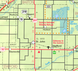
National protected area
- Quivira National Wildlife Refuge (part)
Demographics
| Historical population | |||
|---|---|---|---|
| Census | Pop. | %± | |
| 1880 | 4,755 | — | |
| 1890 | 7,520 | 58.1% | |
| 1900 | 9,829 | 30.7% | |
| 1910 | 12,510 | 27.3% | |
| 1920 | 11,559 | −7.6% | |
| 1930 | 10,460 | −9.5% | |
| 1940 | 10,487 | 0.3% | |
| 1950 | 8,816 | −15.9% | |
| 1960 | 7,451 | −15.5% | |
| 1970 | 5,943 | −20.2% | |
| 1980 | 5,694 | −4.2% | |
| 1990 | 5,365 | −5.8% | |
| 2000 | 4,789 | −10.7% | |
| 2010 | 4,437 | −7.4% | |
| 2020 | 4,072 | −8.2% | |
| U.S. Decennial Census[6] 1790-1960[7] 1900-1990[8] 1990-2000[9] 2010-2020[1] | |||

As of the census[10] of 2000, there were 4,789 people, 2,010 households, and 1,294 families residing in the county. The population density was 6 people per square mile (2/km2). There were 2,458 housing units at an average density of 3 per square mile (1/km2). The racial makeup of the county was 94.97% White, 0.15% Black or African American, 0.38% Native American, 0.13% Asian, 2.97% from other races, and 1.42% from two or more races. 5.41% of the population were Hispanic or Latino of any race.
There were 2,010 households, out of which 29.90% had children under the age of 18 living with them, 55.90% were married couples living together, 5.90% had a female householder with no husband present, and 35.60% were non-families. 33.00% of all households were made up of individuals, and 17.20% had someone living alone who was 65 years of age or older. The average household size was 2.34 and the average family size was 2.99.
In the county, the population was spread out, with 26.30% under the age of 18, 5.40% from 18 to 24, 24.60% from 25 to 44, 22.50% from 45 to 64, and 21.20% who were 65 years of age or older. The median age was 41 years. For every 100 females there were 95.20 males. For every 100 females age 18 and over, there were 91.40 males.
The median income for a household in the county was $31,107, and the median income for a family was $38,235. Males had a median income of $27,328 versus $21,063 for females. The per capita income for the county was $16,409. About 8.70% of families and 11.80% of the population were below the poverty line, including 15.20% of those under age 18 and 8.90% of those age 65 or over.
Government
Stafford County is often carried by Republican Candidates. The last time they have been carried by a democratic candidate was in 1976 by Jimmy Carter.
Presidential elections
| Year | Republican | Democratic | Third party | |||
|---|---|---|---|---|---|---|
| No. | % | No. | % | No. | % | |
| 2020 | 1,645 | 80.88% | 357 | 17.55% | 32 | 1.57% |
| 2016 | 1,490 | 78.59% | 304 | 16.03% | 102 | 5.38% |
| 2012 | 1,385 | 75.31% | 404 | 21.97% | 50 | 2.72% |
| 2008 | 1,495 | 72.08% | 542 | 26.13% | 37 | 1.78% |
| 2004 | 1,649 | 75.43% | 506 | 23.15% | 31 | 1.42% |
| 2000 | 1,546 | 70.27% | 567 | 25.77% | 87 | 3.95% |
| 1996 | 1,604 | 63.03% | 651 | 25.58% | 290 | 11.39% |
| 1992 | 1,064 | 38.55% | 777 | 28.15% | 919 | 33.30% |
| 1988 | 1,532 | 55.95% | 1,121 | 40.94% | 85 | 3.10% |
| 1984 | 2,062 | 69.71% | 844 | 28.53% | 52 | 1.76% |
| 1980 | 1,865 | 62.67% | 872 | 29.30% | 239 | 8.03% |
| 1976 | 1,430 | 45.22% | 1,659 | 52.47% | 73 | 2.31% |
| 1972 | 2,200 | 70.35% | 844 | 26.99% | 83 | 2.65% |
| 1968 | 1,851 | 55.75% | 1,205 | 36.30% | 264 | 7.95% |
| 1964 | 1,516 | 41.64% | 2,087 | 57.32% | 38 | 1.04% |
| 1960 | 2,531 | 65.54% | 1,305 | 33.79% | 26 | 0.67% |
| 1956 | 2,728 | 68.37% | 1,242 | 31.13% | 20 | 0.50% |
| 1952 | 3,162 | 71.28% | 1,174 | 26.47% | 100 | 2.25% |
| 1948 | 2,304 | 51.74% | 2,049 | 46.01% | 100 | 2.25% |
| 1944 | 2,493 | 56.25% | 1,908 | 43.05% | 31 | 0.70% |
| 1940 | 2,795 | 52.17% | 2,509 | 46.84% | 53 | 0.99% |
| 1936 | 1,939 | 37.50% | 3,212 | 62.12% | 20 | 0.39% |
| 1932 | 1,945 | 41.23% | 2,651 | 56.19% | 122 | 2.59% |
| 1928 | 3,278 | 75.27% | 1,025 | 23.54% | 52 | 1.19% |
| 1924 | 3,100 | 68.58% | 957 | 21.17% | 463 | 10.24% |
| 1920 | 2,779 | 70.04% | 1,057 | 26.64% | 132 | 3.33% |
| 1916 | 1,812 | 41.87% | 2,148 | 49.63% | 368 | 8.50% |
| 1912 | 422 | 16.14% | 1,094 | 41.85% | 1,098 | 42.00% |
| 1908 | 1,334 | 50.99% | 1,135 | 43.39% | 147 | 5.62% |
| 1904 | 1,419 | 63.12% | 585 | 26.02% | 244 | 10.85% |
| 1900 | 1,055 | 46.81% | 1,139 | 50.53% | 60 | 2.66% |
| 1896 | 710 | 35.34% | 1,276 | 63.51% | 23 | 1.14% |
| 1892 | 840 | 39.25% | 0 | 0.00% | 1,300 | 60.75% |
| 1888 | 975 | 47.51% | 483 | 23.54% | 594 | 28.95% |
Laws
Although the Kansas Constitution was amended in 1986 to allow the sale of alcoholic liquor by the individual drink with the approval of voters, Stafford County remained a prohibition, or "dry", county[12] until an election in 2016 when this prohibition was removed by 1,304 to 535, 71% of the vote.[13]
Education
Unified school districts
Communities
Cities
Unincorporated communities
- Dillwyn
- Neola
- Zenith
Townships
Stafford County is divided into twenty-one townships. None of the cities within the county are considered governmentally independent, and all figures for the townships include those of the cities. In the following table, the population center is the largest city (or cities) included in that township's population total, if it is of a significant size.
| Township | FIPS | Population center |
Population | Population density /km2 (/sq mi) |
Land area km2 (sq mi) | Water area km2 (sq mi) | Water % | Geographic coordinates |
|---|---|---|---|---|---|---|---|---|
| Albano | 00800 | 56 | 1 (2) | 94 (36) | 0 (0) | 0% | 37°52′43″N 98°51′43″W | |
| Byron | 09825 | 80 | 1 (2) | 94 (36) | 0 (0) | 0.07% | 38°12′50″N 98°38′7″W | |
| Clear Creek | 13825 | 36 | 0 (1) | 93 (36) | 0 (0) | 0% | 37°50′57″N 98°57′31″W | |
| Cleveland | 14125 | 68 | 1 (2) | 93 (36) | 0 (0) | 0.04% | 38°2′11″N 98°52′2″W | |
| Douglas | 18375 | 138 | 1 (4) | 93 (36) | 0 (0) | 0% | 38°8′16″N 98°52′2″W | |
| East Cooper | 19350 | 90 | 1 (3) | 92 (36) | 1 (0) | 0.75% | 38°2′43″N 98°31′6″W | |
| Fairview | 22675 | 98 | 1 (3) | 93 (36) | 0 (0) | 0% | 37°56′52″N 98°31′4″W | |
| Farmington | 23250 | 591 | 6 (16) | 93 (36) | 0 (0) | 0% | 37°57′30″N 98°58′2″W | |
| Hayes | 31025 | 212 | 2 (6) | 93 (36) | 0 (0) | 0% | 38°7′20″N 98°38′49″W | |
| Lincoln | 41225 | 113 | 1 (3) | 93 (36) | 0 (0) | 0.02% | 38°12′38″N 98°52′2″W | |
| North Seward | 51375 | 186 | 2 (5) | 93 (36) | 0 (0) | 0.03% | 38°12′36″N 98°45′27″W | |
| Ohio | 52475 | 409 | 4 (11) | 95 (36) | 0 (0) | 0% | 37°58′40″N 98°45′7″W | |
| Putnam | 58050 | 19 | 0 (0) | 182 (70) | 5 (2) | 2.91% | 38°10′26″N 98°31′51″W | |
| Richland | 59650 | 70 | 1 (2) | 94 (36) | 0 (0) | 0% | 37°57′49″N 98°51′12″W | |
| Rose Valley | 61300 | 74 | 1 (2) | 94 (36) | 0 (0) | 0% | 37°51′41″N 98°44′19″W | |
| St. John | 62300 | 1,037 | 11 (29) | 94 (36) | 0 (0) | 0.07% | 38°0′58″N 98°45′21″W | |
| South Seward | 66975 | 55 | 1 (2) | 93 (36) | 0 (0) | 0.09% | 38°8′11″N 98°44′36″W | |
| Stafford | 67800 | 1,291 | 14 (36) | 93 (36) | 0 (0) | 0% | 37°57′40″N 98°36′50″W | |
| Union | 72450 | 41 | 0 (1) | 93 (36) | 0 (0) | 0.09% | 37°52′31″N 98°37′40″W | |
| West Cooper | 76875 | 64 | 1 (2) | 93 (36) | 0 (0) | 0.14% | 38°2′37″N 98°38′9″W | |
| York | 80800 | 61 | 1 (2) | 93 (36) | 0 (0) | 0.27% | 37°52′14″N 98°31′9″W |
See also
- National Register of Historic Places listings in Stafford County, Kansas
|
|
References
- "QuickFacts; Stafford County, Kansas; Population, Census, 2020 & 2010". United States Census Bureau. Archived from the original on August 20, 2021. Retrieved August 20, 2021.
- "Find a County". National Association of Counties. Retrieved June 7, 2011.
- A History of Stafford County, Frank A. Steele, 1982
- Stafford County, Kansas 1870-1990, Stafford County Historical & Genealogical Society, 1990, p.5
- "US Gazetteer files: 2010, 2000, and 1990". United States Census Bureau. February 12, 2011. Retrieved April 23, 2011.
- "U.S. Decennial Census". United States Census Bureau. Retrieved July 29, 2014.
- "Historical Census Browser". University of Virginia Library. Retrieved July 29, 2014.
- "Population of Counties by Decennial Census: 1900 to 1990". United States Census Bureau. Retrieved July 29, 2014.
- "Census 2000 PHC-T-4. Ranking Tables for Counties: 1990 and 2000" (PDF). United States Census Bureau. Retrieved July 29, 2014.
- "U.S. Census website". United States Census Bureau. Retrieved January 31, 2008.
- "Dave Leip's Atlas of U.S. Presidential Elections".
- "Map of Wet and Dry Counties". Alcoholic Beverage Control, Kansas Department of Revenue. November 2004. Archived from the original on October 8, 2007. Retrieved January 21, 2007.
- "Two Kansas counties approve liquor by the drink". Retrieved November 14, 2018.
- Notes
Further reading
- Standard Atlas of Stafford County, Kansas; Geo. A. Ogle & Co; 56 pages; 1904.
External links
| Wikimedia Commons has media related to Stafford County, Kansas. |
- County
- Maps
- Stafford County Maps: Current, Historic, KDOT
- Kansas Highway Maps: Current, Historic, KDOT
- Kansas Railroad Maps: Current, 1996, 1915, KDOT and Kansas Historical Society
Places adjacent to Stafford County, Kansas | ||||||||||||||||
|---|---|---|---|---|---|---|---|---|---|---|---|---|---|---|---|---|
| ||||||||||||||||
Municipalities and communities of Stafford County, Kansas, United States | ||
|---|---|---|
County seat: St. John | ||
| Cities |  | |
| Unincorporated communities |
| |
| ||

Authority control | |
|---|---|
| General | |
| National libraries | |
На других языках
[de] Stafford County (Kansas)
Stafford County[1] ist ein County im Bundesstaat Kansas der Vereinigten Staaten. Der Verwaltungssitz (County Seat) ist St. John. Das County gehört zu den Dry Countys, was bedeutet, dass der Verkauf von Alkohol eingeschränkt oder verboten ist.- [en] Stafford County, Kansas
[es] Condado de Stafford (Kansas)
El condado de Stafford (en inglés: Stafford County), fundado en 1879, es uno de 105 condados del estado estadounidense de Kansas. En el año 2005, el condado tenía una población de 4,488 habitantes y una densidad poblacional de 2.2 personas por km². La sede del condado es St. John.[1] El condado recibe su nombre en honor al abogado Lewis Stafford.[ru] Стаффорд (округ, Канзас)
Ста́ффорд[1] (англ. Stafford County) — округ в штате Канзас, США. Официально образован в 1879 году. По состоянию на 2010 год, численность населения составляла 4 437 человек.Другой контент может иметь иную лицензию. Перед использованием материалов сайта WikiSort.org внимательно изучите правила лицензирования конкретных элементов наполнения сайта.
WikiSort.org - проект по пересортировке и дополнению контента Википедии