world.wikisort.org - United_Kingdom
East Raynham is a village and former civil parish, now in the parish of Raynham, in the North Norfolk district, in the county of Norfolk, England. It is located on the A1065 some 4 miles (6.4 km) south-west of Fakenham. The River Wensum flows close to the village. The village can trace its origins back and before the Domesday survey of 1086 when it was known as Reinham.[1] Raynham, Massachusetts took the village's name at its incorporation in 1731 at the time of Charles Townshend, 2nd Viscount Townshend (1674–1738), Leader of the House of Lords. In 1931 the parish had a population of 130.[2] On 1 April 1935 the parish was abolished to form Raynham.[3]
This article uses bare URLs, which are uninformative and vulnerable to link rot. (August 2022) |
| East Raynham | |
|---|---|
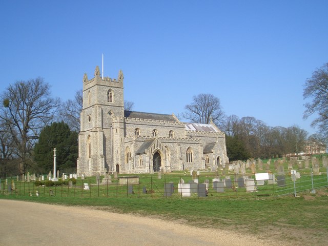 The Church of St Mary | |
 East Raynham Location within Norfolk | |
| OS grid reference | TF8725 |
| • London | 110 miles |
| Civil parish | |
| District |
|
| Shire county | |
| Region | |
| Country | England |
| Sovereign state | United Kingdom |
| Post town | Fakenham |
| Postcode district | NR21 |
| Dialling code | 01328 |
| Police | Norfolk |
| Fire | Norfolk |
| Ambulance | East of England |
| UK Parliament | |
The villages name means 'Regna's homestead/village' or 'Regna's hemmed-in land'.[4]
The Raynhams
Today, The Raynhams would cover the names of three villages East, West Raynham and South Raynham, a large area of farmland known as Raynham Park, which the Raynham villages and 17th century Raynham Hall border.
Raynham Hall
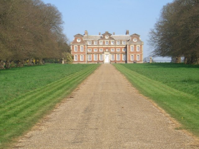
Raynham Hall is a rectangular mansion built of brick and stone dressings. Work commenced in 1619 and was completed in 1630. It is the seat of the Townshend family, and is owned today by the 8th Marquis Townshend.
The Church of St Mary
The church stands in the park of Raynham Hall. It was rebuilt in 1868 but retains the 15th century Easter Sepulchre. The 2nd Viscount, "Turnip" Townshend is buried here.[5] In 2002 the ring of eight bells was restored and augmented.[6] The Queen paid a private visit to the church in July 2002.[7]
Recreation
Much of the area can be visited by a circular walk, which takes in mixed woodland, water meadows, arable land and historic buildings, almost entirely on the Raynham estate.[8]
References
- The Raynhams Archived 2008-07-23 at the Wayback Machine Retrieved February 06 2008
- "Population statistics East Raynham AP/CP through time". A Vision of Britain through Time. Retrieved 2 October 2022.
- "Relationships and changes East Raynham AP/CP through time". A Vision of Britain through Time. Retrieved 2 October 2022.
- http://kepn.nottingham.ac.uk/map/place/Norfolk/Raynham%20East%20South%20and%20West
- Norfolk churches Retrieved February 08 2008
- St Mary's church bells Retrieved February 06 2008
- Her Majesty's visit Retrieved February 08 2008
- Circular walk Retrieved February 08 2008
External links
Другой контент может иметь иную лицензию. Перед использованием материалов сайта WikiSort.org внимательно изучите правила лицензирования конкретных элементов наполнения сайта.
WikiSort.org - проект по пересортировке и дополнению контента Википедии