world.wikisort.org - United_Kingdom
Little Snoring is a village and a civil parish in Norfolk, England.[1]
| Little Snoring | |
|---|---|
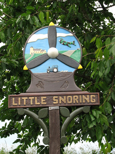 The village sign at Little Snoring | |
 Little Snoring St Andrew's church | |
 Little Snoring Location within Norfolk | |
| Area | 7.31 km2 (2.82 sq mi) |
| Population | 619 (parish, 2011 Census) |
| • Density | 85/km2 (220/sq mi) |
| OS grid reference | TG0134 |
| • London | 105 mi (169 km) SSW |
| Civil parish |
|
| District |
|
| Shire county |
|
| Region | |
| Country | England |
| Sovereign state | United Kingdom |
| Post town | FAKENHAM |
| Postcode district | NR21 |
| Dialling code | 01328 |
| Police | Norfolk |
| Fire | Norfolk |
| Ambulance | East of England |
| UK Parliament |
|
The village is approximately 2 miles (3 km) east-north-east from the town of Fakenham, 17 miles (27 km) west-south-west from Cromer, and to the side of the A148 road.[2]
At the 2011 Census, it had a population of 619.[3] For the purposes of local government, the parish falls within the district of North Norfolk.
History
Little Snoring has an entry in the Domesday Book of 1085[4] and is recorded by the names "Esnaringa", "Snaringa" and "Snarlinga", named after "Snare", the settlers' leader, and thus the name Little Snoring evolved over the centuries. It was the king's land with the main landholders being William de Warenne and Peter de Valognes and his main tenant is said to be Ralph.
Historically the name Snoring Parva was used, "parva" being Latin for "smaller" — nearby is Great Snoring.
Within the parish of Little Snoring, at a place called Queensgate, was a house of the Order of St Lazarus. It is mentioned in the will of Alexander, Rector of Snoring Parva, in 1380. Nothing further about the house is known.[5]
Landmarks
The church of Little Snoring St Andrew is one of 124 existing round-tower churches in Norfolk.[6] The church and its separate tower are Grade I listed buildings.[7][8]
The village has an airfield, formerly RAF Little Snoring, part of which is still active as a private airfield, whilst the other part now belongs to a potato-producing company.
Amenities
Village amenities include a school, post office and the Green Man public house.
The nearest railway station is at Sheringham for the Bittern Line which runs between Sheringham, Cromer and Norwich. The nearest airport is Norwich International Airport.
References
- OS Explorer Map 24 – Norfolk Coast Central. ISBN 0-319-21726-4.
- County A to Z Atlas, Street & Road maps Norfolk, p.227, ISBN 978-1-84348-614-5
- "Civil Parish population 2011". Retrieved 4 September 2015.
- The Domesday Book, England's Heritage, Then and Now, Editor: Thomas Hinde, Norfolk, p.191, Little Snoring, ISBN 1-85833-440-3
- "Snoring Parva Lazarus House, near Fakenham" Archived 25 January 2008 at the Wayback Machine, Prestel.co.uk
- "Little Snoring St Andrew's Round Tower Church • Norfolk".
- Historic England. "Details from listed building database (1373753)". National Heritage List for England. Retrieved 1 September 2014.
- Historic England. "Details from listed building database (1049264)". National Heritage List for England. Retrieved 1 September 2014.
External links
![]() Media related to Little Snoring at Wikimedia Commons
Media related to Little Snoring at Wikimedia Commons
- Little Snoring on the European Round Tower Churches website
- "The Snoring Villages", The-snorings.co.uk
- "Little Snoring Parish Council", Norfolk Rural Community Council
- "Little Snoring Primary School", Norfolk County Council
Другой контент может иметь иную лицензию. Перед использованием материалов сайта WikiSort.org внимательно изучите правила лицензирования конкретных элементов наполнения сайта.
WikiSort.org - проект по пересортировке и дополнению контента Википедии