world.wikisort.org - United_Kingdom
Brumstead (or Brunstead) is a village and a civil parish in the English county of Norfolk.[1] The village is 15.3 miles (24.6 km) north-east of Norwich, 17.6 miles (28.3 km) south-south-east of Cromer and 134 miles (216 km) north-east of London. The village lies 1.2 miles (1.9 km) north of the town of Stalham. The nearest railway station is at North Walsham for the Bittern Line which runs between Cromer and Norwich. The nearest airport is Norwich. The parish had in 2001 census, a population of 84. At the 2011 census the population remained less than 100 and was included in the civil parish of East Ruston. For the purposes of local government, the parish falls within the district of North Norfolk. The village is situated on the route of the B1159 that runs between the town of Cromer and the town of Stalham.[2]
| Brumstead | |
|---|---|
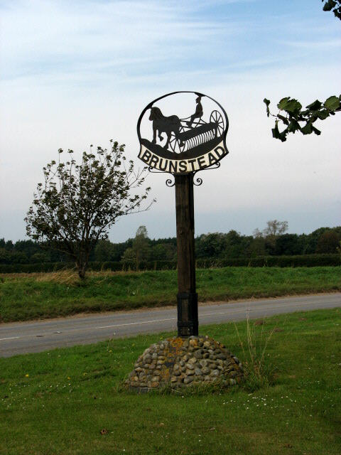 Brumstead village sign | |
 Brumstead Location within Norfolk | |
| Area | 3.22 km2 (1.24 sq mi) |
| Population | 84 (parish, 2001 census) |
| • Density | 26/km2 (67/sq mi) |
| OS grid reference | TG374273 |
| • London | 134 miles (216 km) |
| Civil parish |
|
| District |
|
| Shire county |
|
| Region |
|
| Country | England |
| Sovereign state | United Kingdom |
| Post town | NORWICH |
| Postcode district | NR12 |
| Dialling code | 01692 |
| Police | Norfolk |
| Fire | Norfolk |
| Ambulance | East of England |
Situation
The parish of Brumstead covers an area of approximately 790 acres (3.2 km2). The land is flat and at its highest is only 33 feet (10 metres) above sea level. The land is arable and very open with very few hedges. The parish is bound to the east by the Parish of Ingham and on the north-west by the Parish of East Ruston. The northern boundary is with Happisburgh Common and Witton. In the middle of the parish on the higher ground stand the surviving manorial hall and church.
History
Brumstead has an entry in the Domesday Book of 1085.[3] In the great book Brumstead is recorded by the names Brumestade, and Brunestade. The main landholder was Roger Bigot. The main tenant is said to be Robert from Roger Bigot. The survey also mentions that there were 30 goats, a church and a mill. There was a pannage or woodland for 16 pigs. In the survey the size of the local woodland was given as to the number of swine the woodland could support.[4] The name Brumstead is believed to derive from the "place of broom".
The village has also been known for hundreds of years as Brunstead,[5] as old maps demonstrate. Brunstead is also the name by which the village is known locally, and the name on the village sign.
References
- Ordnance Survey (2005). OS Explorer Map OL40 - The Broads. ISBN 0-319-23769-9.
- County A to Z Atlas, Street & Road maps Norfolk, page 229 ISBN 978-1-84348-614-5
- The Domesday Book, Englands Heritage, Then and Now, Editor: Thomas Hinde,Norfolk page 187, Brumstead, ISBN 1-85833-440-3
- The Normans in Norfolk, By Sue Margeson, Fabienne Seillier and Andrew Rogerson, Pub:1994, Page 100, ISBN 0-903101-62-9
- A Popular Guide to Norfolk Place-names: by James Rye: Published by Larks press, Brumstead/Brunstead, Norfolk, 2000 ; ISBN 0-948400-15-3
External links
Другой контент может иметь иную лицензию. Перед использованием материалов сайта WikiSort.org внимательно изучите правила лицензирования конкретных элементов наполнения сайта.
WikiSort.org - проект по пересортировке и дополнению контента Википедии