world.wikisort.org - United_Kingdom
Honing is a village and a civil parish in the English county of Norfolk.[1] The village is 15.3 miles (24.6 km) north-northeast of Norwich, 13.3 miles (21.4 km) south east of Cromer and 135 miles (217 km) north-east of London. The village lies 3.9 miles (6.3 km) east of the town of North Walsham. The nearest railway station is at Worstead on the Bittern Line which runs between Cromer and Norwich. The nearest airport is Norwich International Airport. The village and parish of Honing with Crostwight had in the 2001 census, a population of 319,[2] but this fell to 312 at the 2011 Census.[3] For the purposes of local government, the village falls within the district of North Norfolk.
| Honing | |
|---|---|
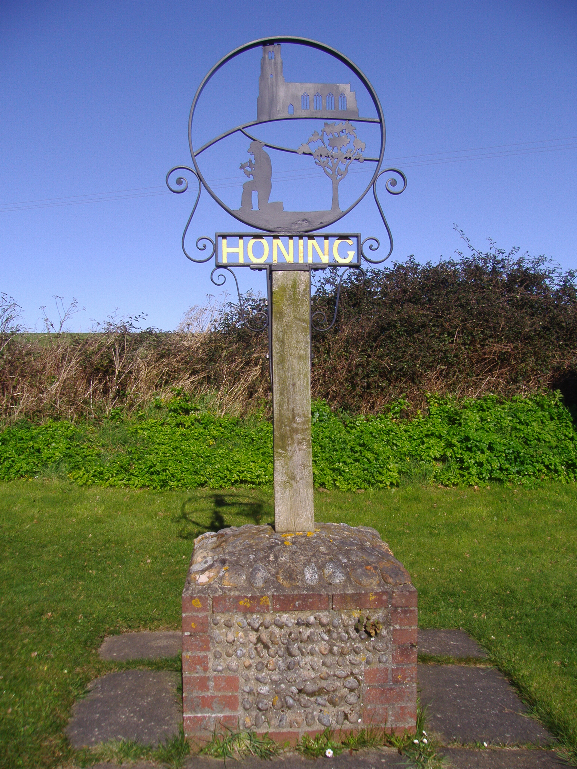 The Village sign, Honing, Norfolk | |
 Honing Location within Norfolk | |
| Area | 8.80 km2 (3.40 sq mi) |
| Population | 312 (2011) |
| • Density | 35/km2 (91/sq mi) |
| • London | 135 miles (217 km) |
| Civil parish |
|
| District |
|
| Shire county |
|
| Region |
|
| Country | England |
| Sovereign state | United Kingdom |
| Post town | NORTH WALSHAM |
| Postcode district | NR28 |
| Dialling code | 01692 |
| Police | Norfolk |
| Fire | Norfolk |
| Ambulance | East of England |
Description
Honing is a large parish in north-east of the county of Norfolk. Its northern boundary is with the civil parish of Witton whilst to the south is the parish of Dilham. West lies Worstead and on the eastern boundary is the parish of East Ruston. The disused North Walsham & Dilham Canal runs along the south-west boundary of the parish. There are several areas of common land within the parish, including Crostwight Common and Honing Common. The Weavers' Way long distance footpath runs across the south east corner of the parish along the old track bed of the Midland and Great Northern Joint Railway that ran between North Walsham and Stalham. The Weavers Way runs for 56 miles (90 km) between Cromer and Great Yarmouth. The village sign depicts a labourer honing his scythe. Since 1935, the civil parish of Honing has incorporated its very small neighbouring village of Crostwight. The name Honing derives from the Old English for something approaching settlement of the people at the hill or rock.[4]
History
There is very little evidence of any human settlement or activity in the parish of Honing until the medieval period and beyond, apart from a Mesolithic or possibly Neolithic flint axehead.
The Domesday Book
Honing has an entry in the Domesday Book of 1085 where it, its population, land ownership and productive resources were extensively detailed[5] In the survey Honing is recorded by the name of Haninga. The main tenants being the Robert Malet from the abbot of Holme who had held the land before and after 1066, Robert de Glanville from Robert Malet, and Ranulf brother of Ilger. The survey also list that there have always been 13 smallholders on this land. 2 ploughs in lordship; 3 men's ploughs; meadow, 35 acres (140,000 m2); woodland, 8 pigs; 1 mill: 2 cobs; 4 head of cattle; 12 pigs; 40 sheep; 30 goats. Also 8 freemen, 41 acres (170,000 m2). Always 2 ploughs; meadow, 5 acres (2.0 ha). Value of the whole 40s. It has 1 league in length and 10 furlongs in width; tax of 10d, whoever holds there.[6]
Notable buildings and structures
The parish church of Saint Peter and Saint Paul
The parish church is situated on raised ground north of the village. On its west elevation is a tall perpendicular tower with flushwork panelling at its base and battlements.[7] The tower has a three light window with transom and tracery. Below the window is another window which was once the west door and thought to have been filled in a period of reconstruction c.1795.[7] In the same period of restoration the aisles were reduced to narrow passages and the length of the chancel was shortened to only four feet.[8] The font dates from the 13th century.[9] The stem is perpendicular with the bowl of Purbeck marble. The roof dates from the 18th century.[8] Between the choir stalls is a brass to Nicholas Parker of 1496. He is depicted in full armour. On the north wall hang two hatchments, both to a man leaving a surviving wife. There are also two tablets, one to Thomas Cubitt who died in 1829,[7] and the other to Edward George Cubitt who died in 1865.[7]
Honing Hall
Honing Hall is a Grade II listed[10] country house which was built in 1748[11] and altered and renovated in 1790 by the prominent architect John Soane.[12] Landscaping and further work on the hall was carried out under the instructions of Humphry Repton[13] in 1792. The house was built originally for a wealthy Worstead weaver called Andrew Chambers[12] on the land once occupied by previous dwellings. The hall and grounds are in private ownership and are currently owned by Cubitt Family whose descendants have lived at the hall since 1784.[12]
Midland and Great Northern Joint Railway
The Midland and Great Northern Joint Railway ran through the parish, part of a line that linked Great Yarmouth to Sutton Bridge via Stalham, North Walsham, Aylsham, Melton Constable, Fakenham and King's Lynn.[14] It opened in stages between 1865 and 1933. The line closed in 1959, although some sections survive and are now part of the Weaver's Way footpath. Other remnants of the line that can still be seen in the parish are a cast iron, steel and brick railway bridge of 1881 on the Dilham road south of the village. At Briggate there are still the disused platforms of Honing Station.[15]
Gallery
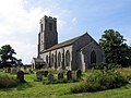 The parish church of Saint Peter & Saint Paul, Honing, Norfolk
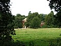 Honing Hall
 The disused North Walsham & Dilham Canal at Dee Bridge south of the village
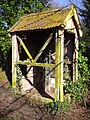 Water pump on the station platform
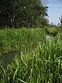 The North Walsham and Dilham Canal near Honing


| Wikimedia Commons has media related to Honing, Norfolk. |
References
- Ordnance Survey (2005). OS Explorer Map OL40 – The Broads. ISBN 0-319-23769-9.
- Office for National Statistics & Norfolk County Council, 2001. Census population and household counts for unparished urban areas and all parishes. Retrieved 2 December 2005.
- "Civil Parish population 2011". Retrieved 1 September 2015.
- A Popular Guide to Norfolk Place-names: by James Rye: Published by Larks press, Dereham, Norfolk, 2000 ; ISBN 0-948400-15-3
- The Domesday Book, England's Heritage, Then and Now, (Editor: Thomas Hinde), Norfolk, page 190, Honing, ISBN 1-85833-440-3
- Domesday Book, Norfolk, Part I and Part II,33, Morris, J. (General Editor), 1984. Published: Phillimore & Co. ISBN 0-85033-479-9
- Norfolk 1: Norwich and North-East, By Nikolaus Pevsner and Bill Wilson, Honing entry, page 169/170. ISBN 0-300-09607-0
- The Popular Guide to Norfolk Churches,1:North-East Norfolk, By D.P. Mortlock & C.V. Roberts, 1981, Pub: Acorn Editions, Page 50, Honing, ISBN 0-906554-04-7
- The King's England series, NORFOLK, by Arthur Mee,Pub:Hodder and Stoughton,1972, page 130 Honing, ISBN 0-340-15061-0
- "Honing Hall– Honing – Norfolk – England". Grade II listing details for Honing Hall. British Listed Buildings. Retrieved 18 August 2014.
- Pevsner, Nikolaus (1976). Norfolk: Norwich and North-east v. 1 (Pevsner Architectural Guides: Buildings of England). Details and description of Honing hall. Penguin Books Ltd. p. 170. ISBN 9780300096071. ISBN No. for a later edition.
- Clarke, David (2006). The Country Houses of Norfolk – The Major Houses. Details and description of Honing Hall. Geo. R. Reeve Ltd, Wymondham, Norfolk. p. 33. ISBN 9780900616761.
- Humphry Repton landscape gardener 1752–1818, Publisher:Sainsbury Centre for Visual Arts, 1982, ISBN 0-946009-03-1
- British Railways Atlas.1947. p.18
- Butt, R.V.J. (1995). The Directory of Railway Stations, Patrick Stephens Ltd, Sparkford, ISBN 1-85260-508-1.
Другой контент может иметь иную лицензию. Перед использованием материалов сайта WikiSort.org внимательно изучите правила лицензирования конкретных элементов наполнения сайта.
WikiSort.org - проект по пересортировке и дополнению контента Википедии