world.wikisort.org - United_Kingdom
Baconsthorpe is a village and civil parish in the North Norfolk district of the English county of Norfolk. It is 4 miles (6 km) south-east of Holt, 5 miles (8 km) south of Sheringham and 20 miles (32 km) north of Norwich.[1]
| Baconsthorpe | |
|---|---|
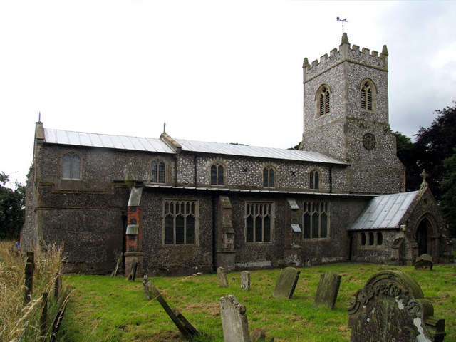 Saint Mary parish church, Baconsthorpe, Norfolk | |
 Baconsthorpe Location within Norfolk | |
| Area | 5.53 km2 (2.14 sq mi) |
| Population | 215 (parish, 2011 census) |
| • Density | 39/km2 (100/sq mi) |
| OS grid reference | TG120370 |
| • London | 130 miles (210 km) |
| Civil parish |
|
| District | |
| Shire county | |
| Region | |
| Country | England |
| Sovereign state | United Kingdom |
| Post town | HOLT |
| Postcode district | NR25 |
| Dialling code | 01263 |
| Police | Norfolk |
| Fire | Norfolk |
| Ambulance | East of England |
Population and governance
The civil parish has an area of 5.53 km². In the 2001 census it had a population of 232 in 105 households. This eased to 215 at the Census 2011,[2] and was estimated at 216 in 2019.[3] For local government, the parish is in the district of North Norfolk.[4]
Heritage
The village's name derives from "Bacon's outlying farm/settlement", Bacon being the surname of the local landowner in Norman times.
The ruins of the 15th-century Baconsthorpe Castle lie about one mile (1.6 km) to the north of the village.
The medieval Anglican Church of St Mary was restored in 1868 and 1958. It contains monuments from the 15th–18th centuries and some 16th-century glass saved from the castle.[5]
Accommodation
There is a tourist campsite with full amenities at Pitt Farm near the west end of the village.[6] Some bed-and-breakfast accommodation and holiday lets are also available. Other facilities and services can be found in the nearby town of Holt.
Notable residents
In order of birth:
- John Baconthorpe [sic] or Bacon (c. 1290–1347), Carmelite monk and scholastic philosopher, born at Baconsthorpe
- John Heydon or Baxter (died 1479) rose from the yeomanry to become prominent as a lawyer.
- Sir Henry Heydon (died 1504), lawyer, courtier and landowner, died at Baconsthorpe.
- Sir Christopher Heydon (1561–1623), soldier, astrologer, and a county member of Parliament for Norfolk, ran his Norfolk estates from Baconsthorpe Castle.
- Robert Brightiffe (c. 1666–1749), a barrister and a member of Parliament for Norwich and recorder there, was born at his father's house in Baconsthorpe.[7]
War Memorial
Baconsthorpe's War Memorials take the form of two plaques in St. Mary's Church, they hold the following names for the First World War:
- Corporal Horace E. Dew (d.1916), 7th Battalion, Royal Norfolk Regiment
- Gunner George R. Cooper (1891-1917), 'A' Depot, Royal Garrison Artillery
- Rifleman Robert Jermy (d.1918), 9th (London) Battalion, Queen Victoria's Rifles
- Private E. F. Frank Thursby (1896-1917), 2nd Battalion, Border Regiment
- Private Henry J. Smith (d.1917), 2nd Battalion, Middlesex Regiment
- Private Frederick B. Dew (1893-1916), 2nd Battalion, Royal Norfolk Regiment
- Private Frederick Knowles (d.1916), 2nd Battalion, Royal Norfolk Regiment
- Private A. W. Richard Cletheroe (1896-1917), 5th Battalion, Royal Norfolk Regiment
- Private William T. Jarvis (1897-1917), 7th Battalion, Royal Norfolk Regiment
- William J. Barnes
And, the following for the Second World War:
- Corporal Leslie F. Smith (d.1944), 1st Battalion, Durham Light Infantry
- Ordinary-Seaman Geoffrey D. Grout (1919-1940), HMS Forfar (F30)
References
- Ordnance Survey (2002). "Norfolk Coast East". OS Explorer Map. 252. ISBN 0-319-21888-0.
- "Civil Parish population 2011". Neighbourhood.statistics.gov.uk. Retrieved 31 August 2015.
- City Population. Retrieved 25 January 2021.
- "Census population and household counts for unparished urban areas and all parishes". Office for National Statistics & Norfolk County Council. 2001. Archived from the original (XLS) on 11 February 2017. Retrieved 2 December 2005.
- Stuff, Good. "Church of St Mary, Baconsthorpe, Norfolk". Britishlistedbuildings.co.uk. Retrieved 12 October 2017.
- Retrieved 25 December 2017.
- John Venn, "Brightiffe, Robert", in Alumni Cantabrigienses (Part I, from earliest times to 1751, vol. i Abbas–Cutts; Cambridge University Press, 1922)
External links
 Media related to Baconsthorpe at Wikimedia Commons
- Information from Genuki Norfolk on Baconsthorpe
- Baconsthorpe in the Domesday Book
Authority control | |
|---|---|
| General |
|
| National libraries | |
Другой контент может иметь иную лицензию. Перед использованием материалов сайта WikiSort.org внимательно изучите правила лицензирования конкретных элементов наполнения сайта.
WikiSort.org - проект по пересортировке и дополнению контента Википедии