world.wikisort.org - United_Kingdom
South Norfolk is a local government district in Norfolk, England. Its council is based in Long Stratton. The population of the Local Authority District was 124,012 as taken at the 2011 Census.[1]
This article needs additional citations for verification. (June 2015) |
South Norfolk District | |
|---|---|
District | |
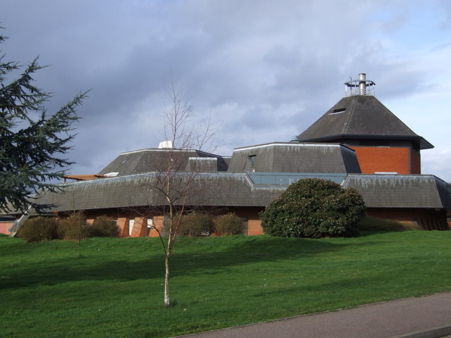 Council headquarters in Long Stratton, built 1979 | |
 Shown within Norfolk | |
| Sovereign state | United Kingdom |
| Constituent country | England |
| Region | East of England |
| Administrative county | Norfolk |
| Formed | 1 April 1974 Local Government Act 1972 |
| Admin. HQ | Long Stratton |
| Government | |
| • Type | South Norfolk District Council |
| • Leadership: | Leader & Cabinet |
| • Executive: | Conservative |
| • MPs: | Richard Bacon (C), George Freeman (C), Clive Lewis (L) |
| Area | |
| • Total | 350.5 sq mi (907.7 km2) |
| • Rank | 37th |
| Population (mid-2019 est.) | |
| • Total | 140,880 |
| • Rank | Ranked 156th |
| • Density | 400/sq mi (160/km2) |
| Time zone | UTC+0 (Greenwich Mean Time) |
| • Summer (DST) | UTC+1 (British Summer Time) |
| ONS code | 33UH (ONS) E07000149 (GSS) |
| Ethnicity | 98.9% White |
| Website | south-norfolk.gov.uk |
History
The district was formed on 1 April 1974 under the Local Government Act 1972, as a merger of Diss Urban District, Wymondham Urban District, Depwade Rural District, Forehoe and Henstead Rural District and Loddon Rural District.
History of governance
The below table outlines the composition of South Norfolk Council from 1973 to 2019.[2]
| Year | Conservative | Lib Dems | Labour | Other | Governance | ||||
|---|---|---|---|---|---|---|---|---|---|
| 1973 | 6 | 1 | 7 | 33 | Independent | ||||
| 1976 | 38 | 2 | 1 | 6 | Conservative | ||||
| 1979 | 38 | 1 | 2 | 6 | Conservative | ||||
| 1983 | 33 | 5 | 1 | 8 | Conservative | ||||
| 1987 | 26 | 16 | 0 | 5 | Conservative | ||||
| 1991 | 22 | 22 | 0 | 3 | No overall control | ||||
| 1995 | 12 | 30 | 3 | 2 | Liberal Democrats | ||||
| 1999 | 16 | 27 | 2 | 2 | Liberal Democrats | ||||
| 2003 | 18 | 28 | 0 | 0 | Liberal Democrats | ||||
| 2007 | 39 | 7 | 0 | 0 | Conservative | ||||
| 2011 | 38 | 8 | 0 | 0 | Conservative | ||||
| 2015 | 40 | 6 | 0 | 0 | Conservative | ||||
| 2019 | 35 | 10 | 1 | 0 | Conservative | ||||
Recent elections
2019 saw the Conservatives lose five seats but retain overall control of the council. The boundaries used were new at this election and saw the Labour Party unexpectedly win a seat on the council for the first time since 2003 gaining Loddon (notionally) from the Conservatives. Liberal Democrat group leader Trevor Lewis, standing in a much changed ward, was not re-elected.
| South Norfolk election results, May 2019 | |||||
|---|---|---|---|---|---|
| Party | Votes | Votes % | Seats | Seats % | |
| Conservative | 31,613 | 46.2 | 35 | 76.1 | |
| Liberal Democrats | 20,311 | 29.7 | 10 | 21.7 | |
| Labour | 13,134 | 19.2 | 1 | 2.2 | |
| Green | 584 | 0.9 | 0 | 0 | |
| Others [1] | 2,733 | 4.0 | 0 | 0 | |
| Totals | 68,375 | 46 | |||
[1] Others: Independents and UKIP.
Political composition
Elections are held every four years, with the last elections occurring in May 2019. The next elections are due to take place in May 2023. The composition of the council, after by-elections and defections, is as follows
| Party | Councillors | |||||||||||||
|---|---|---|---|---|---|---|---|---|---|---|---|---|---|---|
| Conservative | 32 | Liberal Democrats | 10 | Independent (UK) | 3 | Labour (UK) | 1 | Total | 46 | |||||
- UK Youth Parliament
Although the UK Youth Parliament is an apolitical organisation, the elections are run in a way similar to that of the Local Elections. The votes come from 11 to 18 year olds and are combined to make the decision of the next, 2 year Member of Youth Parliament. The elections are run at different times across the country with South Norfolk's typically being in early Spring and bi-annually.
The current Member of Youth Parliament for South Norfolk is Ewan Brett MYP.[3][4][5]
Electoral divisions
| Ward | Parishes | Councillor(s) Elected 2019 | |||
| Beck Vale, Dickleburgh and Scole | Pulham Market; Pulham St Mary; Starston; Dickleburgh & Rushall; Great Moulton; Tivetshall St Margaret; Tivetshall St Mary | Conservative | Clayton Hudson | ||
| Conservative | Conservative | Martin Wilby | |||
| Bressingham and Burston | Bressingham & Fersfield; Burston & Shimpling; Gissing; Heywood; Shelfanger; Winfarthing | Conservative | James Easter | ||
| Brooke | Bergh Apton; Brooke; Howe; Kirstead; Mundham; Seething | Conservative | John Fuller | ||
| Bunwell | Aslacton; Bunwell; Carleton Rode; Tibenham | Conservative | Stephen Ridley | ||
| Cringleford | Colney; Cringleford; Keswick & Intwood; | Conservative | William Kemp | ||
| Conservative | Daniel Elmer | ||||
| Diss and Roydon | Diss; Roydon | Conservative | Jenny Wilby | ||
| Conservative | Graham Minshull | ||||
| Conservative | Keith Kiddie | ||||
| Ditchingham and Earsham | Broome; Ditchingham; Hedenham; Thwaite; Alburgh; Denton; Earsham; Topcroft; Wortwell | Liberal Democrats | Brendon Bernard | ||
| Liberal Democrats | Chris Brown | ||||
| Easton | Barford; Easton; Great Melton; Marlingford & Colton; Wramplingham | Conservative | Margaret Dewsbury | ||
| Forncett | Ashwellthorpe; Fundenhall; The Forncetts; Tacolneston | Conservative | Barry Duffin | ||
| Harleston | Redenhall with Harleston | Conservative | Fleur Curson | ||
| Conservative | Jeremy Savage | ||||
| Hempnall | Bedingham; Hempnall; Morningthorpe; Shelton & Hardwick; Woodton | Conservative | Michael Edney | ||
| Hethersett | Bawburgh; Little Melton; Hethersett | Conservative | Adrian Dearnley | ||
| Conservative | David Bills | ||||
| Conservative | Conservative | Phil Hardy | |||
| Hingham and Deopham | Deopham; Hingham | Conservative | Yvonne Bendle | ||
| Loddon and Chedgrave | Chedgrave; Langley with Hardley; Hales; Heckingham; Raveningham; Stockton; Loddon; Sisland; Norton Subcourse | Conservative | Kay Mason Billig | ||
| Labour | Labour | Jeremy Rowe | |||
| Mulbarton and Stoke Holy Cross | Ashwellthorpe; Bracon Ash; East Carleton; Ketteringham; Mulbarton; Swardeston; Flordon; Wreningham; Stoke Holy Cross | Conservative | Nigel Legg | ||
| Conservative | Gerald Francis | ||||
| Liberal Democrats | Liberal Democrats | Vivienne Clifford-Jackson | |||
| New Costessey | Costessey | Liberal Democrats | John Amis | ||
| Liberal Democrats | Dan Burrill | ||||
| Newton Flotman | Flordon; Newton Flotman; Swainsthorpe; Wreningham | Conservative | Florence Ellis | ||
| Old Costessey | Costessey | Liberal Democrats | Liberal Democrats | Sharon Blundell | |
| Liberal Democrats | Libby Glover | ||||
| Liberal Democrats | Liberal Democrats | Terry Laidlaw | |||
| Poringland, the Framinghams and Trowse | Framingham Earl; Framingham Pigot; Poringland; Caistor St Edmund; Trowse with Newton; Bixley | Conservative | John Overton | ||
| Conservative | Lisa Neal | ||||
| Conservative | Conservative | Trevor Spruce | |||
| Rockland | Alpington; Hellington; Holverston; Kirby Bedon; Rockland St Mary; Surlingham; Yelverton | Conservative | Vic Thomson | ||
| Stratton | Long Stratton; Tharston; Hapton; Wacton | Conservative | Conservative | Alison Thomas | |
| Conservative | Joshua Worley | ||||
| Thurlton | Gillingham; Aldeby; Burgh St Peter; Haddiscoe; Thurlton; Toft Monks; Wheatacre | Conservative | James Knight | ||
| South Wymondham | Spooner Row; Wymondham Town (East Wymondham); Wymondham Town (South Wymondham) | Liberal Democrats | Liberal Democrats | Julian Halls | |
| Liberal Democrats | Liberal Democrats | Suzanne Nuri-Nixon | |||
| Central Wymondham | Wymondham Town (Central)| style="width: 2px; background-color: #0087DC;" data-sort-value="Conservative Party (UK)" | | Conservative | Conservative | Kevin Hurn | |
| Conservative | Conservative | Robert Savage | |||
| North Wymondham | Wymondham Town (North Wymondham)| style="width: 2px; background-color: #0087DC;" data-sort-value="Conservative Party (UK)" | | Conservative | Conservative | Jack Hornby | |
| Conservative | Conservative | Tony Holden | |||
| Wicklewood | Barnham Broom; Kimberley & Carleton Forehoe; Morley; Runhall; Wicklewood | Conservative | Richard Elliott | ||
Geographical composition
The district is entirely parished, and is made up of 119 civil parishes. At the time of the 2001 census, the district had an area of 909 km², with a population of 110,710 in 46,607 households.[6]
The district contains the following civil parishes:
- Alburgh, Aldeby, Alpington, Ashby St. Mary, Ashwellthorpe and Fundenhall, Aslacton
- Barford, Barnham Broom, Bawburgh, Bedingham, Bergh Apton, Bixley, Bracon Ash, Bramerton, Brandon Parva, Coston, Runhall and Welborne, Bressingham, Brockdish, Brooke, Broome, Bunwell, Burgh St. Peter, Burston and Shimpling
- Caistor St. Edmund, Carleton Rode, Carleton St. Peter, Chedgrave, Claxton, Colney, Costessey, Cringleford
- Denton, Deopham, Dickleburgh and Rushall, Diss, Ditchingham
- Earsham, East Carleton, Easton, Ellingham
- Flordon, Forncett (comprising Forncett St Mary and Forncett St Peter), Framingham Earl, Framingham Pigot
- Geldeston, Gillingham, Gissing, Great Melton, Great Moulton
- Haddiscoe, Hales, Heckingham, Hedenham, Hellington, Hempnall, Hethersett, Heywood, Hingham, Holverston, Howe
- Keswick and Intwood, Ketteringham, Kimberley, Kirby Bedon, Kirby Cane, Kirstead
- Langley with Hardley, Little Melton, Loddon, Long Stratton
- Marlingford and Colton,
- Morley, Morningthorpe and Fritton, Mulbarton, Mundham
- Needham, Newton Flotman, Norton Subcourse
- Poringland, Pulham Market, Pulham St. Mary
- Raveningham, Redenhall with Harleston, Rockland St. Mary, Roydon
- Saxlingham Nethergate, Scole, Seething, Shelfanger, Shelton and Hardwick, Shotesham, Sisland, Starston, Stockton, Stoke Holy Cross, Surlingham, Swainsthorpe, Swardeston
- Tacolneston, Tasburgh, Tharston and Hapton, Thurlton, Thurton, Thwaite, Tibenham, Tivetshall St Margaret, Tivetshall St. Mary, Toft Monks, Topcroft, Trowse with Newton,
- Wacton, Wheatacre, Wicklewood, Winfarthing, Woodton, Wortwell, Wramplingham, Wreningham, Wymondham
- Yelverton
Merger
In October 2020, Private Eye reported a total of £594,000 was paid to two managers leaving South Norfolk council as a result of the merger[when?] of the management teams at South Norfolk and Broadland councils, which included £540,000 to outgoing chief executive Sandra Dinneen.[7] (A further £357,000 in termination payments was to be shared between three managers leaving Broadland council due to the merger.) The councils stated these so-called "golden goodbyes" would save them money, as they would have fewer highly paid senior officials after they departed.[8]
Neighbouring districts
| |||||||||||||||||||
Arms
|
References
- "Local Authority District population 2011". Neighbourhood Statistics. Office for National Statistics. Retrieved 26 July 2016.
- "South Norfolk District Council Election Statistics". South Norfolk Council. Retrieved 11 June 2010.
- "Members of Youth Parliament - Norfolk County Council". norfolk.gov.uk.
- "Your Norfolk -". yournorfolk.norfolkpublications.org.uk.
- Cope, Lauren. "Norfolk's four new Members of Youth Parliament are announced". Eastern Daily Press.
- Office for National Statistics & Norfolk County Council (2001). Census population and household counts for unparished urban areas and all parishes Archived 11 February 2017 at the Wayback Machine. Retrieved 2 December 2005.
- "Eastern Daily Press".
- Private Eye, Issue 1532, p. 21
- "East of England Region". Civic Heraldry of England. Retrieved 9 March 2021.
External links
- Diss Express - district's local newspaper website
| Boroughs or districts |
|
|---|---|
| Major settlements |
|
| Topics |
|
Districts of the East of England | ||
|---|---|---|
| Bedfordshire |
|  |
| Cambridgeshire | ||
| Essex |
| |
| Hertfordshire | ||
| Norfolk |
| |
| Suffolk | ||
На других языках
[de] South Norfolk
South Norfolk ist ein District in der Grafschaft Norfolk in England. Verwaltungssitz ist Long Stratton; weitere bedeutende Orte sind Brooke, Costessey, Diss, Loddon, Mulbarton, Newton Flotman, Poringland, Pulham Market und Wymondham.- [en] South Norfolk
[ru] Саут-Норфолк
Саут-Норфолк (Южный Норфолк, англ. South Norfolk) — неметрополитенский район (англ. Non-metropolitan district) в графстве Норфолк (Англия). Административный центр — община Лонг-Страттон.Другой контент может иметь иную лицензию. Перед использованием материалов сайта WikiSort.org внимательно изучите правила лицензирования конкретных элементов наполнения сайта.
WikiSort.org - проект по пересортировке и дополнению контента Википедии