world.wikisort.org - Spain
Sant Joan Despí (Catalan pronunciation: [ˈsaɲ ʒuˈan dəsˈpi]; Old Catalan for '"Saint John of the Pine"') is a city and municipality located in the Baix Llobregat area (Barcelona province in Catalonia, Spain). It is situated on the left bank of the Llobregat river. Es is a dialectal form of the masculine article el, hence Despí would be rendered Del pi in standard Catalan.
Sant Joan Despí | |
|---|---|
Municipality | |
 Torre de la Creu, or "the Egg House" | |
 Flag  Coat of arms | |
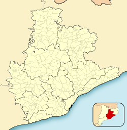 Sant Joan Despí Location in Catalonia  Sant Joan Despí Sant Joan Despí (Spain) | |
| Coordinates: 41°22′05″N 2°03′29″E | |
| Country | |
| Community | |
| Province | Barcelona |
| Comarca | Baix Llobregat |
| Government | |
| • Mayor | Antoni Poveda Zapata (2015)[1] (PSC-PSOE) |
| Area | |
| • Total | 6.2 km2 (2.4 sq mi) |
| Elevation | 10 m (30 ft) |
| Population (2018)[3] | |
| • Total | 34,084 |
| • Density | 5,500/km2 (14,000/sq mi) |
| Website | sjdespi |
Since 2006, the town has been the home of the FC Barcelona training ground and youth academy, the Ciutat Esportiva Joan Gamper; in 2019, the club's Johan Cruyff Stadium for its reserve team opened adjacent to the training facility.
Districts
Currently, Sant Joan Despí has 31,438 inhabitants divided into 5 very disaggregated districts. It also has an industrial quarter.
Barri Centre
Barri Centre (Catalan for center quarter) is the original urban core of the town, formerly called Nucli antic (old town). The district is bounded by the railway, B-23 motorway, Cornellà de Llobregat and by the new Eixample district towards the Llobregat River. It is full of Art Deco buildings, many of them designed by Josep Maria Jujol who was the official town council architect from 1926. It also contains the oldest buildings of the town including Esglèsia de Sant Joan Batista (Saint John the Baptist Church) and a small medieval chapel. In the 1960s, this quarter was still a small set of cottages, where wealthy people from Barcelona spent their holidays, and small houses, but since then, urban spread has changed a lot substituting most of the houses with tall buildings and changing the green spaces into concrete parks. Nowadays you can still find some of the old small houses, and most of the singular ones but they are surrounded by modern buildings.
Les Planes
Les Planes (Catalan for the plains) is a district which appeared during the 1960s and the 1970s to house the incoming immigration from other Spanish regions specially Extremadura and Andalusia. Les Planes is separated from the center quarter by the Polígon Fontsanta industrial quarter and from the TV3 quarter by the Parc Fontsanta park and indeed, it is urbanistically continuous just towards the Padrò quarter of Cornellà de Llobregat.
This quarter is characterized by relatively tall buildings and narrow streets. Democratic councils have alleviated that by turning many of those streets into pedestrian streets.
Pla del Vent/Torreblanca
This district is placed at the other side of the B-23 motorway and to east of the railway. It is closer to Sant Feliu de Llobregat and Sant Just Desvern. This district has two names because is the union of two older quarters. Pla del Vent (Catalan for Wind Plane) was a set of small houses along a road communicating Sant Joan towards Sant Just Desvern. Torreblanca (Catalan for White Tower) was a new urbanization built during the last half of the 1980s besides the monumental Torreblanca Park which gave the name to the quarter. Later urbanizations joined both squares into a single district.
Residential Sant Joan (TV3)
This district was urbanized at the mid 1980s after the building of the main studios of the Catalan autonomic television, TV3, which is the reason why the quarter is popularly known as the 'TV3' quarter. It is a wealthy quarter surrounded by the large green zone called Fontsanta park which connects it with the Polígon Fontsanta and Les Planes.
Eixample
Eixample (Catalan for extension) is a new quarter, being built since 1998, during the real estate bubble in Spain, as an extension toward the Llobregat river of the Barri Centre.
Polígon Fontsanta
Polígon Fontsanta is an industrial district which is in the geographic center of Sant Joan Despí. For many years, such polygon was the attracting factor for new population to the town, which explains why new quarters were built around it instead of around the old town. Important brands had their factories in the square including Gallina Blanca, San Miguel, Trinaranjus...
Transportation
The town is communicated with Barcelona downtown through several public transport:
Bus
- TMB: 63, 157, 78
- EMT-AMB: L10, L46, L52
- Nitbus: N12, N15 (night service)
Train
- Renfe: R1, R4
Tram
- Trambaix: T1, T2, T3
Demography
| 1900 | 1930 | 1950 | 1970 | 1986 | 2005 |
|---|---|---|---|---|---|
| 1171 | 2023 | 2274 | 16,055 | 23,867 | 31,438 |
References
- "Ajuntament de Sant Joan Despí". Generalitat of Catalonia. Retrieved 2015-11-13.
- "El municipi en xifres: Sant Joan Despí". Statistical Institute of Catalonia. Retrieved 2015-11-23.
- Municipal Register of Spain 2018. National Statistics Institute.
- Panareda Clopés, Josep Maria; Rios Calvet, Jaume; Rabella Vives, Josep Maria (1989). Guia de Catalunya, Barcelona: Caixa de Catalunya. ISBN 84-87135-01-3 (Spanish). ISBN 84-87135-02-1 (Catalan).
External links
- Government data pages (in Catalan)
Places adjacent to Sant Joan Despí | |
|---|---|
Municipalities of Baix Llobregat | ||
|---|---|---|
| ||

Authority control | |
|---|---|
| General |
|
| National libraries | |
На других языках
[de] Sant Joan Despí
Sant Joan Despí ist eine katalanische Stadt in der Provinz Barcelona im Nordosten Spaniens. Sie liegt in der Comarca Baix Llobregat und gehört zur Metropolregion Àrea Metropolitana de Barcelona.- [en] Sant Joan Despí
[es] Sant Joan Despí
Sant Joan Despí[1][2] o San Juan Despí[3][4][5] (en catalán y oficialmente, Sant Joan Despí pronunciado [ˈsaɲ ʒuˈan dəsˈpi], forma arcaica con artículo sigmático: Sant Joan del Pi) es un municipio español de la provincia de Barcelona, situado en la comarca del Bajo Llobregat, Cataluña. Su historia se remonta a la era romana en que recibía el nombre de Vicomiciano. Posteriormente el municipio tuvo varios nombres, destacando San Juan del Llobregat y San Juan Despí. Durante la Guerra Civil, el nombre de la población pasó a ser "Pi de Llobregat", eliminando las connotaciones religiosas. En 1939 se dejó sin efecto este cambio de nombre, y se mantuvo San Juan Despí como forma oficial hasta 1984, cuando se adoptó el nombre en catalán Sant Joan Despí.[6][ru] Сан-Жоан-Деспи
Сан-Жоа́н-Деспи́ (кат. Sant Joan Despí, исп. San Juan Despí, баск. Sant Joan Despi) — муниципалитет в Испании, входит в провинцию Барселона в составе автономного сообщества Каталония. Муниципалитет находится в составе района (комарки) Бахо-Льобрегат. Занимает площадь 5,58 км². Население — 32338 человек (на 2010 год). Расстояние до административного центра провинции — 8 км.Другой контент может иметь иную лицензию. Перед использованием материалов сайта WikiSort.org внимательно изучите правила лицензирования конкретных элементов наполнения сайта.
WikiSort.org - проект по пересортировке и дополнению контента Википедии