world.wikisort.org - Spain
Piera is a municipality that covers a large portion of the southeastern corner of the comarca of Anoia in Catalonia, Spain, on the left bank of the Anoia river. The agricultural land, mostly non-irrigated, is used for the cultivation of cereals, grapes, olives and almonds. The town itself hosts a number of light industries: textiles, plastics and construction materials. Tourism during the summer months is also relatively important for the local economy.
Piera | |
|---|---|
Municipality | |
 City hall | |
 Coat of arms | |
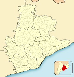 Piera Location in Catalonia  Piera Piera (Spain) | |
| Coordinates: 41°31′20″N 1°44′58″E | |
| Country | |
| Community | |
| Province | Barcelona |
| Comarca | Anoia |
| Government | |
| • Mayor | Jordi Madrid Roca (2015)[1] |
| Area | |
| • Total | 57.2 km2 (22.1 sq mi) |
| Elevation | 324 m (1,063 ft) |
| Population (2018)[3] | |
| • Total | 15,362 |
| • Density | 270/km2 (700/sq mi) |
| Demonym(s) | Pierenc, pierenca |
| Website | www |
The FGC railway line R6 from Martorell and Barcelona to Igualada runs through the town, while local roads lead to Capellades and Sant Sadurní d'Anoia.
Notable monuments include the castle of Fontanet. The castle which was restored in 1916 by Ramon de Viala d'Aiguavives, Baron of Almenar is documented in 955 a.c. and now used for private functions.
The sister of the Baron of Almenar, Isabel de Viala d'Aiguavives also financed and patroned the modernist church of Ca n'Aguilera which was donated to Barcelona's Bishop by Zaragoza de Viala family in 1921. The architect of Ca N'Aguilera modernist church is Francesc Berenguer i Mestres, who was Antoni Gaudi's disciple and personal friend.
Another Piera relevant monument is the church of Santa Maria, with both Gothic and Roman elements.
Subdivisions
The municipality of Piera includes several outlying villages (barris): these are usually distinguished into the older, traditional settlements (barris antics) and the newer urbanisations which have been developed to cope with the expansion of the municipality (barris nous). Populations are given for 1999, from the Ajuntament de Piera and cited in Història de Piera: the town of Piera (nucli urbà) had a population of 5036 at that date, whereas the total population of the municipality was 8551.
Traditional barris
- El Bedorc (237), on the Anoia river
- Ca n'Aguilera (161)
- Can Cairot (28)
- Can Creixell (2)
- La Fortesa (57), on the Anoia river at the southern point of the municipality
- Sant Jaume Sesoliveres (213)
Newer barris
- Bosc de l'Àliga (88)
- Can Bonastre (490)
- Can Bou (93)
- Can Canals (602)
- Can Claramunt (494)
- Can Martí (222)
- Can Mas (427)
- Can Mata (166)
- Castell de la Ventosa (51)
- La Grua (20)
- Vallbonica (26), on the road to Vallbona d'Anoia
- La Venta i Can Musarro (138)
Demography
| 1900 | 1930 | 1950 | 1970 | 1986 | 2007 |
|---|---|---|---|---|---|
| 2663 | 3474 | 3334 | 3813 | 5215 | 13,652 |
Twin towns
Piera is twinned with:
 Estepa, Spain
Independence declaration
On 30 October 2012, Piera proclaimed itself as a Free Catalan Territory.
References
- "Ajuntament de Piera". Generalitat of Catalonia. Retrieved 2015-11-13.
- "El municipi en xifres: Piera". Statistical Institute of Catalonia. Retrieved 2015-11-23.
- Municipal Register of Spain 2018. National Statistics Institute.
- Panareda Clopés, Josep Maria; Rios Calvet, Jaume; Rabella Vives, Josep Maria (1989). "Guia de Catalunya", Barcelona: Caixa de Catalunya. (in Spanish) ISBN 84-87135-01-3. (in Catalan) ISBN 84-87135-02-1.
External links
- Official website (in Catalan)
- Government data pages (in Catalan)
Places adjacent to Piera | ||||||||||||||||
|---|---|---|---|---|---|---|---|---|---|---|---|---|---|---|---|---|
| ||||||||||||||||
| Autoritat del Transport Metropolità Ferrocarrils de la Generalitat de Catalunya | ||||
|---|---|---|---|---|
| Line R6 | ||||
| Barcelona (Plaça d'Espanya) |
↔ | Piera | ↔ | Igualada |
Municipalities of Anoia | ||
|---|---|---|
| ||
Municipalities in the province of Barcelona | ||
|---|---|---|
| 1,500,000+ |
|  |
| 250,000+ |
| |
| 200,000+ |
| |
| 100,000+ |
| |
| 75,000+ |
| |
| 50,000+ |
| |
| 25,000+ |
| |
| under 25,000 |
| |
Authority control | |
|---|---|
| General |
|
| National libraries | |
На других языках
- [en] Piera
[es] Piera
Piera es un municipio de Cataluña, España. Perteneciente a la provincia de Barcelona, en la comarca de Anoia y es el término municipal más extenso de la comarca. Limita al norte con Castellolí y El Bruc, al sur con San Sadurní de Noya, al este con Masquefa, al oeste limita con Cabrera de Igualada, al noreste con Hostalets de Pierola, al noroeste con los términos de La Pobla de Claramunt y Vallbona, al sureste con San Lorenzo de Hortóns y finalmente al suroeste con Torrelavit.[ru] Пьера
Пьера (кат. Piera) — муниципалитет в Испании, входит в провинцию Барселона в составе автономного сообщества Каталония. Муниципалитет находится в составе района (комарки) Анойя. Занимает площадь 57,11 км². Население — 14576 человек (на 2010 год).Другой контент может иметь иную лицензию. Перед использованием материалов сайта WikiSort.org внимательно изучите правила лицензирования конкретных элементов наполнения сайта.
WikiSort.org - проект по пересортировке и дополнению контента Википедии