world.wikisort.org - Spain
Castellar del Riu is a municipality in the comarca of Berguedà, Catalonia, northern Spain. The municipal government is located at Llinars, which is not a village but just a few municipal buildings including a small sports centre.[citation needed]
Castellar del Riu | |
|---|---|
Municipality | |
 Pi de les tres branques, considered a symbol of the united Catalan Countries | |
 Coat of arms | |
 Location in Berguedà | |
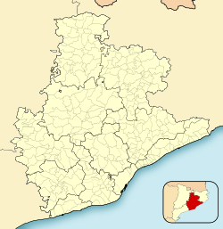 Castellar del Riu Location in Catalonia  Castellar del Riu Castellar del Riu (Spain) | |
| Coordinates: 42°07′59″N 1°42′36″E | |
| Country | |
| Community | |
| Province | Barcelona |
| Comarca | Berguedà |
| Government | |
| • Mayor | Adrià Solé Giralt (2015)[1] (CiU) |
| Area | |
| • Total | 32.7 km2 (12.6 sq mi) |
| Elevation | 1,234 m (4,049 ft) |
| Population (2018)[3] | |
| • Total | 165 |
| • Density | 5.0/km2 (13/sq mi) |
| Demonym(s) | Castellanenc |
| Website | castellardelriu |
Economy
The municipality's economy is principally centered on agriculture, and in particular dryland farming and animal husbandry. There is also small-scale tourism in the municipality, to the Pi de les Tres Branques (a monumental tree which is a popular venue for Catalan nationalist gatherings), and especially the ski station of Rasos de Peguera.
References
- "Ajuntament de Castellar del Riu". Generalitat of Catalonia. Retrieved 2015-11-13.
- "El municipi en xifres: Castellar del Riu". Statistical Institute of Catalonia. Retrieved 2015-11-23.
- Municipal Register of Spain 2018. National Statistics Institute.
External links
- Official website (in Catalan)
- Government data pages (in Catalan)
Municipalities of Berguedà | ||
|---|---|---|
| ||

На других языках
- [en] Castellar del Riu
[es] Castellar del Ríu (Barcelona)
Castellar del Ríu[1][2] (en catalán y oficialmente Castellar del Riu) es un municipio español de la provincia de Barcelona, situado en la comarca de Bergadá, comunidad autónoma de Cataluña. A mediados del siglo XIX se denominaba Castellar de Ruiz y cuadra de Sorribas.[3][ru] Кастельяр-дель-Риу
Кастельяр-дель-Риу (кат. Castellar del Riu) — муниципалитет в Испании, входит в провинцию Барселона в составе автономного сообщества Каталония. Муниципалитет находится в составе района (комарки) Бергеда. Занимает площадь 33,34 км². Население — 163 человека (на 2010 год).Текст в блоке "Читать" взят с сайта "Википедия" и доступен по лицензии Creative Commons Attribution-ShareAlike; в отдельных случаях могут действовать дополнительные условия.
Другой контент может иметь иную лицензию. Перед использованием материалов сайта WikiSort.org внимательно изучите правила лицензирования конкретных элементов наполнения сайта.
Другой контент может иметь иную лицензию. Перед использованием материалов сайта WikiSort.org внимательно изучите правила лицензирования конкретных элементов наполнения сайта.
2019-2026
WikiSort.org - проект по пересортировке и дополнению контента Википедии
WikiSort.org - проект по пересортировке и дополнению контента Википедии