world.wikisort.org - Spain
El Papiol is a municipality in the comarca of the Baix Llobregat in Catalonia, Spain. It is situated on the left bank of the Llobregat river, on the A-7 autopista from Valencia to La Jonquera and the C-1413 road from Sabadell to Molins de Rei. At West it borders on Castellbisbal and Pallejà, at North on Valldoreix (Sant Cugat del Vallès) and at East on Molins de Rei. It is served by the RENFE railway line R4 from Barcelona to Martorell, Vilafranca del Penedès and Sant Vicenç de Calders, which is connected to the village center by a minibus service (6.30 am to 10.31 pm). It is also served by a bus service (L67) and a night bus service (N51) from Barcelona to Esparreguera.
El Papiol | |
|---|---|
Municipality | |
 | |
 Flag  Coat of arms | |
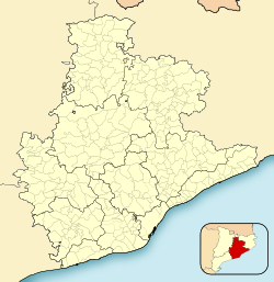 El Papiol Location in Catalonia  El Papiol El Papiol (Spain) | |
| Coordinates: 41°26′21″N 2°0′38″E | |
| Country | |
| Community | |
| Province | Barcelona |
| Comarca | Baix Llobregat |
| Government | |
| • Mayor | Joan Borràs Alborch (2015)[1] |
| Area | |
| • Total | 9.0 km2 (3.5 sq mi) |
| Elevation | 135 m (443 ft) |
| Population (2018)[3] | |
| • Total | 4,103 |
| • Density | 460/km2 (1,200/sq mi) |
| Website | elpapiol |

Demography
| 1900 | 1930 | 1950 | 1970 | 1986 | 2018 |
|---|---|---|---|---|---|
| 912 | 1027 | 1159 | 2620 | 3080 | 4103 |
References
- "Ajuntament del Papiol". Generalitat of Catalonia. Retrieved 2015-11-13.
- "El municipi en xifres: El Papiol". Statistical Institute of Catalonia. Retrieved 2015-11-23.
- Municipal Register of Spain 2018. National Statistics Institute.
- Panareda Clopés, Josep Maria; Rios Calvet, Jaume; Rabella Vives, Josep Maria (1989). Guia de Catalunya, Barcelona: Caixa de Catalunya. ISBN 84-87135-01-3 (Spanish). ISBN 84-87135-02-1 (Catalan).
- Moran i Ocerinjauregui, Josep; Pladevall, Antoni; Riera i Viader, Sebastià; Alier, Roger; Codina, Jaume; Pagès i Paretas, Montserrat, et al. (1982). Gran Geografia Comarcal de Catalunya. Vol. 8: Barcelonès i Baix Llobregat, Barcelona: Fundació Enciclopèdia Catalana. ISBN 84-85194-13-6.
External links
- Government data pages (in Catalan)
Places adjacent to El Papiol | ||||||||||||||||
|---|---|---|---|---|---|---|---|---|---|---|---|---|---|---|---|---|
| ||||||||||||||||
Municipalities of Baix Llobregat | ||
|---|---|---|
| ||
Municipalities in the province of Barcelona | ||
|---|---|---|
| 1,500,000+ |
|  |
| 250,000+ |
| |
| 200,000+ |
| |
| 100,000+ |
| |
| 75,000+ |
| |
| 50,000+ |
| |
| 25,000+ |
| |
| under 25,000 |
| |
| Authority control |
|
|---|
На других языках
- [en] El Papiol
[es] El Papiol
Papiol[1] (en catalán y oficialmente El Papiol) es una villa y municipio español de la comarca del Bajo Llobregat, que se extiende entre las últimas estribaciones de la sierra de Collserola, el río Llobregat y la riera de Rubí.[ru] Эль-Папиоль
Эль-Папиоль (исп. El Papiol) — муниципалитет в Испании, входит в провинцию Барселона в составе автономного сообщества Каталония. Муниципалитет находится в составе района (комарки) Бахо-Льобрегат. Занимает площадь 8,76 км². Население — 3937 человек (на 2010 год). Расстояние до административного центра провинции — 25 км.Текст в блоке "Читать" взят с сайта "Википедия" и доступен по лицензии Creative Commons Attribution-ShareAlike; в отдельных случаях могут действовать дополнительные условия.
Другой контент может иметь иную лицензию. Перед использованием материалов сайта WikiSort.org внимательно изучите правила лицензирования конкретных элементов наполнения сайта.
Другой контент может иметь иную лицензию. Перед использованием материалов сайта WikiSort.org внимательно изучите правила лицензирования конкретных элементов наполнения сайта.
2019-2026
WikiSort.org - проект по пересортировке и дополнению контента Википедии
WikiSort.org - проект по пересортировке и дополнению контента Википедии