world.wikisort.org - Philippines
Kabugao, officially the Municipality of Kabugao, (Ilocano: Ili ti Kabugao; Tagalog: Bayan ng Kabugao), is a 1st class municipality and de jure capital of the province of Apayao, Philippines. According to the 2020 census, it has a population of 16,215 people. [3]
Kabugao | |
|---|---|
Municipality | |
| Municipality of Kabugao | |
 Landscape in Barangay Dibagat | |
 Flag | |
 Map of Apayao with Kabugao highlighted | |
OpenStreetMap  | |
 Kabugao Location within the Philippines | |
| Coordinates: 18°01′26″N 121°11′00″E | |
| Country | Philippines |
| Region | Cordillera Administrative Region |
| Province | Apayao |
| District | Lone district |
| Founded | 1950 |
| Barangays | 21 (see Barangays) |
| Government | |
| • Type | Sangguniang Bayan |
| • Mayor | Bensmar B. Ligwang (PRP) |
| • Vice Mayor | Fabulous B. Tucjang (NPC) |
| • Representative | Eleanor Bulut-Begtang |
| • Municipal Council | Members |
| • Electorate | 11,155 voters (2019) |
| Area | |
| • Total | 935.12 km2 (361.05 sq mi) |
| Elevation | 262 m (860 ft) |
| Highest elevation | 689 m (2,260 ft) |
| Lowest elevation | 78 m (256 ft) |
| Population | |
| • Total | 16,215 |
| • Density | 17/km2 (45/sq mi) |
| • Households | 3,130 |
| Economy | |
| • Income class | 1st municipal income class |
| • Poverty incidence | 35.34% (2018)[4] |
| • Revenue | ₱241,659,681.13 (2020) |
| • Assets | ₱416,690,641.74 (2020) |
| • Expenditure | ₱183,633,486.97 (2020) |
| • Liabilities | ₱66,384,548.22 (2020) |
| Service provider | |
| • Electricity | Kalinga - Apayao Electric Cooperative (KAELCO) |
| Time zone | UTC+8 (PST) |
| ZIP code | 3809 |
| PSGC | |
| IDD : area code | +63 (0)74 |
| Native languages | Isnag Itawis Ilocano Tagalog |
History
On July 12, 1915, Governor General Francis Burton Harrison issued Executive Order No. 45, transferring the capital of then sub-province of Apayao from Tauit to Kabugao, to be effective on August 1.[5]
Kabugao was occupied for a year by the Japanese during the Second World War.[6] It was captured on December 1942 after the USAFIP NL retreated from the town.[citation needed]
Geography
According to the Philippine Statistics Authority, the municipality has a land area of 935.12 square kilometres (361.05 sq mi) [7] constituting 21.19% of the 4,413.35-square-kilometre- (1,704.00 sq mi) total area of Apayao.
Barangays
Kabugao is politically subdivided into 21 barangays.[8] These barangays are headed by elected officials: Barangay Captain, Barangay Council, whose members are called Barangay Councilors. All are elected every three years.
| PSGC | Barangay | Population | ±% p.a. | |||
|---|---|---|---|---|---|---|
| 2020 [3] | 2010 [9] | |||||
| 148104001 | Badduat | 5.8% | 943 | 1,000 | −0.56% | |
| 148104002 | Baliwanan | 3.0% | 480 | 478 | 0.04% | |
| 148104004 | Bulu | 1.8% | 297 | 298 | −0.03% | |
| 148104007 | Cabetayan | 3.8% | 613 | 556 | 0.94% | |
| 148104005 | Dagara | 3.3% | 541 | 484 | 1.07% | |
| 148104006 | Dibagat | 4.3% | 704 | 797 | −1.18% | |
| 148104008 | Karagawan | 4.0% | 655 | 676 | −0.30% | |
| 148104009 | Kumao | 3.5% | 570 | 557 | 0.22% | |
| 148104010 | Laco | 2.5% | 411 | 410 | 0.02% | |
| 148104011 | Lenneng (Liyyeng) | 15.7% | 2,541 | 2,396 | 0.56% | |
| 148104012 | Lucab | 3.7% | 604 | 660 | −0.85% | |
| 148104013 | Luttuacan | 6.4% | 1,042 | 786 | 2.74% | |
| 148104014 | Madatag | 4.9% | 798 | 766 | 0.39% | |
| 148104015 | Madduang | 2.9% | 467 | 423 | 0.95% | |
| 148104016 | Magabta | 1.3% | 203 | 215 | −0.55% | |
| 148104017 | Maragat | 2.8% | 453 | 503 | −1.00% | |
| 148104018 | Musimut | 3.7% | 607 | 822 | −2.86% | |
| 148104019 | Nagbabalayan | 3.0% | 482 | 511 | −0.56% | |
| 148104020 | Poblacion | 16.2% | 2,629 | 3,217 | −1.91% | |
| 148104021 | Tuyangan | 1.8% | 285 | 334 | −1.51% | |
| 148104022 | Waga | 1.3% | 212 | 281 | −2.66% | |
| Total | 16,215 | 16,170 | 0.03% | |||
Climate
| Climate data for Kabugao, Apayao | |||||||||||||
|---|---|---|---|---|---|---|---|---|---|---|---|---|---|
| Month | Jan | Feb | Mar | Apr | May | Jun | Jul | Aug | Sep | Oct | Nov | Dec | Year |
| Average high °C (°F) | 25 (77) |
26 (79) |
29 (84) |
31 (88) |
31 (88) |
31 (88) |
30 (86) |
30 (86) |
29 (84) |
28 (82) |
27 (81) |
25 (77) |
29 (83) |
| Average low °C (°F) | 20 (68) |
20 (68) |
21 (70) |
23 (73) |
24 (75) |
24 (75) |
24 (75) |
24 (75) |
24 (75) |
23 (73) |
22 (72) |
21 (70) |
23 (72) |
| Average precipitation mm (inches) | 133 (5.2) |
87 (3.4) |
68 (2.7) |
44 (1.7) |
127 (5.0) |
134 (5.3) |
160 (6.3) |
162 (6.4) |
134 (5.3) |
192 (7.6) |
194 (7.6) |
260 (10.2) |
1,695 (66.7) |
| Average rainy days | 18.1 | 13.3 | 13.3 | 11.8 | 19.7 | 20.9 | 22.8 | 22.8 | 20.3 | 16.6 | 18.4 | 21.7 | 219.7 |
| Source: Meteoblue[10] | |||||||||||||
Demographics
| Year | Pop. | ±% p.a. |
|---|---|---|
| 1918 | 3,448 | — |
| 1939 | 4,646 | +1.43% |
| 1948 | 4,545 | −0.24% |
| 1960 | 5,961 | +2.29% |
| 1970 | 7,358 | +2.13% |
| 1975 | 8,720 | +3.46% |
| 1980 | 9,600 | +1.94% |
| 1990 | 11,198 | +1.55% |
| 1995 | 12,710 | +2.40% |
| 2000 | 13,985 | +2.07% |
| 2007 | 14,529 | +0.53% |
| 2010 | 16,170 | +3.97% |
| 2015 | 15,537 | −0.76% |
| 2020 | 16,215 | +0.84% |
| Source: Philippine Statistics Authority [11] [9] [12][13] | ||
In the 2020 census, Kabugao had a population of 16,215. [3] The population density was 17 inhabitants per square kilometre (44/sq mi).
Economy
Government
Kabugao, belonging to the lone congressional district of the province of Apayao, is governed by a mayor designated as its local chief executive and by a municipal council as its legislative body in accordance with the Local Government Code. The mayor, vice mayor, and the councilors are elected directly by the people through an election which is being held every three years.
Elected officials
| Position | Name |
|---|---|
| Congressman | Elias C. Bulut Jr. |
| Mayor | Bensmar B. Ligwang |
| Vice-Mayor | Joseph C. Amid |
| Councilors | Jed E. Bosing |
| Marlene B. Tapiru | |
| Paterno C. Amid | |
| Alberto B. Tucjang | |
| Gregorio B. Ligwang | |
| Macpaul L. Talimbong | |
| Max T. Basang | |
| Sedolito Bernard A. Agunos | |
Education
In 1948, Rev. Louis Saunders of an evangelical Protestant sect, The Disciples of Christ, opened the Apayao Christian Academy, Kabugao's first secondary school. In 1950, amidst rivalry among churches, the Catholics started its own secondary school, Our Blessed Lady of Lourdes.[6]
Dibagat

Dibagat is inhabited by the Isnag and the Ilocano.[citation needed] There is a small grass airstrip built by SIL in 1985.[citation needed] Dibagat is accessible only by canoe or by specialized aircraft.[citation needed]
References
- Municipality of Kabugao | (DILG)
- "2015 Census of Population, Report No. 3 – Population, Land Area, and Population Density" (PDF). Philippine Statistics Authority. Quezon City, Philippines. August 2016. ISSN 0117-1453. Archived (PDF) from the original on May 25, 2021. Retrieved July 16, 2021.
- Census of Population (2020). "Cordillera Administrative Region (CAR)". Total Population by Province, City, Municipality and Barangay. PSA. Retrieved 8 July 2021.
- "PSA Releases the 2018 Municipal and City Level Poverty Estimates". Philippine Statistics Authority. 15 December 2021. Retrieved 22 January 2022.
- Executive Orders, 1915. Manila: Bureau of Printing. 1916. p. 91–92. Retrieved 2022-08-02.
- "The Manolay cult: The genesis and dissolution of millenarian sentiments among the Isneg of Northern Luzon" (PDF). Asian Studies. University of the Philippines Diliman. Retrieved 2022-07-31.
- "Province: Apayao". PSGC Interactive. Quezon City, Philippines: Philippine Statistics Authority. Retrieved 12 November 2016.
- "Municipal: Kabugao". PSGC Interactive. Quezon City, Philippines: Philippine Statistics Authority. Retrieved 8 January 2016.
- Census of Population and Housing (2010). "Cordillera Administrative Region (CAR)". Total Population by Province, City, Municipality and Barangay. NSO. Retrieved 29 June 2016.
- "Kabugao: Average Temperatures and Rainfall". Meteoblue. Retrieved 8 March 2020.
- Census of Population (2015). "Cordillera Administrative Region (CAR)". Total Population by Province, City, Municipality and Barangay. PSA. Retrieved 20 June 2016.
- Censuses of Population (1903–2007). "Cordillera Administrative Region (CAR)". Table 1. Population Enumerated in Various Censuses by Province/Highly Urbanized City: 1903 to 2007. NSO.
- "Province of Apayao". Municipality Population Data. Local Water Utilities Administration Research Division. Retrieved 17 December 2016.
- "Poverty incidence (PI):". Philippine Statistics Authority. Retrieved 28 December 2020.
- https://psa.gov.ph/sites/default/files/NSCB_LocalPovertyPhilippines_0.pdf; publication date: 29 November 2005; publisher: Philippine Statistics Authority.
- https://psa.gov.ph/sites/default/files/2003%20SAE%20of%20poverty%20%28Full%20Report%29_1.pdf; publication date: 23 March 2009; publisher: Philippine Statistics Authority.
- https://psa.gov.ph/sites/default/files/2006%20and%202009%20City%20and%20Municipal%20Level%20Poverty%20Estimates_0_1.pdf; publication date: 3 August 2012; publisher: Philippine Statistics Authority.
- https://psa.gov.ph/sites/default/files/2012%20Municipal%20and%20City%20Level%20Poverty%20Estima7tes%20Publication%20%281%29.pdf; publication date: 31 May 2016; publisher: Philippine Statistics Authority.
- https://psa.gov.ph/sites/default/files/City%20and%20Municipal-level%20Small%20Area%20Poverty%20Estimates_%202009%2C%202012%20and%202015_0.xlsx; publication date: 10 July 2019; publisher: Philippine Statistics Authority.
- "PSA Releases the 2018 Municipal and City Level Poverty Estimates". Philippine Statistics Authority. 15 December 2021. Retrieved 22 January 2022.
- "2019 National and Local Elections" (PDF). Commission on Elections. Retrieved March 12, 2022.
{{cite web}}: CS1 maint: url-status (link)
External links
![]() Media related to Kabugao at Wikimedia Commons
Media related to Kabugao at Wikimedia Commons
Places adjacent to Kabugao | ||||||||||||||||
|---|---|---|---|---|---|---|---|---|---|---|---|---|---|---|---|---|
| ||||||||||||||||
Kabugao (capital) | |
| Municipalities | |
| Barangays | See: List of barangays in Apayao |
Cordillera Administrative Region (CAR) | ||
|---|---|---|
| Regional center | 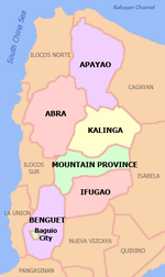 | |
| Provinces |
| |
| Highly urbanized city | ||
| Component city | ||
| Provincial capitals | ||
| Municipalities |
| |
Luzon, Republic of the Philippines | ||
| |||||
| |||||
| |||||
1 de facto seat of provincial government |
This article about a location in the Cordillera Administrative Region is a stub. You can help Wikipedia by expanding it. |
На других языках
[de] Kabugao
Kabugao ist eine philippinische Stadtgemeinde in der Provinz Apayao. Sie hat 15.537 Einwohner (Zensus 1. August 2015). Kabugao ist Sitz der Provinzregierung der Provinz Apayao. Die Gemeinde liegt im Wassereinzugsgebiet des Flusses Abulug.- [en] Kabugao
Другой контент может иметь иную лицензию. Перед использованием материалов сайта WikiSort.org внимательно изучите правила лицензирования конкретных элементов наполнения сайта.
WikiSort.org - проект по пересортировке и дополнению контента Википедии