world.wikisort.org - Philippines
Villaviciosa, officially the Municipality of Villaviciosa (Ilocano: Ili ti Villaviciosa; Tagalog: Bayan ng Villaviciosa), is a 5th class municipality in the province of Abra, Philippines. According to the 2020 census, it has a population of 5,675 people. [3]
Villaviciosa | |
|---|---|
Municipality | |
| Municipality of Villaviciosa | |
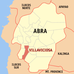 Map of Abra with Villaviciosa highlighted | |
OpenStreetMap  | |
 Villaviciosa Location within the Philippines | |
| Coordinates: 17°26′N 120°38′E | |
| Country | Philippines |
| Region | Cordillera Administrative Region |
| Province | Abra |
| District | Lone district |
| Barangays | 8 (see Barangays) |
| Government | |
| • Type | Sangguniang Bayan |
| • Mayor | Jose W. Lagen Jr. |
| • Vice Mayor | Marjorie L. Lagen |
| • Representative | Menchie B. Bernos |
| • Municipal Council | Members |
| • Electorate | 4,370 voters (2019) |
| Area | |
| • Total | 102.93 km2 (39.74 sq mi) |
| Elevation | 325 m (1,066 ft) |
| Highest elevation | 667 m (2,188 ft) |
| Lowest elevation | 126 m (413 ft) |
| Population | |
| • Total | 5,675 |
| • Density | 55/km2 (140/sq mi) |
| • Households | 1,058 |
| Economy | |
| • Income class | 5th municipal income class |
| • Poverty incidence | 19.93% (2018)[4] |
| • Revenue | ₱230,244,608.01 (2020) |
| • Assets | ₱725,556,274.93 (2020) |
| • Expenditure | ₱91,287,916.46 (2020) |
| • Liabilities | ₱36,029,814.44 (2020) |
| Service provider | |
| • Electricity | Abra Electric Cooperative (ABRECO) |
| Time zone | UTC+8 (PST) |
| ZIP code | 2811 |
| PSGC | |
| IDD : area code | +63 (0)74 |
| Native languages | Itneg Atta Ilocano Tagalog |
The population was 5,675 at the 2020 census. [3] The town is known for the Kimkimay Lake, a reminder of the wrath of the gods against people who have numerous vices.[5]
Geography
Villaviciosa is located at 17°26′N 120°38′E.
According to the Philippine Statistics Authority, the municipality has a land area of 102.93 square kilometres (39.74 sq mi) [6] constituting 2.47% of the 4,165.25-square-kilometre- (1,608.21 sq mi) total area of Abra.
The municipality is geographically situated at the southern portion of Abra, bounded in the north-west by San Isidro, north by Bucay, east by Manabo and Luba, south by San Emilio, and west by Pilar.
Villaviciosa is accessible from Benguet by land transportation through the Abra-Ilocos Sur Road, the more frequently used route. From the nearby Province of Ilocos Sur, it is also accessible through the Candon via San Emilio to Luba‑Tamac, Villaviciosa Road and the Santa Maria‑Burgos via Pilar‑Villaviciosa Road.
Climate
| Climate data for Villaviciosa, Abra | |||||||||||||
|---|---|---|---|---|---|---|---|---|---|---|---|---|---|
| Month | Jan | Feb | Mar | Apr | May | Jun | Jul | Aug | Sep | Oct | Nov | Dec | Year |
| Average high °C (°F) | 29 (84) |
30 (86) |
31 (88) |
33 (91) |
31 (88) |
30 (86) |
29 (84) |
29 (84) |
29 (84) |
30 (86) |
30 (86) |
29 (84) |
30 (86) |
| Average low °C (°F) | 18 (64) |
18 (64) |
20 (68) |
22 (72) |
24 (75) |
24 (75) |
23 (73) |
23 (73) |
23 (73) |
21 (70) |
20 (68) |
18 (64) |
21 (70) |
| Average precipitation mm (inches) | 10 (0.4) |
10 (0.4) |
14 (0.6) |
23 (0.9) |
80 (3.1) |
103 (4.1) |
121 (4.8) |
111 (4.4) |
119 (4.7) |
114 (4.5) |
39 (1.5) |
15 (0.6) |
759 (30) |
| Average rainy days | 5.2 | 3.9 | 6.2 | 9.1 | 18.5 | 21.4 | 22.9 | 19.8 | 19.8 | 16.2 | 10.5 | 6.1 | 159.6 |
| Source: Meteoblue[7] | |||||||||||||
Barangays
Villaviciosa is politically subdivided into 8 barangays.[8] These barangays are headed by elected officials: Barangay Captain, Barangay Council, whose members are called Barangay Councilors. All are elected every three years.
| PSGC | Barangay | Population | ±% p.a. | |||
|---|---|---|---|---|---|---|
| 2020 [3] | 2010 [9] | |||||
| 140127001 | Ap-apaya | 9.0% | 512 | 531 | −0.35% | |
| 140127002 | Bol-lilising | 5.3% | 301 | 294 | 0.23% | |
| 140127003 | Cal-lao | 16.4% | 929 | 931 | −0.02% | |
| 140127004 | Lap-lapog | 13.5% | 765 | 766 | −0.01% | |
| 140127005 | Lumaba | 8.9% | 504 | 552 | −0.87% | |
| 140127006 | Poblacion | 16.8% | 954 | 836 | 1.27% | |
| 140127007 | Tamac | 10.5% | 595 | 627 | −0.50% | |
| 140127008 | Tuquib | 14.7% | 832 | 840 | −0.09% | |
| Total | 5,675 | 5,377 | 0.52% | |||
Demographics
| Year | Pop. | ±% p.a. |
|---|---|---|
| 1918 | 1,621 | — |
| 1939 | 2,574 | +2.23% |
| 1948 | 2,474 | −0.44% |
| 1960 | 3,194 | +2.15% |
| 1970 | 4,006 | +2.29% |
| 1975 | 3,865 | −0.72% |
| 1980 | 3,933 | +0.35% |
| 1990 | 4,612 | +1.61% |
| 1995 | 4,634 | +0.09% |
| 2000 | 4,877 | +1.10% |
| 2007 | 5,147 | +0.75% |
| 2010 | 5,377 | +1.60% |
| 2015 | 5,392 | +0.05% |
| 2020 | 5,675 | +1.01% |
| Source: Philippine Statistics Authority [10] [9] [11][12] | ||
In the 2020 census, Villaviciosa had a population of 5,675. [3] The population density was 55 inhabitants per square kilometre (140/sq mi).
Economy
Government
Villaviciosa, belonging to the lone congressional district of the province of Abra, is governed by a mayor designated as its local chief executive and by a municipal council as its legislative body in accordance with the Local Government Code. The mayor, vice mayor, and the councilors are elected directly by the people through an election which is being held every three years.
Elected officials
| Position | Name |
|---|---|
| Congressman | Joseph Santo Niño B. Bernos |
| Mayor | Jose W. Lagen Jr. |
| Vice-Mayor | Marjorie L. Lagen |
| Councilors | Nelson L. Piyo |
| Edmundo B. Belmes | |
| Nixon B. Belmes | |
| Amelito M. Bagno | |
| Ingrid B. Oca | |
| Ernest G. Binnong | |
| Elsie L. Bona | |
| Tessie G. Paned | |
References
- Municipality of Villaviciosa | (DILG)
- "2015 Census of Population, Report No. 3 – Population, Land Area, and Population Density" (PDF). Philippine Statistics Authority. Quezon City, Philippines. August 2016. ISSN 0117-1453. Archived (PDF) from the original on May 25, 2021. Retrieved July 16, 2021.
- Census of Population (2020). "Cordillera Administrative Region (CAR)". Total Population by Province, City, Municipality and Barangay. PSA. Retrieved 8 July 2021.
- "PSA Releases the 2018 Municipal and City Level Poverty Estimates". Philippine Statistics Authority. 15 December 2021. Retrieved 22 January 2022.
- "Kimkimay Lake in Villaviciosa, Abra, Philippines". Archived from the original on 2018-01-21.
- "Province: Abra". PSGC Interactive. Quezon City, Philippines: Philippine Statistics Authority. Retrieved 12 November 2016.
- "Villaviciosa: Average Temperatures and Rainfall". Meteoblue. Retrieved 26 April 2020.
- "Municipal: Villaviciosa, Abra". PSGC Interactive. Quezon City, Philippines: Philippine Statistics Authority. Retrieved 8 January 2016.
- Census of Population and Housing (2010). "Cordillera Administrative Region (CAR)". Total Population by Province, City, Municipality and Barangay. NSO. Retrieved 29 June 2016.
- Census of Population (2015). "Cordillera Administrative Region (CAR)". Total Population by Province, City, Municipality and Barangay. PSA. Retrieved 20 June 2016.
- Censuses of Population (1903–2007). "Cordillera Administrative Region (CAR)". Table 1. Population Enumerated in Various Censuses by Province/Highly Urbanized City: 1903 to 2007. NSO.
- "Province of Abra". Municipality Population Data. Local Water Utilities Administration Research Division. Retrieved 17 December 2016.
- "Poverty incidence (PI):". Philippine Statistics Authority. Retrieved 28 December 2020.
- https://psa.gov.ph/sites/default/files/NSCB_LocalPovertyPhilippines_0.pdf; publication date: 29 November 2005; publisher: Philippine Statistics Authority.
- https://psa.gov.ph/sites/default/files/2003%20SAE%20of%20poverty%20%28Full%20Report%29_1.pdf; publication date: 23 March 2009; publisher: Philippine Statistics Authority.
- https://psa.gov.ph/sites/default/files/2006%20and%202009%20City%20and%20Municipal%20Level%20Poverty%20Estimates_0_1.pdf; publication date: 3 August 2012; publisher: Philippine Statistics Authority.
- https://psa.gov.ph/sites/default/files/2012%20Municipal%20and%20City%20Level%20Poverty%20Estima7tes%20Publication%20%281%29.pdf; publication date: 31 May 2016; publisher: Philippine Statistics Authority.
- https://psa.gov.ph/sites/default/files/City%20and%20Municipal-level%20Small%20Area%20Poverty%20Estimates_%202009%2C%202012%20and%202015_0.xlsx; publication date: 10 July 2019; publisher: Philippine Statistics Authority.
- "PSA Releases the 2018 Municipal and City Level Poverty Estimates". Philippine Statistics Authority. 15 December 2021. Retrieved 22 January 2022.
- "2019 National and Local Elections" (PDF). Commission on Elections. Retrieved March 12, 2022.
{{cite web}}: CS1 maint: url-status (link)
External links
Places adjacent to Villaviciosa, Abra | ||||||||||||||||
|---|---|---|---|---|---|---|---|---|---|---|---|---|---|---|---|---|
| ||||||||||||||||
Bangued (capital) | |
| Municipalities | |
| Barangays | See: List of barangays in Abra |
На других языках
[de] Villaviciosa (Abra)
Villaviciosa ist eine philippinische Stadtgemeinde in der Provinz Abra. Sie hat 5392 Einwohner (Zensus 2015).- [en] Villaviciosa, Abra
Другой контент может иметь иную лицензию. Перед использованием материалов сайта WikiSort.org внимательно изучите правила лицензирования конкретных элементов наполнения сайта.
WikiSort.org - проект по пересортировке и дополнению контента Википедии