world.wikisort.org - Philippines
Natonin, officially the Municipality of Natonin, is a 4th class municipality in the province of Mountain Province, Philippines. According to the 2020 census, it has a population of 10,339 people. [3]
Natonin | |
|---|---|
Municipality | |
| Municipality of Natonin | |
 Flag  Seal | |
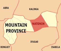 Map of Mountain Province with Natonin highlighted | |
OpenStreetMap  | |
 Natonin Location within the Philippines | |
| Coordinates: 17°06′32″N 121°16′47″E | |
| Country | Philippines |
| Region | Cordillera Administrative Region |
| Province | Mountain Province |
| District | Lone district |
| Founded | 1915 |
| Barangays | 11 (see Barangays) |
| Government | |
| • Type | Sangguniang Bayan |
| • Mayor | Jose T. Agagon |
| • Vice Mayor | Raymundo L. Lapasen |
| • Representative | Maximo Y. Dalog Jr. |
| • Municipal Council | Members |
| • Electorate | 8,049 voters (2019) |
| Area | |
| • Total | 252.00 km2 (97.30 sq mi) |
| Elevation | 831 m (2,726 ft) |
| Highest elevation | 1,879 m (6,165 ft) |
| Lowest elevation | 276 m (906 ft) |
| Population | |
| • Total | 10,339 |
| • Density | 41/km2 (110/sq mi) |
| • Households | 2,187 |
| Economy | |
| • Income class | 4th municipal income class |
| • Poverty incidence | 23.07% (2018)[4] |
| • Revenue | ₱105,140,058.96 (2020) |
| • Assets | ₱164,656,681.95 (2020) |
| • Expenditure | ₱98,733,746.36 (2020) |
| • Liabilities | ₱110,286,147.62 (2020) |
| Service provider | |
| • Electricity | Mountain Province Electric Cooperative (MOPRECO) |
| Time zone | UTC+8 (PST) |
| ZIP code | 2624 |
| PSGC | |
| IDD : area code | +63 (0)74 |
| Native languages | Balangao Bontoc Ilocano Tagalog |
Geography
It is a landlocked municipality bordered by Kalinga Province to the North, Paracelis to the East, Barlig to the West and Ifugao to the South. The barangays are mostly carved at the foot of the mountains along which the now National Highway was carved with the exception Barangay Maducayan and some far-flung sitios of Barangay Banawel. It has a total land area of around 20 000 hectares.
Barangays
Natonin is politically subdivided into 11 barangays. These barangays are headed by elected officials: Barangay Captain, Barangay Council, whose members are called Barangay Councilors. All are elected every three years.
- Alunogan
- Balangao
- Banao
- Banawel
- Butac
- Maducayan
- Poblacion
- Saliok
- Santa Isabel
- Tonglayan
- Pudo
Climate
| Climate data for Natonin, Mountain Province | |||||||||||||
|---|---|---|---|---|---|---|---|---|---|---|---|---|---|
| Month | Jan | Feb | Mar | Apr | May | Jun | Jul | Aug | Sep | Oct | Nov | Dec | Year |
| Average high °C (°F) | 20 (68) |
21 (70) |
23 (73) |
26 (79) |
26 (79) |
26 (79) |
25 (77) |
25 (77) |
24 (75) |
23 (73) |
22 (72) |
20 (68) |
23 (74) |
| Average low °C (°F) | 14 (57) |
15 (59) |
16 (61) |
17 (63) |
18 (64) |
18 (64) |
18 (64) |
18 (64) |
18 (64) |
18 (64) |
17 (63) |
16 (61) |
17 (62) |
| Average precipitation mm (inches) | 103 (4.1) |
73 (2.9) |
49 (1.9) |
38 (1.5) |
141 (5.6) |
144 (5.7) |
172 (6.8) |
181 (7.1) |
155 (6.1) |
148 (5.8) |
147 (5.8) |
208 (8.2) |
1,559 (61.5) |
| Average rainy days | 17.1 | 12.8 | 11.0 | 9.6 | 18.9 | 21.5 | 23.5 | 24.5 | 21.7 | 16.1 | 17.1 | 20.5 | 214.3 |
| Source: Meteoblue[5] | |||||||||||||
Demographics
| Year | Pop. | ±% p.a. |
|---|---|---|
| 1918 | 5,118 | — |
| 1939 | 5,999 | +0.76% |
| 1948 | 5,847 | −0.28% |
| 1960 | 9,397 | +4.03% |
| 1970 | 5,690 | −4.89% |
| 1975 | 6,691 | +3.30% |
| 1980 | 7,325 | +1.83% |
| 1990 | 9,813 | +2.97% |
| 1995 | 8,997 | −1.61% |
| 2000 | 9,065 | +0.16% |
| 2007 | 9,431 | +0.55% |
| 2010 | 10,048 | +2.33% |
| 2015 | 10,272 | +0.42% |
| 2020 | 10,339 | +0.13% |
| Source: Philippine Statistics Authority [6] [7] [8][9] | ||
The natives of Natonin are generally called Balangaos, or Iferangao, and speak the Finerangao language. There are two sub-tribes: the Hakki, who inhabit the western part of the town, and the iMajukayongs (people of the subtribe Majukayong), who inhabit the barangays of Saliok and Maducayan. The iMajukayongs initially came from southern Kalinga Province. Populations of the town are of Igorot lineage. Headhunting was practiced throughout Natonin as late as the mid-1930s, but was set aside in favor of Christianity and education after World War II.
Languages
Natonin is home to two indigenous dialects which have existed there since before the arrival of the Spanish: the Balangaw dialect and the Majukayong dialect. Immigrants from the Ilocos Region came in the 1970s and imported the Ilokano dialect during the era of martial law.
Economy
The primary crop is rice, although limited arable space, mechanization and innovative agriculture renders the harvest to a subsistence level only. Backyard piggery mostly produce the pork supply. Vegetable gardening, fruit tree growing and tilapia raising are also starting to see commercial viability. Whatever is of shortage or lacking are imported outside the municipality. Few local handicrafts are promoted and are only made to order.
Government
Natonin, belonging to the lone congressional district of the province of Mountain Province, is governed by a mayor designated as its local chief executive and by a municipal council as its legislative body in accordance with the Local Government Code. The mayor, vice mayor, and the councilors are elected directly by the people through an election which is being held every three years.
Elected officials
| Position | Name |
|---|---|
| Congressman | Maximo Y. Dalog Jr. |
| Mayor | Jose T. Agagon |
| Vice-Mayor | Raymundo L. Lapasen |
| Councilors | Rafael Bulawe |
| Jose F. Biangalen | |
| Leon Pangsiw | |
| Jimmy G. Todco | |
| Fernandez Linggayo | |
| Jerry N. Chumilang | |
| Fernando Magranga Jr. | |
| Oscar Fangonon | |
Transportation
Since the widening of the national highways started in 2010, the Paracelis-Natonin Road is paved now. Although, some parts are either eroded or slipped away, and during rainy seasons landslides can render the roads impassable. Public utility or for-hire vans are the easiest transportation either to and from the municipality (e.g. Baguio and Manila).
Tourism
Though it's not yet that improved, Natonin has the following sites:
- The Legendary Silent Mountain of Finaratan, located in Barangay Maducayan.
- The Apatan Rice Terraces
- The Balococ Waterfall
- The Naropaan Waterfall
- Tonglayan Rice Terraces
- Lagan River in Balangao
- Penadna Waterfalls
- Lettalet Waterfalls
- Fuyon Spring in Siffu River located at Brgy. Saliok
References
- Municipality of Natonin | (DILG)
- "2015 Census of Population, Report No. 3 – Population, Land Area, and Population Density" (PDF). Philippine Statistics Authority. Quezon City, Philippines. August 2016. ISSN 0117-1453. Archived (PDF) from the original on May 25, 2021. Retrieved July 16, 2021.
- Census of Population (2020). "Cordillera Administrative Region (CAR)". Total Population by Province, City, Municipality and Barangay. PSA. Retrieved 8 July 2021.
- "PSA Releases the 2018 Municipal and City Level Poverty Estimates". Philippine Statistics Authority. 15 December 2021. Retrieved 22 January 2022.
- "Natonin: Average Temperatures and Rainfall". Meteoblue. Retrieved 8 March 2020.
- Census of Population (2015). "Cordillera Administrative Region (CAR)". Total Population by Province, City, Municipality and Barangay. PSA. Retrieved 20 June 2016.
- Census of Population and Housing (2010). "Cordillera Administrative Region (CAR)". Total Population by Province, City, Municipality and Barangay. NSO. Retrieved 29 June 2016.
- Censuses of Population (1903–2007). "Cordillera Administrative Region (CAR)". Table 1. Population Enumerated in Various Censuses by Province/Highly Urbanized City: 1903 to 2007. NSO.
- "Province of Mountain Province". Municipality Population Data. Local Water Utilities Administration Research Division. Retrieved 17 December 2016.
- "Poverty incidence (PI):". Philippine Statistics Authority. Retrieved 28 December 2020.
- https://psa.gov.ph/sites/default/files/NSCB_LocalPovertyPhilippines_0.pdf; publication date: 29 November 2005; publisher: Philippine Statistics Authority.
- https://psa.gov.ph/sites/default/files/2003%20SAE%20of%20poverty%20%28Full%20Report%29_1.pdf; publication date: 23 March 2009; publisher: Philippine Statistics Authority.
- https://psa.gov.ph/sites/default/files/2006%20and%202009%20City%20and%20Municipal%20Level%20Poverty%20Estimates_0_1.pdf; publication date: 3 August 2012; publisher: Philippine Statistics Authority.
- https://psa.gov.ph/sites/default/files/2012%20Municipal%20and%20City%20Level%20Poverty%20Estima7tes%20Publication%20%281%29.pdf; publication date: 31 May 2016; publisher: Philippine Statistics Authority.
- https://psa.gov.ph/sites/default/files/City%20and%20Municipal-level%20Small%20Area%20Poverty%20Estimates_%202009%2C%202012%20and%202015_0.xlsx; publication date: 10 July 2019; publisher: Philippine Statistics Authority.
- "PSA Releases the 2018 Municipal and City Level Poverty Estimates". Philippine Statistics Authority. 15 December 2021. Retrieved 22 January 2022.
- "2019 National and Local Elections" (PDF). Commission on Elections. Retrieved March 13, 2022.
{{cite web}}: CS1 maint: url-status (link)
External links
Places adjacent to Natonin | ||||||||||||||||
|---|---|---|---|---|---|---|---|---|---|---|---|---|---|---|---|---|
| ||||||||||||||||
Bontoc (capital) | |
| Municipalities | |
| Barangays | See: List of barangays in Mountain Province |
Другой контент может иметь иную лицензию. Перед использованием материалов сайта WikiSort.org внимательно изучите правила лицензирования конкретных элементов наполнения сайта.
WikiSort.org - проект по пересортировке и дополнению контента Википедии