world.wikisort.org - France
Les Autels (French pronunciation: [le.z‿otɛl]) is a commune in the department of Aisne in the Hauts-de-France region of northern France.
Les Autels | |
|---|---|
Commune | |
 | |
Location of Les Autels  | |
 Les Autels  Les Autels | |
| Coordinates: 49°45′51″N 4°13′33″E | |
| Country | France |
| Region | Hauts-de-France |
| Department | Aisne |
| Arrondissement | Vervins |
| Canton | Vervins |
| Intercommunality | Portes de la Thiérache |
| Government | |
| • Mayor (2020–2026) | Éric Halle |
| Area 1 | 5.99 km2 (2.31 sq mi) |
| Population | 59 |
| • Density | 9.8/km2 (26/sq mi) |
| Time zone | UTC+01:00 (CET) |
| • Summer (DST) | UTC+02:00 (CEST) |
| INSEE/Postal code | 02038 /02360 |
| Elevation | 178–260 m (584–853 ft) |
| 1 French Land Register data, which excludes lakes, ponds, glaciers > 1 km2 (0.386 sq mi or 247 acres) and river estuaries. | |
Geography
Les Autels is located some 35 km west of Charleville-Mézières and 10 km south of Aubenton. The northern and eastern borders of the commune are the departmental border between Aisne and Ardennes. Access to the commune is by the D1100 road from Brunehamel in the west which passes through the village and continues south to join the D530 south of the village. The D530 goes north in the commune changing to the D10B at the border and continues north to Blanchefosse-et-Bay. Apart from the village there is also the hamlet of Haut-Chemin south of the village. The commune is mostly farmland with some scattered forests.[2]
The Ruisseau du Moulin Bataille flows through the north of the commune towards the southwest forming part of the western border before continuing south to join the Serre near Mainbresson. An unnamed stream rises near the village and flows southwest to join the Ruisseau du Moulin Bataille.[2]
Neighbouring communes and villages[2]
Places adjacent to Les Autels | |
|---|---|
Administration
This list is incomplete; you can help by adding missing items. (April 2021) |
List of Successive Mayors[3]
| From | To | Name |
|---|---|---|
| 2001 | incumbent | Eric Halle |
Demography
In 2017 the commune had 57 inhabitants.
|
| ||||||||||||||||||||||||||||||||||||||||||||||||||||||||||||||||||||||||||||||||||||||||||||||||||||||||||||||||||
| Source: EHESS[4] and INSEE[5] | |||||||||||||||||||||||||||||||||||||||||||||||||||||||||||||||||||||||||||||||||||||||||||||||||||||||||||||||||||


Sites and monuments
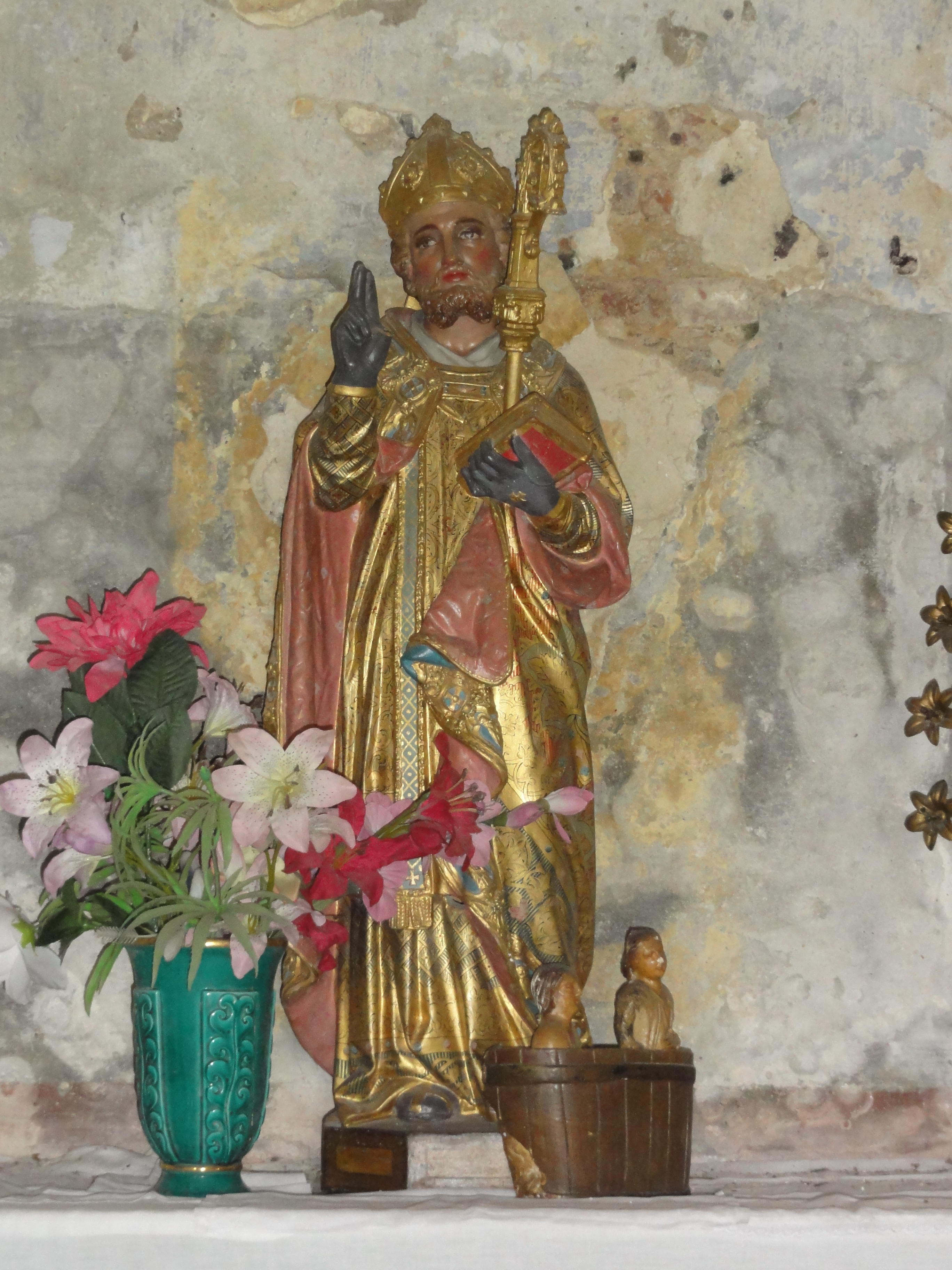
- The Church of Saint-Nicolas
- The War Memorial
- The Lavoir (Public laundry)
 The Church grounds
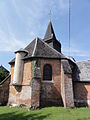 The Chevet of the Church of Saint-Nicolas
 The Statue of Saint Nicolas in the church
 Stained glass window of Saint Genevieve
 Stained glass window
 The Altar
 Statue of Christ in the church
 A Wayside Cross
 The Nave
 The War Memorial
 The Lavoir


See also
External links
- Les Autels on the old IGN website (in French)
- Les Autels on Géoportail, National Geographic Institute (IGN) website (in French)
- Les Autels on the 1750 Cassini Map
References
- "Populations légales 2019". The National Institute of Statistics and Economic Studies. 29 December 2021.
- Google Maps
- List of Mayors of France (in French)
- Des villages de Cassini aux communes d'aujourd'hui: Commune data sheet Les Autels, EHESS. (in French)
- Population en historique depuis 1968, INSEE
На других языках
[de] Les Autels
Les Autels ist eine französische Gemeinde mit 59 Einwohnern (Stand 1. Januar 2019) im Département Aisne in der Region Hauts-de-France (vor 2016 Picardie). Sie gehört zum Arrondissement Vervins, zum Kanton Vervins und zum Gemeindeverband Portes de la Thiérache.- [en] Les Autels
[ru] Лез-Отель
Лез-Отель (фр. Les Autels) — коммуна во Франции, находится в регионе Пикардия. Департамент коммуны — Эна. Входит в состав кантона Вервен. Округ коммуны — Вервен.Другой контент может иметь иную лицензию. Перед использованием материалов сайта WikiSort.org внимательно изучите правила лицензирования конкретных элементов наполнения сайта.
WikiSort.org - проект по пересортировке и дополнению контента Википедии