world.wikisort.org - France
Barenton-Cel (French pronunciation: [baʁɑ̃tɔ̃ sɛl]) is a commune in the department of Aisne in the Hauts-de-France region of northern France.
Barenton-Cel | |
|---|---|
Commune | |
 | |
Location of Barenton-Cel  | |
 Barenton-Cel  Barenton-Cel | |
| Coordinates: 49°38′36″N 3°39′12″E | |
| Country | France |
| Region | Hauts-de-France |
| Department | Aisne |
| Arrondissement | Laon |
| Canton | Marle |
| Intercommunality | Pays de la Serre |
| Government | |
| • Mayor (2020–2026) | David Petit[1] |
| Area 1 | 6.69 km2 (2.58 sq mi) |
| Population | 108 |
| • Density | 16/km2 (42/sq mi) |
| Time zone | UTC+01:00 (CET) |
| • Summer (DST) | UTC+02:00 (CEST) |
| INSEE/Postal code | 02047 /02000 |
| Elevation | 63–106 m (207–348 ft) |
| 1 French Land Register data, which excludes lakes, ponds, glaciers > 1 km2 (0.386 sq mi or 247 acres) and river estuaries. | |
Geography
Barenton-Cel is located some 10 km north by northeast of Laon and 40 km southeast of Saint-Quentin. It can be accessed by the D547 road from Verneuil-sur-Serre in the northeast continuing southwest through the commune and the village to Aulnois-sous-Laon in the southwest. There is also the D545 road from Barenton-Bugny on the southeastern border. The commune consists entirely of farmland with no other villages or hamlets.[3]
The Ru des Barentons stream forms the southeastern border of the commune and flows northeast to join the Souche river in the north.[3]
Neighbouring communes and villages
Places adjacent to Barenton-Cel | ||||||||||||||||
|---|---|---|---|---|---|---|---|---|---|---|---|---|---|---|---|---|
| ||||||||||||||||
Administration
This list is incomplete; you can help by adding missing items. (April 2021) |
List of Successive Mayors of Barenton-Cel[4]
| From | To | Name | Party |
|---|---|---|---|
| 1995 | 2008 | Bernard Brazier | DVD |
| 2008 | Present | David Petit | UMP then LR |
Population
| Year | Pop. | ±% p.a. |
|---|---|---|
| 1968 | 108 | — |
| 1975 | 129 | +2.57% |
| 1982 | 147 | +1.88% |
| 1990 | 141 | −0.52% |
| 1999 | 133 | −0.65% |
| 2007 | 147 | +1.26% |
| 2012 | 133 | −1.98% |
| 2017 | 114 | −3.04% |
| Source: INSEE[5] | ||


- Picture Gallery
 Barenton-Cel Church
 Plaque on the Church: "The Bell is given in remembrance of the collaboration of the American Red Cross with the Association of Devastated Aisne".
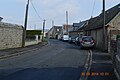 A street in Barenton-Cel
 Barenton-Cel Landscape


See also
References
- "Répertoire national des élus: les maires". data.gouv.fr, Plateforme ouverte des données publiques françaises (in French). 2 December 2020.
- "Populations légales 2019". The National Institute of Statistics and Economic Studies. 29 December 2021.
- Google Maps
- List of Mayors of France (in French)
- Population en historique depuis 1968, INSEE
External links
- Barenton-Cel on the old IGN website (in French)
- Bell Towers website (in French)
- 40000 Bell Towers website (in French)
- Barenton-Cel on Géoportail, National Geographic Institute (IGN) website (in French)
- Baranton Cel on the 1750 Cassini Map
Wikimedia Commons has media related to Barenton-Cel.
На других языках
[de] Barenton-Cel
Barenton-Cel ist eine französische Gemeinde mit 108 Einwohnern (Stand 1. Januar 2019) im Département Aisne in der Region Hauts-de-France (vor 2016 Picardie). Sie gehört zum Arrondissement Laon, zum Kanton Marle und zum Gemeindeverband Pays de la Serre.- [en] Barenton-Cel
[ru] Барантон-Сель
Барантон-Се́ль (фр. Barenton-Cel) — коммуна во Франции, находится в регионе Пикардия. Департамент коммуны — Эна. Входит в состав кантона Марль. Округ коммуны — Лан.Текст в блоке "Читать" взят с сайта "Википедия" и доступен по лицензии Creative Commons Attribution-ShareAlike; в отдельных случаях могут действовать дополнительные условия.
Другой контент может иметь иную лицензию. Перед использованием материалов сайта WikiSort.org внимательно изучите правила лицензирования конкретных элементов наполнения сайта.
Другой контент может иметь иную лицензию. Перед использованием материалов сайта WikiSort.org внимательно изучите правила лицензирования конкретных элементов наполнения сайта.
2019-2026
WikiSort.org - проект по пересортировке и дополнению контента Википедии
WikiSort.org - проект по пересортировке и дополнению контента Википедии