world.wikisort.org - Canada
Cornwallis is a rural municipality located in the Canadian province of Manitoba. It surrounds the east, south and west sides of Brandon, Manitoba. Most of the land comprising the municipality is farmland, but it contains a few settlements. One of the larger settlements, Sprucewoods, sits at the north gate of Canadian Forces Base Shilo and contains a large group of the municipal population. In the past, there has been friction between the community and the farming base that make up much of Cornwallis.
Cornwallis | |
|---|---|
Rural municipality | |
| Rural Municipality of Cornwallis | |
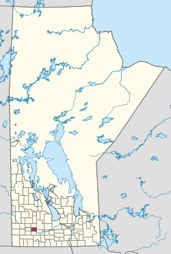 Location of Cornwallis in Manitoba | |
| Coordinates: 49°47′53″N 99°50′53″W | |
| Country | Canada |
| Province | Manitoba |
| Incorporated | December 22, 1883 |
| Area | |
| • Total | 500.36 km2 (193.19 sq mi) |
| Population (2016) | |
| • Total | 4,520 |
| • Density | 9.0/km2 (23/sq mi) |
| Time zone | UTC-6 (CST) |
| • Summer (DST) | UTC-5 (CDT) |

The municipality is divided into six wards, each represented by one councillor. The council is made up of the six councillors and the reeve, or head of council.
Communities
- Chater
- Cottonwoods
- Sprucewoods
- Roseland
Demographics
In the 2021 Census of Population conducted by Statistics Canada, Cornwallis had a population of 4,568 living in 1,704 of its 1,850 total private dwellings, a change of 1.4% from its 2016 population of 4,506. With a land area of 500.51 km2 (193.25 sq mi), it had a population density of 9.1/km2 (23.6/sq mi) in 2021.[1]
References
- "Population and dwelling counts: Canada, provinces and territories, and census subdivisions (municipalities), Manitoba". Statistics Canada. February 9, 2022. Retrieved February 20, 2022.
- Map of Cornwallis R.M. at Statcan
- Community Profile: Rural Municipality of Cornwallis, Manitoba; Statistics Canada
- Rural Municipality of Cornwallis Web Site
- Manitoba Historical Society - Rural Municipality of Cornwallis
External links
Places adjacent to Rural Municipality of Cornwallis | |
|---|---|
| Cities | 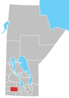 | ||
|---|---|---|---|
| Towns |
| ||
| Villages |
| ||
| Rural municipalities |
| ||
| Unincorporated communities |
| ||
| |||
Другой контент может иметь иную лицензию. Перед использованием материалов сайта WikiSort.org внимательно изучите правила лицензирования конкретных элементов наполнения сайта.
WikiSort.org - проект по пересортировке и дополнению контента Википедии