world.wikisort.org - Canada
The Rural Municipality of Whitemouth is a rural municipality located in southeastern Manitoba.
Whitemouth | |
|---|---|
Rural municipality | |
| Rural Municipality of Whitemouth | |
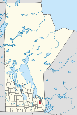 Location of the Rural Municipality of Whitemouth in Manitoba | |
| Coordinates: 49°58′01″N 95°57′30″W | |
| Country | Canada |
| Province | Manitoba |
| Region | Eastman Region |
| First incorporated | March 1, 1905 |
| Incorporated (amalgamated) | January 1, 2015 |
| Population (2016[1]) | |
| • Total | 1,557 |
| Time zone | UTC-6 (CST) |
| • Summer (DST) | UTC-5 (CDT) |
The community of Whitemouth is located in the municipality, which also contains the Whitemouth Bog Ecological Reserve, and small parts of Manitoba's Agassiz Provincial Forest (in its southwest quadrant) and Whiteshell Provincial Forest (in its northeast corner).
Communities
- Darwin
- Elma
- River Hills
- Seven Sisters Falls
- Whitemouth
Demographics
In the 2021 Census of Population conducted by Statistics Canada, Whitemouth had a population of 1,630 living in 631 of its 780 total private dwellings, a change of 4.7% from its 2016 population of 1,557. With a land area of 697.35 km2 (269.25 sq mi), it had a population density of 2.3/km2 (6.1/sq mi) in 2021.[2]
References
- "RM of Whitemouth Census 2016". Statistics Canada. Retrieved 2020-12-17.
- "Population and dwelling counts: Canada, provinces and territories, and census subdivisions (municipalities), Manitoba". Statistics Canada. February 9, 2022. Retrieved February 20, 2022.
External links
 Media related to Rural Municipality of Whitemouth at Wikimedia Commons
- Official website
- Manitoba Historical Society: Rural Municipality of Whitemouth
- Geographic Names of Manitoba (pg. 294) - the Millennium Bureau of Canada
Places adjacent to Rural Municipality of Whitemouth | ||||||||||||||||
|---|---|---|---|---|---|---|---|---|---|---|---|---|---|---|---|---|
| ||||||||||||||||
Subdivisions of Manitoba | |||
|---|---|---|---|
| Subdivisions |
| ||
| Cities | |||
| Towns |
| ||
| Villages |
| ||
| Rural municipalities |
| ||
| |||
Division No. 1, Manitoba (Eastern Manitoba) | ||
|---|---|---|
| Towns |  | |
| Local government districts | ||
| Rural municipalities |
| |
| First Nations |
| |
| Indian reserves |
| |
| Unorganized areas |
| |
| Unincorporated communities |
| |
| ||
Authority control | |
|---|---|
| General |
|
| National libraries | |
This Manitoba location article is a stub. You can help Wikipedia by expanding it. |
Другой контент может иметь иную лицензию. Перед использованием материалов сайта WikiSort.org внимательно изучите правила лицензирования конкретных элементов наполнения сайта.
WikiSort.org - проект по пересортировке и дополнению контента Википедии